ATL: TEN - Remnants - Discussion

Moderator: S2k Moderators

Message
Author
bob rulz
Category 5
Category 5
Posts: 1667
Age: 34
Joined: Sat Jan 28, 2006 7:30 pm
Location: Salt Lake City, Utah

Re: ATL: INVEST 93L - Discussion

#61 Postby bob rulz » Thu Jul 30, 2020 11:47 pm

zhukm29 wrote:
bob rulz wrote:The NHC has simultaneously tracked 4+ storms before, so I don't really see why that would be an issue. I think they're just hesitant to designate storms right off the coast of Africa because of how quickly those big tropical waves can fall apart, especially with limited to no model support.


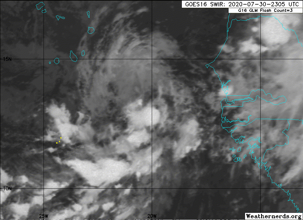
Personally, I think if it meets the requirements, it should be designated for consistency. What ends up happening is that a storm isn't designated even though it is like a TC, and then it falls apart when NHC waits too long. 93L has looked better than several other tropical depressions over the past day, and models have done a not-so-great job this year so far.

That being said, I'll defer to the experts on this - maybe they're seeing something we don't. 2020 might end up getting snubbed out of its record 6th July TC... I hope it doesn't try to beat 2005 in another way out of spite. :lol:


I definitely agree with you. This seems to our eyes to meet the definition of a tropical cyclone so it should be designated, but as you said maybe the NHC sees something we don't. But I've certainly seen more questionable cases and worse-looking depressions get designated before, so who knows? I think it just comes down to the fact that weather forecasting, even in real-time, is not an exact forecast and subjectivity and bias still play a part even amongst the experts.
0 likes   

User avatar
FireRat
Category 5
Category 5
Posts: 1138
Age: 36
Joined: Sun Sep 26, 2010 11:38 pm
Location: North Carolina

Re: ATL: INVEST 93L - Discussion

#62 Postby FireRat » Fri Jul 31, 2020 1:00 am

Sciencerocks wrote:This is a tropical cyclone!
https://imagizer.imageshack.com/img924/9341/uVv6Vz.gif


Looks like Josephine. Guess the NHC might upgrade it in post-season if they end up missing it. On the bearish side, I'd still say this is at least a TD.
2 likes   
Georges '98, Irene '99, Frances '04, Jeanne '04, Katrina '05, Wilma '05, Gustav '08, Isaac '12, Matthew '16, Florence '18, Michael '18, Ian '22

User avatar
cycloneye
Admin
Admin
Posts: 139026
Age: 67
Joined: Thu Oct 10, 2002 10:54 am
Location: San Juan, Puerto Rico

Re: ATL: INVEST 93L - Discussion

#63 Postby cycloneye » Fri Jul 31, 2020 6:57 am

Next.

Showers and thunderstorms associated with a small area of low
pressure located a couple of hundred miles east-southeast of the
Cabo Verde Islands have become less organized since yesterday. The
system is moving northward toward less favorable environmental
conditions, and the chance of this system becoming a tropical
depression is decreasing.
* Formation chance through 48 hours...low...20 percent.
* Formation chance through 5 days...low...20 percent.
0 likes   
Visit the Caribbean-Central America Weather Thread where you can find at first post web cams,radars
and observations from Caribbean basin members Click Here

zhukm29
Tropical Storm
Tropical Storm
Posts: 219
Joined: Tue Aug 28, 2018 2:37 pm

Re: ATL: INVEST 93L - Discussion

#64 Postby zhukm29 » Fri Jul 31, 2020 8:09 am

Not sure why a storm that had a pretty defined circulation, 30-35kt winds on ASCAT, and pretty decent convection the last few days was never designated as a tropical cyclone. I guess location does really matter... if this had been in the Gulf, I think it would have definitely gained some more recognition.

At least the name Josephine will maybe have a chance of going to a better storm. Josephine hasn't been a hurricane since 1990, and it was never a major during the times it was a hurricane. I always find it quite odd that the 'I' names always cause a ruckus, but 'J' never has the same reputation even though it also happens during peak season (and it's right next to 'I'). The 'J' name has only been retired 5 times, compared to 11 times for the 'I' name (and it could even be 12 or 13 depending if Imelda and Isaias are also on the cutting block).
2 likes   

User avatar
cainjamin
Tropical Storm
Tropical Storm
Posts: 158
Age: 32
Joined: Mon Apr 17, 2017 1:38 pm
Location: Nova Scotia, Canada

Re: ATL: INVEST 93L - Discussion

#65 Postby cainjamin » Fri Jul 31, 2020 10:17 am

Poor little 93L. My unofficial take is that this has been a TD for at least the last couple days but it got ignored because of big brother Isaias. It's still firing some decent convection to its west, and if that can migrate over the centre then maybe we'll see it classified, but its chances are dwindling as we speak.
2 likes   
Noel '07, Kyle '08, Earl '10, Arthur '14, Dorian '19, Teddy '20

User avatar
HurricaneEnzo
Category 2
Category 2
Posts: 723
Joined: Wed Mar 14, 2018 12:18 pm
Location: Newport, NC (Hurricane Alley)

Re: ATL: INVEST 93L - Discussion

#66 Postby HurricaneEnzo » Fri Jul 31, 2020 11:36 am

Haven't seen a recent ASCAT but if it has TD or TS winds I still think this is classifiable. We have seen plenty of sheared systems like this named. Center looks wrapped up tight on satellite imagery. Wouldn't be surprised if this was near TS strength.

https://tropicaltidbits.com/sat/satloop ... roduct=vis
0 likes   
Bertha 96' - Fran 96' - Bonnie 98' - Dennis 99' - Floyd 99' - Isabel 03' - Alex 04' - Ophelia 05' - Irene 11' - Arthur 14' - Matthew 16' - Florence 18' - Dorian 19' - Isaias 20' (countless other tropical storms and Hurricane swipes)

I am not a Professional Met just an enthusiast. Get your weather forecasts from the Pros!

User avatar
CyclonicFury
Category 5
Category 5
Posts: 1971
Age: 25
Joined: Sun Jul 02, 2017 12:32 pm
Location: NC
Contact:

Re: ATL: INVEST 93L - Discussion

#67 Postby CyclonicFury » Fri Jul 31, 2020 11:45 am

The LLC is clearly well defined and convection has persisted west of the exposed center. This has probably been a tropical depression for some time now.
4 likes   
NCSU B.S. in Meteorology Class of 2021. Tropical weather blogger at http://www.cyclonicfury.com. My forecasts and thoughts are NOT official, for official forecasts please consult the National Hurricane Center.

User avatar
cycloneye
Admin
Admin
Posts: 139026
Age: 67
Joined: Thu Oct 10, 2002 10:54 am
Location: San Juan, Puerto Rico

Re: ATL: INVEST 93L - Discussion

#68 Postby cycloneye » Fri Jul 31, 2020 12:30 pm

Showers and thunderstorms remain separated from the center of a
small area of low pressure located a couple of hundred miles east of
the Cabo Verde Islands. The system is moving northward toward less
favorable environmental conditions, and significant development of
this system appears unlikely.
* Formation chance through 48 hours...low...20 percent.
* Formation chance through 5 days...low...20 percent.
0 likes   
Visit the Caribbean-Central America Weather Thread where you can find at first post web cams,radars
and observations from Caribbean basin members Click Here

User avatar
cainjamin
Tropical Storm
Tropical Storm
Posts: 158
Age: 32
Joined: Mon Apr 17, 2017 1:38 pm
Location: Nova Scotia, Canada

Re: ATL: INVEST 93L - Discussion

#69 Postby cainjamin » Fri Jul 31, 2020 1:14 pm

Image

Well it at least has some convection right over its centre. Could be now or never for classification.
0 likes   
Noel '07, Kyle '08, Earl '10, Arthur '14, Dorian '19, Teddy '20

User avatar
cycloneye
Admin
Admin
Posts: 139026
Age: 67
Joined: Thu Oct 10, 2002 10:54 am
Location: San Juan, Puerto Rico

Re: ATL: INVEST 93L - Discussion

#70 Postby cycloneye » Fri Jul 31, 2020 1:31 pm

1 likes   
Visit the Caribbean-Central America Weather Thread where you can find at first post web cams,radars
and observations from Caribbean basin members Click Here

User avatar
Cataegis96
Professional-Met
Professional-Met
Posts: 54
Age: 28
Joined: Mon Jul 10, 2017 3:46 pm
Contact:

Re: ATL: INVEST 93L - Discussion

#71 Postby Cataegis96 » Fri Jul 31, 2020 1:53 pm

Sustained deep convection now over the well-defined LLC. This is a TC and has been for some time. SSTs quickly drop off from here, though. Doubt they name it at 5, but that is its only chance now. If not then, should be added in the post-season.
7 likes   
Lead Meteorologist Mars, Inc
WE ARE! The Pennsylvania State University 2018
UA U KNOW! University at Albany, SUNY 2020

User avatar
CyclonicFury
Category 5
Category 5
Posts: 1971
Age: 25
Joined: Sun Jul 02, 2017 12:32 pm
Location: NC
Contact:

Re: ATL: INVEST 93L - Discussion

#72 Postby CyclonicFury » Fri Jul 31, 2020 1:54 pm

Convection starting to cover the LLC now. NHC may have no choice but to classify if this continues.
2 likes   
NCSU B.S. in Meteorology Class of 2021. Tropical weather blogger at http://www.cyclonicfury.com. My forecasts and thoughts are NOT official, for official forecasts please consult the National Hurricane Center.

Sciencerocks
Category 5
Category 5
Posts: 7282
Age: 38
Joined: Thu Jul 06, 2017 1:51 am

Re: ATL: INVEST 93L - Discussion

#73 Postby Sciencerocks » Fri Jul 31, 2020 1:58 pm

Image
3 likes   

User avatar
EquusStorm
Category 5
Category 5
Posts: 1649
Age: 33
Joined: Thu Nov 07, 2013 1:04 pm
Location: Jasper, AL
Contact:

Re: ATL: INVEST 93L - Discussion

#74 Postby EquusStorm » Fri Jul 31, 2020 2:02 pm

I think they're desperately hoping it goes away so they don't have to write like two advisories on a brief middle of nowhere storm at the edge of satellite coverage. That said, they do that frequently so...

Fully agree it completely meets the definition though and am baffled as to why no classification
1 likes   
Colors of lost purpose on the canvas of irrelevance

Not a meteorologist, in fact more of an idiot than anything. You should probably check with the NHC or a local NWS office for official information.

User avatar
EquusStorm
Category 5
Category 5
Posts: 1649
Age: 33
Joined: Thu Nov 07, 2013 1:04 pm
Location: Jasper, AL
Contact:

Re: ATL: INVEST 93L - Discussion

#75 Postby EquusStorm » Fri Jul 31, 2020 2:05 pm

Special TWO issued, 50/50

Standard small increase in organization could lead to advisories wording, but I dunno how much more organization they're waiting to see lol, it's been impressive for 48 hours. It's like the storm exposed its LLC to prove it had one then started covering itself up, it wants to sneak in a 6th July TC so badly :)
1 likes   
Colors of lost purpose on the canvas of irrelevance

Not a meteorologist, in fact more of an idiot than anything. You should probably check with the NHC or a local NWS office for official information.

Sciencerocks
Category 5
Category 5
Posts: 7282
Age: 38
Joined: Thu Jul 06, 2017 1:51 am

Re: ATL: INVEST 93L - Discussion

#76 Postby Sciencerocks » Fri Jul 31, 2020 2:30 pm

EquusStorm wrote:Special TWO issued, 50/50

Standard small increase in organization could lead to advisories wording, but I dunno how much more organization they're waiting to see lol, it's been impressive for 48 hours. It's like the storm exposed its LLC to prove it had one then started covering itself up, it wants to sneak in a 6th July TC so badly :)


They want to see an eye with -80 convection over the center!
0 likes   

User avatar
Ubuntwo
Category 5
Category 5
Posts: 1089
Age: 30
Joined: Thu Oct 05, 2017 10:41 pm

Re: ATL: INVEST 93L - Discussion

#77 Postby Ubuntwo » Fri Jul 31, 2020 3:21 pm

5 likes   
Kendall -> SLO -> PBC

Memorable Storms: Katrina (for its Florida landfall...) Wilma Matthew Irma

BobHarlem
Category 5
Category 5
Posts: 1665
Joined: Thu Oct 20, 2005 6:11 pm

Re: ATL: INVEST 93L - Discussion

#78 Postby BobHarlem » Fri Jul 31, 2020 3:22 pm

from NHC page
NHC will initiate advisories on Tropical Depression Ten, located about 200 miles west of the coast of Africa at 8pm CVT (2100 UTC).
Last edited by BobHarlem on Fri Jul 31, 2020 3:24 pm, edited 1 time in total.
4 likes   

User avatar
EquusStorm
Category 5
Category 5
Posts: 1649
Age: 33
Joined: Thu Nov 07, 2013 1:04 pm
Location: Jasper, AL
Contact:

Re: ATL: INVEST 93L - Discussion

#79 Postby EquusStorm » Fri Jul 31, 2020 3:23 pm

Nice!! Just in the nick of time haha. Last three hours of July UTC
2 likes   
Colors of lost purpose on the canvas of irrelevance

Not a meteorologist, in fact more of an idiot than anything. You should probably check with the NHC or a local NWS office for official information.

User avatar
cainjamin
Tropical Storm
Tropical Storm
Posts: 158
Age: 32
Joined: Mon Apr 17, 2017 1:38 pm
Location: Nova Scotia, Canada

Re: ATL: TEN - Tropical Depression - Discussion

#80 Postby cainjamin » Fri Jul 31, 2020 3:28 pm

10 systems before August, with 4 being from tropical sources. Insane.
3 likes   
Noel '07, Kyle '08, Earl '10, Arthur '14, Dorian '19, Teddy '20


Return to “2020”

Who is online

Users browsing this forum: No registered users and 30 guests