ATL: LAURA - Post-Tropical - Discussion

Moderator: S2k Moderators

Message
Author
AlabamaDave
Tropical Storm
Tropical Storm
Posts: 166
Joined: Wed Aug 11, 2004 6:44 pm

Re: ATL: LAURA - Hurricane - Discussion

#7741 Postby AlabamaDave » Thu Aug 27, 2020 1:52 pm

Not to make light of what happened in Louisiana at all, but after watching the stormchaser videos while the eyewall came through last night, I honestly expected the damage to look far worse today. I guess I had been primed by the stunning damage in the aftermath of Michael. I think some of the shock from Michael in the Panama City area was because of the obliteration of the very dense tree canopy in many areas. From looking at Google Street View images of the Lake Charles area, it wasn't as dense in many areas. That may reduce some of the horror of the before/after photos and likely reduced damage from falling trees.

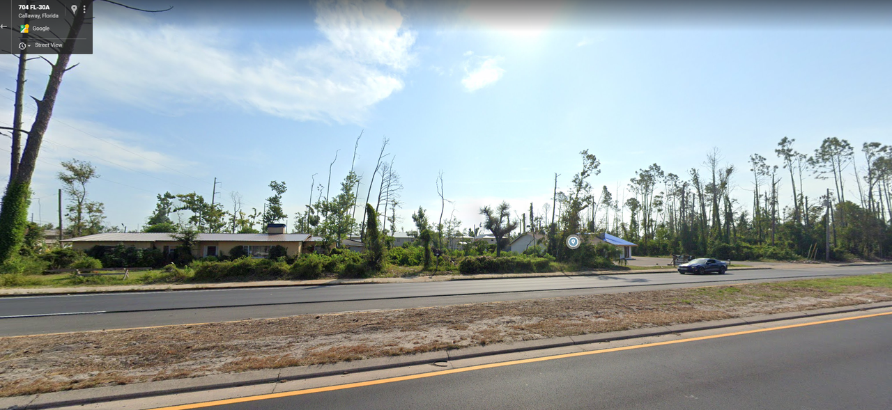
Example from Callaway:

2017: Image

2019: Image
Last edited by AlabamaDave on Thu Aug 27, 2020 2:00 pm, edited 1 time in total.
1 likes   

User avatar
storm_in_a_teacup
Category 1
Category 1
Posts: 348
Joined: Wed Aug 16, 2017 5:01 pm
Location: Huntsville, Alabama
Contact:

Re: ATL: LAURA - Hurricane - Discussion

#7742 Postby storm_in_a_teacup » Thu Aug 27, 2020 1:58 pm

otowntiger wrote:
RL3AO wrote:In hindsight, Eric Blake deserves a lot of credit for not over doing the westward shift on Tuesday morning. It was looking like a Houston storm after those early morning runs, but he kept the NHC forecast on the eastern side of the guidance with a landfall near the TX/LA border.

Agreed- and yet another example of humans doing a good job of blending scientific data, analysis, climatology, experience and good old fashioned forecasting for an outcome that exceeds any single computer model or group of models.


Probably should tell that to a physics professor I know who thinks meteorologists are useless and just can be replaced with computer models. They grew up in Israel and live in California now, so I'm really tempted to tell them "if you lived on the Gulf Coast you'd know better."
12 likes   
I know I can't straddle the atmosphere...just a tiny storm in your teacup, girl.

Sanibel
Category 5
Category 5
Posts: 10348
Joined: Mon Aug 30, 2004 11:06 pm
Location: Offshore SW Florida

ATL: LAURA - Hurricane - Discussion

#7743 Postby Sanibel » Thu Aug 27, 2020 1:59 pm

Reminds me of Hurricane Charley damage...Some homes blasted to bits...Others right next to them without a scratch...

Another 20mph and this storm would have been much worse...
0 likes   

User avatar
wxman57
Moderator-Pro Met
Moderator-Pro Met
Posts: 22480
Age: 66
Joined: Sat Jun 21, 2003 8:06 pm
Location: Houston, TX (southwest)

Re: ATL: LAURA - Tropical Storm - Discussion

#7744 Postby wxman57 » Thu Aug 27, 2020 2:02 pm

Looks like the mid-level circulation is racing out ahead of the LLC now. Should be a remnant low tomorrow.
2 likes   

tomatkins
Tropical Storm
Tropical Storm
Posts: 220
Joined: Wed Sep 05, 2018 2:11 pm

Re: ATL: LAURA - Hurricane - Discussion

#7745 Postby tomatkins » Thu Aug 27, 2020 2:19 pm

storm_in_a_teacup wrote:
otowntiger wrote:
RL3AO wrote:In hindsight, Eric Blake deserves a lot of credit for not over doing the westward shift on Tuesday morning. It was looking like a Houston storm after those early morning runs, but he kept the NHC forecast on the eastern side of the guidance with a landfall near the TX/LA border.

Agreed- and yet another example of humans doing a good job of blending scientific data, analysis, climatology, experience and good old fashioned forecasting for an outcome that exceeds any single computer model or group of models.


Probably should tell that to a physics professor I know who thinks meteorologists are useless and just can be replaced with computer models. They grew up in Israel and live in California now, so I'm really tempted to tell them "if you lived on the Gulf Coast you'd know better."

Seems easy enough. Give him a spaghetti plot of all of the ensemble model outcomes from say the past 24 hours and ask him to design an algorithm that will take that data and nail the final landfall to within a handful of miles 80 hours out.

Just the fact that the models have WILDLY divergent outcomes on track and intensity, even within the same model, should tell him that its not so easy.
7 likes   

User avatar
'CaneFreak
Category 5
Category 5
Posts: 1475
Joined: Mon Jun 05, 2006 10:50 am
Location: New Bern, NC

Re: ATL: LAURA - Hurricane - Discussion

#7746 Postby 'CaneFreak » Thu Aug 27, 2020 2:21 pm

Where's "here"? I'm curious about where the 20 feet of surge actually might have occurred. Thanks!

Rail Dawg wrote:Waiting for surge to recede. 20’ last night down here I’m told.

Chuck
0 likes   

User avatar
EquusStorm
Category 5
Category 5
Posts: 1649
Age: 33
Joined: Thu Nov 07, 2013 1:04 pm
Location: Jasper, AL
Contact:

Re: ATL: LAURA - Tropical Storm - Discussion

#7747 Postby EquusStorm » Thu Aug 27, 2020 2:21 pm

And that mid level separation kind of looks like it's on a trajectory to clip north AL lol, already got a band of strong to severe storms racing north on the eastern reaches of the system here
2 likes   
Colors of lost purpose on the canvas of irrelevance

Not a meteorologist, in fact more of an idiot than anything. You should probably check with the NHC or a local NWS office for official information.

tomatkins
Tropical Storm
Tropical Storm
Posts: 220
Joined: Wed Sep 05, 2018 2:11 pm

Re: ATL: LAURA - Hurricane - Discussion

#7748 Postby tomatkins » Thu Aug 27, 2020 2:21 pm

Steve wrote:
ConvergenceZone wrote:I don’t want to downplay any of this damage whatsoever, but I expected so much more to be flattened and underwater when I woke up, especially after hearing what they were forecasting. This is great news though. Perhaps the storm wasn’t as catastrophic as they thought? My prayers go out to those though who did suffer damage or lost their homes


Closer to the cost there will be more damage except there isn't much of anything there anymore. Lake Charles is fairly far inland and does have substantial structural and roof damage to a lot of homes and businesses. But it could have been worse and certainly would have if this was a city on the Gulf or not as far inland as it is. The weather people here always suggested that every mile of coastal marsh can knock a category of surge and other effects off a storm - like a wave break or whatever. I don't know if that's just an old urban legend, but with the lost of coastal marshes throughout the rest of the state, luckily they still had a bit there.


Well you gotta figure theres a reason they built these cities where they did.
2 likes   

User avatar
PTPatrick
Category 5
Category 5
Posts: 1827
Joined: Sat Jun 12, 2004 8:38 am

Re: ATL: LAURA - Tropical Storm - Discussion

#7749 Postby PTPatrick » Thu Aug 27, 2020 2:33 pm

By all accounts Laura had appeared to have stabilized at landfall so not surprised That wind didnt match what we saw in Panama City. I never expected to to see PC type damage in lake Charles proper. Not sure why anybody would of... It’s 30 miles inland. Compare lake Charles to Blountstown and it’s a much more apt comparison. The later probably looked a little worse than Lake Charles, owed largely to The fact that michael was strengthening in at landfall and Laura was not. Mike may have even been moving faster too. LC area had also been pruned in the last 15 years by Rita and Ike. Michael hit an area largely spared By that type of wind for many years. We have yet to see much footage of Communities near the gulf but I suspect it’s not pretty. We are very fortunate that the eyewall and worst surge hit some of the least populous gulf real estate next to the Everglades.
6 likes   

User avatar
robbielyn
Category 5
Category 5
Posts: 1239
Joined: Wed May 07, 2003 9:45 am
Location: brooksville, fl

Re: ATL: LAURA - Hurricane - Discussion

#7750 Postby robbielyn » Thu Aug 27, 2020 2:35 pm

Blow_Hard wrote:
p1nheadlarry wrote:
Blow_Hard wrote:

As a resident of Panama City I agree with both of you. Larry is correct in his assertion that many of the buildings in Downtown PC were old and definitely not built to code. However, I agree with Panda because we were in the western eyewall for over 2 hours and if you go back and look at images of Michael at LF you'll notice the western eyewall was very, very intense. There were many, many structures on 23rd st and points north that were newer and built to code and they were obliterated. I live 8 miles north of town rightoff Hwy 231 and on my street there was a home that had been built by the contractor who lived in the home and he had put rebar in the foundation and the studs were fastened to that to take extra precautions. After the storm the four walls were all that were left of his home, I think the greatest testament to Michael's strength was blowing rail cars off the tracks. An empty boxcar weighs about 30-50 tons. I know I've probably harped excessively about Michael but being an avid extreme weather junkie who always used to get pumped in anticipation of experiencing a TC, I can tell you that going through Michael changed my perspective forever and I will be perfectly fine if I never experience another Storm or Hurricane.


Yes, he/she is right. Didn't take the eye going east of town into account, but the Springfield/Callaway/Parker area was hit even harder (Wewa Hwy was breathtakingly bad when I drove through it the first time) which did get the eye. I was going to be in the area where my gf was in Gulf County at the time but stayed in TLH.


Yeah Larry, Callaway, Springfield, Parker etc. to the brunt in the Panama City area and there are thousands of homes that are uninhabitable in those areas. The western part of the eye went over Callaway. Tyndall AFB found the top of one of their towers in the woods near Wewa. l


i lived in the area back in the 80's so still interested in Michael. I was shocked to see all the train cars tipped over.
0 likes   
Robbielyn McCrary
I know just about enough to sound like I know what I'm talking about sometimes. But for your safety please follow the nhc for truly professional forecasting. :D

Blow_Hard
Tropical Storm
Tropical Storm
Posts: 156
Joined: Sun Aug 07, 2016 4:29 pm
Location: Panama City, FL

Re: ATL: LAURA - Hurricane - Discussion

#7751 Postby Blow_Hard » Thu Aug 27, 2020 3:22 pm

robbielyn wrote:
Blow_Hard wrote:
p1nheadlarry wrote:
Yes, he/she is right. Didn't take the eye going east of town into account, but the Springfield/Callaway/Parker area was hit even harder (Wewa Hwy was breathtakingly bad when I drove through it the first time) which did get the eye. I was going to be in the area where my gf was in Gulf County at the time but stayed in TLH.


Yeah Larry, Callaway, Springfield, Parker etc. to the brunt in the Panama City area and there are thousands of homes that are uninhabitable in those areas. The western part of the eye went over Callaway. Tyndall AFB found the top of one of their towers in the woods near Wewa. l


i lived in the area back in the 80's so still interested in Michael. I was shocked to see all the train cars tipped over.


Robbie...the landscape of Bay County is forever changed. I rode the storm out 2 miles up the road from where the rail cars tipped over. It was so surreal to come outside after the storm to see just the localized destruction the subdivision. A few doors down the people had a beautiful 6 wheel motorhome that had been parked in their driveway but when the storm was over, it was in their front yard on it's side. There is still lots and lots of visible damage and it's really sad. They estimate the City of Panama City lost 4000 residents because of the storm. So many had no homes or jobs so they left permanently.
1 likes   

User avatar
AnnularCane
S2K Supporter
S2K Supporter
Posts: 2634
Joined: Thu Jun 08, 2006 9:18 am
Location: Wytheville, VA

Re: ATL: LAURA - Hurricane - Discussion

#7752 Postby AnnularCane » Thu Aug 27, 2020 3:24 pm

storm_in_a_teacup wrote:
otowntiger wrote:
RL3AO wrote:In hindsight, Eric Blake deserves a lot of credit for not over doing the westward shift on Tuesday morning. It was looking like a Houston storm after those early morning runs, but he kept the NHC forecast on the eastern side of the guidance with a landfall near the TX/LA border.

Agreed- and yet another example of humans doing a good job of blending scientific data, analysis, climatology, experience and good old fashioned forecasting for an outcome that exceeds any single computer model or group of models.


Probably should tell that to a physics professor I know who thinks meteorologists are useless and just can be replaced with computer models. They grew up in Israel and live in California now, so I'm really tempted to tell them "if you lived on the Gulf Coast you'd know better."


You should do that. :lol: I'd hate to think where we'd be if we were relying solely on computer models THIS season. Or really any season, but especially this one.
4 likes   

PandaCitrus
Category 1
Category 1
Posts: 424
Joined: Mon Sep 04, 2017 2:44 pm

Re: ATL: LAURA - Tropical Storm - Discussion

#7753 Postby PandaCitrus » Thu Aug 27, 2020 3:38 pm

This is some of the worst damage I've seen so far. We'll get more of this now that the helicopters are in the air. I'm not sure where this is but I'd guess in some of the little towns east of Lake Charles that never saw the eye and were in the eastern eye wall for hours.

 https://twitter.com/ABC/status/1299080682354941952


1 likes   

supercane4867
Category 5
Category 5
Posts: 4966
Joined: Wed Nov 14, 2012 10:43 am

Re: ATL: LAURA - Tropical Storm - Discussion

#7754 Postby supercane4867 » Thu Aug 27, 2020 3:43 pm

0 likes   

User avatar
Beef Stew
Category 1
Category 1
Posts: 284
Joined: Sat May 30, 2020 11:31 am
Location: South Florida

Re: ATL: LAURA - Tropical Storm - Discussion

#7755 Postby Beef Stew » Thu Aug 27, 2020 3:44 pm

Aerial videos of Cameron are starting to come in too. I think once we start to see the full extent of the damage from Cameron to Grand Chenier, the talk of it not being as bad as expected will quiet down. Scenes like this are pretty grim.


Link: https://youtu.be/Ku6AvbOY2IU
12 likes   

User avatar
EquusStorm
Category 5
Category 5
Posts: 1649
Age: 33
Joined: Thu Nov 07, 2013 1:04 pm
Location: Jasper, AL
Contact:

Re: ATL: LAURA - Tropical Storm - Discussion

#7756 Postby EquusStorm » Thu Aug 27, 2020 3:47 pm

Aaaand that north-racing band east of the decoupling mid-level circulation just barrelled through here. Broken tree limbs, monsoonal downpour, and loose debris thrown around. Obviously nothing compared to the devastation in Louisiana but surprised to have some distantly related impacts this far east so early. Pulled into the Slight Risk for tornadoes tomorrow as well.

Image

Image
7 likes   
Colors of lost purpose on the canvas of irrelevance

Not a meteorologist, in fact more of an idiot than anything. You should probably check with the NHC or a local NWS office for official information.

wx98
Category 5
Category 5
Posts: 1218
Joined: Sat Aug 25, 2018 9:24 pm

Re: ATL: LAURA - Tropical Storm - Discussion

#7757 Postby wx98 » Thu Aug 27, 2020 3:47 pm

BULLETIN
Tropical Storm Laura Advisory Number 32
NWS National Hurricane Center Miami FL AL132020
400 PM CDT Thu Aug 27 2020

...FLOODING RAINFALL AND TROPICAL STORM FORCE WINDS SPREADING
INLAND OVER PORTIONS OF ARKANSAS...


SUMMARY OF 400 PM CDT...2100 UTC...INFORMATION
----------------------------------------------
LOCATION...33.4N 92.8W
ABOUT 80 MI...130 KM NE OF SHREVEPORT LOUISIANA
ABOUT 130 MI...210 KM SSW OF LITTLE ROCK ARKANSAS
MAXIMUM SUSTAINED WINDS...50 MPH...85 KM/H
PRESENT MOVEMENT...NNE OR 15 DEGREES AT 15 MPH...24 KM/H
MINIMUM CENTRAL PRESSURE...991 MB...29.27 INCHES
0 likes   

User avatar
EquusStorm
Category 5
Category 5
Posts: 1649
Age: 33
Joined: Thu Nov 07, 2013 1:04 pm
Location: Jasper, AL
Contact:

Re: ATL: LAURA - Tropical Storm - Discussion

#7758 Postby EquusStorm » Thu Aug 27, 2020 4:08 pm

Uh... well the MLC is definitely heading this way, no question based on satellite trends. That's a tremendous amount of energy aloft and I'm getting a bit intrigued at the possibility of some high gusts in any convection that hangs out here tonight. Seems like the energy is further southeast and faster than expected.
3 likes   
Colors of lost purpose on the canvas of irrelevance

Not a meteorologist, in fact more of an idiot than anything. You should probably check with the NHC or a local NWS office for official information.

gailwarning
S2K Supporter
S2K Supporter
Posts: 33
Joined: Sun Sep 10, 2017 1:09 pm
Location: N. Georgia. Sick of FL

Re: ATL: LAURA - Tropical Storm - Discussion

#7759 Postby gailwarning » Thu Aug 27, 2020 4:24 pm

Beef Stew wrote:Aerial videos of Cameron are starting to come in too. I think once we start to see the full extent of the damage from Cameron to Grand Chenier, the talk of it not being as bad as expected will quiet down. Scenes like this are pretty grim.

https://youtu.be/Ku6AvbOY2IU

What's disturbing is no sign of life. As many as 150 people were said to have refused evacuation.
1 likes   

User avatar
DestinHurricane
Category 4
Category 4
Posts: 930
Joined: Tue May 01, 2018 8:05 am
Location: Columbus, OH... need to get back in the action

Re: ATL: LAURA - Tropical Storm - Discussion

#7760 Postby DestinHurricane » Thu Aug 27, 2020 4:43 pm

gailwarning wrote:
Beef Stew wrote:Aerial videos of Cameron are starting to come in too. I think once we start to see the full extent of the damage from Cameron to Grand Chenier, the talk of it not being as bad as expected will quiet down. Scenes like this are pretty grim.

https://youtu.be/Ku6AvbOY2IU

What's disturbing is no sign of life. As many as 150 people were said to have refused evacuation.


150 people spread across cameron County. Only a fraction were actually in cameron.
0 likes   
Destin/Santa Rosa Beach, Florida: Ivan 2004, Dennis 2005, Michael 2018, Sally 2020

Fort Lauderdale, Florida Eta 2020, Many future storms!

THE Ohio State University: :cold:


Return to “2020”

Who is online

Users browsing this forum: No registered users and 34 guests