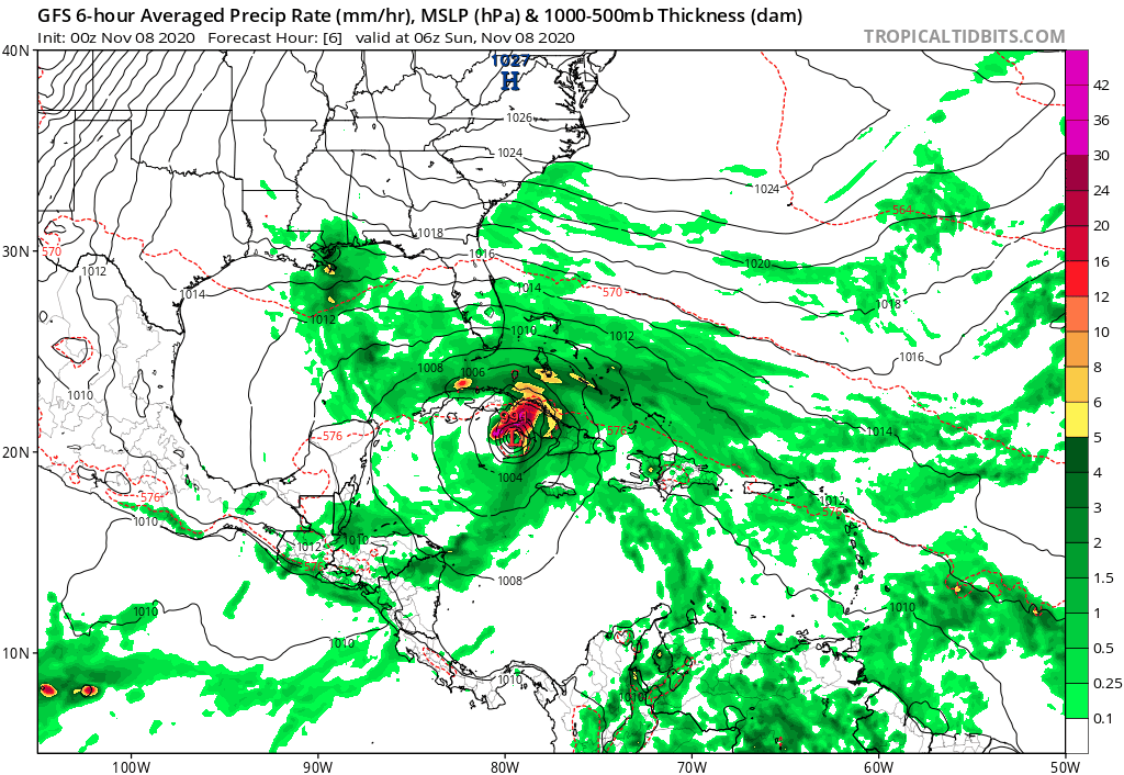
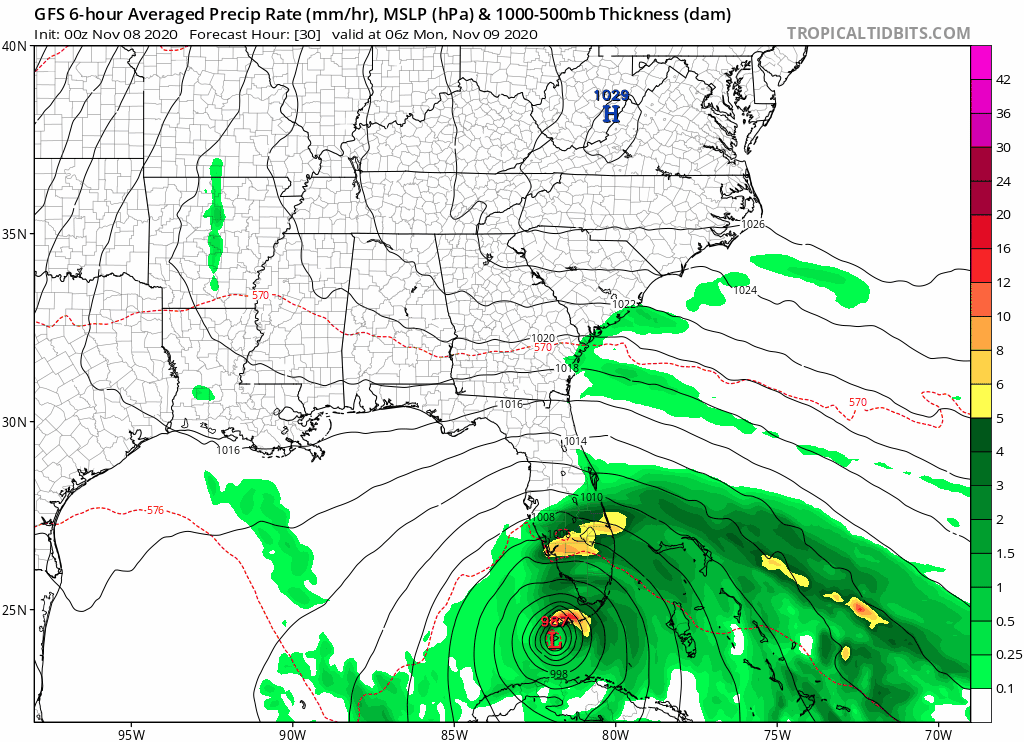
aspen wrote:Seems like most of the models have shifted to having Eta move further SW (closer to the Yucatán Channel) and slowing down at least somewhat. The GFS and HMON put it in the optimal place to become a Cat 2/3, while the HWRF, CMC, and ICON don’t show anything stronger than they’ve previously had over the last multiple runs.
Even if this were to strengthen into a significant hurricane again in the Gulf I don’t think South Florida at least will have to worry about any troughs coming through to pull it back towards us as the NAO remains positive along with a -PNA allowing the SE Ridge to persist.