

ATL: SAM - Models
Moderator: S2k Moderators
Re: ATL: SAM - Models
TVCN continues shifting SW.
6 likes
The following post is NOT an official forecast and should not be used as such. It is just the opinion of the poster and may or may not be backed by sound meteorological data. It is NOT endorsed by any professional institution including storm2k.org For Official Information please refer to the NHC and NWS products.
-
Shell Mound
- Category 5

- Posts: 2434
- Age: 31
- Joined: Thu Sep 07, 2017 3:39 pm
- Location: St. Petersburg, FL → Scandinavia
Re: ATL: SAM - Models
I would expect the TVCN to shift eastward over time. It gives too much weight to weaker guidance at the expense of the stronger, and Sam is currently exceeding even the most bullish guidance to date. The key is that the vast majority of the strongest EPS and GEFS members have been showing OTS, cycle after cycle, run after run. The weaker members were showing impacts to the northeastern Caribbean and other land-masses, but Sam’s (E)RI likely nullifies all of the western-leaning solutions and will contribute to an eastward bias in upcoming guidance. Expect future corrections.
2 likes
CVW / MiamiensisWx / Shell Mound
The posts in this forum are NOT official forecasts and should not be used as such. They are just the opinion of the poster and may or may not be backed by sound meteorological data. They are NOT endorsed by any professional institution or STORM2K. For official information, please refer to products from the NHC and NWS.

Re: ATL: SAM - Models
I'm not even going to try to guess anywhere past 3 days into the future, there is too many things that can cause this system to do different things.
8 likes
Personal Forecast Disclaimer:
The posts in this forum are NOT official forecast and should not be used as such. They are just the opinion of the poster and may or may not be backed by sound meteorological data. They are NOT endorsed by any professional institution or storm2k.org. For official information, please refer to the NHC and NWS products.
The posts in this forum are NOT official forecast and should not be used as such. They are just the opinion of the poster and may or may not be backed by sound meteorological data. They are NOT endorsed by any professional institution or storm2k.org. For official information, please refer to the NHC and NWS products.
-
Hurricaneman

- Category 5
- Posts: 7284
- Age: 43
- Joined: Tue Aug 31, 2004 3:24 pm
- Location: central florida
Re: ATL: SAM - Models
Anymore shifts west in the GFS and New England would get the brunt of Sam so let’s hope for between Bermuda and North Carolina then out to sea
0 likes
Re: ATL: SAM - Models
18z Euro ENS. vs 12z Euro ENS. OPS making a close run at the islands. The OPS is on the southern end of the strong cluster.
18z

12z

18z
12z
Last edited by blp on Thu Sep 23, 2021 9:03 pm, edited 2 times in total.
2 likes
The following post is NOT an official forecast and should not be used as such. It is just the opinion of the poster and may or may not be backed by sound meteorological data. It is NOT endorsed by any professional institution including storm2k.org For Official Information please refer to the NHC and NWS products.
-
Category5Kaiju

- Category 5
- Posts: 3404
- Age: 22
- Joined: Thu Dec 24, 2020 12:45 pm
- Location: Seattle
Re: ATL: SAM - Models
3 likes
Unless explicitly stated, all information covered in my posts is based on my opinions and observations. Please refer to a professional meteorologist or an accredited weather research agency otherwise, especially if serious decisions must be made in the event of a potentially life-threatening tropical storm or hurricane.
Re: ATL: SAM - Models
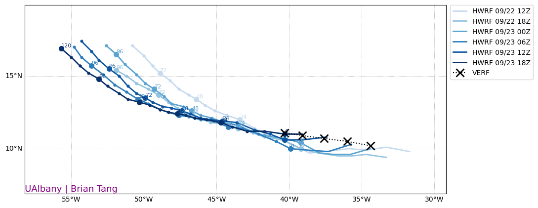
HWRF also trending West
0 likes
The following post is NOT an official forecast and should not be used as such. It is just the opinion of the poster and may or may not be backed by sound meteorological data. It is NOT endorsed by any professional institution including storm2k.org For Official Information please refer to the NHC and NWS products.
Re: ATL: SAM - Models
blp wrote:18z Euro ENS. vs 12z Euro ENS. OPS making a close run at the islands. The OPS is on the southern end of the strong cluster.
18z
https://i.ibb.co/5LVQrzj/tc-guidance-1.png
12z
https://i.ibb.co/kGvdVX3/tc-guidance.png
Looks like the 18z OPS crosses 60w at around 17.5N, which is further S than the 12z. Also, extrapolating, this run looks a bit faster.
0 likes
-
Category5Kaiju
- Category 5
- Posts: 3404
- Age: 22
- Joined: Thu Dec 24, 2020 12:45 pm
- Location: Seattle
Re: ATL: SAM - Models
Just a thought, but I wonder if regardless of strength, size would be a major player in where Sam goes? Like perhaps its compactness will help it go further west? Or is this not right?
2 likes
Unless explicitly stated, all information covered in my posts is based on my opinions and observations. Please refer to a professional meteorologist or an accredited weather research agency otherwise, especially if serious decisions must be made in the event of a potentially life-threatening tropical storm or hurricane.
-
Blown Away

- S2K Supporter

- Posts: 9867
- Joined: Wed May 26, 2004 6:17 am
Re: ATL: SAM - Models
It seems when the models trend S & W like they have today we see a faster paced storm and when they trend N & E they tend to show a slower paced storm.
0 likes
Hurricane Eye Experience: David 79, Irene 99, Frances 04, Jeanne 04, Wilma 05... EYE COMING MY WAY IN 2024…
Hurricane Brush Experience: Andrew 92, Erin 95, Floyd 99, Matthew 16, Irma 17, Ian 22, Nicole 22…
Hurricane Brush Experience: Andrew 92, Erin 95, Floyd 99, Matthew 16, Irma 17, Ian 22, Nicole 22…
-
ScottNAtlanta

- Category 5
- Posts: 2006
- Joined: Sat May 25, 2013 3:11 pm
- Location: Atlanta, GA
Re: ATL: SAM - Models
Category5Kaiju wrote:Just a thought, but I wonder if regardless of strength, size would be a major player in where Sam goes? Like perhaps its compactness will help it go further west? Or is this not right?
Speed is going to be a much bigger player than strength. A minimal hurricane and a strong hurricane are going to feel the same steering flow.
0 likes
The posts in this forum are NOT official forecast and should not be used as such. They are just the opinion of the poster and may or may not be backed by sound meteorological data. They are NOT endorsed by any professional institution or storm2k.org. For official information, please refer to the NHC and NWS products.
-
Spacecoast

- Category 2

- Posts: 687
- Joined: Thu Aug 31, 2017 2:03 pm
Re: ATL: SAM - Models
NHC 11pm:
24H 25/0000Z 11.8N 45.0W 90 KT 105 MPH
36H 25/1200Z 12.1N 46.6W 105 KT 120 MPH
48H 26/0000Z 12.5N 47.8W 110 KT 125 MPH
60H 26/1200Z 13.0N 49.1W 110 KT 125 MPH
72H 27/0000Z 13.5N 50.4W 110 KT 125 MPH
96H 28/0000Z 15.3N 53.2W 110 KT 125 MPH
120H 29/0000Z 17.3N 56.1W 110 KT 125 MPH
For reference, I've added a small square dot at 17.3N 56.1W to latest ensembles
3 likes

Re: ATL: SAM - Models
0Z GFS coming in a bit weaker and moving a little faster than the 18Z run.
0 likes
Re: ATL: SAM - Models
ScottNAtlanta wrote:Category5Kaiju wrote:Just a thought, but I wonder if regardless of strength, size would be a major player in where Sam goes? Like perhaps its compactness will help it go further west? Or is this not right?
Speed is going to be a much bigger player than strength. A minimal hurricane and a strong hurricane are going to feel the same steering flow.
They would not have the same steering flow.
0 likes
Personal Forecast Disclaimer:
The posts in this forum are NOT official forecast and should not be used as such. They are just the opinion of the poster and may or may not be backed by sound meteorological data. They are NOT endorsed by any professional institution or storm2k.org. For official information, please refer to the NHC and NWS products.
The posts in this forum are NOT official forecast and should not be used as such. They are just the opinion of the poster and may or may not be backed by sound meteorological data. They are NOT endorsed by any professional institution or storm2k.org. For official information, please refer to the NHC and NWS products.
-
ncforecaster89
- Tropical Storm

- Posts: 219
- Age: 54
- Joined: Sat Oct 20, 2018 12:32 pm
- Contact:
Re: ATL: SAM - Models
Actually, a weaker, more shallow system will be steered more westerly and at a faster transitional speed by the lower-level winds than a deeper, more intense TC…that will tend to move more northerly.
2 likes
Re: ATL: SAM - Models
00Z GFS Sam barely misses Bermuda to the east. Nova Scotia probably going to get hit again this run.
0 likes
-
Hurricaneman
- Category 5
- Posts: 7284
- Age: 43
- Joined: Tue Aug 31, 2004 3:24 pm
- Location: central florida
Re: ATL: SAM - Models
Looks to be having a slight west component similar to the 18z and if so it would landfall in extreme Eastern Maine but with that beyond 7 days it will probably change
It heads out south of Atlantic Canada
It heads out south of Atlantic Canada
0 likes

Re: ATL: SAM - Models
Lol, the GFS seems to make Sam plow through a ridge again (even if you go by the contours and not the colors in the 500mb height plot).
1 likes
-
Hurricaneman
- Category 5
- Posts: 7284
- Age: 43
- Joined: Tue Aug 31, 2004 3:24 pm
- Location: central florida
Re: ATL: SAM - Models
Teban54 wrote:Lol, the GFS seems to make Sam plow through a ridge again (even if you go by the contours and not the colors in the 500mb height plot).
The difference is the cutoff didn’t phase with Sam this run
0 likes
Re: ATL: SAM - Models
So could we be seeing a possible Long Island Express??
0 likes
Personal Forecast Disclaimer:
The posts in this forum are NOT official forecast and should not be used as such. They are just the opinion of the poster and may or may not be backed by sound meteorological data. They are NOT endorsed by any professional institution or storm2k.org. For official information, please refer to the NHC and NWS products.
The posts in this forum are NOT official forecast and should not be used as such. They are just the opinion of the poster and may or may not be backed by sound meteorological data. They are NOT endorsed by any professional institution or storm2k.org. For official information, please refer to the NHC and NWS products.
Who is online
Users browsing this forum: No registered users and 9 guests