Moderator: S2k Moderators


Cat5James wrote:GFS also shifted East not just the Euro.... so now we are discounting the two major global models? In favor of what, the HMON and HWRF?


Cat5James wrote:GFS also shifted East not just the Euro.... so now we are discounting the two major global models? In favor of what, the HMON and HWRF?


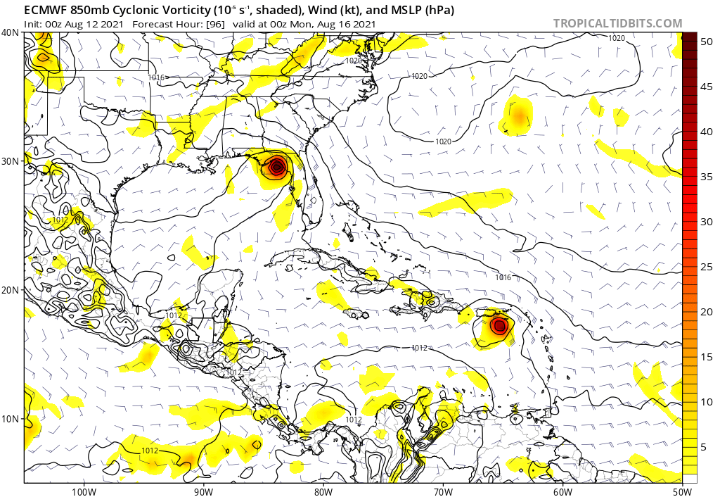
We have seen them intensify on approach to the big bend, lets see how it does today and what the models do with it now that it is moving awayNDG wrote:06z Euro says don't turn your back on Fred.
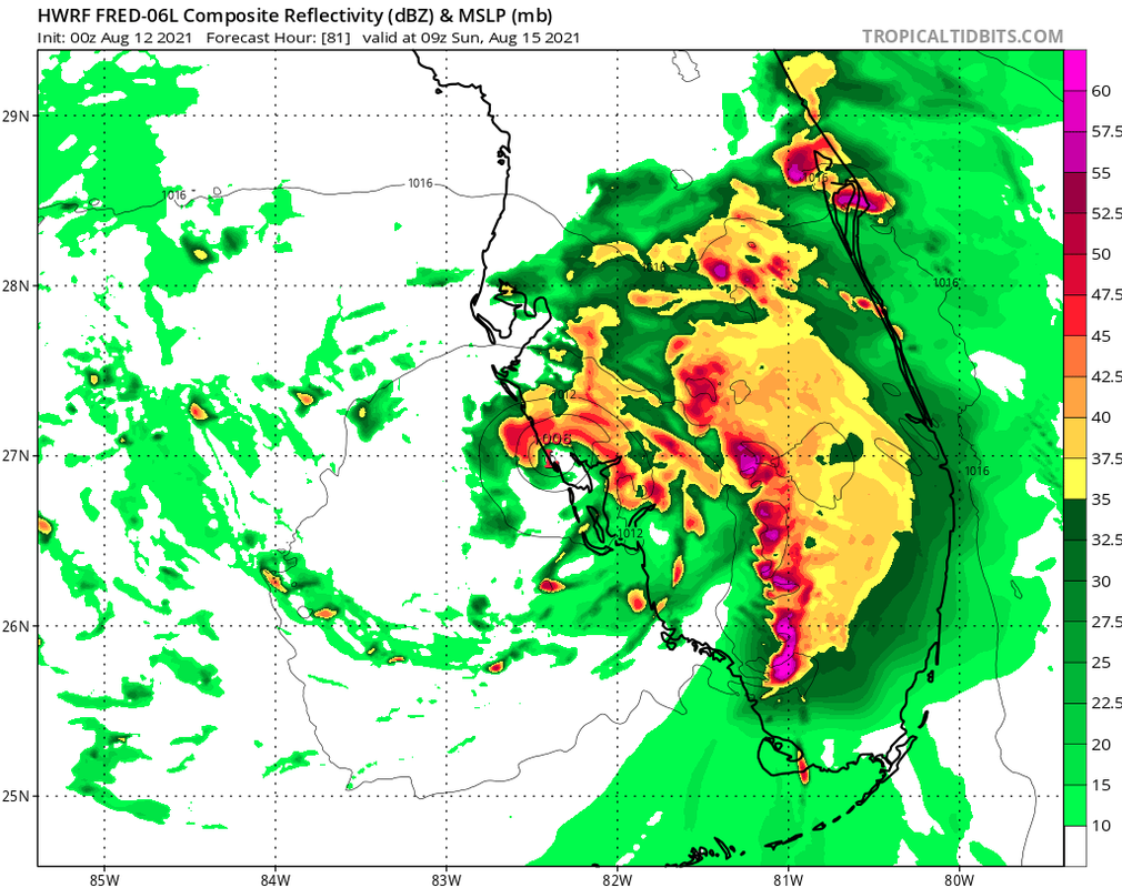
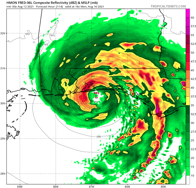
This is what I have been talking about, if Fred is able to track near or just offshore of W coast of FL conditions will not be that bad for it to strengthen with almost 48 hrs to do so and over very warm waters.
https://i.imgur.com/TlmtNWN.gif
Users browsing this forum: No registered users and 37 guests