CPAC: LINDA - Post-Tropical

Moderator: S2k Moderators

Message
Author
User avatar
cycloneye
Admin
Admin
Posts: 139062
Age: 67
Joined: Thu Oct 10, 2002 10:54 am
Location: San Juan, Puerto Rico

CPAC: LINDA - Post-Tropical

#1 Postby cycloneye » Sun Aug 08, 2021 8:01 am

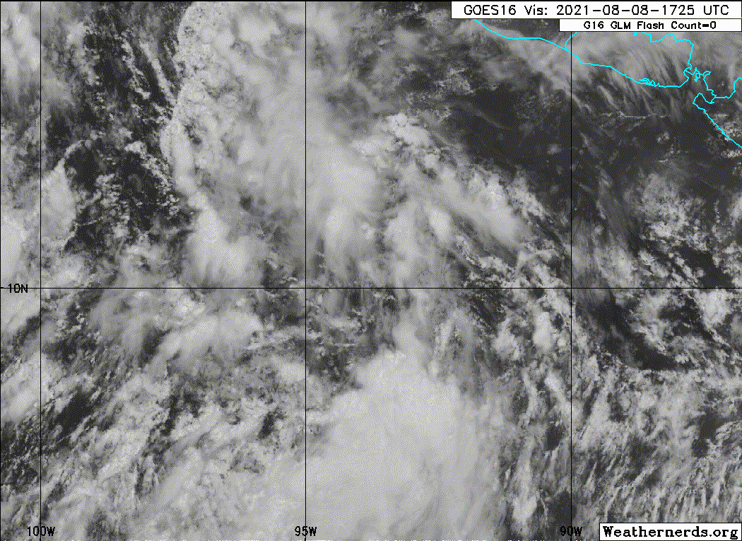
EP, 93, 2021080812, , BEST, 0, 124N, 941W, 20, 1010, DB, 34, NEQ, 0, 0, 0, 0, 1012, 120, 50, 0, 0, E, 0, , 0, 0, INVEST, S, 0, , 0, 0, 0, 0, genesis-num, 017, SPAWNINVEST, ep782021 to ep932021,


https://ftp.nhc.noaa.gov/atcf/btk/

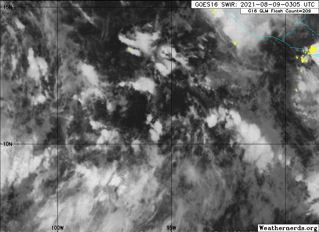
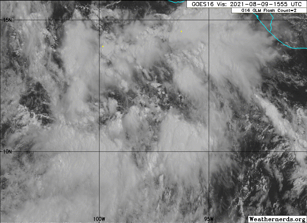
If the models are right, this invest will be the second major of the season but we will see on that.
0 likes   
Visit the Caribbean-Central America Weather Thread where you can find at first post web cams,radars
and observations from Caribbean basin members Click Here

User avatar
Yellow Evan
Professional-Met
Professional-Met
Posts: 15951
Age: 25
Joined: Fri Jul 15, 2011 12:48 pm
Location: Henderson, Nevada/Honolulu, HI
Contact:

Re: EPAC: INVEST 93E

#2 Postby Yellow Evan » Sun Aug 08, 2021 8:27 am

A broad area of low pressure is producing some disorganized shower
activity a few hundred miles offshore of the coasts of southern
Mexico, Guatemala, and El Salvador. Environmental conditions are
expected to be conducive for development of this system, and a
tropical depression is likely to form during the early or middle
portions of the week. This system is expected to move westward to
west-northwestward at about 10 mph during the next several days,
parallel to and offshore of the coast of southern Mexico.
* Formation chance through 48 hours...medium...50 percent.
* Formation chance through 5 days...high...80 percent.
0 likes   

User avatar
cycloneye
Admin
Admin
Posts: 139062
Age: 67
Joined: Thu Oct 10, 2002 10:54 am
Location: San Juan, Puerto Rico

Re: EPAC: INVEST 93E

#3 Postby cycloneye » Sun Aug 08, 2021 12:44 pm

A broad area of low pressure is producing disorganized shower
activity a few hundred miles offshore of the coasts of southern
Mexico and Guatemala. Environmental conditions are expected to be
conducive for development of this disturbance, and a tropical
depression is likely to form during the early or middle portions of
the week. This system is expected to move westward to
west-northwestward at about 10 mph during the next several days,
parallel to and offshore of the coast of southern Mexico.
* Formation chance through 48 hours...medium...50 percent.
* Formation chance through 5 days...high...90 percent.
0 likes   
Visit the Caribbean-Central America Weather Thread where you can find at first post web cams,radars
and observations from Caribbean basin members Click Here

User avatar
Kingarabian
S2K Supporter
S2K Supporter
Posts: 15434
Joined: Sat Aug 08, 2009 3:06 am
Location: Honolulu, Hawaii

Re: EPAC: INVEST 93E

#4 Postby Kingarabian » Sun Aug 08, 2021 2:46 pm

Unfortunately the models are keeping the track ever so close to Mexico. AKA max peak as a Cat.1 maybe Cat.2, so long that track holds.
0 likes   
RIP Kobe Bryant

User avatar
cycloneye
Admin
Admin
Posts: 139062
Age: 67
Joined: Thu Oct 10, 2002 10:54 am
Location: San Juan, Puerto Rico

Re: EPAC: INVEST 93E

#5 Postby cycloneye » Sun Aug 08, 2021 2:51 pm

I dont see them too close to the coast.

Image
0 likes   
Visit the Caribbean-Central America Weather Thread where you can find at first post web cams,radars
and observations from Caribbean basin members Click Here

User avatar
Kingarabian
S2K Supporter
S2K Supporter
Posts: 15434
Joined: Sat Aug 08, 2009 3:06 am
Location: Honolulu, Hawaii

Re: EPAC: INVEST 93E

#6 Postby Kingarabian » Sun Aug 08, 2021 3:27 pm

cycloneye wrote:I dont see them too close to the coast.

https://i.imgur.com/1EEPa7Z.png


Not explicitly hugging the coast but those tracks are still pretty close to Mexico. TVCN already has it reaching 17N/110W. That's the tracks Guillermo and Kevin took. Other systems in 2019 and 2020 took similar tracks and also struggled. What happens is that after they pass 15N, the model don't factor how much subsidence + some divergence is in that area. Big reason why this area isn't favorable for developing is due to the blocking high off of California. It's creating more easterly shear than normal. It's also the same blocking high that's causing the upwelling in the area and playing a big part in the -PDO/-PMM look.

The Euro originally had this becoming a major hurricane later on while tracking west and never going north of 16N. That's more believable for a major hurricane track.

Image
1 likes   
RIP Kobe Bryant

Sciencerocks
Category 5
Category 5
Posts: 7286
Age: 38
Joined: Thu Jul 06, 2017 1:51 am

Re: EPAC: INVEST 93E

#7 Postby Sciencerocks » Sun Aug 08, 2021 3:55 pm

Image
0 likes   

User avatar
Kingarabian
S2K Supporter
S2K Supporter
Posts: 15434
Joined: Sat Aug 08, 2009 3:06 am
Location: Honolulu, Hawaii

Re: EPAC: INVEST 93E

#8 Postby Kingarabian » Sun Aug 08, 2021 4:02 pm

Best case scenario is for this to take its sweet time to develop. Might allow it to track further west than NW, then as it develops and the break in the ridge later on it would be a healthy hurricane.
2 likes   
RIP Kobe Bryant

User avatar
Kingarabian
S2K Supporter
S2K Supporter
Posts: 15434
Joined: Sat Aug 08, 2009 3:06 am
Location: Honolulu, Hawaii

Re: EPAC: INVEST 93E

#9 Postby Kingarabian » Sun Aug 08, 2021 6:01 pm

Extremely speculative, but assuming this gets a strong as advertised, GFS is showing its remnants reaching just off shore of SoCal. Maybe if it can remain east of its forecast it can reach SoCal a little stronger to bring much needed rains to the SW CONUS.
Image
0 likes   
RIP Kobe Bryant

User avatar
Yellow Evan
Professional-Met
Professional-Met
Posts: 15951
Age: 25
Joined: Fri Jul 15, 2011 12:48 pm
Location: Henderson, Nevada/Honolulu, HI
Contact:

Re: EPAC: INVEST 93E

#10 Postby Yellow Evan » Sun Aug 08, 2021 6:25 pm

Kingarabian wrote:Extremely speculative, but assuming this gets a strong as advertised, GFS is showing its remnants reaching just off shore of SoCal. Maybe if it can remain east of its forecast it can reach SoCal a little stronger to bring much needed rains to the SW CONUS.
https://i.imgur.com/yVD2Bkj.gif


GFS has high bias over colder SST’s intensity wise. There should be no talk to of any low pressure actually reaching the state. Pending what other meteorological features are there, impacts are uncertain at this stage just because it’s so far out. The worst flooding events have been when there’s also a trough to draw up moisture.
3 likes   

User avatar
cycloneye
Admin
Admin
Posts: 139062
Age: 67
Joined: Thu Oct 10, 2002 10:54 am
Location: San Juan, Puerto Rico

Re: EPAC: INVEST 93E

#11 Postby cycloneye » Sun Aug 08, 2021 6:29 pm

A broad area of low pressure located a few hundred miles south of
the Gulf of Tehuantepec continues to produce disorganized showers
and thunderstorms. Environmental conditions are conducive for
development of this disturbance, and a tropical depression is
expected to form during the next two or three days. This system is
forecast to move westward to west-northwestward at about 10 mph
during the next several days, parallel to and offshore of the coast
of southern Mexico.
* Formation chance through 48 hours...medium...60 percent.
* Formation chance through 5 days...high...90 percent.
0 likes   
Visit the Caribbean-Central America Weather Thread where you can find at first post web cams,radars
and observations from Caribbean basin members Click Here

User avatar
Yellow Evan
Professional-Met
Professional-Met
Posts: 15951
Age: 25
Joined: Fri Jul 15, 2011 12:48 pm
Location: Henderson, Nevada/Honolulu, HI
Contact:

Re: EPAC: INVEST 93E

#12 Postby Yellow Evan » Sun Aug 08, 2021 7:51 pm

0 likes   

User avatar
ElectricStorm
Category 5
Category 5
Posts: 4528
Age: 23
Joined: Tue Aug 13, 2019 11:23 pm
Location: Skiatook, OK / Norman, OK

Re: EPAC: INVEST 93E

#13 Postby ElectricStorm » Mon Aug 09, 2021 12:37 am

1. A broad area of low pressure located a few hundred miles south of
the Gulf of Tehuantepec continues to produce disorganized showers
and a few thunderstorms. Environmental conditions are conducive for
development of this disturbance, and a tropical depression is
expected to form within the next couple of days. This system is
forecast to move westward to west-northwestward at about 10 mph
through midweek, parallel to and offshore of the coast of southern
Mexico.
* Formation chance through 48 hours...high...70 percent.
* Formation chance through 5 days...high...90 percent.
0 likes   
I am in no way a professional. Take what I say with a grain of salt as I could be totally wrong. Please refer to the NHC, NWS, or SPC for official information.

Boomer Sooner!

Sciencerocks
Category 5
Category 5
Posts: 7286
Age: 38
Joined: Thu Jul 06, 2017 1:51 am

Re: EPAC: INVEST 93E

#14 Postby Sciencerocks » Mon Aug 09, 2021 1:31 am

Image
0 likes   

User avatar
cycloneye
Admin
Admin
Posts: 139062
Age: 67
Joined: Thu Oct 10, 2002 10:54 am
Location: San Juan, Puerto Rico

Re: EPAC: INVEST 93E

#15 Postby cycloneye » Mon Aug 09, 2021 7:50 am

A broad area of low pressure located a few hundred miles south of
the Gulf of Tehuantepec continues to produce disorganized showers
and a few thunderstorms. Environmental conditions are conducive for
development of this disturbance, and a tropical depression is
expected to form within the next couple of days. This system is
forecast to move westward to west-northwestward at about 10 mph
through midweek, parallel to and offshore of the coast of southern
Mexico.
* Formation chance through 48 hours...high...70 percent.
* Formation chance through 5 days...high...90 percent.
0 likes   
Visit the Caribbean-Central America Weather Thread where you can find at first post web cams,radars
and observations from Caribbean basin members Click Here

User avatar
Yellow Evan
Professional-Met
Professional-Met
Posts: 15951
Age: 25
Joined: Fri Jul 15, 2011 12:48 pm
Location: Henderson, Nevada/Honolulu, HI
Contact:

Re: EPAC: INVEST 93E

#16 Postby Yellow Evan » Mon Aug 09, 2021 12:16 pm

Wind shear could still be somewhat of an issue here btw if the GFS is correct at least early on.
0 likes   

User avatar
cycloneye
Admin
Admin
Posts: 139062
Age: 67
Joined: Thu Oct 10, 2002 10:54 am
Location: San Juan, Puerto Rico

Re: EPAC: INVEST 93E

#17 Postby cycloneye » Mon Aug 09, 2021 12:33 pm

A broad area of low pressure located a few hundred miles south of
Acapulco, Mexico continues to produce disorganized showers and a few
thunderstorms. Environmental conditions are conducive for
development of this disturbance, and a tropical depression is
expected to form within the next couple of days. This system is
forecast to move westward to west-northwestward at about 10 mph
through midweek, parallel to and offshore of the coast of southern
Mexico.
* Formation chance through 48 hours...high...80 percent.
* Formation chance through 5 days...high...90 percent.
0 likes   
Visit the Caribbean-Central America Weather Thread where you can find at first post web cams,radars
and observations from Caribbean basin members Click Here

Sciencerocks
Category 5
Category 5
Posts: 7286
Age: 38
Joined: Thu Jul 06, 2017 1:51 am

Re: EPAC: INVEST 93E

#18 Postby Sciencerocks » Mon Aug 09, 2021 2:28 pm

Image
0 likes   

User avatar
Yellow Evan
Professional-Met
Professional-Met
Posts: 15951
Age: 25
Joined: Fri Jul 15, 2011 12:48 pm
Location: Henderson, Nevada/Honolulu, HI
Contact:

Re: EPAC: INVEST 93E

#19 Postby Yellow Evan » Mon Aug 09, 2021 2:37 pm

* GFS version *
* EAST PACIFIC 2021 SHIPS INTENSITY FORECAST *
* IR SAT DATA AVAILABLE, OHC AVAILABLE *
* INVEST EP932021 08/09/21 18 UTC *

TIME (HR) 0 6 12 18 24 36 48 60 72 84 96 108 120 132 144 156 168
V (KT) NO LAND 25 29 34 40 45 53 62 68 75 81 88 89 91 86 85 81 79
V (KT) LAND 25 29 34 40 45 53 62 68 75 81 88 89 91 86 85 81 79
V (KT) LGEM 25 27 29 31 33 35 38 41 45 50 58 66 72 76 73 69 66
Storm Type TROP TROP TROP TROP TROP TROP TROP TROP TROP TROP TROP TROP TROP TROP TROP TROP TROP

SHEAR (KT) 16 19 22 24 26 25 23 28 17 12 13 17 16 17 8 8 6
SHEAR ADJ (KT) 1 2 2 2 -1 2 0 -1 -2 2 0 0 0 7 7 1 1
SHEAR DIR 343 360 13 15 19 33 29 18 358 17 48 40 50 67 63 56 82
SST (C) 28.8 28.9 29.0 29.1 29.1 29.1 28.8 28.7 28.8 28.9 28.6 28.2 28.3 27.5 26.7 25.7 25.4
POT. INT. (KT) 153 153 154 155 155 155 152 150 151 153 150 146 147 139 131 119 115
200 MB T (C) -53.3 -53.0 -53.5 -53.6 -53.2 -53.4 -53.5 -53.3 -53.2 -53.3 -53.3 -52.9 -52.9 -52.4 -52.1 -51.8 -51.8
200 MB VXT (C) -0.1 -0.1 -0.1 -0.1 -0.2 0.0 0.3 0.3 0.5 0.4 0.6 0.7 0.5 0.6 0.9 1.5 1.3
TH_E DEV (C) 4 4 3 3 5 4 5 5 5 5 5 5 4 3 3 2 2
700-500 MB RH 85 86 85 83 83 84 81 83 82 81 82 79 75 69 66 62 60
MODEL VTX (KT) 8 9 11 13 15 15 18 20 23 26 32 33 36 35 38 38 39
850 MB ENV VOR -47 -39 -60 -61 -58 -50 -33 -15 -11 -6 12 21 35 57 82 112 125
200 MB DIV 164 189 164 139 133 122 119 118 122 119 90 73 53 46 41 5 5
700-850 TADV -5 -7 -7 -7 -7 -7 -5 -11 -9 -18 -8 -3 -1 0 1 0 -2
LAND (KM) 448 456 466 443 421 406 443 467 516 584 604 599 675 785 915 1044 1159
LAT (DEG N) 12.2 xx.x xx.x xx.x xx.x xx.x xx.x xx.x xx.x xx.x xx.x xx.x xx.x xx.x xx.x xx.x xx.x
LONG(DEG W) 99.4 xxx.x xxx.x xxx.x xxx.x xxx.x xxx.x xxx.x xxx.x xxx.x xxx.x xxx.x xxx.x xxx.x xxx.x xxx.x xxx.x
STM SPEED (KT) 10 8 9 9 8 8 8 7 7 9 9 8 9 11 10 8 6
HEAT CONTENT 16 19 25 28 22 18 16 15 15 13 11 8 8 4 1 0 0

FORECAST TRACK FROM OFPI INITIAL HEADING/SPEED (DEG/KT):290/ 13 CX,CY: -11/ 4
T-12 MAX WIND: 20 PRESSURE OF STEERING LEVEL (MB): 620 (MEAN=587)
GOES IR BRIGHTNESS TEMP. STD DEV. 50-200 KM RAD: 17.1 (MEAN=14.5)
% GOES IR PIXELS WITH T < -20 C 50-200 KM RAD: 92.0 (MEAN=65.0)
PRELIM RI PROB (DV .GE. 35 KT IN 36 HR): 32.5

INDIVIDUAL CONTRIBUTIONS TO INTENSITY CHANGE
6 12 18 24 36 48 60 72 84 96 108 120 132 144 156 168
------------------------------------------------------------------------------
SAMPLE MEAN CHANGE 0. 0. 1. 1. 1. 2. 1. 1. 0. -0. -1. -2. -2. -3. -4. -4.
SST POTENTIAL -0. -0. -0. 1. 5. 12. 19. 25. 29. 32. 35. 37. 39. 40. 40. 41.
VERTICAL SHEAR MAG 1. 1. 1. 2. 1. -3. -8. -12. -14. -15. -15. -14. -13. -12. -12. -12.
VERTICAL SHEAR ADJ -0. -0. -0. -0. -1. -1. -0. -0. -0. -0. -0. 0. -0. -0. -0. -0.
VERTICAL SHEAR DIR -0. 0. 0. 1. 1. 2. 3. 3. 3. 3. 2. 2. 2. 1. 1. 1.
PERSISTENCE 1. 1. 1. 2. 1. 1. 1. 1. 1. 1. 1. 1. 1. 1. 1. 1.
200/250 MB TEMP. 0. 0. -0. -0. -1. -1. -2. -3. -3. -2. -2. -1. 1. 2. 4. 5.
THETA_E EXCESS -0. -1. -1. -1. -2. -3. -3. -3. -4. -4. -4. -4. -5. -5. -6. -8.
700-500 MB RH 0. 0. 1. 1. 2. 2. 2. 2. 2. 2. 3. 3. 3. 4. 5. 7.
MODEL VTX TENDENCY 0. 1. 3. 5. 5. 9. 14. 20. 25. 32. 32. 33. 29. 29. 26. 24.
850 MB ENV VORTICITY -0. -0. -0. -0. -0. 0. 1. 1. 1. 1. 2. 2. 2. 1. 1. 1.
200 MB DIVERGENCE 1. 1. 2. 2. 3. 4. 7. 9. 10. 10. 9. 7. 4. 1. -1. -2.
850-700 T ADVEC 0. 0. 0. 0. 0. -0. -0. -0. -0. -0. -1. -1. -1. -1. -1. -2.
ZONAL STORM MOTION 0. 0. 1. 1. 1. 2. 2. 2. 1. 1. 1. 1. 1. 1. 0. -0.
STEERING LEVEL PRES 0. 0. 0. 0. 0. 1. 1. 1. 1. 1. 1. 1. 1. 1. 1. 0.
DAYS FROM CLIM. PEAK 0. 0. 0. 0. 0. 0. 0. 1. 1. 1. 1. 2. 2. 2. 2. 3.
GOES PREDICTORS 1. 2. 2. 2. 2. 2. 2. 2. 2. 1. 2. 2. 2. 1. 1. 0.
OCEAN HEAT CONTENT -0. 0. 0. 0. 0. 0. 0. 0. -0. -0. 0. 0. 0. 1. 1. 2.
RI POTENTIAL 1. 2. 3. 5. 7. 7. 4. 1. -1. -2. -3. -3. -3. -3. -3. -3.
------------------------------------------------------------------------------
TOTAL CHANGE 4. 9. 15. 20. 28. 37. 43. 50. 56. 63. 64. 66. 61. 60. 56. 54.

CURRENT MAX WIND (KT): 25. LAT, LON: 12.2 99.4

** 2021 E. Pacific RI INDEX EP932021 INVEST 08/09/21 18 UTC **
(SHIPS-RII PREDICTOR TABLE for 30 KT OR MORE MAXIMUM WIND INCREASE IN NEXT 24-h)

Predictor Value RI Predictor Range Scaled Value(0-1) % Contribution
POT = MPI-VMAX (KT) : 129.1 40.5 to 149.3 0.81 999.0
12 HR PERSISTENCE (KT) : 5.0 -22.0 to 44.0 0.41 999.0
D200 (10**7s-1) : 157.8 -33.0 to 159.5 0.99 999.0
850-200 MB SHEAR (KT) : 21.6 19.6 to 1.3 0.00 0.0
MAXIMUM WIND (KT) : 25.0 22.5 to 132.0 0.07 999.0
STD DEV OF IR BR TEMP : 17.1 37.8 to 2.1 0.58 999.0
BL DRY-AIR FLUX (W/M2) : 3.6 800.8 to -82.5 0.90 999.0
HEAT CONTENT (KJ/CM2) : 22.0 2.7 to 106.7 0.19 999.0
%area of TPW <45 mm upshear : 0.0 56.6 to 0.0 1.00 999.0
2nd PC OF IR BR TEMP : -0.2 2.2 to -2.3 0.53 999.0

SHIPS Prob RI for 20kt/ 12hr RI threshold= 0% is 0.0 times climatological mean ( 6.3%)
SHIPS Prob RI for 25kt/ 24hr RI threshold= 21% is 1.7 times climatological mean (12.5%)
SHIPS Prob RI for 30kt/ 24hr RI threshold= 0% is 0.0 times climatological mean ( 8.6%)
SHIPS Prob RI for 35kt/ 24hr RI threshold= 0% is 0.0 times climatological mean ( 6.2%)
SHIPS Prob RI for 40kt/ 24hr RI threshold= 0% is 0.0 times climatological mean ( 4.2%)
SHIPS Prob RI for 45kt/ 36hr RI threshold= 0% is 0.0 times climatological mean ( 6.7%)
SHIPS Prob RI for 55kt/ 48hr RI threshold= 0% is 0.0 times climatological mean ( 5.9%)
SHIPS Prob RI for 65kt/ 72hr RI threshold= 0% is 0.0 times climatological mean ( 4.7%)

Matrix of RI probabilities
------------------------------------------------------------------------------
RI (kt / h) | 20/12 | 25/24 | 30/24 | 35/24 | 40/24 | 45/36 | 55/48 |65/72
------------------------------------------------------------------------------
SHIPS-RII: 0.0% 20.6% 0.0% 0.0% 0.0% 0.0% 0.0% 0.0%
Logistic: 0.8% 5.2% 1.5% 0.8% 0.2% 3.5% 28.0% 25.7%
Bayesian: 0.0% 1.6% 0.0% 0.0% 0.0% 0.0% 0.0% 0.5%
Consensus: 0.3% 9.1% 0.5% 0.3% 0.1% 1.2% 9.3% 8.7%
DTOPS: 1.0% 25.0% 13.0% 7.0% 6.0% 6.0% 17.0% 33.0%

## ANNULAR HURRICANE INDEX (AHI) EP932021 INVEST 08/09/21 18 UTC ##
## STORM NOT ANNULAR, SCREENING STEP FAILED, NPASS=6 NFAIL=1 ##
## AHI= 0 (AHI OF 100 IS BEST FIT TO ANN. STRUC., 1 IS MARGINAL, 0 IS NOT ANNULAR) ##
0 likes   

User avatar
Yellow Evan
Professional-Met
Professional-Met
Posts: 15951
Age: 25
Joined: Fri Jul 15, 2011 12:48 pm
Location: Henderson, Nevada/Honolulu, HI
Contact:

Re: EPAC: INVEST 93E

#20 Postby Yellow Evan » Mon Aug 09, 2021 2:41 pm

Image

12z GFS brings this over 952 mbar despite high shear and marginal SST's.
0 likes   


Return to “2021”

Who is online

Users browsing this forum: No registered users and 57 guests