ATL: JULIAN - Post-Tropical

Moderator: S2k Moderators

Message
Author
hipshot
Category 1
Category 1
Posts: 468
Joined: Tue Jul 06, 2010 9:18 pm
Location: Dallas, Texas

Re: ATL: INVEST 97L - Discussion (It is the tropical low West of the Cape Verde islands)

#21 Postby hipshot » Mon Aug 23, 2021 4:34 pm

AlphaToOmega wrote:The CMC supports development of this system. SSTs seem conducive enough for development in the subtropics.

I'm seeing all of these "X"'s on the map and no invest designator. Has something changed. One has been there for a week and the other two
just popped up not long ago. What's up, have things changed at the NHC?
1 likes   

AlphaToOmega
Category 5
Category 5
Posts: 1448
Joined: Sat Jun 26, 2021 10:51 am
Location: Somewhere in Massachusetts

Re: ATL: INVEST 97L - Discussion (It is the tropical low West of the Cape Verde islands)

#22 Postby AlphaToOmega » Mon Aug 23, 2021 4:37 pm

hipshot wrote:
AlphaToOmega wrote:The CMC supports development of this system. SSTs seem conducive enough for development in the subtropics.

I'm seeing all of these "X"'s on the map and no invest designator. Has something changed. One has been there for a week and the other two
just popped up not long ago. What's up, have things changed at the NHC?

I believe the NHC declares invests if they want to see what the models show. For instance, HWRF can only be run on invests or tropical cyclones.
1 likes   

hipshot
Category 1
Category 1
Posts: 468
Joined: Tue Jul 06, 2010 9:18 pm
Location: Dallas, Texas

Re: ATL: INVEST 97L - Discussion (It is the tropical low West of the Cape Verde islands)

#23 Postby hipshot » Mon Aug 23, 2021 4:47 pm

AlphaToOmega wrote:
hipshot wrote:
AlphaToOmega wrote:The CMC supports development of this system. SSTs seem conducive enough for development in the subtropics.

I'm seeing all of these "X"'s on the map and no invest designator. Has something changed. One has been there for a week and the other two
just popped up not long ago. What's up, have things changed at the NHC?

I believe the NHC declares invests if they want to see what the models show. For instance, HWRF can only be run on invests or tropical cyclones.

So why even bother putting them on the map until they become an area of concern??
0 likes   

User avatar
Hammy
Category 5
Category 5
Posts: 5594
Age: 40
Joined: Fri May 25, 2012 5:25 pm
Contact:

Re: ATL: INVEST 97L - Discussion (It is the tropical low West of the Cape Verde islands)

#24 Postby Hammy » Mon Aug 23, 2021 5:43 pm

hipshot wrote:
AlphaToOmega wrote:
hipshot wrote:I'm seeing all of these "X"'s on the map and no invest designator. Has something changed. One has been there for a week and the other two
just popped up not long ago. What's up, have things changed at the NHC?

I believe the NHC declares invests if they want to see what the models show. For instance, HWRF can only be run on invests or tropical cyclones.

So why even bother putting them on the map until they become an area of concern??


Outlook has always been five days, the map came along in (I think) 2008 or 09. Anything that has a chance within five days goes on the map, even if the chances are zero in the 48h range.

As far as I can tell, they don't seem to declare an invest until the chances are above 30%, and the 48h chances are above zero.
0 likes   
The above post is not official and should not be used as such. It is the opinion of the poster and may or may not be backed by sound meteorological data. It is not endorsed by any professional institution or storm2k.org. For official information, please refer to the NHC and NWS products.

hipshot
Category 1
Category 1
Posts: 468
Joined: Tue Jul 06, 2010 9:18 pm
Location: Dallas, Texas

Re: ATL: INVEST 97L - Discussion (It is the tropical low West of the Cape Verde islands)

#25 Postby hipshot » Mon Aug 23, 2021 5:49 pm

Hammy wrote:
hipshot wrote:
AlphaToOmega wrote:I believe the NHC declares invests if they want to see what the models show. For instance, HWRF can only be run on invests or tropical cyclones.

So why even bother putting them on the map until they become an area of concern??


Outlook has always been five days, the map came along in (I think) 2008 or 09. Anything that has a chance within five days goes on the map, even if the chances are zero in the 48h range.

As far as I can tell, they don't seem to declare an invest until the chances are above 30%, and the 48h chances are above zero.

I've been following this site for at least 7 years and I've never seen this, something has changed.
1 likes   

User avatar
Teban54
Category 5
Category 5
Posts: 1957
Joined: Sat May 19, 2018 1:19 pm

Re: ATL: INVEST 97L - Discussion - WNW of Cabo Verde Islands

#26 Postby Teban54 » Mon Aug 23, 2021 6:03 pm

97L is now sandwiched between two SAL plumes. The fact that it's not completely dead and still fired some convection recently is kinda impressive.
0 likes   

hipshot
Category 1
Category 1
Posts: 468
Joined: Tue Jul 06, 2010 9:18 pm
Location: Dallas, Texas

Re: ATL: INVEST 97L - Discussion - WNW of Cabo Verde Islands

#27 Postby hipshot » Mon Aug 23, 2021 6:06 pm

Teban54 wrote:97L is now sandwiched between two SAL plumes. The fact that it's not completely dead and still fired some convection recently is kinda impressive.


Ok, which one is 97L, I see no designation on the map at the top of the page!
1 likes   

User avatar
Hammy
Category 5
Category 5
Posts: 5594
Age: 40
Joined: Fri May 25, 2012 5:25 pm
Contact:

Re: ATL: INVEST 97L - Discussion (It is the tropical low West of the Cape Verde islands)

#28 Postby Hammy » Mon Aug 23, 2021 6:10 pm

hipshot wrote:
Hammy wrote:
hipshot wrote:So why even bother putting them on the map until they become an area of concern??


Outlook has always been five days, the map came along in (I think) 2008 or 09. Anything that has a chance within five days goes on the map, even if the chances are zero in the 48h range.

As far as I can tell, they don't seem to declare an invest until the chances are above 30%, and the 48h chances are above zero.

I've been following this site for at least 7 years and I've never seen this, something has changed.


The site's been showing the NHC map this year more than the S2K map, on that end I'm not quite sure why.
0 likes   
The above post is not official and should not be used as such. It is the opinion of the poster and may or may not be backed by sound meteorological data. It is not endorsed by any professional institution or storm2k.org. For official information, please refer to the NHC and NWS products.

User avatar
cycloneye
Admin
Admin
Posts: 139059
Age: 67
Joined: Thu Oct 10, 2002 10:54 am
Location: San Juan, Puerto Rico

Re: ATL: INVEST 97L - Discussion - WNW of Cabo Verde Islands

#29 Postby cycloneye » Mon Aug 23, 2021 6:56 pm

1. A broad low pressure area is producing disorganized showers and
thunderstorms over the east-central tropical Atlantic more than 800
miles west of the Cabo Verde Islands. Little development is
expected during the next couple of days due to only marginally
conducive ocean temperatures. Thereafter, however, some gradual
development is possible through the end of the week while the system
moves northwestward to northward at 10 to 15 mph over the central
Atlantic.
* Formation chance through 48 hours...low...10 percent.
* Formation chance through 5 days...medium...40 percent.
0 likes   
Visit the Caribbean-Central America Weather Thread where you can find at first post web cams,radars
and observations from Caribbean basin members Click Here

User avatar
cycloneye
Admin
Admin
Posts: 139059
Age: 67
Joined: Thu Oct 10, 2002 10:54 am
Location: San Juan, Puerto Rico

Re: ATL: INVEST 97L - Discussion - WNW of Cabo Verde Islands

#30 Postby cycloneye » Mon Aug 23, 2021 8:16 pm

AL, 97, 2021082400, , BEST, 0, 195N, 413W, 25, 1010, LO
0 likes   
Visit the Caribbean-Central America Weather Thread where you can find at first post web cams,radars
and observations from Caribbean basin members Click Here

User avatar
ElectricStorm
Category 5
Category 5
Posts: 4527
Age: 23
Joined: Tue Aug 13, 2019 11:23 pm
Location: Skiatook, OK / Norman, OK

Re: ATL: INVEST 97L - Discussion - WNW of Cabo Verde Islands

#31 Postby ElectricStorm » Mon Aug 23, 2021 8:19 pm

hipshot wrote:
Teban54 wrote:97L is now sandwiched between two SAL plumes. The fact that it's not completely dead and still fired some convection recently is kinda impressive.


Ok, which one is 97L, I see no designation on the map at the top of the page!

97L is the one in the middle, 98L is the eastern one and the western one isn't tagged yet but should be 99L within the next couple days.
0 likes   
I am in no way a professional. Take what I say with a grain of salt as I could be totally wrong. Please refer to the NHC, NWS, or SPC for official information.

Boomer Sooner!

User avatar
galaxy401
Category 5
Category 5
Posts: 2299
Age: 28
Joined: Sat Aug 25, 2012 9:04 pm
Location: Casa Grande, Arizona

Re: ATL: INVEST 97L - Discussion - WNW of Cabo Verde Islands

#32 Postby galaxy401 » Tue Aug 24, 2021 1:08 am

Up to 10/50.

Tropical Weather Outlook
NWS National Hurricane Center Miami FL
200 AM EDT Tue Aug 24 2021

For the North Atlantic...Caribbean Sea and the Gulf of Mexico:

The Weather Prediction Center is issuing Public Advisories on
Post-Tropical Cyclone Henri, located inland near southern New
England.

A broad trough of low pressure is producing disorganized showers and
thunderstorms over the east-central tropical Atlantic more than 1000
miles west-northwest of the Cabo Verde Islands. Little development
is expected during the next day or two due to marginally conducive
ocean temperatures and strong upper-level winds. Afterwards,
environmental conditions are expected to become more favorable for
gradual development, and a tropical depression could form by the end
of the week while the system moves northwestward to northward at 10
to 15 mph over the central Atlantic.
* Formation chance through 48 hours...low...10 percent.
* Formation chance through 5 days...medium...50 percent.
0 likes   
Got my eyes on moving right into Hurricane Alley: Florida.

Subtrop
Category 1
Category 1
Posts: 448
Joined: Sun Feb 21, 2021 9:45 pm

Re: ATL: INVEST 97L - Discussion - WNW of Cabo Verde Islands

#33 Postby Subtrop » Tue Aug 24, 2021 1:55 am

AL, 97, 2021082406, , BEST, 0, 213N, 446W, 35, 1010, DB, 34, NEQ, 40, 0, 0, 0, 1012, 150, 40, 0, 0, L, 0, , 0, 0, INVEST, M, 0, , 0, 0, 0, 0, genesis-num, 023,
2 likes   

Sciencerocks
Category 5
Category 5
Posts: 7286
Age: 38
Joined: Thu Jul 06, 2017 1:51 am

Re: ATL: INVEST 97L - Discussion - WNW of Cabo Verde Islands

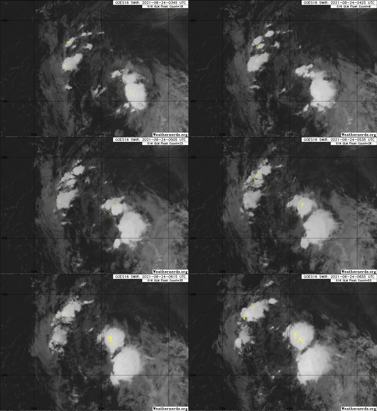
#34 Postby Sciencerocks » Tue Aug 24, 2021 2:08 am

Image
1 likes   

Sciencerocks
Category 5
Category 5
Posts: 7286
Age: 38
Joined: Thu Jul 06, 2017 1:51 am

Re: ATL: INVEST 97L - Discussion - WNW of Cabo Verde Islands

#35 Postby Sciencerocks » Tue Aug 24, 2021 2:09 am

A broad trough of low pressure is producing disorganized showers and
thunderstorms over the east-central tropical Atlantic more than 1000
miles west-northwest of the Cabo Verde Islands. Little development
is expected during the next day or two due to marginally conducive
ocean temperatures and strong upper-level winds. Afterwards,
environmental conditions are expected to become more favorable for
gradual development, and a tropical depression could form by the end
of the week while the system moves northwestward to northward at 10
to 15 mph over the central Atlantic.
* Formation chance through 48 hours...low...10 percent.
* Formation chance through 5 days...medium...50 percent
0 likes   

User avatar
cycloneye
Admin
Admin
Posts: 139059
Age: 67
Joined: Thu Oct 10, 2002 10:54 am
Location: San Juan, Puerto Rico

Re: ATL: INVEST 97L - Discussion - WNW of Cabo Verde Islands

#36 Postby cycloneye » Tue Aug 24, 2021 6:29 am

A tropical wave is along 44W, from 21N southward. The wave is
moving W at 10 to 15 knots. A 1010 mb low pressure is analyzed
near the northern end of the wave axis. Fresh to strong winds are
noted per scatterometer data on the E side of the low center.
Scattered moderate convection is seen from 20N-23N between 42W-
45W. Little development is expected during the next day or two due
to marginally conducive ocean temperatures and strong upper-
level winds. Afterwards, environmental conditions are expected to
become more favorable for gradual development, and a tropical
depression could form by the end of the week while the system
moves northwestward to northward at 10 to 15 mph over the central
Atlantic. The latest Tropical Weather Outlook gives this system a
medium chance of tropical cyclone formation through 5 days.
0 likes   
Visit the Caribbean-Central America Weather Thread where you can find at first post web cams,radars
and observations from Caribbean basin members Click Here

User avatar
cycloneye
Admin
Admin
Posts: 139059
Age: 67
Joined: Thu Oct 10, 2002 10:54 am
Location: San Juan, Puerto Rico

Re: ATL: INVEST 97L - Discussion - WNW of Cabo Verde Islands

#37 Postby cycloneye » Tue Aug 24, 2021 6:47 am

A broad trough of low pressure is producing disorganized showers and
thunderstorms over the central tropical Atlantic about 900 miles
east-northeast of the northern Leeward Islands. Little development
of this system is expected during the next day or two due while
it moves northwestward at about 15 mph over marginally conducive
ocean temperatures and is affected by strong upper-level winds.
Afterwards, environmental conditions are expected to become more
favorable for gradual development, and a tropical depression could
form by the end of the week while the system turns eastward over
the central Atlantic.
* Formation chance through 48 hours...low...20 percent.
* Formation chance through 5 days...medium...60 percent.

.
0 likes   
Visit the Caribbean-Central America Weather Thread where you can find at first post web cams,radars
and observations from Caribbean basin members Click Here

User avatar
cycloneye
Admin
Admin
Posts: 139059
Age: 67
Joined: Thu Oct 10, 2002 10:54 am
Location: San Juan, Puerto Rico

Re: ATL: INVEST 97L - Discussion - WNW of Cabo Verde Islands

#38 Postby cycloneye » Tue Aug 24, 2021 7:14 am

2 likes   
Visit the Caribbean-Central America Weather Thread where you can find at first post web cams,radars
and observations from Caribbean basin members Click Here

User avatar
cycloneye
Admin
Admin
Posts: 139059
Age: 67
Joined: Thu Oct 10, 2002 10:54 am
Location: San Juan, Puerto Rico

Re: ATL: INVEST 97L - Discussion - NE of Leeward Islands

#39 Postby cycloneye » Tue Aug 24, 2021 8:46 am

AL, 97, 2021082412, , BEST, 0, 220N, 468W, 35, 1009, DB
0 likes   
Visit the Caribbean-Central America Weather Thread where you can find at first post web cams,radars
and observations from Caribbean basin members Click Here

Sciencerocks
Category 5
Category 5
Posts: 7286
Age: 38
Joined: Thu Jul 06, 2017 1:51 am

Re: ATL: INVEST 97L - Discussion - NE of Leeward Islands

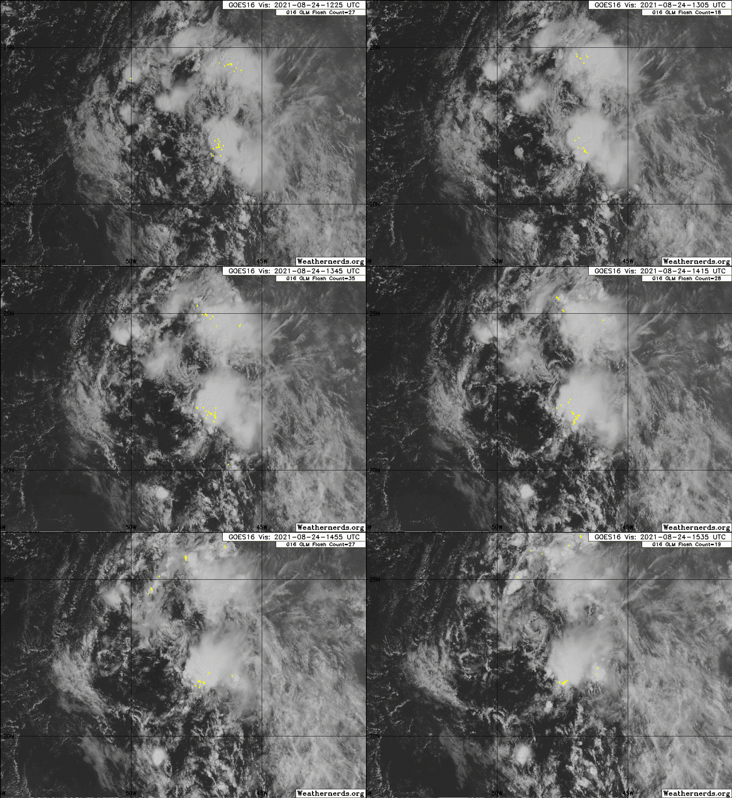
#40 Postby Sciencerocks » Tue Aug 24, 2021 10:59 am

Image
0 likes   


Return to “2021”

Who is online

Users browsing this forum: Google [Bot] and 55 guests