EPAC: NORA - Remnants
Moderator: S2k Moderators
-
Sciencerocks
- Category 5

- Posts: 7282
- Age: 38
- Joined: Thu Jul 06, 2017 1:51 am
-
Yellow Evan

- Professional-Met

- Posts: 15951
- Age: 25
- Joined: Fri Jul 15, 2011 12:48 pm
- Location: Henderson, Nevada/Honolulu, HI
- Contact:
Re: EPAC: NORA - Tropical Storm
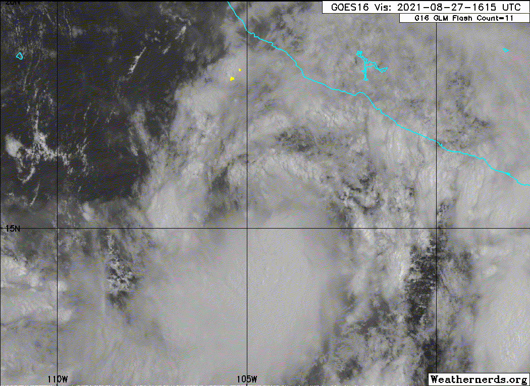
This is rotating convection upshear again. We’ll see if it persist as this is now battling northerly shear.
0 likes
-
Yellow Evan
- Professional-Met
- Posts: 15951
- Age: 25
- Joined: Fri Jul 15, 2011 12:48 pm
- Location: Henderson, Nevada/Honolulu, HI
- Contact:
Re: EPAC: NORA - Tropical Storm
TXPZ25 KNES 271750
TCSENP
A. 14E (NORA)
B. 27/1730Z
C. 15.4N
D. 104.4W
E. THREE/GOES-E
F. T3.5/3.5
G. IR/EIR/VIS
H. REMARKS...SYSTEM LLCC IS 1/3 DEGREES INTO THE COLD OVERCAST RESULTING
IN A SHEAR PATTERN DT OF 3.5. MOST OF THE ACTIVITY CONVECTION REMAINS
SOUTH OF THE LLCC. THERE IS A NEW BANDING FEATURE APPEARING ON VISIBLE
SATELLITE IMAGERY POSSIBLY SUGGESTING FURTHER ORGANIZATION. THE 24 HR
TREND IS DEVELOPING SLOWLY RESULTING MET TO BE 3.0 AND PT TO BE 3.5. FT
IS BASED ON DT.
I. ADDL POSITIONS
NIL
...PATEL
0 likes
-
Yellow Evan
- Professional-Met
- Posts: 15951
- Age: 25
- Joined: Fri Jul 15, 2011 12:48 pm
- Location: Henderson, Nevada/Honolulu, HI
- Contact:
Re: EPAC: NORA - Tropical Storm

12z ECMWF further east, slams this into the east coast of Baja.
0 likes
-
Kingarabian

- S2K Supporter

- Posts: 15434
- Joined: Sat Aug 08, 2009 3:06 am
- Location: Honolulu, Hawaii
Re: EPAC: NORA - Tropical Storm
Yellow Evan wrote:This is rotating convection upshear again. We’ll see if it persist as this is now battling northerly shear.
Considering that this is where the highest OHC is in the basin, these storms off of Mexico used to be surefire hurricanes in the past. Fortunately they've been struggling in the past couple of years.
0 likes
RIP Kobe Bryant
-
Yellow Evan
- Professional-Met
- Posts: 15951
- Age: 25
- Joined: Fri Jul 15, 2011 12:48 pm
- Location: Henderson, Nevada/Honolulu, HI
- Contact:
Re: EPAC: NORA - Tropical Storm

12z GFS moves this into Jalisco but initializes too far east so disregard.
0 likes
-
Yellow Evan
- Professional-Met
- Posts: 15951
- Age: 25
- Joined: Fri Jul 15, 2011 12:48 pm
- Location: Henderson, Nevada/Honolulu, HI
- Contact:
Re: EPAC: NORA - Tropical Storm
* GFS version *
* EAST PACIFIC 2021 SHIPS INTENSITY FORECAST *
* IR SAT DATA AVAILABLE, OHC AVAILABLE *
* NORA EP142021 08/27/21 18 UTC *
TIME (HR) 0 6 12 18 24 36 48 60 72 84 96 108 120 132 144 156 168
V (KT) NO LAND 55 59 61 60 57 51 49 48 49 49 51 52 55 56 58 60 64
V (KT) LAND 55 59 61 60 57 51 49 48 49 49 51 52 55 38 31 28 27
V (KT) LGEM 55 58 60 59 56 50 48 48 49 50 49 49 49 35 30 N/A N/A
Storm Type TROP TROP TROP TROP TROP TROP TROP TROP TROP TROP TROP TROP TROP TROP TROP N/A N/A
SHEAR (KT) 11 8 8 12 14 8 6 6 4 5 8 15 16 22 21 N/A N/A
SHEAR ADJ (KT) -1 -3 2 7 10 -1 -2 -4 0 -3 0 1 1 0 -3 N/A N/A
SHEAR DIR 29 43 90 108 124 127 101 79 43 85 125 156 188 185 216 N/A N/A
SST (C) 28.8 28.7 28.5 28.5 28.7 29.4 30.1 30.6 30.7 30.7 30.7 31.1 30.8 29.1 29.4 N/A N/A
POT. INT. (KT) 152 151 149 149 152 159 165 170 170 169 170 170 170 154 157 N/A N/A
200 MB T (C) -52.4 -52.0 -52.1 -52.4 -51.9 -51.8 -51.8 -51.6 -51.6 -51.8 -51.7 -51.6 -51.8 -51.6 -51.8 N/A N/A
200 MB VXT (C) 0.5 0.3 0.2 0.4 0.4 0.7 0.5 0.5 0.1 0.2 -0.1 0.0 0.3 0.2 0.0 N/A N/A
TH_E DEV (C) 5 6 6 6 7 7 8 6 7 5 6 5 6 5 7 N/A N/A
700-500 MB RH 82 83 80 78 76 76 73 68 67 64 64 58 56 53 44 N/A N/A
MODEL VTX (KT) 21 21 21 17 14 5 5 4 5 4 5 3 3 1 LOST LOST LOST
850 MB ENV VOR 55 48 48 52 67 89 75 57 23 30 8 25 24 50 19 N/A N/A
200 MB DIV 96 125 94 113 129 84 20 26 -11 17 4 40 4 31 9 N/A N/A
700-850 TADV -5 -3 -9 -9 -6 -1 1 0 0 0 0 0 -1 -1 0 N/A N/A
LAND (KM) 371 336 314 234 169 136 210 72 47 45 16 43 7 -65 -85 N/A N/A
LAT (DEG N) 15.2 15.9 16.5 17.5 18.4 20.3 21.9 23.2 24.2 25.1 26.1 27.2 28.6 xx.x xx.x N/A N/A
LONG(DEG W) 104.7 105.2 105.7 106.0 106.2 107.0 107.9 108.7 109.6 110.4 111.1 111.6 111.8 xxx.x xxx.x N/A N/A
STM SPEED (KT) 9 8 9 10 10 9 8 7 6 5 6 6 7 6 6 N/A N/A
HEAT CONTENT 15 13 12 12 14 26 31 26 26 25 29 36 31 18 31 N/A N/A
FORECAST TRACK FROM OFCI INITIAL HEADING/SPEED (DEG/KT):300/ 10 CX,CY: -8/ 5
T-12 MAX WIND: 45 PRESSURE OF STEERING LEVEL (MB): 403 (MEAN=587)
GOES IR BRIGHTNESS TEMP. STD DEV. 50-200 KM RAD: 15.0 (MEAN=14.5)
% GOES IR PIXELS WITH T < -20 C 50-200 KM RAD: 93.0 (MEAN=65.0)
PRELIM RI PROB (DV .GE. 35 KT IN 36 HR): 0.8
INDIVIDUAL CONTRIBUTIONS TO INTENSITY CHANGE
6 12 18 24 36 48 60 72 84 96 108 120 132 144 156 168
------------------------------------------------------------------------------
SAMPLE MEAN CHANGE 0. 0. 1. 1. 1. 2. 1. 1. 0. -0. -1. -2. -2. -3. -4. -4.
SST POTENTIAL 1. 2. 3. 4. 6. 7. 9. 12. 13. 15. 17. 20. 22. 23. 24. 26.
VERTICAL SHEAR MAG 0. 0. 0. 0. 1. 3. 4. 5. 5. 6. 5. 3. 1. -2. -3. -4.
VERTICAL SHEAR ADJ 0. 0. -0. -1. -1. -1. -0. 0. 0. 0. 0. 0. 0. 0. 0. 0.
VERTICAL SHEAR DIR 0. 1. 1. 1. 1. 0. -1. -3. -5. -6. -6. -5. -4. -3. -3. -2.
PERSISTENCE 2. 3. 3. 3. 3. 2. 1. 1. 1. 1. 1. 1. 1. 1. 1. 1.
200/250 MB TEMP. -0. -0. -0. -1. -1. -1. -2. -2. -2. -2. -2. -2. -2. -2. -1. -1.
THETA_E EXCESS -0. -0. -0. -0. -0. 0. 0. 0. 0. 0. -0. -0. -1. -1. -1. -1.
700-500 MB RH 0. 0. 0. 1. 1. 1. 1. 1. 1. 1. 1. 1. 1. 1. 2. 3.
MODEL VTX TENDENCY 0. -0. -3. -5. -12. -16. -21. -23. -24. -23. -23. -22. -21. -19. -18. -16.
850 MB ENV VORTICITY 0. 0. 0. 0. 0. -0. -0. -1. -1. -1. -0. -0. -1. -0. -0. -0.
200 MB DIVERGENCE 0. 1. 1. 1. 2. 2. 3. 2. 2. 1. 1. 1. 0. 0. -0. -0.
850-700 T ADVEC 0. 0. 0. 0. 0. -0. -0. -0. -0. -0. -0. -0. -0. -0. -0. -0.
ZONAL STORM MOTION 0. 0. 0. 0. 0. 0. 0. 0. 0. 0. 0. 0. 0. 0. 0. -0.
STEERING LEVEL PRES -0. -0. -1. -1. -2. -3. -3. -3. -3. -4. -4. -4. -3. -3. -2. -1.
DAYS FROM CLIM. PEAK 0. 0. 0. 0. 0. 1. 1. 1. 2. 2. 3. 3. 4. 4. 5. 6.
GOES PREDICTORS 0. 1. 1. 1. 1. 1. 2. 2. 2. 2. 2. 2. 2. 2. 2. 2.
OCEAN HEAT CONTENT -0. -0. -0. -0. -0. 0. 0. 0. 0. 0. -0. -0. -1. -1. -2. -3.
RI POTENTIAL -0. -1. -2. -2. -4. -4. -3. -1. 1. 2. 3. 4. 4. 4. 4. 4.
------------------------------------------------------------------------------
TOTAL CHANGE 4. 6. 5. 2. -4. -6. -7. -6. -6. -4. -3. -0. 1. 3. 5. 9.
CURRENT MAX WIND (KT): 55. LAT, LON: 15.2 104.7
** 2021 E. Pacific RI INDEX EP142021 NORA 08/27/21 18 UTC **
(SHIPS-RII PREDICTOR TABLE for 30 KT OR MORE MAXIMUM WIND INCREASE IN NEXT 24-h)
Predictor Value RI Predictor Range Scaled Value(0-1) % Contribution
POT = MPI-VMAX (KT) : 95.6 40.5 to 149.3 0.51 5.5
12 HR PERSISTENCE (KT) : 10.0 -22.0 to 44.0 0.48 6.1
D200 (10**7s-1) : 111.4 -33.0 to 159.5 0.75 7.6
850-200 MB SHEAR (KT) : 10.5 19.6 to 1.3 0.50 4.8
MAXIMUM WIND (KT) : 55.0 22.5 to 132.0 0.92 7.1
STD DEV OF IR BR TEMP : 15.0 37.8 to 2.1 0.64 4.4
BL DRY-AIR FLUX (W/M2) : 59.0 800.8 to -82.5 0.84 -6.4
HEAT CONTENT (KJ/CM2) : 13.2 2.7 to 106.7 0.10 0.6
%area of TPW <45 mm upshear : 0.0 56.6 to 0.0 1.00 2.2
2nd PC OF IR BR TEMP : -0.3 2.2 to -2.3 0.56 0.7
SHIPS Prob RI for 20kt/ 12hr RI threshold= 15% is 2.4 times climatological mean ( 6.3%)
SHIPS Prob RI for 25kt/ 24hr RI threshold= 48% is 3.8 times climatological mean (12.5%)
SHIPS Prob RI for 30kt/ 24hr RI threshold= 32% is 3.8 times climatological mean ( 8.6%)
SHIPS Prob RI for 35kt/ 24hr RI threshold= 24% is 3.9 times climatological mean ( 6.2%)
SHIPS Prob RI for 40kt/ 24hr RI threshold= 14% is 3.4 times climatological mean ( 4.2%)
SHIPS Prob RI for 45kt/ 36hr RI threshold= 33% is 5.0 times climatological mean ( 6.7%)
SHIPS Prob RI for 55kt/ 48hr RI threshold= 27% is 4.6 times climatological mean ( 5.9%)
SHIPS Prob RI for 65kt/ 72hr RI threshold= 16% is 3.3 times climatological mean ( 4.7%)
Matrix of RI probabilities
------------------------------------------------------------------------------
RI (kt / h) | 20/12 | 25/24 | 30/24 | 35/24 | 40/24 | 45/36 | 55/48 |65/72
------------------------------------------------------------------------------
SHIPS-RII: 14.9% 47.6% 32.4% 24.5% 14.4% 33.4% 27.0% 15.7%
Logistic: 7.6% 23.8% 12.1% 7.4% 1.5% 9.6% 6.5% 1.8%
Bayesian: 5.8% 11.2% 10.9% 4.8% 0.7% 3.0% 1.8% 1.0%
Consensus: 9.4% 27.5% 18.5% 12.2% 5.5% 15.4% 11.8% 6.2%
DTOPS: 14.0% 3.0% 1.0% 1.0% 0.0% 0.0% 0.0% 0.0%
## ANNULAR HURRICANE INDEX (AHI) EP142021 NORA 08/27/21 18 UTC ##
## STORM NOT ANNULAR, SCREENING STEP FAILED, NPASS=4 NFAIL=3 ##
## AHI= 0 (AHI OF 100 IS BEST FIT TO ANN. STRUC., 1 IS MARGINAL, 0 IS NOT ANNULAR) ##
0 likes
-
Kingarabian
- S2K Supporter
- Posts: 15434
- Joined: Sat Aug 08, 2009 3:06 am
- Location: Honolulu, Hawaii
Re: EPAC: NORA - Tropical Storm
GFS now showing much more moisture for SWUSA from Nora. Latest GFS also has another systems with a lot of moisture for Arizona in another 10 days. Serious flooding is setting up if this verifies.
2 likes
RIP Kobe Bryant
-
Yellow Evan
- Professional-Met
- Posts: 15951
- Age: 25
- Joined: Fri Jul 15, 2011 12:48 pm
- Location: Henderson, Nevada/Honolulu, HI
- Contact:
Re: EPAC: NORA - Tropical Storm
Kingarabian wrote:Yellow Evan wrote:This is rotating convection upshear again. We’ll see if it persist as this is now battling northerly shear.
Considering that this is where the highest OHC is in the basin, these storms off of Mexico used to be surefire hurricanes in the past. Fortunately they've been struggling in the past couple of years.
Nora probably becomes a hurricane, and time away from land permitting, has some chance at a strong one, but it's also not very CDO dominant, making it vulnerable to dry air intrusions.
2 likes
-
Kingarabian
- S2K Supporter
- Posts: 15434
- Joined: Sat Aug 08, 2009 3:06 am
- Location: Honolulu, Hawaii
Re: EPAC: NORA - Tropical Storm
Yellow Evan wrote:Kingarabian wrote:Yellow Evan wrote:This is rotating convection upshear again. We’ll see if it persist as this is now battling northerly shear.
Considering that this is where the highest OHC is in the basin, these storms off of Mexico used to be surefire hurricanes in the past. Fortunately they've been struggling in the past couple of years.
Nora probably becomes a hurricane, and time away from land permitting, has some chance at a strong one, but it's also not very CDO dominant, making it vulnerable to dry air intrusions.
All that mid shear and dry air intrusion has made the scene type per Dvorak change consistently. Not a sign of a storm that has a high ceiling.
0 likes
RIP Kobe Bryant
-
galaxy401

- Category 5
- Posts: 2299
- Age: 28
- Joined: Sat Aug 25, 2012 9:04 pm
- Location: Casa Grande, Arizona
Re: EPAC: NORA - Tropical Storm
Kingarabian wrote:GFS now showing much more moisture for SWUSA from Nora. Latest GFS also has another systems with a lot of moisture for Arizona in another 10 days. Serious flooding is setting up if this verifies.
My Weather app shows a big cooldown next week along with thunderstorms, starting on Monday. Watching this storm quite a bit. Those east shifts could mean it moves over the Valley.
3 likes
Got my eyes on moving right into Hurricane Alley: Florida.
-
Kingarabian
- S2K Supporter
- Posts: 15434
- Joined: Sat Aug 08, 2009 3:06 am
- Location: Honolulu, Hawaii
Re: EPAC: NORA - Tropical Storm
galaxy401 wrote:Kingarabian wrote:GFS now showing much more moisture for SWUSA from Nora. Latest GFS also has another systems with a lot of moisture for Arizona in another 10 days. Serious flooding is setting up if this verifies.
My Weather app shows a big cooldown next week along with thunderstorms, starting on Monday. Watching this storm quite a bit. Those east shifts could mean it moves over the Valley.
Yeah I think regardless of landfall point, it depends on how strong and large Nora can get now. I think if this intensifies to a Cat/2borderline major hurricane before hitting Baja and entering the gulf of California, there would be a very high chance for a significant amount of moisture to make its way over parts of Arizona.
0 likes
RIP Kobe Bryant
-
Yellow Evan
- Professional-Met
- Posts: 15951
- Age: 25
- Joined: Fri Jul 15, 2011 12:48 pm
- Location: Henderson, Nevada/Honolulu, HI
- Contact:
Re: EPAC: NORA - Tropical Storm
Kingarabian wrote:Yellow Evan wrote:Kingarabian wrote:Considering that this is where the highest OHC is in the basin, these storms off of Mexico used to be surefire hurricanes in the past. Fortunately they've been struggling in the past couple of years.
Nora probably becomes a hurricane, and time away from land permitting, has some chance at a strong one, but it's also not very CDO dominant, making it vulnerable to dry air intrusions.
All that mid shear and dry air intrusion has made the scene type per Dvorak change consistently. Not a sign of a storm that has a high ceiling.
Not sure if any of this is true. Much like Odile, it's oscillated between between curved band and shear patterns which is typical for a storm in 15-20 knots of shear with high divergence. IIRC studies show that systems that start in high shear environments and enter low shear environments tend to be stronger then ones that just stay in low shear environment. It's CDO is quite cold and there's a ULAC nearby so the potential is there for a high intensity, but I don't think there's adequate time either due to close proximity to land (which isn't directly affected by PDO/PMM/ENSO). It's possible the apparent vertical instability issues I've highlighted earlier in the seasonal thread are slowing the intensification process of certain storms down but I don't really have the means to investigate this further.
0 likes
-
Yellow Evan
- Professional-Met
- Posts: 15951
- Age: 25
- Joined: Fri Jul 15, 2011 12:48 pm
- Location: Henderson, Nevada/Honolulu, HI
- Contact:
Re: EPAC: NORA - Tropical Storm
galaxy401 wrote:Kingarabian wrote:GFS now showing much more moisture for SWUSA from Nora. Latest GFS also has another systems with a lot of moisture for Arizona in another 10 days. Serious flooding is setting up if this verifies.
My Weather app shows a big cooldown next week along with thunderstorms, starting on Monday. Watching this storm quite a bit. Those east shifts could mean it moves over the Valley.
In order to maximize rainfall prospects over Arizona specifically, probably going to need a northward turn to occur around 110-115W. Might end up going further east than that tbh.
0 likes
-
cycloneye

- Admin

- Posts: 139049
- Age: 67
- Joined: Thu Oct 10, 2002 10:54 am
- Location: San Juan, Puerto Rico
Re: EPAC: NORA - Tropical Storm
Tropical Storm Nora Discussion Number 9
NWS National Hurricane Center Miami FL EP142021
400 PM CDT Fri Aug 27 2021
A 1656 UTC ASCAT-B scatterometer pass showed that Nora still does
not have a tight inner core and instead has a 30-35 n mi region of
winds 20 kt or less. However, the pass did show maximum wind
vectors a little over 50 kt, so the storm has been strengthening,
and maximum winds are estimated to be 55 kt. This is supported by
Dvorak estimates of T3.5/55 kt from TAFB and SAB.
A slight adjustment was made to Nora's initial position based on
the scatterometer data, but the storm is still moving toward the
northwest (310/10 kt). Nora is expected to maintain a motion
toward the northwest or north-northwest as it heads in the
direction of a weakness in the subtropical ridge which has
developed over the U.S. southern Rockies and northern Mexico. The
track guidance envelope appears to have tightened up compared to
the past few days, with nearly all the model trackers showing
Nora's center passing offshore just west of Cabo Corrientes,
Mexico, in about 24 hours and then continuing northwestward either
across the waters of the Gulf of California or inland over Baja
California Sur. The new NHC track forecast has been nudged
westward from this morning's forecast, but this is mainly due to
the adjustment of the storm's initial position. This track is very
close to the HCCA and other consensus aids.
Nora's convective structure appears to be responding to a decrease
in northeasterly shear, which is analyzed to be out of the
northeast at 10-15 kt. This shear is forecast to decrease to 10 kt
or less by tonight. Although Nora's broad structure could limit
the storm's rate of strengthening, warm waters and upper-level
divergence should allow it to become a hurricane over the next day
or so. After that time, Nora's intensity will be strongly
modulated on whether its center moves over mainland Mexico or the
Baja California peninsula. If the center remains over water, as is
shown in the official forecast, then environmental conditions
appear conducive for Nora to remain as a hurricane for several more
days, and the NHC forecast still closely follows the ECMWF-based
SHIPS and LGEM models. That said, there is still greater-than-
normal uncertainty in the intensity forecast after 48 hours.
Key Messages:
1. Nora is forecast to strengthen to a hurricane on Saturday while
passing nearby the coasts of the Mexican states of Jalisco and
Nayarit, and hurricane watches and tropical storm warnings are
in effect for portions of that coastline. Interests in these areas
should closely monitor the progress of Nora and subsequent updates
to the forecast.
2. Heavy rain associated with Nora is expected across coastal
sections of the Mexican states of Oaxaca, Guerrero, Michoacan,
Colima, and Jalisco, as well as Baja California Sur.
Life-threatening flash flooding and mudslides are expected.
3. Nora is forecast to move over the Gulf of California as a
hurricane early next week, bringing a risk of wind and rain impacts
to portions of the Mexican states of Baja California Sur, Sinaloa,
and Sonora. Given the above-average uncertainty in the forecast,
it is still too soon to determine the magnitude and location of
these potential impacts.
FORECAST POSITIONS AND MAX WINDS
INIT 27/2100Z 15.5N 104.9W 55 KT 65 MPH
12H 28/0600Z 16.5N 105.6W 60 KT 70 MPH
24H 28/1800Z 18.3N 106.2W 65 KT 75 MPH
36H 29/0600Z 20.3N 107.0W 70 KT 80 MPH
48H 29/1800Z 21.9N 107.8W 75 KT 85 MPH
60H 30/0600Z 22.9N 108.6W 80 KT 90 MPH
72H 30/1800Z 23.9N 109.4W 80 KT 90 MPH
96H 31/1800Z 25.9N 110.9W 70 KT 80 MPH
120H 01/1800Z 28.4N 111.8W 55 KT 65 MPH
$$
Forecaster Berg
0 likes
Visit the Caribbean-Central America Weather Thread where you can find at first post web cams,radars
and observations from Caribbean basin members Click Here
and observations from Caribbean basin members Click Here
-
Kingarabian
- S2K Supporter
- Posts: 15434
- Joined: Sat Aug 08, 2009 3:06 am
- Location: Honolulu, Hawaii
Re: EPAC: NORA - Tropical Storm
Yellow Evan wrote:Kingarabian wrote:Yellow Evan wrote:
Nora probably becomes a hurricane, and time away from land permitting, has some chance at a strong one, but it's also not very CDO dominant, making it vulnerable to dry air intrusions.
All that mid shear and dry air intrusion has made the scene type per Dvorak change consistently. Not a sign of a storm that has a high ceiling.
Not sure if any of this is true. Much like Odile, it's oscillated between between curved band and shear patterns which is typical for a storm in 15-20 knots of shear with high divergence. IIRC studies show that systems that start in high shear environments and enter low shear environments tend to be stronger then ones that just stay in low shear environment. It's CDO is quite cold and there's a ULAC nearby so the potential is there for a high intensity, but I don't think there's adequate time either due to close proximity to land (which isn't directly affected by PDO/PMM/ENSO). It's possible the apparent vertical instability issues I've highlighted earlier in the seasonal thread are slowing the intensification process of certain storms down but I don't really have the means to investigate this further.
Maybe for storms moving west away from land that is true. But for storms off the coast of Mexico that are destined to eventually turn NE and into land, an initial 15-20kts of shear (in this case not just initial, the shear lasts longer than estimated) and in turn an oscillating scene type, is detrimental to the storms ceiling. I'm not sure how higher shear initially -> that turns into lower shear will result into a higher intensity makes sense for these types of systems. The models have repeatedly busted on these scenarios. This has been a prevailing issue since 2019. Reason why I'm pretty sure is the -ENSO/-PDO phases.
1 likes
RIP Kobe Bryant
-
Yellow Evan
- Professional-Met
- Posts: 15951
- Age: 25
- Joined: Fri Jul 15, 2011 12:48 pm
- Location: Henderson, Nevada/Honolulu, HI
- Contact:
Re: EPAC: NORA - Tropical Storm
Kingarabian wrote:Yellow Evan wrote:Kingarabian wrote:All that mid shear and dry air intrusion has made the scene type per Dvorak change consistently. Not a sign of a storm that has a high ceiling.
Not sure if any of this is true. Much like Odile, it's oscillated between between curved band and shear patterns which is typical for a storm in 15-20 knots of shear with high divergence. IIRC studies show that systems that start in high shear environments and enter low shear environments tend to be stronger then ones that just stay in low shear environment. It's CDO is quite cold and there's a ULAC nearby so the potential is there for a high intensity, but I don't think there's adequate time either due to close proximity to land (which isn't directly affected by PDO/PMM/ENSO). It's possible the apparent vertical instability issues I've highlighted earlier in the seasonal thread are slowing the intensification process of certain storms down but I don't really have the means to investigate this further.
Maybe for storms moving west away from land that is true. But for storms off the coast of Mexico that are destined to eventually turn NE and into land, an initial 15-20kts of shear (in this case not just initial, the shear lasts longer than estimated) and in turn an oscillating scene type, is detrimental to the storms ceiling. I'm not sure how higher shear initially -> that turns into lower shear will result into a higher intensity makes sense for these types of systems. The models have repeatedly busted on these scenarios. This has been a prevailing issue since 2019. Reason why I'm pretty sure is the -ENSO/-PDO phases.
Examples? Only Lorena/Narda 19 and Dolores this year took the track you are describing and neither of those three really struggled as I can recall.
0 likes
-
Kingarabian
- S2K Supporter
- Posts: 15434
- Joined: Sat Aug 08, 2009 3:06 am
- Location: Honolulu, Hawaii
Re: EPAC: NORA - Tropical Storm
Yellow Evan wrote:Kingarabian wrote:Yellow Evan wrote:
Not sure if any of this is true. Much like Odile, it's oscillated between between curved band and shear patterns which is typical for a storm in 15-20 knots of shear with high divergence. IIRC studies show that systems that start in high shear environments and enter low shear environments tend to be stronger then ones that just stay in low shear environment. It's CDO is quite cold and there's a ULAC nearby so the potential is there for a high intensity, but I don't think there's adequate time either due to close proximity to land (which isn't directly affected by PDO/PMM/ENSO). It's possible the apparent vertical instability issues I've highlighted earlier in the seasonal thread are slowing the intensification process of certain storms down but I don't really have the means to investigate this further.
Maybe for storms moving west away from land that is true. But for storms off the coast of Mexico that are destined to eventually turn NE and into land, an initial 15-20kts of shear (in this case not just initial, the shear lasts longer than estimated) and in turn an oscillating scene type, is detrimental to the storms ceiling. I'm not sure how higher shear initially -> that turns into lower shear will result into a higher intensity makes sense for these types of systems. The models have repeatedly busted on these scenarios. This has been a prevailing issue since 2019. Reason why I'm pretty sure is the -ENSO/-PDO phases.
Examples? Only Lorena/Narda 19 and Dolores this year took the track you are describing and neither of those three really struggled as I can recall.
My first point (since 2019) is that majority of storms that tracked near Mexico from 115W to 105W while moving N/NW/NE to 15N to 20N before crossing the 25C isotherm or landfalling into Mexico, have struggled due to persistent northerly shear and dry air intrusion. They've struggled despite being over the highest OHC in the basin.
My second point is that systems within this region, whose scene types that start to oscillate because of shear and dry air (typically for the first 36-48 hours), fail to realize their maximum potential or get as strong as modeled. The first 2-3 days are crucial for maximum intensity in storms that are destined to landfall over Mexico or cross the 25C isotherm.
The pattern is this: Models, model out a strong hurricane to landfall somewhere over Mexico or Baja or before tracking into cooler waters -> system forms looks impressive -> scene type starts to oscillate due to shear/dry air -> remains this way but the system slowly or never gains strength -> eventually runs into land or cooler water before ever realizing its highest intensity.
Lorena/Narda and Dolores were nowhere near as strong as modeled. MPI in this area is always Cat.5. So the ceiling of those systems should've been at least Cat.2 which didn't happen.
Watch Nora make me eat my words but I've seen enough shear and dry air hit Enrique, Dolores, Guillermo, Kevin, Linda, and Marty in this area so far this season.
1 likes
RIP Kobe Bryant


-
Yellow Evan
- Professional-Met
- Posts: 15951
- Age: 25
- Joined: Fri Jul 15, 2011 12:48 pm
- Location: Henderson, Nevada/Honolulu, HI
- Contact:
Re: EPAC: NORA - Tropical Storm
Kingarabian wrote:Yellow Evan wrote:Kingarabian wrote:
Maybe for storms moving west away from land that is true. But for storms off the coast of Mexico that are destined to eventually turn NE and into land, an initial 15-20kts of shear (in this case not just initial, the shear lasts longer than estimated) and in turn an oscillating scene type, is detrimental to the storms ceiling. I'm not sure how higher shear initially -> that turns into lower shear will result into a higher intensity makes sense for these types of systems. The models have repeatedly busted on these scenarios. This has been a prevailing issue since 2019. Reason why I'm pretty sure is the -ENSO/-PDO phases.
Examples? Only Lorena/Narda 19 and Dolores this year took the track you are describing and neither of those three really struggled as I can recall.
My first point (since 2019) is that majority of storms that tracked near Mexico from 115W to 105W while moving N/NW/NE to 15N to 20N before crossing the 25C isotherm or landfalling into Mexico, have struggled due to persistent northerly shear and dry air intrusion. They've struggled despite being over the highest OHC in the basin.
My second point is that systems within this region, whose scene types that start to oscillate because of shear and dry air (typically for the first 36-48 hours), fail to realize their maximum potential or get as strong as modeled. The first 2-3 days are crucial for maximum intensity in storms that are destined to landfall over Mexico or cross the 25C isotherm.
The pattern is this: Models, model out a strong hurricane to landfall somewhere over Mexico or Baja or before tracking into cooler waters -> system forms looks impressive -> scene type starts to oscillate due to shear/dry air -> remains this way but the system slowly or never gains strength -> eventually runs into land or cooler water before ever realizing its highest intensity.
Lorena/Narda and Dolores were nowhere near as strong as modeled. MPI in this area is always Cat.5. So the ceiling of those systems should've been at least Cat.2 which didn't happen.
Watch Nora make me eat my words but I've seen enough shear and dry air hit Enrique, Dolores, Guillermo, Kevin, Linda, and Marty in this area so far this season.
The biggest effect that PMM/ENSO have on the basin generally is shifting the activity westward and slightly northward (I can provide links to at least prove the latter if asked). This was observed in 2014-18 if you were to look at the storm tracks of the season, where the following major hurricanes occurred between the area I referenced above:
Willa 2018
Sergio 2018
Bud 2018
Aletta 2018
Seymour 2016
Sandra 2015
Patricia 2015
Dolores 2015
Blanca 2015
Odile 2014
Marie 2014
Cristina 2014
Amanda 2014
Worth noting that the 110-115W where the storm in particularly is unlikely to touch is where most of the 13 storms I mentioned moved through. If limited to 105-110W, the number of storms on this list would be much smaller. There does seem to be a decline in activity in the 110W-120W 15-22N hotspot (where only one major hurricane has been observed in the last 3 seasons) from 2014-18, though it's likely less pronounced than the decline observed further west and southwest than the CPAC. Having a semblance of an El Nino in 3 of those years likely played a role in the heightened rising motion across the 110-120W area which increased. The +PDO/+PMM extended the area of warm waters north and west respectively, given storms in moderate environments more time to get their act together but in part due to the lack of activity in 2015 over 110-120W, I don't think it was a driving force here at least compared to certain other areas in the basin. Furthermore, if you go further west and restrict yourself to 15-20N and 105-110W, where Nora actually is right now, there doesn't seem to be much correlation in activity by comparing 2014-2018 and 2019-now. Warmth concentrated off the west coast of Mexico results in fairly high levels of activity while also driving the bulk of the activity further eastward (see 1983 and 1990 and to a lesser extent 2014), which this year actually has shown at times, hence why your initial comment threw me off.
2 likes
Who is online
Users browsing this forum: No registered users and 33 guests