EPAC: NORA - Remnants

Moderator: S2k Moderators

Message
Author
User avatar
cycloneye
Admin
Admin
Posts: 139080
Age: 67
Joined: Thu Oct 10, 2002 10:54 am
Location: San Juan, Puerto Rico

Re: EPAC: NORA - Hurricane

#161 Postby cycloneye » Sat Aug 28, 2021 4:38 pm

BULLETIN
Hurricane Nora Advisory Number 13
NWS National Hurricane Center Miami FL EP142021
400 PM CDT Sat Aug 28 2021

...NORA'S CENTER GRAZING THE COAST OF JALISCO MEXICO...
...HURRICANE WARNINGS EXTENDED NORTHWARD ALONG THE NAYARIT AND
SINALOA COASTS...


SUMMARY OF 400 PM CDT...2100 UTC...INFORMATION
----------------------------------------------
LOCATION...19.7N 105.4W
ABOUT 65 MI...100 KM SSW OF PUERTO VALLARTA MEXICO
ABOUT 365 MI...585 KM SE OF CABO SAN LUCAS MEXICO
MAXIMUM SUSTAINED WINDS...85 MPH...140 KM/H
PRESENT MOVEMENT...N OR 350 DEGREES AT 14 MPH...22 KM/H
MINIMUM CENTRAL PRESSURE...977 MB...28.85 INCHES


WATCHES AND WARNINGS
--------------------
CHANGES WITH THIS ADVISORY:

The government of Mexico has upgraded the Tropical Storm Warning
and Hurricane Watch north of San Blas to Altata, Mexico, to a
Hurricane Warning.

SUMMARY OF WATCHES AND WARNINGS IN EFFECT:

A Hurricane Warning is in effect for...
* Manzanillo to Altata Mexico

A Hurricane Watch is in effect for...
* North of Altata to Topolobampo Mexico

A Tropical Storm Warning is in effect for...
* South of Manzanillo to Lazaro Cardenas Mexico

A Tropical Storm Watch is in effect for...
* Cabo San Lucas to La Paz Mexico

A Hurricane Warning means that hurricane conditions are expected
somewhere within the warning area. A warning is typically issued
36 hours before the anticipated first occurrence of
tropical-storm-force winds, conditions that make outside
preparations difficult or dangerous. Preparations to protect life
and property should be rushed to completion.

A Hurricane Watch means that hurricane conditions are possible
within the watch area. A watch is typically issued 48 hours
before the anticipated first occurrence of tropical-storm-force
winds, conditions that make outside preparations difficult or
dangerous.

A Tropical Storm Warning means that tropical storm conditions are
expected somewhere within the warning area within 36 hours.

A Tropical Storm Watch means that tropical storm conditions are
possible within the watch area, generally within 48 hours.

Interests elsewhere along the coasts of Sinaloa, Sonora, and Baja
California Sur should monitor the progress of Nora. Additional
watches and warnings may be required for portions of these areas
tonight or on Sunday.

For storm information specific to your area, please monitor
products issued by your national meteorological service.


DISCUSSION AND OUTLOOK
----------------------
At 400 PM CDT (2100 UTC), the center of Hurricane Nora was located
near latitude 19.7 North, longitude 105.4 West. Nora is moving
toward the north near 14 mph (22 km/h). A turn toward the
north-northwest is expected tonight and on Sunday, followed by a
slower northwestward motion Sunday night through Tuesday. On the
forecast track, the center of Nora will move near or over western
Jalisco during the next few hours, and then move over the Gulf
of California near or along the coasts of Nayarit and Sinaloa
tonight through Tuesday.

Maximum sustained winds are near 85 mph (140 km/h) with higher
gusts. Little change in strength is forecast during the next few
days if Nora's center remains over the waters of the Gulf of
California. However, weakening would likely occur if the center
moves inland.

Hurricane-force winds extend outward up to 35 miles (55 km) from the
center and tropical-storm-force winds extend outward up to 160 miles
(260 km). A sustained wind of 77 mph (124 km/h) was recently
reported at Chamela-Cuixmala, Jalisco.

The estimated minimum central pressure is 977 mb (28.85 inches).


HAZARDS AFFECTING LAND
----------------------
Key messages for Nora can be found in the Tropical Cyclone
Discussion under AWIPS header MIATCDEP4, WMO header WTPZ44 KNHC,
and on the web at hurricanes.gov/graphics_ep4.shtml?key_messages.

WIND: Hurricane conditions are occurring within the southern
portion of the hurricane warning area and are likely to spread
northward within hurricane warning area through Monday. Hurricane
conditions are also possible within the hurricane watch area late
Monday. Tropical storm conditions will continue over the tropical
storm warning area through tonight. Tropical storm conditions are
possible within the tropical storm watch area in Baja California
Sur on Monday.

RAINFALL: Nora is expected to produce rainfall totals of 8 to 12
inches with maximum amounts of 20 inches this weekend into early
next week along the west coast of Mexico from the Mexican states of
Guerrero northward to southern Sonora, including Baja California
Sur. This rainfall will produce life-threatening flash flooding and
mudslides.

Toward the middle and latter part of next week, moisture associated
with Nora may bring heavy rainfall to portions of the southwestern
U.S. and central Rockies.

STORM SURGE: Storm surge is expected to produce significant
coastal flooding in areas of onshore winds. Near the coast, the
surge will be accompanied by large and destructive waves.

SURF: Swells generated by Nora are affecting the southern and
southwestern coast of Mexico and will spread northward to the coast
of Baja California Sur and into the Gulf of California into early
next week. These swells are likely to cause life-threatening surf
and rip current conditions. Please consult products from your
local weather office.


NEXT ADVISORY
-------------
Next intermediate advisory at 700 PM CDT.
Next complete advisory at 1000 PM CDT.

$$
Forecaster Berg


Hurricane Nora Discussion Number 13
NWS National Hurricane Center Miami FL EP142021
400 PM CDT Sat Aug 28 2021

Nora developed a cloud-filled eye during the past few hours, with
the center now grazing the coast and the eyewall moving across
western Jalisco, Mexico. An Air Force Reserve Hurricane Hunter
aircraft has been investigating the hurricane, but unfortunately
the storm is now too close to the mountainous coastline for the
plane to safely locate the surface center or sample the
likely-stronger wind field on the eastern side of the circulation.
Based mainly on T4.5/77 kt Dvorak estimates from TAFB and SAB, the
initial intensity is estimated to be 75 kt.

The center has been moving a little faster to the west of due
north, or 350/12 kt. The track models are in agreement that Nora
should turn toward the north-northwest and northwest during the next
few days, generally keeping the center of the hurricane over the
waters of the Gulf of California. However, due to the complex
geography and mountainous topography of the region, the track
forecast is challenging, and it's almost impossible to know if
Nora's center will remain over water or graze the coastlines of
Nayarit and Sinaloa over the next few days. By days 4 and 5, Nora's
center is forecast to move inland over Sonora after traversing a
significant length of the Gulf of California.

Assuming a path that keeps Nora just offshore, low shear and very
warm sea surface temperatures in the Gulf of California should be
sufficient to at least maintain hurricane intensity for the next 3
days. However, any slight deviations of the track could cause Nora
to weaken and fall below hurricane intensity sooner than is
indicated in the official forecast. Given the uncertainties,
however, the government of Mexico has extended the hurricane
warning farther north along the coasts of Nayarit and Sinaloa out
of an abundance of caution. Weakening will become more likely the
farther north Nora gets up the Gulf of California, both due to
possible land interaction and ingestion of drier air off the Mexican
plateau.


Key Messages:

1. Nora is forecast to be a hurricane while it moves near or
along the coasts of the Mexican states of Jalisco, Nayarit, and
Sinaloa through Monday, and hurricane warnings are in effect for
portions of that coastline. Interests in these areas should closely
monitor the progress of Nora and subsequent updates to the forecast.

2. Heavy rain associated with Nora is expected across the west coast
of Mexico from the Mexican states of Guerrero, northward to southern
Sonora, including Baja California Sur. This rain will likely
result in life-threatening flash flooding and mudslides across these
regions. Rainfall from Nora may spread into the southwestern U.S.
and central Rockies during the middle to latter portion of next
week.

3. Nora is forecast to continue moving northward over the Gulf of
California Tuesday and Wednesday, bringing a risk of wind impacts to
portions of the Mexican states of Baja California Sur, northern
Sinaloa, and Sonora. Given the above-average uncertainty in the
forecast intensity, confidence is not high enough to determine the
magnitude and location of these potential impacts.


FORECAST POSITIONS AND MAX WINDS

INIT 28/2100Z 19.7N 105.4W 75 KT 85 MPH...ON THE COAST
12H 29/0600Z 21.5N 105.9W 75 KT 85 MPH
24H 29/1800Z 22.9N 106.7W 75 KT 85 MPH
36H 30/0600Z 23.5N 107.4W 75 KT 85 MPH
48H 30/1800Z 24.2N 108.1W 75 KT 85 MPH
60H 31/0600Z 24.8N 108.9W 70 KT 80 MPH
72H 31/1800Z 25.6N 109.5W 70 KT 80 MPH
96H 01/1800Z 27.6N 110.4W 55 KT 65 MPH...INLAND
120H 02/1800Z 29.4N 110.6W 30 KT 35 MPH...INLAND

$$
Forecaster Berg
0 likes   
Visit the Caribbean-Central America Weather Thread where you can find at first post web cams,radars
and observations from Caribbean basin members Click Here

User avatar
Yellow Evan
Professional-Met
Professional-Met
Posts: 15952
Age: 25
Joined: Fri Jul 15, 2011 12:48 pm
Location: Henderson, Nevada/Honolulu, HI
Contact:

Re: EPAC: NORA - Hurricane

#162 Postby Yellow Evan » Sat Aug 28, 2021 5:08 pm

Eye seems like it moved onshore but recon supports the idea that the center is still offshore. This is degrading fast regardless.

Nvm: I’m a dumbass, probably slightly onshore northwestern Jalisco in a mountainous unpopulated area.
3 likes   

User avatar
Yellow Evan
Professional-Met
Professional-Met
Posts: 15952
Age: 25
Joined: Fri Jul 15, 2011 12:48 pm
Location: Henderson, Nevada/Honolulu, HI
Contact:

Re: EPAC: NORA - Hurricane

#163 Postby Yellow Evan » Sat Aug 28, 2021 8:51 pm

000
WTPZ34 KNHC 282353
TCPEP4

BULLETIN
Hurricane Nora Intermediate Advisory Number 13A
NWS National Hurricane Center Miami FL EP142021
700 PM CDT Sat Aug 28 2021

...NORA'S CENTER REMAINS NEAR THE COAST OF MEXICO AFTER MAKING
LANDFALL IN NORTHWEST JALISCO...


SUMMARY OF 700 PM CDT...0000 UTC...INFORMATION
----------------------------------------------
LOCATION...20.2N 105.4W
ABOUT 30 MI...50 KM SSW OF PUERTO VALLARTA MEXICO
ABOUT 345 MI...555 KM ESE OF CABO SAN LUCAS MEXICO
MAXIMUM SUSTAINED WINDS...80 MPH...130 KM/H
PRESENT MOVEMENT...N OR 350 DEGREES AT 14 MPH...22 KM/H
MINIMUM CENTRAL PRESSURE...980 MB...28.94 INCHES


WATCHES AND WARNINGS
--------------------
CHANGES WITH THIS ADVISORY:

The government of Mexico has discontinued the Tropical Storm
Warning from Lazaro Cardenas to Manzanillo.

SUMMARY OF WATCHES AND WARNINGS IN EFFECT:

A Hurricane Warning is in effect for...
* Manzanillo to Altata Mexico

A Hurricane Watch is in effect for...
* North of Altata to Topolobampo Mexico

A Tropical Storm Watch is in effect for...
* Cabo San Lucas to La Paz Mexico

A Hurricane Warning means that hurricane conditions are expected
somewhere within the warning area. A warning is typically issued
36 hours before the anticipated first occurrence of
tropical-storm-force winds, conditions that make outside
preparations difficult or dangerous. Preparations to protect life
and property should be rushed to completion.

A Hurricane Watch means that hurricane conditions are possible
within the watch area. A watch is typically issued 48 hours
before the anticipated first occurrence of tropical-storm-force
winds, conditions that make outside preparations difficult or
dangerous.

A Tropical Storm Watch means that tropical storm conditions are
possible within the watch area, generally within 48 hours.

Interests elsewhere along the coasts of Sinaloa, Sonora, and Baja
California Sur should monitor the progress of Nora. Additional
watches and warnings may be required for portions of these areas
tonight or on Sunday.

For storm information specific to your area, please monitor
products issued by your national meteorological service.


DISCUSSION AND OUTLOOK
----------------------
At 700 PM CDT (0000 UTC), the center of Hurricane Nora was located
near the coast of Mexico at latitude 20.2 North, longitude 105.4
West. Surface data from Mexico and data from an Air Force Reserve
Hurricane Hunter aircraft indicate that Nora made landfall along the
northwest coast of Jalisco near Vincente Guerrero, and has continued
to move near the coast since then. Nora is moving toward the north
near 14 mph (22 km/h). A turn toward north-northwest is possible
tonight and on Sunday, followed by a slower northwestward motion
Sunday night through Tuesday. On the current forecast track, the
center of Nora will continue to move near the coast of Mexico during
the next several hours. It could then re-emerge over the Gulf of
California, moving roughly parallel to the coast of Mexico through
early next week. However, even a small deviation of the hurricane's
motion to the right could cause Nora to move further inland and
dissipate.

Maximum sustained winds have decreased to 80 mph (130 km/h) with
higher gusts. Little change in strength is forecast during the
next few days if Nora's center moves over the waters of the Gulf
of California. However, weakening would likely occur if the center
moves further inland.

Hurricane-force winds extend outward up to 35 miles (55 km) from
the center and tropical-storm-force winds extend outward up to 160
miles (260 km).

The estimated minimum central pressure is 980 mb (28.94 inches).


HAZARDS AFFECTING LAND
----------------------
Key messages for Nora can be found in the Tropical Cyclone
Discussion under AWIPS header MIATCDEP4, WMO header WTPZ44 KNHC,
and on the web at hurricanes.gov/graphics_ep4.shtml?key_messages.

WIND: Hurricane conditions will continue in portions of the
southern parts of the hurricane warning area and are likely to
spread northward within hurricane warning area through Sunday.
Hurricane conditions are also possible within the hurricane watch
area late Monday. Tropical storm conditions are possible within the
tropical storm watch area in Baja California Sur on Monday.

RAINFALL: Nora is expected to produce rainfall totals of 8 to 12
inches with maximum amounts of 20 inches this weekend into early
next week along the west coast of Mexico from the Mexican states of
Guerrero northward to southern Sonora, including Baja California
Sur. This rainfall will produce life-threatening flash flooding and
mudslides.

Toward the middle and latter part of next week, moisture associated
with Nora may bring heavy rainfall to portions of the southwestern
U.S. and central Rockies.

STORM SURGE: Storm surge is expected to produce significant
coastal flooding in areas of onshore winds. Near the coast, the
surge will be accompanied by large and destructive waves.

SURF: Swells generated by Nora are affecting the southern and
southwestern coast of Mexico and will spread northward to the coast
of Baja California Sur and into the Gulf of California into early
next week. These swells are likely to cause life-threatening surf
and rip current conditions. Please consult products from your
local weather office.


NEXT ADVISORY
-------------
Next complete advisory at 1000 PM CDT.

$$
Forecaster D. Zelinsky
0 likes   

Netzero9455
Tropical Low
Tropical Low
Posts: 19
Joined: Sun Oct 23, 2016 6:23 pm

Re: EPAC: NORA - Hurricane

#164 Postby Netzero9455 » Sat Aug 28, 2021 9:07 pm

Astromanía wrote::uarrow: Sierra Madre del Sur very near the coast, Puerto Vallarta must be getting hurricane conditions


We're just now getting the brunt of it, I believe it's the backside or onshore flow, first time in 18 years we've had tropical storm conditions, definitely not hurricane conditions though, I'm estimating the winds at no more than 40-45mph at worst though, definitely tolerable. Perhaps right at the shoreline 50-55 mph gusts or thereabouts.
1 likes   

Sciencerocks
Category 5
Category 5
Posts: 7286
Age: 38
Joined: Thu Jul 06, 2017 1:51 am

Re: EPAC: NORA - Hurricane

#165 Postby Sciencerocks » Sat Aug 28, 2021 9:36 pm

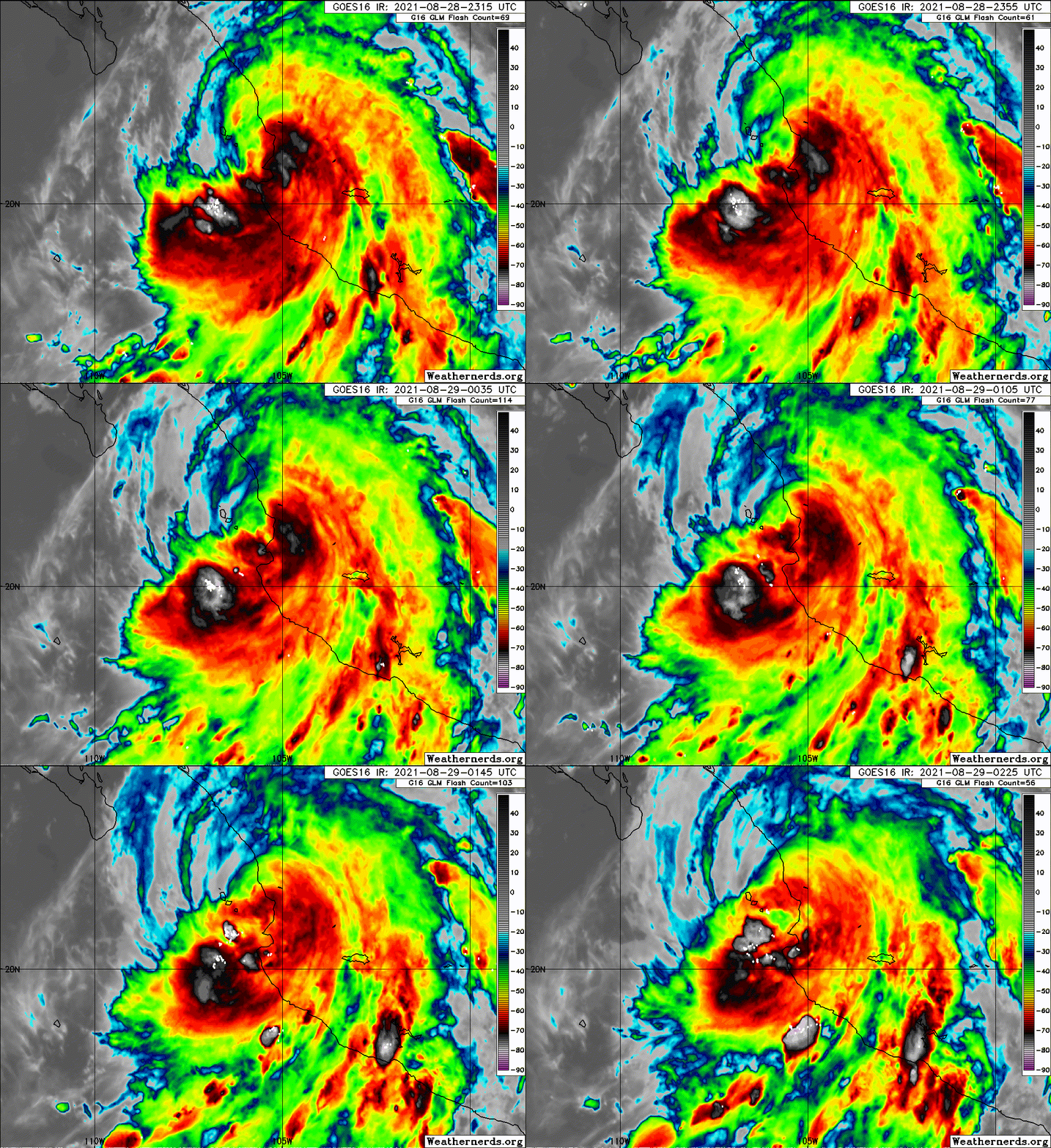
Image
0 likes   

User avatar
cycloneye
Admin
Admin
Posts: 139080
Age: 67
Joined: Thu Oct 10, 2002 10:54 am
Location: San Juan, Puerto Rico

Re: EPAC: NORA - Hurricane

#166 Postby cycloneye » Sat Aug 28, 2021 9:57 pm

Hurricane Nora Discussion Number 13
NWS National Hurricane Center Miami FL EP142021
400 PM CDT Sat Aug 28 2021

Nora developed a cloud-filled eye during the past few hours, with
the center now grazing the coast and the eyewall moving across
western Jalisco, Mexico. An Air Force Reserve Hurricane Hunter
aircraft has been investigating the hurricane, but unfortunately
the storm is now too close to the mountainous coastline for the
plane to safely locate the surface center or sample the
likely-stronger wind field on the eastern side of the circulation.
Based mainly on T4.5/77 kt Dvorak estimates from TAFB and SAB, the
initial intensity is estimated to be 75 kt.

The center has been moving a little faster to the west of due
north, or 350/12 kt. The track models are in agreement that Nora
should turn toward the north-northwest and northwest during the next
few days, generally keeping the center of the hurricane over the
waters of the Gulf of California. However, due to the complex
geography and mountainous topography of the region, the track
forecast is challenging, and it's almost impossible to know if
Nora's center will remain over water or graze the coastlines of
Nayarit and Sinaloa over the next few days. By days 4 and 5, Nora's
center is forecast to move inland over Sonora after traversing a
significant length of the Gulf of California.

Assuming a path that keeps Nora just offshore, low shear and very
warm sea surface temperatures in the Gulf of California should be
sufficient to at least maintain hurricane intensity for the next 3
days. However, any slight deviations of the track could cause Nora
to weaken and fall below hurricane intensity sooner than is
indicated in the official forecast. Given the uncertainties,
however, the government of Mexico has extended the hurricane
warning farther north along the coasts of Nayarit and Sinaloa out
of an abundance of caution. Weakening will become more likely the
farther north Nora gets up the Gulf of California, both due to
possible land interaction and ingestion of drier air off the Mexican
plateau.


Key Messages:

1. Nora is forecast to be a hurricane while it moves near or
along the coasts of the Mexican states of Jalisco, Nayarit, and
Sinaloa through Monday, and hurricane warnings are in effect for
portions of that coastline. Interests in these areas should closely
monitor the progress of Nora and subsequent updates to the forecast.

2. Heavy rain associated with Nora is expected across the west coast
of Mexico from the Mexican states of Guerrero, northward to southern
Sonora, including Baja California Sur. This rain will likely
result in life-threatening flash flooding and mudslides across these
regions. Rainfall from Nora may spread into the southwestern U.S.
and central Rockies during the middle to latter portion of next
week.

3. Nora is forecast to continue moving northward over the Gulf of
California Tuesday and Wednesday, bringing a risk of wind impacts to
portions of the Mexican states of Baja California Sur, northern
Sinaloa, and Sonora. Given the above-average uncertainty in the
forecast intensity, confidence is not high enough to determine the
magnitude and location of these potential impacts.


FORECAST POSITIONS AND MAX WINDS

INIT 28/2100Z 19.7N 105.4W 75 KT 85 MPH...ON THE COAST
12H 29/0600Z 21.5N 105.9W 75 KT 85 MPH
24H 29/1800Z 22.9N 106.7W 75 KT 85 MPH
36H 30/0600Z 23.5N 107.4W 75 KT 85 MPH
48H 30/1800Z 24.2N 108.1W 75 KT 85 MPH
60H 31/0600Z 24.8N 108.9W 70 KT 80 MPH
72H 31/1800Z 25.6N 109.5W 70 KT 80 MPH
96H 01/1800Z 27.6N 110.4W 55 KT 65 MPH...INLAND
120H 02/1800Z 29.4N 110.6W 30 KT 35 MPH...INLAND

$$
Forecaster Berg
0 likes   
Visit the Caribbean-Central America Weather Thread where you can find at first post web cams,radars
and observations from Caribbean basin members Click Here

User avatar
Yellow Evan
Professional-Met
Professional-Met
Posts: 15952
Age: 25
Joined: Fri Jul 15, 2011 12:48 pm
Location: Henderson, Nevada/Honolulu, HI
Contact:

Re: EPAC: NORA - Hurricane

#167 Postby Yellow Evan » Sat Aug 28, 2021 10:45 pm

000
WTPZ44 KNHC 290259
TCDEP4

Hurricane Nora Discussion Number 14
NWS National Hurricane Center Miami FL EP142021
1000 PM CDT Sat Aug 28 2021

Surface data from Mexico, data from an Air Force Reserve Hurricane
Hunter aircraft, and microwave imagery from an 2344 UTC SSMIS
indicate that the center of Nora moved over the far northwestern
coast of Jalisco earlier this evening. Since then, the cloud
pattern of the hurricane has degraded, but not enough to bring the
latest Dvorak estimates below hurricane strength. The advisory
intensity is therefore set at 65 kt based on the assumption that
interaction with land has caused weakening, however there is low
confidence in this assessment.

The ever-so-slight rightward deviation from the forecast track that
brought Nora inland, at least briefly, highlights the sensitivity of
the system's future to its exact track. A sizable portion of the
latest dynamical guidance, including the GFS, ECMWF, and HWRF models
indicate that Nora will move inland tonight or early Sunday and
dissipate. All three models also indicate it could reform over the
Gulf of California in a few days. Other models, like the UKMET and
CMC global models maintain Nora as a coherent tropical cyclone much
longer. While the models can easily flip flop from run to run, the
NHC forecast cannot drastically change solutions so cavalierly.
Therefore, the official forecast is based on the condition that Nora
will stay far enough offshore to persist as a tropical cyclone.
Regardless of its exact state, Nora is forecast to turn toward the
northwest on Sunday and then move along the coast toward northern
Mexico early next week. This general solution is supported by all of
the available guidance. A slight eastward adjustment has been made
to the NHC track forecast to account for the slightly east initial
position.

Given Nora's recent movement over land, the intensity forecast has
been lowered substantially at all forecast hours, but still
maintains Nora near hurricane strength for the next couple of days.
This is well above the most recent intensity consensus, which is
heavily influenced by the dynamical models that move Nora inland.
If it doesn't move inland sooner, Nora will likely quickly weaken
as it moves permanently inland by around 96 h, and become a remnant
low by the end of the forecast period.


Key Messages:

1. Nora is forecast to be at or near hurricane strength while
it moves near the coasts of Nayarit and Sinaloa through the
weekend, and hurricane warnings are in effect for portions of that
coastline. Interests in these areas should closely monitor the
progress of Nora and subsequent updates to the forecast.

2. Heavy rain associated with Nora is expected across the west coast
of Mexico from the states of Michoacan northward to southern Sonora,
including Baja California Sur. This rain will likely result in
life-threatening flash flooding and mudslides across these regions.
Rainfall from Nora may spread into the southwestern U.S. and central
Rockies during the middle to latter portion of next week.

3. Nora is forecast to continue moving northward over the Gulf of
California Tuesday and Wednesday, bringing a risk of wind impacts to
portions of the Mexican states of Baja California Sur, northern
Sinaloa, and Sonora. Given the above-average uncertainty in the
forecast intensity, confidence is not high enough to determine the
magnitude and location of these potential impacts.


FORECAST POSITIONS AND MAX WINDS

INIT 29/0300Z 21.3N 105.5W 65 KT 75 MPH
12H 29/1200Z 22.8N 106.2W 65 KT 75 MPH
24H 30/0000Z 23.7N 107.1W 60 KT 70 MPH
36H 30/1200Z 24.4N 107.9W 60 KT 70 MPH
48H 31/0000Z 24.9N 108.6W 60 KT 70 MPH
60H 31/1200Z 25.6N 109.4W 55 KT 65 MPH
72H 01/0000Z 26.8N 110.1W 55 KT 65 MPH
96H 02/0000Z 28.6N 110.7W 35 KT 40 MPH...INLAND
120H 03/0000Z 30.2N 110.9W 20 KT 25 MPH...POST-TROP/REMNT LOW

$$
Forecaster D. Zelinsky
0 likes   

User avatar
Yellow Evan
Professional-Met
Professional-Met
Posts: 15952
Age: 25
Joined: Fri Jul 15, 2011 12:48 pm
Location: Henderson, Nevada/Honolulu, HI
Contact:

Re: EPAC: NORA - Hurricane

#168 Postby Yellow Evan » Sat Aug 28, 2021 10:47 pm

This is going to crash into Nayarit as well actually even if briefly. Once this turns to around 300-310, it'll move offshore but this storm may dissipate before then.
0 likes   

User avatar
Yellow Evan
Professional-Met
Professional-Met
Posts: 15952
Age: 25
Joined: Fri Jul 15, 2011 12:48 pm
Location: Henderson, Nevada/Honolulu, HI
Contact:

Re: EPAC: NORA - Hurricane

#169 Postby Yellow Evan » Sat Aug 28, 2021 11:19 pm

0z GFS no longer moves this back over water but initializes a bit too inland.
1 likes   

User avatar
galaxy401
Category 5
Category 5
Posts: 2299
Age: 28
Joined: Sat Aug 25, 2012 9:04 pm
Location: Casa Grande, Arizona

Re: EPAC: NORA - Hurricane

#170 Postby galaxy401 » Sun Aug 29, 2021 12:44 am

This storm needs to turn west now or it's never going to get into the Gulf of California and just die in Mexico.
0 likes   
Got my eyes on moving right into Hurricane Alley: Florida.

User avatar
Yellow Evan
Professional-Met
Professional-Met
Posts: 15952
Age: 25
Joined: Fri Jul 15, 2011 12:48 pm
Location: Henderson, Nevada/Honolulu, HI
Contact:

Re: EPAC: NORA - Hurricane

#171 Postby Yellow Evan » Sun Aug 29, 2021 2:53 am

ECMWF dropped the idea of re-development in the Gulf of California.
0 likes   

User avatar
Yellow Evan
Professional-Met
Professional-Met
Posts: 15952
Age: 25
Joined: Fri Jul 15, 2011 12:48 pm
Location: Henderson, Nevada/Honolulu, HI
Contact:

Re: EPAC: NORA - Hurricane

#172 Postby Yellow Evan » Sun Aug 29, 2021 10:42 am

1 likes   

User avatar
Zonacane
Tropical Storm
Tropical Storm
Posts: 217
Joined: Tue Aug 03, 2021 2:23 pm

Re: EPAC: NORA - Hurricane

#173 Postby Zonacane » Sun Aug 29, 2021 11:04 am

No enhanced monsoonal moisture for me D:
0 likes   

User avatar
Yellow Evan
Professional-Met
Professional-Met
Posts: 15952
Age: 25
Joined: Fri Jul 15, 2011 12:48 pm
Location: Henderson, Nevada/Honolulu, HI
Contact:

Re: EPAC: NORA - Hurricane

#174 Postby Yellow Evan » Sun Aug 29, 2021 11:25 am

ZCZC MIATCDEP4 ALL
TTAA00 KNHC DDHHMM

Hurricane Nora Discussion Number 15
NWS National Hurricane Center Miami FL EP142021
400 AM CDT Sun Aug 29 2021

There have been no recent in-situ observations for estimating the
intensity of Nora, but the cyclone is still fairly well-organized on
satellite images. Taking a blend of T- and Current Intensity
numbers from TAFB and SAB along with ADT estimates from UW-CIMSS
still supports keeping the system as a hurricane at this time.

Center fixes indicate that Nora is moving a little west of due
north at a decreased forward speed, or around 350/9 kt. The
tropical cyclone is expected to move north-northwestward to
northwestward during the next few days, on the southwestern side of
a mid-level ridge. This would take Nora over the eastern part of
the Gulf of California, but very near the coast of mainland Mexico
over the next few days. The track guidance has shifted somewhat to
the east, and now suggests that it is a very distinct possibility
that the system will move inland much sooner than shown by the
latest NHC track forecast.

The future intensity of Nora is of course highly dependent on how
soon the center moves inland. The official intensity forecast
assumes that the system will remain just offshore so that only slow
weakening will occur during the next 72 hours or so. This is in
good agreement with the NOAA corrected consensus guidance.
Alternatively, Nora may move inland sooner than indicated, in which
case the system would probably dissipate in 2 to 3 days or less.
Obviously, this intensity forecast is of low confidence.


Key Messages:

1. Nora is forecast to be at or near hurricane strength while
it moves near the coasts of Nayarit and Sinaloa through the
weekend and into Monday, and hurricane warnings or watches are in
effect for portions of that coastline. Interests in these areas
should closely monitor the progress of Nora and subsequent updates
to the forecast.

2. Heavy rain associated with Nora is expected across the west coast
of Mexico from the states of Colima northward to southern Sonora.
This rain will likely result in life-threatening flash flooding and
mudslides across these regions. Rainfall from Nora is likely to
spread into the southwestern U.S. and central Rockies during the
middle to latter portion of the week, bringing the potential for
flash flooding to the region.

3. Nora is forecast to move north-northwestward to northwestward
over the Gulf of California Tuesday and Wednesday, bringing a risk
of wind impacts to portions of the Mexican states of Baja California
Sur, northern Sinaloa, and Sonora. Given the above-average
uncertainty in the forecast intensity, confidence is not high enough
to determine the magnitude and location of these potential impacts.


FORECAST POSITIONS AND MAX WINDS

INIT 29/0900Z 22.5N 105.9W 65 KT 75 MPH
12H 29/1800Z 23.6N 106.8W 65 KT 75 MPH
24H 30/0600Z 24.2N 107.4W 60 KT 70 MPH
36H 30/1800Z 24.7N 108.1W 60 KT 70 MPH
48H 31/0600Z 25.2N 108.8W 60 KT 70 MPH
60H 31/1800Z 26.0N 109.5W 55 KT 65 MPH
72H 01/0600Z 27.0N 110.2W 55 KT 65 MPH
96H 02/0600Z 29.5N 111.0W 30 KT 35 MPH...INLAND
120H 03/0600Z...DISSIPATED

$$
Forecaster Pasch
0 likes   

User avatar
Yellow Evan
Professional-Met
Professional-Met
Posts: 15952
Age: 25
Joined: Fri Jul 15, 2011 12:48 pm
Location: Henderson, Nevada/Honolulu, HI
Contact:

Re: EPAC: NORA - Hurricane

#175 Postby Yellow Evan » Sun Aug 29, 2021 11:26 am

000
WTPZ44 KNHC 291445
TCDEP4

Hurricane Nora Discussion Number 16
NWS National Hurricane Center Miami FL EP142021
900 AM MDT Sun Aug 29 2021

Nora has a healthy satellite appearance this morning. The deep
convection near and to the west of the estimated center is
maintaining a fairly large central dense overcast with very cold
infrared cloud tops. Recent ATMS and SSMIS microwave data indicate
Nora still has a pronounced mid-level eye structure, with the center
very near the coast of extreme southern Sinaloa. A blend of the
UW-CIMSS objective ADT estimate and 12 UTC subjective Dvorak
classifications from TAFB and SAB support holding the initial
intensity at 65 kt for this advisory.

The estimated initial motion of Nora is north-northwestward or 345/9
kt, although this is somewhat uncertain due to the lack of in-situ
observations. A mid-level ridge should continue to steer the
tropical cyclone generally north-northwestward to northwestward
during the next few days. This motion will bring the center over the
eastern Gulf of California and very near or over the coast of
west-central Mexico. The official NHC track forecast is adjusted
just slightly to the right of the previous one, in line with the
latest track guidance.

Nora's intensity forecast remains highly dependent on whether the
center moves inland over mainland Mexico or along the Gulf of
California, parallel to the west-central coast of Mexico. Given the
slight eastward track adjustment, the official NHC intensity
forecast shows gradual weakening over the next few days due to at
least intermittent land interaction as Nora skirts the coast. This
is consistent with the general intensity guidance consensus, which
no longer supports strengthening given Nora's proximity to land. Due
to the complex geography of western Mexico, even a slight eastward
deviation from the forecast track would result in more rapid
weakening as Nora moves further inland. Conversely, a more
northwestward motion over the warm Gulf of California waters could
allow Nora to remain a stronger tropical storm early this week. As
previously mentioned, confidence in the intensity forecast is lower
than normal.

Key Messages:

1. Nora is forecast to be at or near hurricane strength while it
moves near the coasts of Nayarit and Sinaloa today and into Monday,
and hurricane warnings or watches are in effect for portions of that
coastline. Interests in these areas should closely monitor the
progress of Nora and subsequent updates to the forecast.

2. Heavy rain associated with Nora is expected across the west coast
of Mexico from the states of Colima northward to southern Sonora.
This rain will likely result in life-threatening flash flooding and
mudslides across these regions. Rainfall from Nora is likely to
spread into the southwestern U.S. and central Rockies during the
middle to latter portion of the week, bringing the potential for
flash flooding to the region.

3. Nora is forecast to move north-northwestward to northwestward
near or over the Gulf of California Tuesday and Wednesday, bringing
a risk of wind impacts to portions of the Mexican states of Baja
California Sur, northern Sinaloa, and Sonora. Given the
above-average uncertainty in the intensity forecast, confidence is
not high enough to determine the magnitude and location of these
potential impacts.

FORECAST POSITIONS AND MAX WINDS

INIT 29/1500Z 23.3N 106.4W 65 KT 75 MPH
12H 30/0000Z 23.8N 106.9W 60 KT 70 MPH...NEAR THE COAST
24H 30/1200Z 24.3N 107.5W 55 KT 65 MPH...NEAR THE COAST
36H 31/0000Z 24.9N 108.2W 55 KT 65 MPH...NEAR THE COAST
48H 31/1200Z 25.6N 109.0W 50 KT 60 MPH...NEAR THE COAST
60H 01/0000Z 26.5N 109.6W 50 KT 60 MPH...NEAR THE COAST
72H 01/1200Z 27.5N 110.0W 40 KT 45 MPH...INLAND
96H 02/1200Z 29.5N 111.2W 30 KT 35 MPH...INLAND
120H 03/1200Z...DISSIPATED

$$
Forecaster Reinhart
0 likes   

Sciencerocks
Category 5
Category 5
Posts: 7286
Age: 38
Joined: Thu Jul 06, 2017 1:51 am

Re: EPAC: NORA - Tropical Storm

#176 Postby Sciencerocks » Sun Aug 29, 2021 3:01 pm

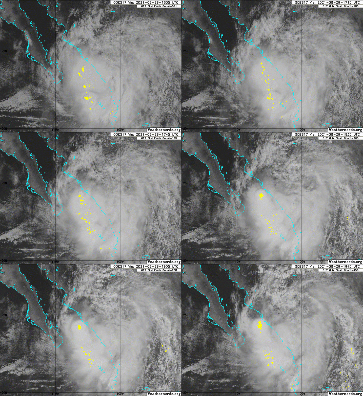
Image
0 likes   

zeehag
Tropical Storm
Tropical Storm
Posts: 172
Age: 75
Joined: Sun Jul 17, 2011 9:49 pm
Location: mazatlan,sinaloa, mexico, fixing patricia's mess.
Contact:

Re: EPAC: NORA - Tropical Storm

#177 Postby zeehag » Sun Aug 29, 2021 3:06 pm

this storm has plenty of water to share with aridzona.. right now, storm has left mazatlan and after it left it unleashed its unholy winds it spared us until now.. wow inmy heavy deep keeled cruising formosa i thought we were going to the moon to join alice for a minuet.. was a great blow.. and filled with water.
storm itself was not a lot of wind and very heavy rains. was lovely until the blast of sideways rain and blowdry.
0 likes   
life is an adventure meant to be LIVED!!!

http://www.sksolitarybird.org

User avatar
cycloneye
Admin
Admin
Posts: 139080
Age: 67
Joined: Thu Oct 10, 2002 10:54 am
Location: San Juan, Puerto Rico

Re: EPAC: NORA - Tropical Storm

#178 Postby cycloneye » Sun Aug 29, 2021 4:13 pm

Tropical Storm Nora Discussion Number 17
NWS National Hurricane Center Miami FL EP142021
300 PM MDT Sun Aug 29 2021

Visible satellite imagery and surface observations along the
west-central coast of Mexico suggest that the center of Nora has
re-formed closer to a mass of deep convection that has persisted
today over the southern Gulf of California. Various satellite data
sets indicate that Nora is weakening. The latest SSMIS microwave
data reveal that the structure of Nora has degraded since this
morning, especially in the mid-levels where an eyewall structure is
no longer evident. Additionally, a 15 UTC ASCAT-A pass shows the
winds are substantially weaker than previously estimated. Thus, the
initial intensity has been lowered to 50 kt for this advisory.

The initial motion is somewhat uncertain given the earlier center
relocation, but it is estimated to be north-northwestward, or 330/10
kt. The global models suggest the tropical cyclone will move
generally northwestward over the next couple of days, between an
upper-level low offshore the Baja California peninsula and a
mid-level ridge to the east of Nora. This motion should keep the
center of Nora along the coast, or just inland over mainland
west-central or northwestern Mexico. The official NHC track forecast
is once again shifted a little to the right based on the latest
track guidance, which brings the cyclone further inland by Tuesday.

Nora is forecast to gradually weaken over the next few days as the
system continues to interact with the coastline of Mexico. Despite
warm SSTs in the Gulf of California and weak environmental shear, it
appears unlikely that Nora will move far enough away from the coast
to take advantage of this favorable environment. In fact, it is
certainly plausible that the center of Nora could move well inland
earlier than forecast and weaken more rapidly. The NHC intensity
forecast has been adjusted about 10 kt weaker at all forecast hours
based on today's data supporting a much weaker initial intensity.


Key Messages:

1. Nora is forecast to be at or near tropical storm strength while
it moves near the coast of Sinaloa and southern Sonora through early
Tuesday, and tropical storm warnings and watches are in effect for
portions of that coastline. Interests in these areas should closely
monitor the progress of Nora.

2. Heavy rain associated with Nora is expected across the west coast
of Mexico from the states of Colima northward to southern Sonora.
This rain will likely result in life-threatening flash flooding and
mudslides across these regions. Rainfall from Nora is likely to
spread into the southwestern U.S. and central Rockies during the
middle to latter portion of the week bringing the potential for
flash flooding to the region.


FORECAST POSITIONS AND MAX WINDS

INIT 29/2100Z 24.3N 107.5W 50 KT 60 MPH...NEAR THE COAST
12H 30/0600Z 25.1N 108.2W 45 KT 50 MPH...NEAR THE COAST
24H 30/1800Z 25.8N 108.8W 40 KT 45 MPH...NEAR THE COAST
36H 31/0600Z 26.5N 109.3W 40 KT 45 MPH...NEAR THE COAST
48H 31/1800Z 27.2N 109.9W 35 KT 40 MPH...INLAND
60H 01/0600Z 28.2N 110.6W 30 KT 35 MPH...INLAND
72H 01/1800Z 28.9N 111.1W 30 KT 35 MPH...INLAND
96H 02/1800Z...DISSIPATED

$$
Forecaster Reinhart
0 likes   
Visit the Caribbean-Central America Weather Thread where you can find at first post web cams,radars
and observations from Caribbean basin members Click Here

Astromanía
Category 2
Category 2
Posts: 737
Age: 25
Joined: Sat Aug 25, 2018 10:34 pm
Location: Monterrey, N.L, México

Re: EPAC: NORA - Tropical Storm

#179 Postby Astromanía » Sun Aug 29, 2021 9:00 pm

This thing althoug weak is doing lot of destruction in Mexico, it will be interesting to see the rainfall totals when this dissipates, I hope there are not fatalities but it doesn't seem likely, I have seen horrible videos of the flooding
1 likes   

User avatar
galaxy401
Category 5
Category 5
Posts: 2299
Age: 28
Joined: Sat Aug 25, 2012 9:04 pm
Location: Casa Grande, Arizona

Re: EPAC: NORA - Tropical Storm

#180 Postby galaxy401 » Sun Aug 29, 2021 9:32 pm

It's becoming difficult to locate the center now. Just a disorganized mess now which does mean heavy rainfall however.
0 likes   
Got my eyes on moving right into Hurricane Alley: Florida.


Return to “2021”

Who is online

Users browsing this forum: No registered users and 56 guests