

Sent from my iPhone using Tapatalk
Moderator: S2k Moderators

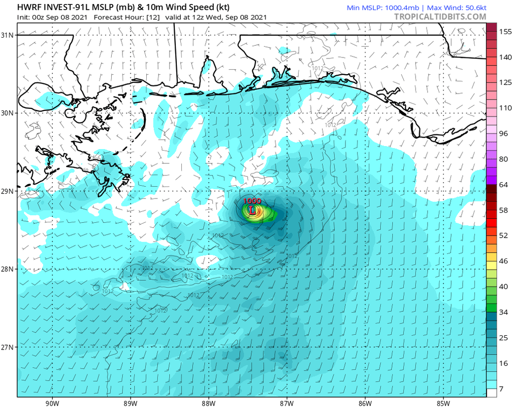
chaser1 wrote:If something were to come out of 91L, I have to think it'll originate in the deep convection east of that LLC this a.m. that got quickly obliterated. I believe there is a weak mid level rotation but it would need time. I personally think that the GFS is a bit too fast on the primary vorticity reaching the Panhandle late Wednesday night. Clearly though, model support is meh... Can't even get our crazy uncle OR NAM to bite on development LOL
Dean4Storms wrote:chaser1 wrote:If something were to come out of 91L, I have to think it'll originate in the deep convection east of that LLC this a.m. that got quickly obliterated. I believe there is a weak mid level rotation but it would need time. I personally think that the GFS is a bit too fast on the primary vorticity reaching the Panhandle late Wednesday night. Clearly though, model support is meh... Can't even get our crazy uncle OR NAM to bite on development LOL
18z NAM 3km does develop and takes toward PCB with 60mph wind gusts.


robbielyn wrote:Gums wrote:Salute!
We Panhandle folks are praying for the cold front and send the future Mindy over to Big Bend or even Tampa
Been saved by early fronts many times
Gums sends..
Uh well we in tampabay area don’t want 91L either. hopefully it’s just rain.

Users browsing this forum: No registered users and 42 guests


