
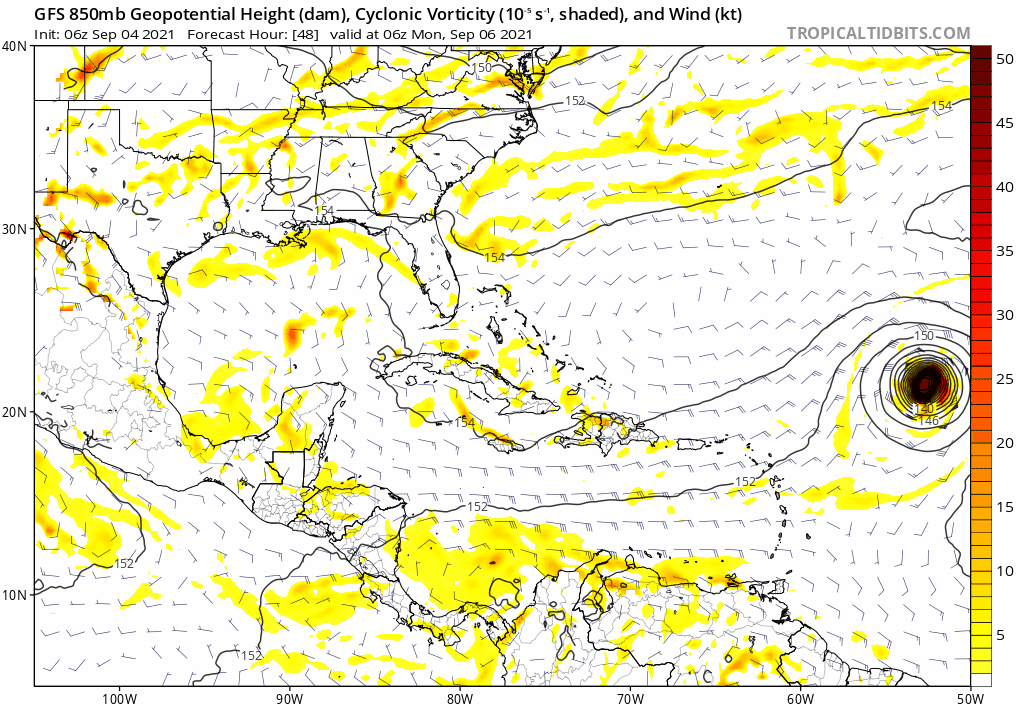
IcyTundra wrote:91L GFS ensemble members.
https://www.tropicaltidbits.com/storminfo/91L_gefs_latest.png
This is odd. Does it just drop it.
Moderator: S2k Moderators
IcyTundra wrote:91L GFS ensemble members.
https://www.tropicaltidbits.com/storminfo/91L_gefs_latest.png


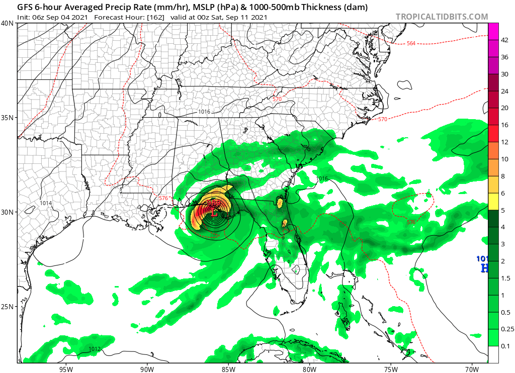
NDG wrote:Hope the 06z GFS is not correct, it will bring insult to injure to SE LA.
The good news is that the 06z GFS is fairly much all alone among the global models, the bad news is that we are not talking about the crappy GFS from a few years ago.
Something to watch over the next couple of days.

AlphaToOmega wrote:GFS bullies Florida
https://i.postimg.cc/7P5dLNS7/gfs-mslp-pcpn-seus-27.png
Kohlecane wrote:AlphaToOmega wrote:GFS bullies Florida
https://i.postimg.cc/7P5dLNS7/gfs-mslp-pcpn-seus-27.png
EDIT: This is is 91L if i'm not mistaken? And we are within the week time frame, so as Larry is fascinating to track, this one is a sleeper, model support continue to grows wouldn't be surprised to see this area go orange by tomorrow
AlphaToOmega wrote:Kohlecane wrote:AlphaToOmega wrote:GFS bullies Florida
https://i.postimg.cc/7P5dLNS7/gfs-mslp-pcpn-seus-27.png
EDIT: This is is 91L if i'm not mistaken? And we are within the week time frame, so as Larry is fascinating to track, this one is a sleeper, model support continue to grows wouldn't be surprised to see this area go orange by tomorrow
This is Invest 91L.
SoupBone wrote:NDG wrote:Hope the 06z GFS is not correct, it will bring insult to injure to SE LA.
The good news is that the 06z GFS is fairly much all alone among the global models, the bad news is that we are not talking about the crappy GFS from a few years ago.
Something to watch over the next couple of days.
What are the other globals showing? I'm too lazy to look.
ConvergenceZone wrote:It will be interesting if the other models start to trend towards what the GFS is showing....

ConvergenceZone wrote:It will be interesting if the other models start to trend towards what the GFS is showing....
gatorcane wrote:ConvergenceZone wrote:It will be interesting if the other models start to trend towards what the GFS is showing....
The GFS Texas major is from another area not 91l.
Gums wrote:Salute!
We Panhandle folks are praying for the cold front and send the future Mindy over to Big Bend or even Tampa
Been saved by early fronts many times
Gums sends..


Users browsing this forum: No registered users and 20 guests


