Hurricane Kay Discussion Number 18
NWS National Hurricane Center Miami FL EP122022
300 PM MDT Thu Sep 08 2022
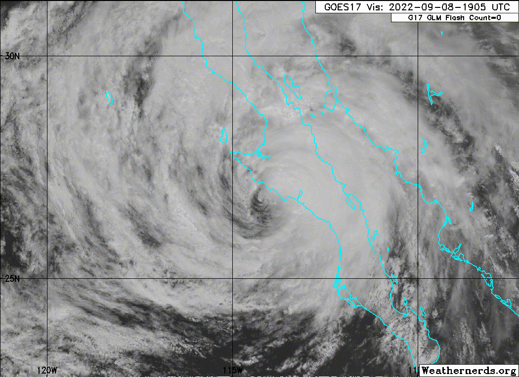
Satellite imagery and reports from an Air Force Reserve Hurricane
Hunter aircraft show that Kay continues to weaken. The aircraft
did not find winds supporting hurricane intensity in the part of
the storm it sampled, and it reported that the central pressure has
risen to 982 mb. However, the plane was not able to sample the area
of convection just northeast of the center where the strongest
winds were likely occurring. The initial intensity is reduced to 65
kt on the premise that those winds still exist in the northeastern
quadrant. However, this could be generous.
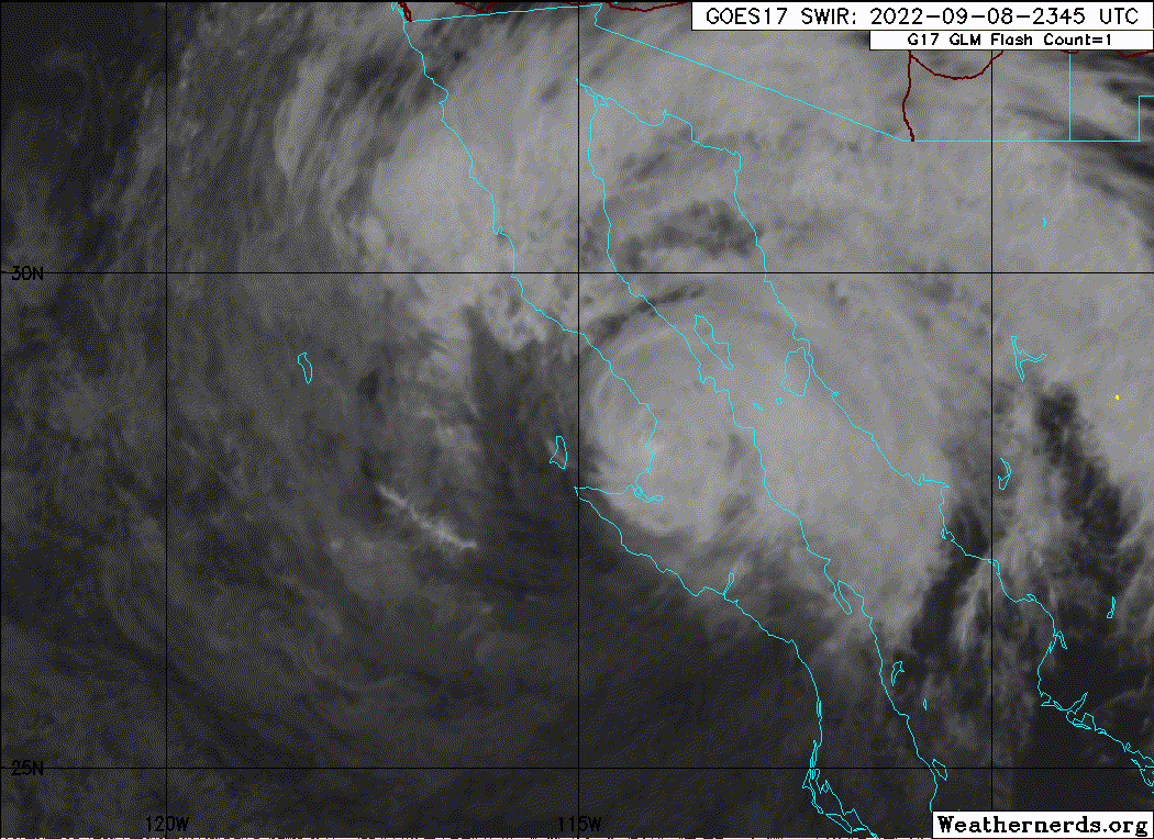
The core of Kay will be crossing portions of Baja California near
Punta Eugenia during the next few hours, and then move back over
the cold water of the Pacific. This combination should cause
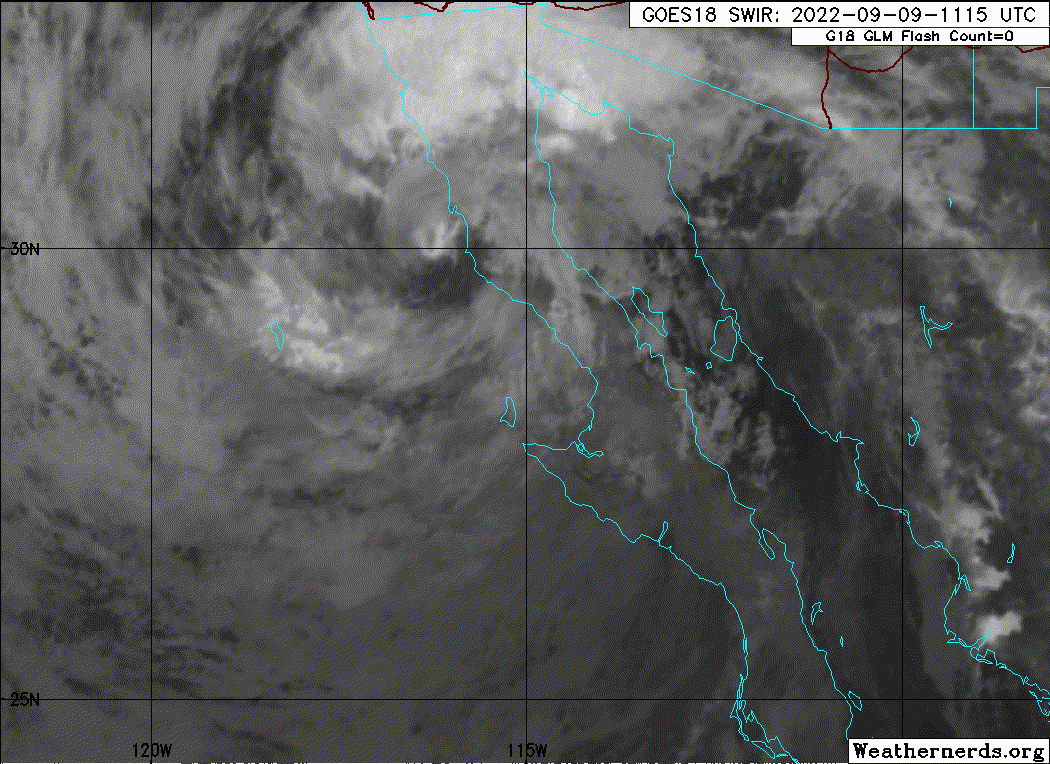
additional weakening. Kay is expected to weaken to a tropical
storm during the next few hours, and the cyclone is forecast to
lose its convection in about 48-60 h at roughly the same time the
winds drop below 35 kt. After that, the cyclone should quickly
decay to a remnant area of low pressure.
Kay continues to move north-northwestward or 335/12 kt. There is
again no change to the previous track forecast philosophy. A
mid-level ridge to the east of Kay should steer it on a
north-northwestward heading during the next 24 to 36 hours. After
that time, a weaker and more vertically shallow Kay is expected to
turn more westward, and eventually southward to the southeast of a
low-level ridge over the eastern Pacific. The new track forecast
again has only minor adjustments from the previous forecast.
Recent scatterometer and dropsonde data indicate that Kay remains a
very large tropical cyclone, with a large area of tropical-storm-
force winds over the Gulf of California. It is also producing an
extensive area of high seas, with swells affecting portions of
southwestern Mexico, the Gulf of California, and the Baja California
peninsula. Although Kay is forecast to weaken, high wind, surf, and
rainfall impacts will continue to extend far from the center so
users should not focus on the exact forecast track.
KEY MESSAGES:
1. Heavy rainfall could lead to flash flooding, including
landslides, across the Baja California peninsula and portions of
mainland northwestern Mexico through Saturday morning. Flash,
urban, and small stream flooding is likely across Southern
California beginning Friday, especially in and near the peninsular
ranges. Flash, urban, and small stream flooding is possible
beginning Friday in Southwest Arizona.
2. Hurricane conditions are occuring over portion of the central
Baja California Peninsula and should continue for a few more hours.
3. Tropical storm conditions are occurring over portions of the
Baja California peninsula, and these conditions are expected to
spread northward during the next day or so, where a Tropical Storm
Warning is in effect.
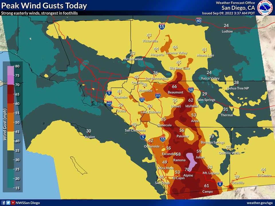
4. Strong winds not directly associated with Kay's core wind field
are expected across portions of southern California and extreme
southwestern Arizona beginning on Friday. For information on this
wind hazard, users should see High Wind Warnings and other products
from their local NWS Weather Forecast Office.
FORECAST POSITIONS AND MAX WINDS
INIT 08/2100Z 27.1N 114.3W 65 KT 75 MPH...ON COAST
12H 09/0600Z 28.7N 115.4W 55 KT 65 MPH
24H 09/1800Z 30.4N 116.9W 45 KT 50 MPH
36H 10/0600Z 31.3N 118.4W 40 KT 45 MPH
48H 10/1800Z 31.7N 119.6W 35 KT 40 MPH
60H 11/0600Z 31.7N 120.5W 30 KT 35 MPH...POST-TROP/REMNT LOW
72H 11/1800Z 31.0N 121.5W 25 KT 30 MPH...POST-TROP/REMNT LOW
96H 12/1800Z 29.5N 121.0W 20 KT 25 MPH...POST-TROP/REMNT LOW
120H 13/1800Z 28.5N 120.0W 20 KT 25 MPH...POST-TROP/REMNT LOW
$$
Forecaster Beven
NWS National Hurricane Center Miami FL EP122022
300 PM MDT Thu Sep 08 2022
Satellite imagery and reports from an Air Force Reserve Hurricane
Hunter aircraft show that Kay continues to weaken. The aircraft
did not find winds supporting hurricane intensity in the part of
the storm it sampled, and it reported that the central pressure has
risen to 982 mb. However, the plane was not able to sample the area
of convection just northeast of the center where the strongest
winds were likely occurring. The initial intensity is reduced to 65
kt on the premise that those winds still exist in the northeastern
quadrant. However, this could be generous.
The core of Kay will be crossing portions of Baja California near
Punta Eugenia during the next few hours, and then move back over
the cold water of the Pacific. This combination should cause
additional weakening. Kay is expected to weaken to a tropical
storm during the next few hours, and the cyclone is forecast to
lose its convection in about 48-60 h at roughly the same time the
winds drop below 35 kt. After that, the cyclone should quickly
decay to a remnant area of low pressure.
Kay continues to move north-northwestward or 335/12 kt. There is
again no change to the previous track forecast philosophy. A
mid-level ridge to the east of Kay should steer it on a
north-northwestward heading during the next 24 to 36 hours. After
that time, a weaker and more vertically shallow Kay is expected to
turn more westward, and eventually southward to the southeast of a
low-level ridge over the eastern Pacific. The new track forecast
again has only minor adjustments from the previous forecast.
Recent scatterometer and dropsonde data indicate that Kay remains a
very large tropical cyclone, with a large area of tropical-storm-
force winds over the Gulf of California. It is also producing an
extensive area of high seas, with swells affecting portions of
southwestern Mexico, the Gulf of California, and the Baja California
peninsula. Although Kay is forecast to weaken, high wind, surf, and
rainfall impacts will continue to extend far from the center so
users should not focus on the exact forecast track.
KEY MESSAGES:
1. Heavy rainfall could lead to flash flooding, including
landslides, across the Baja California peninsula and portions of
mainland northwestern Mexico through Saturday morning. Flash,
urban, and small stream flooding is likely across Southern
California beginning Friday, especially in and near the peninsular
ranges. Flash, urban, and small stream flooding is possible
beginning Friday in Southwest Arizona.
2. Hurricane conditions are occuring over portion of the central
Baja California Peninsula and should continue for a few more hours.
3. Tropical storm conditions are occurring over portions of the
Baja California peninsula, and these conditions are expected to
spread northward during the next day or so, where a Tropical Storm
Warning is in effect.
4. Strong winds not directly associated with Kay's core wind field
are expected across portions of southern California and extreme
southwestern Arizona beginning on Friday. For information on this
wind hazard, users should see High Wind Warnings and other products
from their local NWS Weather Forecast Office.
FORECAST POSITIONS AND MAX WINDS
INIT 08/2100Z 27.1N 114.3W 65 KT 75 MPH...ON COAST
12H 09/0600Z 28.7N 115.4W 55 KT 65 MPH
24H 09/1800Z 30.4N 116.9W 45 KT 50 MPH
36H 10/0600Z 31.3N 118.4W 40 KT 45 MPH
48H 10/1800Z 31.7N 119.6W 35 KT 40 MPH
60H 11/0600Z 31.7N 120.5W 30 KT 35 MPH...POST-TROP/REMNT LOW
72H 11/1800Z 31.0N 121.5W 25 KT 30 MPH...POST-TROP/REMNT LOW
96H 12/1800Z 29.5N 121.0W 20 KT 25 MPH...POST-TROP/REMNT LOW
120H 13/1800Z 28.5N 120.0W 20 KT 25 MPH...POST-TROP/REMNT LOW
$$
Forecaster Beven