ATL: INVEST 95L - Discussion
Moderator: S2k Moderators
Re: ATL: INVEST 95L - Discussion
95L has split itself, the original part is down south near the ABC islands and the rest of the wave much further north. The models have had problems with 95L in the way they track storms, they lock on to the strongest signal only problem is when the lose the lock of a system they wonder around and miss the actual system. Anyway the models have been showing this split with the larger part hitting Central America.


1 likes
Re: ATL: INVEST 95L - Discussion
Is the purple triangle whose hypotenuse intersects St. Croix in the last several frames of the below image a severe thunderstorm watch box or something?


0 likes
- cycloneye
- Admin

- Posts: 142552
- Age: 68
- Joined: Thu Oct 10, 2002 10:54 am
- Location: San Juan, Puerto Rico
Re: ATL: INVEST 95L - Discussion
abajan wrote:Is the purple triangle whose hypotenuse intersects St. Croix in the last several frames of the below image a severe thunderstorm watch box or something?
https://images2.imgbox.com/d1/a0/8D6Dkzz3_o.gif
A Special Marine Warning there.
https://twitter.com/NWSSanJuan/status/1683889694780854273
1 likes
Visit the Caribbean-Central America Weather Thread where you can find at first post web cams,radars
and observations from Caribbean basin members Click Here
and observations from Caribbean basin members Click Here
Re: ATL: INVEST 95L - Discussion
msbee wrote:cycloneye wrote:msbee wrote:https://meteofrance.mq/fr/vigilance-meteo-antilles
Guadeloupe and Martinique are under yellow and orange alerts for heavy rain and wind.
Stay safe Barbara.
Thanks Luis. I believe it will be passing south of us.
Perhaps not as far south as previously thought, as much of the activity seems to have shifted a bit north. We're currently getting heavy showers in Barbados however, and it appears the rest of the afternoon will be a generally showery one, as not only is the trailing moisture from 95L in our area but so is the ITCZ. (Just heard a bit of distant thunder too.)
[youtube]https://youtu.be/qYDQVE7bVTI[/youtube]
1 likes
Re: ATL: INVEST 95L - Discussion
Another thought... Even though 95L didn't develop, it's the first invest of the year that failed to do so. 90L thru 94L all developed into the first five storms of the season respectively.
2 likes
- cycloneye
- Admin

- Posts: 142552
- Age: 68
- Joined: Thu Oct 10, 2002 10:54 am
- Location: San Juan, Puerto Rico
Re: ATL: INVEST 95L - Discussion
Iceresistance wrote:cycloneye wrote:Invest is still up.AL, 95, 2023072512, , BEST, 0, 120N, 624W, 25, 1012, DB
It has popped back up on CIMSS, likely a relocation of the possible Invest circulation.
Has been taken out, this time for good.
1 likes
Visit the Caribbean-Central America Weather Thread where you can find at first post web cams,radars
and observations from Caribbean basin members Click Here
and observations from Caribbean basin members Click Here
-
jconsor
- Professional-Met

- Posts: 544
- Joined: Mon Jun 30, 2008 9:31 pm
- Location: Jerusalem, Israel
- Contact:
Re: ATL: INVEST 95L - Discussion
Don't sleep on 95L just yet. It looks highly sheared and convectively anemic at the present time, but could gain renewed energy in the W. Caribbean.
https://twitter.com/yconsor/status/1684132821785522177
https://twitter.com/yconsor/status/1684135318054895617
https://twitter.com/yconsor/status/1684137135501111296
https://twitter.com/yconsor/status/1684132821785522177
https://twitter.com/yconsor/status/1684135318054895617
https://twitter.com/yconsor/status/1684137135501111296
2 likes
Re: ATL: INVEST 95L - Discussion
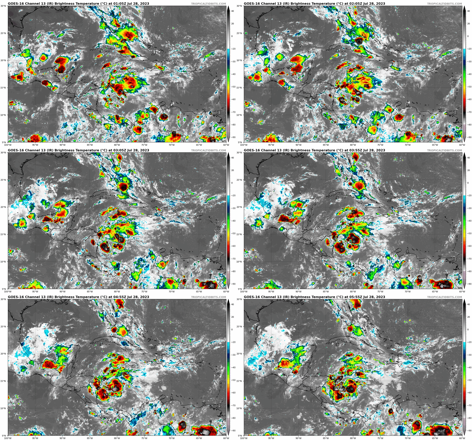
For those who still remember 95L, here's how it looks right now. Seems that conditions in the western Caribbean are actually great, just that it ran out of time.


0 likes
Who is online
Users browsing this forum: No registered users and 7 guests


