ATL: OPHELIA - Post-Tropical - Discussion

Moderator: S2k Moderators

Message
Author
User avatar
cycloneye
Admin
Admin
Posts: 139338
Age: 67
Joined: Thu Oct 10, 2002 10:54 am
Location: San Juan, Puerto Rico

ATL: OPHELIA - Post-Tropical - Discussion

#1 Postby cycloneye » Thu Sep 21, 2023 7:41 am

AL, 99, 2023092112, , BEST, 0, 285N, 760W, 25, 1012, DB, 34, NEQ, 0, 0, 0, 0, 1013, 140, 120, 0, 0, L, 0, , 0, 0, INVEST, S, 0, , 0, 0, 0, 0, genesis-num, 033, SPAWNINVEST, al772023 to al992023,


https://ftp.nhc.noaa.gov/atcf/btk/bal992023.dat

Image
0 likes   
Visit the Caribbean-Central America Weather Thread where you can find at first post web cams,radars
and observations from Caribbean basin members Click Here

hipshot
Category 1
Category 1
Posts: 468
Joined: Tue Jul 06, 2010 9:18 pm
Location: Dallas, Texas

Re: ATL: INVEST 99L - Discussion

#2 Postby hipshot » Thu Sep 21, 2023 8:28 am

cycloneye wrote:
AL, 99, 2023092112, , BEST, 0, 285N, 760W, 25, 1012, DB, 34, NEQ, 0, 0, 0, 0, 1013, 140, 120, 0, 0, L, 0, , 0, 0, INVEST, S, 0, , 0, 0, 0, 0, genesis-num, 033, SPAWNINVEST, al772023 to al992023,


https://ftp.nhc.noaa.gov/atcf/btk/bal992023.dat

https://i.imgur.com/lzACME0.png


I wonder why the disturbance off the African coast hasn't been designated yet with a greater than a 60% chance of development.
1 likes   

tolakram
Admin
Admin
Posts: 19171
Age: 60
Joined: Sun Aug 27, 2006 8:23 pm
Location: Florence, KY (name is Mark)

Re: ATL: INVEST 99L - Discussion

#3 Postby tolakram » Thu Sep 21, 2023 8:31 am

hipshot wrote:
cycloneye wrote:
AL, 99, 2023092112, , BEST, 0, 285N, 760W, 25, 1012, DB, 34, NEQ, 0, 0, 0, 0, 1013, 140, 120, 0, 0, L, 0, , 0, 0, INVEST, S, 0, , 0, 0, 0, 0, genesis-num, 033, SPAWNINVEST, al772023 to al992023,


https://ftp.nhc.noaa.gov/atcf/btk/bal992023.dat

https://i.imgur.com/lzACME0.png


I wonder why the disturbance off the African coast hasn't been designated yet with a greater than a 60% chance of development.


That's the 7 day percentages and it's not threatening anyone yet. These possible near coast storms get invests sooner. Remember the NHC mission statement is about warning and protecting lives, not being basin wide consistent with invests.
0 likes   
M a r k
- - - - -
Join us in chat: Storm2K Chatroom Invite. Android and IOS apps also available.

The posts in this forum are NOT official forecasts and should not be used as such. Posts are NOT endorsed by any professional institution or STORM2K.org. For official information and forecasts, please refer to NHC and NWS products.

User avatar
wxman57
Moderator-Pro Met
Moderator-Pro Met
Posts: 22484
Age: 66
Joined: Sat Jun 21, 2003 8:06 pm
Location: Houston, TX (southwest)

Re: ATL: INVEST 99L - Discussion

#4 Postby wxman57 » Thu Sep 21, 2023 8:46 am

It's clear that the low is forming this morning. Models indicate that it will remain frontal up to when it reaches the Outer Banks Saturday morning. GFS has some 60 mph wind over the OBX. Euro has a very similar path and only has 45 mph wind. Main question remains whether or not the NHC will declare this storm center subtropical or tropical. Their outlook says 40% chance of such a classification, but I think they'll be upping that percentage to maybe 60% by tomorrow. While I think it will remain frontal, the NHC may see a need to start advisories to keep everyone along the beaches safer. The public will pay more attention to a named storm then one with no name, even though impacts will be the same.
7 likes   

Subtrop
Category 1
Category 1
Posts: 452
Joined: Sun Feb 21, 2021 9:45 pm

Re: ATL: INVEST 99L - Discussion

#5 Postby Subtrop » Thu Sep 21, 2023 9:21 am

AL, 16, 2023092112, , BEST, 0, 285N, 760W, 30, 1012, LO, 34, NEQ, 0, 0, 0, 0, 1013, 140, 120, 0, 0, L, 0, , 0, 0, SIXTEEN, S, 0, , 0, 0, 0, 0, genesis-num, 033, SPAWNINVEST, al772023 to al992023, TRANSITIONED, alB92023 to al162023,


Special outlook issued to raise probabilities and update discussion

Updated...A trough of low pressure located several hundred miles
east of the Florida peninsula continues to produce a large area of
disorganized showers and thunderstorms. A non-tropical low pressure
system is expected to form within this area by early Friday, and
there are increasing chances that this system could acquire some
tropical or subtropical characteristics on Friday or early Saturday
while it moves generally northward toward the coast of North
Carolina. Regardless of tropical or subtropical development, this
low is likely to bring tropical storm force winds, heavy rain,
coastal flooding, and high surf to portions of the southeast and
mid-Atlantic United States coastline on Friday and into the
weekend. Tropical Storm watches or warnings could be required for
this system as soon as later this morning. Additional information on
this system, including storm and gale warnings, can be found in High
Seas Forecasts and products from your local National Weather Service
office.
* Formation chance through 48 hours...medium...50 percent.
* Formation chance through 7 days...medium...50 percent.
1 likes   

Subtrop
Category 1
Category 1
Posts: 452
Joined: Sun Feb 21, 2021 9:45 pm

Re: ATL: SIXTEEN - Potential Tropical Cyclone - Discussion

#6 Postby Subtrop » Thu Sep 21, 2023 9:38 am

Special Message from NHC Issued 21 Sep 2023 14:34 UTC
NHC will initiate advisories on Potential Tropical Cyclone Sixteen, located offshore of the southeast coast of the United States, at 1100 AM EDT (1500 UTC).
1 likes   

MarioProtVI
Category 2
Category 2
Posts: 671
Age: 22
Joined: Sun Sep 29, 2019 7:33 pm
Location: New Jersey

Re: ATL: SIXTEEN - Potential Tropical Cyclone - Discussion

#7 Postby MarioProtVI » Thu Sep 21, 2023 9:40 am

Jesus that was fast. And I agree with wxman, they may name it and say it’s subtropical just to get people aware even though it may not fully become subtropical since models are pretty meh on this shedding fronts.
1 likes   

User avatar
ScottNAtlanta
Category 5
Category 5
Posts: 2006
Joined: Sat May 25, 2013 3:11 pm
Location: Atlanta, GA

Re: ATL: SIXTEEN - Potential Tropical Cyclone - Discussion

#8 Postby ScottNAtlanta » Thu Sep 21, 2023 9:51 am

There is an LLC south of the main convection.
0 likes   
The posts in this forum are NOT official forecast and should not be used as such. They are just the opinion of the poster and may or may not be backed by sound meteorological data. They are NOT endorsed by any professional institution or storm2k.org. For official information, please refer to the NHC and NWS products.

User avatar
ElectricStorm
Category 5
Category 5
Posts: 4597
Age: 23
Joined: Tue Aug 13, 2019 11:23 pm
Location: Skiatook, OK / Norman, OK

Re: ATL: SIXTEEN - Potential Tropical Cyclone - Discussion

#9 Postby ElectricStorm » Thu Sep 21, 2023 9:53 am

I don't think I've seen a PTC designation for a 50/50 invest before. I'm thinking that means they'll raise the odds quite a bit at the next TWO.

I think this becomes Ophelia. If it can break away from the front it might have a decent shot at intensification, although it doesn't have much time. Both GFS and Euro get to the low 990s so maybe a strong TS/Cat 1 is possible. Probably not any more than that.

Hurricane models haven't started running yet
3 likes   
I am in no way a professional. Take what I say with a grain of salt as I could be totally wrong. Please refer to the NHC, NWS, or SPC for official information.

Boomer Sooner!

User avatar
cycloneye
Admin
Admin
Posts: 139338
Age: 67
Joined: Thu Oct 10, 2002 10:54 am
Location: San Juan, Puerto Rico

Re: ATL: SIXTEEN - Potential Tropical Cyclone - Discussion

#10 Postby cycloneye » Thu Sep 21, 2023 9:57 am

It will be tropical and not subtropical.

FORECAST VALID 23/0000Z 33.2N 75.6W...TROPICAL CYCLONE
MAX WIND 50 KT...GUSTS 60 KT.
50 KT... 0NE 30SE 60SW 0NW.
34 KT...380NE 90SE 130SW 180NW.

FORECAST VALID 23/1200Z 35.1N 76.4W...TROPICAL CYCLONE
MAX WIND 50 KT...GUSTS 60 KT.
50 KT... 0NE 60SE 40SW 0NW.
34 KT...410NE 120SE 90SW 80NW.

FORECAST VALID 24/0000Z 37.3N 76.4W...TROPICAL CYCLONE
MAX WIND 40 KT...GUSTS 50 KT.
34 KT...210NE 150SE 0SW 0NW.
1 likes   
Visit the Caribbean-Central America Weather Thread where you can find at first post web cams,radars
and observations from Caribbean basin members Click Here

Sciencerocks
Category 5
Category 5
Posts: 7287
Age: 38
Joined: Thu Jul 06, 2017 1:51 am

Re: ATL: SIXTEEN - Potential Tropical Cyclone - Discussion

#11 Postby Sciencerocks » Thu Sep 21, 2023 9:58 am

Image
1 likes   

User avatar
ScottNAtlanta
Category 5
Category 5
Posts: 2006
Joined: Sat May 25, 2013 3:11 pm
Location: Atlanta, GA

Re: ATL: SIXTEEN - Potential Tropical Cyclone - Discussion

#12 Postby ScottNAtlanta » Thu Sep 21, 2023 9:59 am

This could go warm core

Image
0 likes   
The posts in this forum are NOT official forecast and should not be used as such. They are just the opinion of the poster and may or may not be backed by sound meteorological data. They are NOT endorsed by any professional institution or storm2k.org. For official information, please refer to the NHC and NWS products.

User avatar
CronkPSU
S2K Supporter
S2K Supporter
Posts: 1900
Joined: Sun Aug 07, 2005 10:44 pm
Location: Avalon Park, FL

Re: ATL: SIXTEEN - Potential Tropical Cyclone - Discussion

#13 Postby CronkPSU » Thu Sep 21, 2023 10:08 am


is that the LLC basically due west of Melbourne/Cape Canaveral?
0 likes   
Just like Jon Snow..."I know nothing" except what I know, and most of what I know is gathered by the fine people of the NHC

Sciencerocks
Category 5
Category 5
Posts: 7287
Age: 38
Joined: Thu Jul 06, 2017 1:51 am

Re: ATL: SIXTEEN - Potential Tropical Cyclone - Discussion

#14 Postby Sciencerocks » Thu Sep 21, 2023 10:23 am

CronkPSU wrote:


is that the LLC basically due west of Melbourne/Cape Canaveral?


Yes, it is currently exposed. Hopefully as it becomes more tropical it will be able to focus convection over it.
1 likes   

User avatar
HurricaneEnzo
Category 2
Category 2
Posts: 724
Joined: Wed Mar 14, 2018 12:18 pm
Location: Newport, NC (Hurricane Alley)

Re: ATL: SIXTEEN - Potential Tropical Cyclone - Discussion

#15 Postby HurricaneEnzo » Thu Sep 21, 2023 10:38 am

Game on. NHC track puts the center almost right on my house. I live in an area more inland that isn't really a threat to flood unless it is a Florence type system but down east Carteret county where I grew up is very low land for the most part. Wouldn't surpise me if a couple of the homes in the lowest areas come real close to taking in water. This is the kind of track you don't want to see if you live down there. Very good track for pushing up that water.
Last edited by HurricaneEnzo on Thu Sep 21, 2023 10:41 am, edited 1 time in total.
4 likes   
Bertha 96' - Fran 96' - Bonnie 98' - Dennis 99' - Floyd 99' - Isabel 03' - Alex 04' - Ophelia 05' - Irene 11' - Arthur 14' - Matthew 16' - Florence 18' - Dorian 19' - Isaias 20' (countless other tropical storms and Hurricane swipes)

I am not a Professional Met just an enthusiast. Get your weather forecasts from the Pros!

capepoint
Category 1
Category 1
Posts: 414
Joined: Sat Jul 19, 2008 7:13 pm
Location: Beaufort, NC

Re: ATL: SIXTEEN - Potential Tropical Cyclone - Discussion

#16 Postby capepoint » Thu Sep 21, 2023 10:40 am

They just posted Tropical Storm Warnings for the Carolina coast, citing gusts up to 70. Whether hedging their bets or covering their tails... either way, they are stepping back from the non-tropical language they were using earlier.
1 likes   
Ginger-(eye),Dennis,Diana,Kate,Gloria,Charley-(eye),Allison,Arthur,Bertha,Fran,Josephine,Bonnie,Earl,Dennis-(twice),Floyd, Isabel-(eye),Charley,Ophelia-(eyewall),Ernesto,Barry,Hanna,Irene-(eye),Arthur-(eye), Florence, Dorian, and countless depressions, storms, and nor'easters.

User avatar
Iceresistance
Category 5
Category 5
Posts: 8925
Age: 20
Joined: Sat Oct 10, 2020 9:45 am
Location: Tecumseh, OK/Norman, OK

Re: ATL: SIXTEEN - Potential Tropical Cyclone - Discussion

#17 Postby Iceresistance » Thu Sep 21, 2023 10:41 am

Tiny Circulation, likely the center

Image
https://s11.gifyu.com/images/S4R8O.gif
0 likes   
Bill 2015 & Beta 2020

Winter 2020-2021 :cold:

All observations are in Tecumseh, OK unless otherwise noted.

Winter posts are focused mainly for Oklahoma & Texas.

Take any of my forecasts with a grain of salt, refer to the NWS, SPC, and NHC for official information

Never say Never with weather! Because ANYTHING is possible!

OuterBanker
S2K Supporter
S2K Supporter
Posts: 1704
Joined: Wed Feb 26, 2003 10:53 am
Location: Nags Head, NC
Contact:

Re: ATL: SIXTEEN - Potential Tropical Cyclone - Discussion

#18 Postby OuterBanker » Thu Sep 21, 2023 11:17 am

All that warm water, the very visible llc and the fact it will pass over gulf stream before landfall does have me concerned. It also seems to me that the banding east and south of the llc seems to want to entrain. The convection to the north also seems to be moving in the direction of trying to wrap into the center. This may become tropical quickly.
0 likes   

psyclone
S2K Supporter
S2K Supporter
Posts: 4493
Joined: Wed Aug 24, 2005 9:04 pm
Location: palm harbor fl

Re: ATL: SIXTEEN - Potential Tropical Cyclone - Discussion

#19 Postby psyclone » Thu Sep 21, 2023 11:30 am

This system has the potential to bring me my first sub 70 low of the fall season and a couple days of low humidity. I'm excited.
2 likes   

OuterBanker
S2K Supporter
S2K Supporter
Posts: 1704
Joined: Wed Feb 26, 2003 10:53 am
Location: Nags Head, NC
Contact:

Re: ATL: SIXTEEN - Potential Tropical Cyclone - Discussion

#20 Postby OuterBanker » Thu Sep 21, 2023 11:39 am

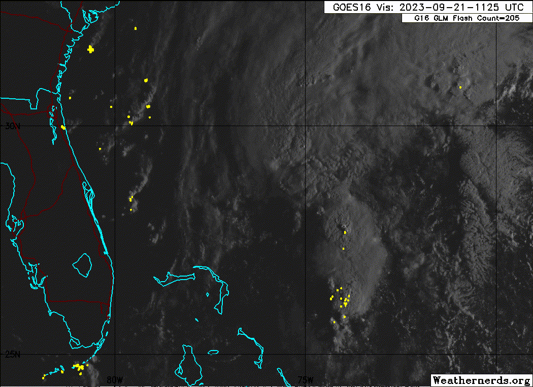
The general public rarely ever reads NWS statements. If sixteen doesn't get a name most will ignore. Our local NWS statement does seem rather ominous though.

Tropical Storm Warning
Sixteen Local Watch/Warning Statement/Advisory Number 1
National Weather Service Newport/Morehead City, NC AL162023
1114 AM EDT Thu Sep 21 2023

NCZ203-212315-
/O.NEW.KMHX.SS.A.1016.230921T1514Z-000000T0000Z/
/O.NEW.KMHX.TR.W.1016.230921T1514Z-000000T0000Z/
Northern Outer Banks-
1114 AM EDT Thu Sep 21 2023

...TROPICAL STORM WARNING IN EFFECT...
...STORM SURGE WATCH IN EFFECT...

A Storm Surge Watch means life-threatening inundation, from rising
water moving inland from the coastline, is possible somewhere within
this area within the next 48 hours

A Tropical Storm Warning means tropical storm-force winds are
expected somewhere within this area within the next 36 hours

* LOCATIONS AFFECTED
- Kitty Hawk
- Nags Head
- Manteo

* WIND
- LATEST LOCAL FORECAST: Equivalent Tropical Storm force wind
- Peak Wind Forecast: 45-55 mph with gusts to 70 mph
- Window for Tropical Storm force winds: Friday evening until
Saturday afternoon

- THREAT TO LIFE AND PROPERTY THAT INCLUDES TYPICAL FORECAST
UNCERTAINTY IN TRACK, SIZE AND INTENSITY: Potential for wind 58
to 73 mph
- PLAN: Plan for dangerous wind of equivalent strong tropical
storm force.
- PREPARE: Remaining efforts to protect life and property
should be completed as soon as possible. Prepare for
significant wind damage.
- ACT: Move to safe shelter before the wind becomes hazardous.

- POTENTIAL IMPACTS: Significant
- Some damage to roofing and siding materials, along with
damage to porches, awnings, carports, and sheds. A few
buildings experiencing window, door, and garage door
failures. Mobile homes damaged, especially if unanchored.
Unsecured lightweight objects become dangerous projectiles.
- Several large trees snapped or uprooted, but with greater
numbers in places where trees are shallow rooted. Several
fences and roadway signs blown over.
- Some roads impassable from large debris, and more within
urban or heavily wooded places. A few bridges, causeways,
and access routes impassable.
- Scattered power and communications outages, but more
prevalent in areas with above ground lines.

* STORM SURGE
- LATEST LOCAL FORECAST: Life-threatening storm surge possible
- Peak Storm Surge Inundation: The potential for 2-4 feet
above ground somewhere within surge prone areas
- Window of concern: through Saturday afternoon

- THREAT TO LIFE AND PROPERTY THAT INCLUDES TYPICAL FORECAST
UNCERTAINTY IN TRACK, SIZE AND INTENSITY: Potential for storm
surge flooding greater than 3 feet above ground
- PLAN: Plan for life-threatening storm surge flooding of
greater than 3 feet above ground.
- PREPARE: Evacuation efforts and flood preparations should
soon be brought to completion before conditions become
unsafe.
- ACT: Leave immediately if evacuation orders are given for
your area to avoid being cut off from emergency services or
needlessly risk lives.

- POTENTIAL IMPACTS: Significant
- Areas of inundation with storm surge flooding accentuated
by waves. Damage to several buildings, mainly near the
coast.
- Sections of near-shore escape routes and secondary roads
become weakened or washed out, especially in usually
vulnerable low spots.
- Major beach erosion with heavy surf breaching dunes. Strong
and numerous rip currents.
- Moderate damage to marinas, docks, boardwalks, and piers.
Several small craft broken away from moorings, especially
in unprotected anchorages.

* FLOODING RAIN
- LATEST LOCAL FORECAST:
- Peak Rainfall Amounts: 3-6 inches, with locally higher
amounts

- THREAT TO LIFE AND PROPERTY THAT INCLUDES TYPICAL FORECAST
UNCERTAINTY IN TRACK, SIZE AND INTENSITY: Potential for
moderate flooding rain
- PLAN: Emergency plans should include the potential for
moderate flooding from heavy rain. Evacuations and rescues
are possible.
- PREPARE: Consider protective actions if you are in an area
vulnerable to flooding.
- ACT: Heed any flood watches and warnings. Failure to take
action may result in serious injury or loss of life.

- POTENTIAL IMPACTS: Significant
- Moderate rainfall flooding may prompt several evacuations
and rescues.
- Rivers and tributaries may quickly become swollen with
swifter currents and overspill their banks in a few places,
especially in usually vulnerable spots. Small streams,
creeks, canals, and ditches overflow.
- Flood waters can enter some structures or weaken
foundations. Several places may experience expanded areas
of rapid inundation at underpasses, low-lying spots, and
poor drainage areas. Some streets and parking lots take on
moving water as storm drains and retention ponds overflow.
Driving conditions become hazardous. Some road and bridge
closures.

* TORNADO
- LATEST LOCAL FORECAST:
- Situation is somewhat favorable for tornadoes

- THREAT TO LIFE AND PROPERTY THAT INCLUDES TYPICAL FORECAST
UNCERTAINTY IN TRACK, SIZE AND INTENSITY: Potential for a few
tornadoes
- PLAN: Emergency plans should include the potential for a
few tornadoes.
- PREPARE: If your shelter is particularly vulnerable to
tornadoes, prepare to relocate to safe shelter before
hazardous weather arrives.
- ACT: If a tornado warning is issued, be ready to shelter
quickly.

- POTENTIAL IMPACTS: Limited
- The occurrence of isolated tornadoes can hinder the
execution of emergency plans during tropical events.
- A few places may experience tornado damage, along with
power and communications disruptions.
- Locations could realize roofs peeled off buildings,
chimneys toppled, mobile homes pushed off foundations or
overturned, large tree tops and branches snapped off,
shallow-rooted trees knocked over, moving vehicles blown
off roads, and small boats pulled from moorings.

* FOR MORE INFORMATION:
- http://ready.gov/hurricanes

$$
0 likes   


Return to “2023”

Who is online

Users browsing this forum: No registered users and 4 guests