ATL: INVEST 91L - Discussion

Moderator: S2k Moderators

Message
Author
User avatar
DESTRUCTION5
Category 5
Category 5
Posts: 4419
Age: 43
Joined: Wed Sep 03, 2003 11:25 am
Location: Stuart, FL

Re: ATL: INVEST 91L - Discussion

#181 Postby DESTRUCTION5 » Tue Oct 21, 2008 12:17 pm

Blown_away wrote:Anybody seeing a possible LLC near 17N/86.4W moving NW? Or is it an eddy?
http://www.ssd.noaa.gov/goes/flt/t1/loop-vis.html


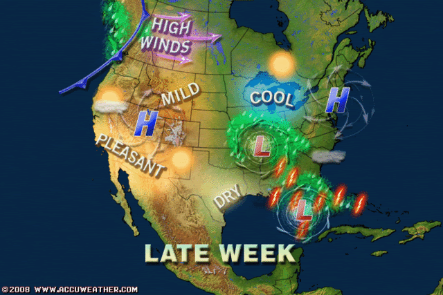
Only thing i see here is a Tropical Wave ariving on the scene to provide some more convection...Worst i can see here is a Eastsided low with a rainy day for FL...Just hope it brings Fall...
0 likes   

User avatar
AJC3
Admin
Admin
Posts: 3963
Age: 60
Joined: Tue Aug 31, 2004 7:04 pm
Location: West Melbourne, Florida
Contact:

Re: ATL: INVEST 91L - Discussion

#182 Postby AJC3 » Tue Oct 21, 2008 12:18 pm

Tampa Bay Hurricane wrote: AJC3 and Wxman57, a question:

Will I still get to feel some 40-50 mph gusts at the beach along the west coast
tampa bay? Cause extratropical systems can have big windfields? That would be AWESOME
to be at the beach in.

I'm a storm-chasing wild surfing nut :cheesy:


Well, you could...if the forcing was strong enough to produce significant pressure falls. However, in this case, it's not. The strength and orientation of the mid/upper trough is such that I think any baroclinic low pressure area (or wave) that comes out of there would be pretty weak, and Florida is more likely to experience stronger winds out of the east and southeast THU-FRI, and these are associated with the strong high rebuilding to the north of Florida rather than anything coming out of the GOMEX. Since you're on the west coast, you'd have to come over to my side to get in the higher winds and surf. :wink:
0 likes   

User avatar
Blown Away
S2K Supporter
S2K Supporter
Posts: 10119
Joined: Wed May 26, 2004 6:17 am

Re: ATL: INVEST 91L - Discussion

#183 Postby Blown Away » Tue Oct 21, 2008 12:30 pm

Can anybody tell me why there have not been any model runs since last night?
0 likes   

User avatar
Tampa Bay Hurricane
Category 5
Category 5
Posts: 5596
Age: 36
Joined: Fri Jul 22, 2005 7:54 pm
Location: St. Petersburg, FL

Re: ATL: INVEST 91L - Discussion

#184 Postby Tampa Bay Hurricane » Tue Oct 21, 2008 12:36 pm

AJC3 wrote:
Tampa Bay Hurricane wrote: AJC3 and Wxman57, a question:

Will I still get to feel some 40-50 mph gusts at the beach along the west coast
tampa bay? Cause extratropical systems can have big windfields? That would be AWESOME
to be at the beach in.

I'm a storm-chasing wild surfing nut :cheesy:


Well, you could...if the forcing was strong enough to produce significant pressure falls. However, in this case, it's not. The strength and orientation of the mid/upper trough is such that I think any baroclinic low pressure area (or wave) that comes out of there would be pretty weak, and Florida is more likely to experience stronger winds out of the east and southeast THU-FRI, and these are associated with the strong high rebuilding to the north of Florida rather than anything coming out of the GOMEX. Since you're on the west coast, you'd have to come over to my side to get in the higher winds and surf. :wink:


Thanks! maybe the cold front will bring some breezy showers
0 likes   

User avatar
HURAKAN
Professional-Met
Professional-Met
Posts: 46086
Age: 37
Joined: Thu May 20, 2004 4:34 pm
Location: Key West, FL
Contact:

#185 Postby HURAKAN » Tue Oct 21, 2008 12:57 pm

TROPICAL WEATHER OUTLOOK
NWS TPC/NATIONAL HURRICANE CENTER MIAMI FL
200 PM EDT TUE OCT 21 2008

FOR THE NORTH ATLANTIC...CARIBBEAN SEA AND THE GULF OF MEXICO...

A LARGE AREA OF DISTURBED WEATHER IS LOCATED OVER THE NORTHWESTERN
CARIBBEAN SEA. PRESSURES HAVE RISEN IN THIS AREA AND THE SYSTEM
REMAINS DISORGANIZED. SIGNIFICANT DEVELOPMENT APPEARS UNLIKELY.
HOWEVER...LOCALLY HEAVY RAINS ARE POSSIBLE OVER PORTIONS OF
HONDURAS...GUATEMALA...BELIZE...AND THE YUCATAN PENINSULA AS THE
SYSTEM DRIFTS WESTWARD DURING THE NEXT DAY OR SO.


ELSEWHERE...TROPICAL CYCLONE FORMATION IS NOT EXPECTED DURING THE
NEXT 48 HOURS.

$$

FORECASTER PASCH
0 likes   

Ed Mahmoud

Re: ATL: INVEST 91L - Discussion

#186 Postby Ed Mahmoud » Tue Oct 21, 2008 1:02 pm

I like the 12Z GFS (not too different from 0Z) of a non-tropical or mostly non-tropical low forming in the Gulf North of where the current disturbance is now. It'll be under 40 knots of shear, and 850 mb vorticity appears stretched in a way suggesting frontal features, as does the 850 mb and 700 mb relative humidities.

In 5 days, while the primary polar low is still up in Canada, this helps form a nice little secondary, right near NYC, with what appears to be screaming Southerly winds into New England.

Not tropical, but exciting, none the less.

Sustained winds on the coast sustained near 30 knots, easily gusting to 50 as suggested by GFS forecast sounding for Block Island

Image
0 likes   

caneman

Re: ATL: INVEST 91L - Discussion

#187 Postby caneman » Tue Oct 21, 2008 1:23 pm

Blown Away,

which models are you refering too? ONly GFDL and HWRF haven't run and I'm not sure why. However, 12z CMC,GFS,UKMET have run and show some development to one extent or another affecting soemwhere between Appalach. to Tampa Bay in about 72 hours.
0 likes   

Sanibel
Category 5
Category 5
Posts: 10369
Joined: Mon Aug 30, 2004 11:06 pm
Location: Offshore SW Florida

Re: ATL: INVEST 91L - Discussion

#188 Postby Sanibel » Tue Oct 21, 2008 1:34 pm

Mid-level center 17.25N-87.2W
0 likes   

Ed Mahmoud

Re: ATL: INVEST 91L - Discussion

#189 Postby Ed Mahmoud » Tue Oct 21, 2008 2:20 pm

Sanibel wrote:Mid-level center 17.25N-87.2W


I'm not so sure. I see a poorly defined swirl in the lower level clouds near there, but nothing too organized.
0 likes   

Rainband

Re: ATL: INVEST 91L - Discussion

#190 Postby Rainband » Tue Oct 21, 2008 3:11 pm


821
fxus62 ktbw 211725 cca
afdtbw


Area forecast discussion...corrected
National Weather Service Tampa Bay Ruskin Florida
123 PM EDT Tuesday Oct 21 2008


Corrected long term and aviation sections


Short term (tonight-thu)...high pressure is ridging across the
area from the north. This will become reinforced from a high
centered over Canada tonight and Wednesday as an area of weak low
pressure over the southern Gulf/northern Caribbean begins to
slowly lift north along the remnant frontal boundary. For Wednesday
night and Thursday...the weak area of low pressure will continue
to lift north into the Gulf with the high pressure ridge shifting
east. Deep moisture will overspread the area by Thursday with some
upper energy moving over the area Thursday afternoon. Have
therefore increased rain chances for Thursday from 20 percent
north to 50 percent south as the moisture lift north over the
area. Temperatures will be near normal through the period with highs
generally in the Lower-Middle 80s and lows in the middle 50s to lower
60s north...lower to middle 60s interior and middle-upper 60s coastal
for the central and southern zones.


Long term (thu night-tue)...models beginning to come in better
agreement with Gulf system to begin the extended period. Deep upper
low from S plains into the middle miss RV valley with SW flow over the
Gulf and Florida as series of short waves/vorticity maxes rotate overhead
in upper flow. Weak baroclinic/non tropical/cold core low expected
to form in S Gulf along old frontal boundary to lift north-northeast Ward. Warm
front associated with this low to move over the southern half of the
Florida Peninsula Thursday nt then north half Friday with high end chance probability of precipitation
with mostly cloudy conditions Thursday nt-Friday and may need to increase
probability of precipitation as we get more confident in this scenario. Around 1012mb low
and cold front with this system to be pushed over the area Friday nt
into Sat with potent vorticity maximum. Could see some strong storms with the
entire system with significant upper dynamics and low level boundary
convergence.


Sat nt/sun last vorticity lobe to wrap around upper low in Ohio River
valley to build strong surface high pressure into the region with
moderate northwest flow off the Gulf and cool and dry airmass to the area
for temperatures slightly below normal.


Monday/Tuesday upper low swings through the NE U.S. As surface high pressure
weakens and settles into the region keeping dry conditions and near
normal temperatures Monday afternoon through Tuesday.


&&


Aviation...VFR conditions should prevail through tonight.


&&


Marine...high pressure will ridge across the waters through early
Thursday. An area of low pressure/remnant frontal boundary will
then move over the area late Thursday through Saturday. The cold
front from this system will then clear out the area late Saturday
and Sunday. Winds and seas will begin to increase Wednesday
night/Thursday as the pressure gradient tightens between the high
pressure ridge and the lifting low pressure area. An advisory may
become required late in the week.


&&


Fire weather...no concerns.


&&


Preliminary point temps/pops...
tpa 65 84 67 85 / 5 10 10 30
fmy 65 84 69 85 / 5 20 20 50
gif 63 83 66 83 / 5 10 10 30
srq 64 85 67 85 / 5 10 20 40
bkv 56 84 63 84 / 5 5 10 20
spg 68 83 70 83 / 5 10 10 30


&&


Tbw watches/warnings/advisories...
Florida...none.
Gulf waters...none.


&&


$$


Short term/marine....24/Colson
long term/aviation...25/Davis
0 likes   

Sanibel
Category 5
Category 5
Posts: 10369
Joined: Mon Aug 30, 2004 11:06 pm
Location: Offshore SW Florida

Re: ATL: INVEST 91L - Discussion

#191 Postby Sanibel » Tue Oct 21, 2008 3:35 pm

That's energy folks:

Image
0 likes   

User avatar
wxman57
Moderator-Pro Met
Moderator-Pro Met
Posts: 22771
Age: 67
Joined: Sat Jun 21, 2003 8:06 pm
Location: Houston, TX (southwest)

Re: ATL: INVEST 91L - Discussion

#192 Postby wxman57 » Tue Oct 21, 2008 3:41 pm

Weak frontal low looks most likely. SW-WSW upper-level winds are just ripping across NW Caribbean/southern Gulf now. Tropical development chances appear slim to none.
0 likes   

User avatar
boca
Category 5
Category 5
Posts: 6357
Age: 60
Joined: Mon Dec 15, 2003 8:49 am
Location: Boca Raton,FL

Re: ATL: INVEST 91L - Discussion

#193 Postby boca » Tue Oct 21, 2008 4:02 pm

This is a snipprt out of NWS Key West.

CURRENTLY...HIGH PRESSURE IS CENTERED OVER THE SOUTHEAST US...WHILE
LOW PRESSURE DEEPENS IN THE WESTERN CARIB. A SURFACE TROF EXTENDS
FROM THE WESTERN CARIB ACROSS CENTRAL CUBA AND INTO THE CENTRAL
BAHAMAS. MEANWHILE...HIGH PRESSURE ALOFT HAS PUT A SUBSIDENCE
INVERSION ACROSS THE AREA...KEEPING PRECIP AT BAY...EXCEPT IN THE
OUTER STRAITS NEAR THE TROF. THIS COMBINATION HAS RESULTED IN PARTLY
CLOUDY SKIES WITH EAST WINDS NEAR 20 KNOTS OVER THE WATERS TODAY.

Why would they say low pressure deepening in the Western Caribbean if pressures are rising this question goes out to wxman57 or AJC3.
0 likes   

Ed Mahmoud

Re: ATL: INVEST 91L - Discussion

#194 Postby Ed Mahmoud » Tue Oct 21, 2008 4:31 pm

wxman57 wrote:Weak frontal low looks most likely. SW-WSW upper-level winds are just ripping across NW Caribbean/southern Gulf now. Tropical development chances appear slim to none.


Of course, but you have to admit the chance (as seen by the GFS) that this helps spawn a nice storm along the front that eventually sort of becomes the secondary low of a monster polar low in Canada and brings 50 knot gusts from the South to coastal New England in 5 days, well, that is kind of exciting. Check out the 5 day forecast sounding for UUU!

Image


Edit to Add

Can't get too detailed on what could be a pretty impressive non-tropical storm (even if it originates from 91L) battering New England with possible hurricane force wind gusts on the coast, but I'm getting pretty excited on this thread about the weather produced as tropical influences battle Canadian air!
Last edited by Ed Mahmoud on Tue Oct 21, 2008 4:48 pm, edited 1 time in total.
0 likes   

User avatar
gatorcane
S2K Supporter
S2K Supporter
Posts: 23651
Age: 46
Joined: Sun Mar 13, 2005 3:54 pm
Location: Boca Raton, FL

Re: ATL: INVEST 91L - Discussion

#195 Postby gatorcane » Tue Oct 21, 2008 4:43 pm

boca wrote:This is a snipprt out of NWS Key West.

CURRENTLY...HIGH PRESSURE IS CENTERED OVER THE SOUTHEAST US...WHILE
LOW PRESSURE DEEPENS IN THE WESTERN CARIB. A SURFACE TROF EXTENDS
FROM THE WESTERN CARIB ACROSS CENTRAL CUBA AND INTO THE CENTRAL
BAHAMAS. MEANWHILE...HIGH PRESSURE ALOFT HAS PUT A SUBSIDENCE
INVERSION ACROSS THE AREA...KEEPING PRECIP AT BAY...EXCEPT IN THE
OUTER STRAITS NEAR THE TROF. THIS COMBINATION HAS RESULTED IN PARTLY
CLOUDY SKIES WITH EAST WINDS NEAR 20 KNOTS OVER THE WATERS TODAY.

Why would they say low pressure deepening in the Western Caribbean if pressures are rising this question goes out to wxman57 or AJC3.


This buoy in the NW Caribbean is seeing a a pressure drop but its typical that it drops in the afternoon like this.

10 21 1950 ESE 11.7 15.5 5.2 7 5.6 ENE 29.94 -0.09 78.3 84.0 73.8 - - -
10 21 1850 SE 11.7 15.5 5.9 7 5.7 ENE 29.96 -0.09 78.3 84.0 72.9 - - -

http://www.ndbc.noaa.gov/station_page.php?station=42056
0 likes   

User avatar
wxman57
Moderator-Pro Met
Moderator-Pro Met
Posts: 22771
Age: 67
Joined: Sat Jun 21, 2003 8:06 pm
Location: Houston, TX (southwest)

Re: ATL: INVEST 91L - Discussion

#196 Postby wxman57 » Tue Oct 21, 2008 4:48 pm

boca wrote:This is a snipprt out of NWS Key West.

CURRENTLY...HIGH PRESSURE IS CENTERED OVER THE SOUTHEAST US...WHILE
LOW PRESSURE DEEPENS IN THE WESTERN CARIB. A SURFACE TROF EXTENDS
FROM THE WESTERN CARIB ACROSS CENTRAL CUBA AND INTO THE CENTRAL
BAHAMAS. MEANWHILE...HIGH PRESSURE ALOFT HAS PUT A SUBSIDENCE
INVERSION ACROSS THE AREA...KEEPING PRECIP AT BAY...EXCEPT IN THE
OUTER STRAITS NEAR THE TROF. THIS COMBINATION HAS RESULTED IN PARTLY
CLOUDY SKIES WITH EAST WINDS NEAR 20 KNOTS OVER THE WATERS TODAY.

Why would they say low pressure deepening in the Western Caribbean if pressures are rising this question goes out to wxman57 or AJC3.


Pressures in the NW Caribbean are actually about 3mb lower than they were this morning now (1014mb vs 1017mb). Yesterday at this time they were around 1014mb. But this is due mainly to the high pressure moving out of the eastern Gulf in advance of the next cold front - not because of a "low pressure deepening in the western Caribbean". There is no such deepening low. No change yesterday to today in terms of the pressure field. The only change is convection is weaker and shear is stronger.
0 likes   

User avatar
HURAKAN
Professional-Met
Professional-Met
Posts: 46086
Age: 37
Joined: Thu May 20, 2004 4:34 pm
Location: Key West, FL
Contact:

#197 Postby HURAKAN » Tue Oct 21, 2008 6:49 pm

TROPICAL WEATHER OUTLOOK
NWS TPC/NATIONAL HURRICANE CENTER MIAMI FL
800 PM EDT TUE OCT 21 2008

FOR THE NORTH ATLANTIC...CARIBBEAN SEA AND THE GULF OF MEXICO...

DISORGANIZED SHOWERS AND THUNDERSTORMS REMAIN OVER THE NORTHWESTERN
CARIBBEAN SEA AND ADJACENT LAND AREAS IN ASSOCIATION WITH A WEAK
SURFACE TROUGH. SIGNIFICANT DEVELOPMENT APPEARS UNLIKELY DUE TO
PROXIMITY OF LAND. HOWEVER...LOCALLY HEAVY RAINS ARE POSSIBLE OVER
PORTIONS OF HONDURAS...GUATEMALA...BELIZE...AND THE YUCATAN
PENINSULA AS THE SYSTEM DRIFTS WESTWARD DURING THE NEXT DAY OR SO.

ELSEWHERE...TROPICAL CYCLONE FORMATION IS NOT EXPECTED DURING THE
NEXT 48 HOURS.

$$

FORECASTER BLAKE
0 likes   

User avatar
captain east
Tropical Storm
Tropical Storm
Posts: 213
Joined: Thu Aug 28, 2008 2:53 pm
Location: South East Florida

Re: ATL: INVEST 91L - Discussion

#198 Postby captain east » Tue Oct 21, 2008 7:08 pm

Looks like it's almost dead, might bring some gusts and rains though, but that's all I can see. After this you probably won't see anything over a yellow blob on NHC, if any, till next season.
See you guys around. :wink:

Personal Forecast Disclaimer:
The posts in this forum are NOT official forecast and should not be used as such. They are just the opinion of the poster and may or may not be backed by sound meteorological data. They are NOT endorsed by any professional institution or storm2k.org. For official information, please refer to the NHC and NWS products.
Last edited by captain east on Wed Oct 22, 2008 5:28 am, edited 1 time in total.
0 likes   

User avatar
HURAKAN
Professional-Met
Professional-Met
Posts: 46086
Age: 37
Joined: Thu May 20, 2004 4:34 pm
Location: Key West, FL
Contact:

#199 Postby HURAKAN » Tue Oct 21, 2008 9:50 pm

Image
0 likes   

User avatar
cycloneye
Admin
Admin
Posts: 142552
Age: 68
Joined: Thu Oct 10, 2002 10:54 am
Location: San Juan, Puerto Rico

Re: ATL: INVEST 91L - Discussion

#200 Postby cycloneye » Wed Oct 22, 2008 7:59 am

BEGIN
NHC
invest_DEACTIVATE_al912008.ren
FSTDA
R
U
040
010
0000
200810221236
NONE
NOTIFY=ATRP
END
0 likes   


Return to “2008”

Who is online

Users browsing this forum: No registered users and 0 guests