

Still areas of convection flaring up with this invest but its still not at all organised with it.
As for El Nino, 2002 and 2004 both weren't that active really and featured an El nino during the summer and Autumn. If it gets upto the top end weak/moderate by August however it will start to make a bigger difference.
EPAC : Invest 91E
Moderator: S2k Moderators
-
HURAKAN

- Professional-Met

- Posts: 46086
- Age: 37
- Joined: Thu May 20, 2004 4:34 pm
- Location: Key West, FL
- Contact:
Re: EPAC : Invest 91E
The first tropical storm was named on
1988 - June 16
1993 - June 12
1994 - June 19*
1995 - June 15
1998 - June 13
1999 - June 18
* = Record
Lets see where 2009 will fall. This will still be the latest in the EPAC in at least a decade.
1988 - June 16
1993 - June 12
1994 - June 19*
1995 - June 15
1998 - June 13
1999 - June 18
* = Record
Lets see where 2009 will fall. This will still be the latest in the EPAC in at least a decade.
0 likes

-
cycloneye

- Admin

- Posts: 139019
- Age: 67
- Joined: Thu Oct 10, 2002 10:54 am
- Location: San Juan, Puerto Rico
Re: EPAC : Invest 91E
409
ABPZ20 KNHC 092333
TWOEP
TROPICAL WEATHER OUTLOOK
NWS TPC/NATIONAL HURRICANE CENTER MIAMI FL
500 PM PDT TUE JUN 9 2009
FOR THE EASTERN NORTH PACIFIC...EAST OF 140 DEGREES WEST LONGITUDE..
SHOWERS AND THUNDERSTORMS ASSOCIATED WITH A BROAD AREA OF LOW
PRESSURE LOCATED ABOUT 1100 MILES SOUTH-SOUTHWEST OF THE SOUTHERN
TIP OF BAJA CALIFORNIA REMAIN POORLY ORGANIZED. DEVELOPMENT OF THIS
SYSTEM...IF ANY...SHOULD BE SLOW TO OCCUR AS IT MOVES SLOWLY WEST-
NORTHWESTWARD TO NORTHWESTWARD. THERE IS A LOW CHANCE...LESS THAN
30 PERCENT...OF THIS SYSTEM BECOMING A TROPICAL CYCLONE DURING THE
NEXT 48 HOURS.
ELSEWHERE...TROPICAL CYCLONE FORMATION IS NOT EXPECTED DURING THE
NEXT 48 HOURS.
$$
FORECASTER PASCH
0 likes
-
cycloneye
- Admin
- Posts: 139019
- Age: 67
- Joined: Thu Oct 10, 2002 10:54 am
- Location: San Juan, Puerto Rico
Re: EPAC : Invest 91E
They are still tracking a low center somewhere in that mess.
00 UTC Best Track
EP, 91, 2009061000, , BEST, 0, 106N, 1206W, 20, 1008, DB,
00 UTC Best Track
EP, 91, 2009061000, , BEST, 0, 106N, 1206W, 20, 1008, DB,
0 likes

-
cycloneye
- Admin
- Posts: 139019
- Age: 67
- Joined: Thu Oct 10, 2002 10:54 am
- Location: San Juan, Puerto Rico
Re: EPAC : Invest 91E
221
ABPZ20 KNHC 101133
TWOEP
TROPICAL WEATHER OUTLOOK
NWS TPC/NATIONAL HURRICANE CENTER MIAMI FL
500 AM PDT WED JUN 10 2009
FOR THE EASTERN NORTH PACIFIC...EAST OF 140 DEGREES WEST LONGITUDE..
A LARGE BUT DISORGANIZED AREA OF SHOWERS AND THUNDERSTORMS CENTERED
ABOUT 1000 MILES SOUTHWEST OF THE SOUTHERN TIP OF BAJA CALIFORNIA
IS ASSOCIATED WITH A BROAD AREA OF LOW PRESSURE. DEVELOPMENT...IF
ANY...SHOULD BE SLOW TO OCCUR AS THE SYSTEM MOVES SLOWLY TOWARD THE
WEST-NORTHWEST OR NORTHWEST. THERE IS A LOW CHANCE...LESS THAN 30
PERCENT...OF THIS SYSTEM BECOMING A TROPICAL CYCLONE DURING THE
NEXT 48 HOURS.
ELSEWHERE...TROPICAL CYCLONE FORMATION IS NOT EXPECTED DURING THE
NEXT 48 HOURS.
$$
FORECASTER AVILA
0 likes
-
HURAKAN
- Professional-Met
- Posts: 46086
- Age: 37
- Joined: Thu May 20, 2004 4:34 pm
- Location: Key West, FL
- Contact:
Loop: http://www.ssd.noaa.gov/goes/flt/t6/flash-vis.html
Looking better organized and now a rotation is visible. 91E is not giving up!
Looking better organized and now a rotation is visible. 91E is not giving up!
0 likes

-
cycloneye
- Admin
- Posts: 139019
- Age: 67
- Joined: Thu Oct 10, 2002 10:54 am
- Location: San Juan, Puerto Rico
Re: EPAC : Invest 91E
The 12 UTC Best Track plots came out very late today,but here they are.
EP, 91, 2009061012, , BEST, 0, 105N, 1170W, 20, 1008, DB
EP, 91, 2009061012, , BEST, 0, 105N, 1170W, 20, 1008, DB
0 likes
-
cycloneye
- Admin
- Posts: 139019
- Age: 67
- Joined: Thu Oct 10, 2002 10:54 am
- Location: San Juan, Puerto Rico
Re: EPAC : Invest 91E
Code Orange
611
ABPZ20 KNHC 101749
TWOEP
TROPICAL WEATHER OUTLOOK
NWS TPC/NATIONAL HURRICANE CENTER MIAMI FL
1100 AM PDT WED JUN 10 2009
FOR THE EASTERN NORTH PACIFIC...EAST OF 140 DEGREES WEST LONGITUDE..
SATELLITE IMAGES INDICATE THAT THE SHOWER ACTIVITY ASSOCIATED WITH
THE BROAD AREA OF LOW PRESSURE HAS BECOME A LITTLE MORE
CONCENTRATED ABOUT 950 MILES SOUTHWEST OF THE SOUTHERN TIP OF BAJA
CALIFORNIA. THIS SYSTEM IS GRADUALLY BECOMING BETTER ORGANIZED AND
HAS THE POTENTIAL TO BECOME A TROPICAL DEPRESSION DURING THE NEXT
DAY OR SO. THERE IS A MEDIUM CHANCE...30 TO 50 PERCENT...OF THIS
SYSTEM BECOMING A TROPICAL CYCLONE DURING THE NEXT 48 HOURS.
ELSEWHERE...TROPICAL CYCLONE FORMATION IS NOT EXPECTED DURING THE
NEXT 48 HOURS.
$$
FORECASTER AVILA
0 likes
-
HURAKAN
- Professional-Met
- Posts: 46086
- Age: 37
- Joined: Thu May 20, 2004 4:34 pm
- Location: Key West, FL
- Contact:

Loop: http://rammb.cira.colostate.edu/ramsdis ... is_floater
Looks like the first system is hours from development.
0 likes
-
cycloneye
- Admin
- Posts: 139019
- Age: 67
- Joined: Thu Oct 10, 2002 10:54 am
- Location: San Juan, Puerto Rico
Re: EPAC : Invest 91E
18 UTC Best Track
EP, 91, 2009061018, , BEST, 0, 110N, 1173W, 20, 1009, LO,
EP, 91, 2009061018, , BEST, 0, 110N, 1173W, 20, 1009, LO,
0 likes
-
HURAKAN
- Professional-Met
- Posts: 46086
- Age: 37
- Joined: Thu May 20, 2004 4:34 pm
- Location: Key West, FL
- Contact:
820
WHXX01 KMIA 101828
CHGE77
TROPICAL CYCLONE GUIDANCE MESSAGE
NWS TPC/NATIONAL HURRICANE CENTER MIAMI FL
1828 UTC WED JUN 10 2009
DISCLAIMER...NUMERICAL MODELS ARE SUBJECT TO LARGE ERRORS.
PLEASE REFER TO NHC OFFICIAL FORECASTS FOR TROPICAL CYCLONE
AND SUBTROPICAL CYCLONE INFORMATION.
EAST PACIFIC OBJECTIVE AIDS FOR
DISTURBANCE INVEST (EP912009) 20090610 1800 UTC
...00 HRS... ...12 HRS... ...24 HRS. .. ...36 HRS...
090610 1800 090611 0600 090611 1800 090612 0600
LAT LON LAT LON LAT LON LAT LON
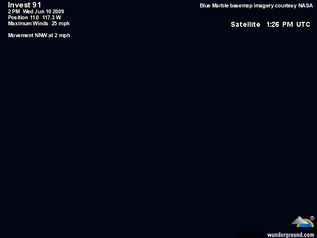
BAMS 11.0N 117.3W 12.2N 118.9W 13.4N 120.2W 14.6N 121.3W
BAMD 11.0N 117.3W 11.7N 118.9W 12.5N 120.4W 13.6N 121.7W
BAMM 11.0N 117.3W 11.7N 118.8W 12.7N 120.3W 13.7N 121.5W
LBAR 11.0N 117.3W 11.7N 118.3W 12.9N 119.9W 14.5N 121.3W
SHIP 20KTS 24KTS 31KTS 35KTS
DSHP 20KTS 24KTS 31KTS 35KTS
...48 HRS... ...72 HRS... ...96 HRS. .. ..120 HRS...
090612 1800 090613 1800 090614 1800 090615 1800
LAT LON LAT LON LAT LON LAT LON
BAMS 16.0N 121.8W 18.8N 121.1W 21.3N 119.6W 23.6N 116.6W
BAMD 14.7N 122.4W 17.6N 122.5W 20.8N 121.9W 24.1N 120.0W
BAMM 14.8N 122.4W 17.6N 122.7W 20.0N 122.4W 22.4N 122.3W
LBAR 16.4N 122.3W 22.2N 122.0W 30.1N 114.2W 38.9N 95.7W
SHIP 36KTS 31KTS 20KTS 0KTS
DSHP 36KTS 31KTS 20KTS 0KTS
...INITIAL CONDITIONS...
LATCUR = 11.0N LONCUR = 117.3W DIRCUR = 330DEG SPDCUR = 2KT
LATM12 = 10.5N LONM12 = 117.0W DIRM12 = 360DEG SPDM12 = 0KT
LATM24 = 10.5N LONM24 = 117.0W
WNDCUR = 20KT RMAXWD = 50NM WNDM12 = 20KT
CENPRS = 1009MB OUTPRS = 1012MB OUTRAD = 200NM SDEPTH = M
RD34NE = 0NM RD34SE = 0NM RD34SW = 0NM RD34NW = 0NM
$$
NNNN
WHXX01 KMIA 101828
CHGE77
TROPICAL CYCLONE GUIDANCE MESSAGE
NWS TPC/NATIONAL HURRICANE CENTER MIAMI FL
1828 UTC WED JUN 10 2009
DISCLAIMER...NUMERICAL MODELS ARE SUBJECT TO LARGE ERRORS.
PLEASE REFER TO NHC OFFICIAL FORECASTS FOR TROPICAL CYCLONE
AND SUBTROPICAL CYCLONE INFORMATION.
EAST PACIFIC OBJECTIVE AIDS FOR
DISTURBANCE INVEST (EP912009) 20090610 1800 UTC
...00 HRS... ...12 HRS... ...24 HRS. .. ...36 HRS...
090610 1800 090611 0600 090611 1800 090612 0600
LAT LON LAT LON LAT LON LAT LON
BAMS 11.0N 117.3W 12.2N 118.9W 13.4N 120.2W 14.6N 121.3W
BAMD 11.0N 117.3W 11.7N 118.9W 12.5N 120.4W 13.6N 121.7W
BAMM 11.0N 117.3W 11.7N 118.8W 12.7N 120.3W 13.7N 121.5W
LBAR 11.0N 117.3W 11.7N 118.3W 12.9N 119.9W 14.5N 121.3W
SHIP 20KTS 24KTS 31KTS 35KTS
DSHP 20KTS 24KTS 31KTS 35KTS
...48 HRS... ...72 HRS... ...96 HRS. .. ..120 HRS...
090612 1800 090613 1800 090614 1800 090615 1800
LAT LON LAT LON LAT LON LAT LON
BAMS 16.0N 121.8W 18.8N 121.1W 21.3N 119.6W 23.6N 116.6W
BAMD 14.7N 122.4W 17.6N 122.5W 20.8N 121.9W 24.1N 120.0W
BAMM 14.8N 122.4W 17.6N 122.7W 20.0N 122.4W 22.4N 122.3W
LBAR 16.4N 122.3W 22.2N 122.0W 30.1N 114.2W 38.9N 95.7W
SHIP 36KTS 31KTS 20KTS 0KTS
DSHP 36KTS 31KTS 20KTS 0KTS
...INITIAL CONDITIONS...
LATCUR = 11.0N LONCUR = 117.3W DIRCUR = 330DEG SPDCUR = 2KT
LATM12 = 10.5N LONM12 = 117.0W DIRM12 = 360DEG SPDM12 = 0KT
LATM24 = 10.5N LONM24 = 117.0W
WNDCUR = 20KT RMAXWD = 50NM WNDM12 = 20KT
CENPRS = 1009MB OUTPRS = 1012MB OUTRAD = 200NM SDEPTH = M
RD34NE = 0NM RD34SE = 0NM RD34SW = 0NM RD34NW = 0NM
$$
NNNN
0 likes
-
cycloneye
- Admin
- Posts: 139019
- Age: 67
- Joined: Thu Oct 10, 2002 10:54 am
- Location: San Juan, Puerto Rico
Re: EPAC : Invest 91E
Organizing slowly.Good rotation seen in the loop.
http://rammb.cira.colostate.edu/ramsdis ... is_floater
http://rammb.cira.colostate.edu/ramsdis ... is_floater
0 likes
-
HURAKAN
- Professional-Met
- Posts: 46086
- Age: 37
- Joined: Thu May 20, 2004 4:34 pm
- Location: Key West, FL
- Contact:
Re: EPAC : Invest 91E
Ed Mahmoud wrote:Looks like 1994 probably keeps its title...
I agree but not much time for intensification according to the cumputer forecasts.
0 likes
Who is online
Users browsing this forum: No registered users and 16 guests