WPAC: NALGAE - Tropical Depression

Moderator: S2k Moderators

Message
Author
User avatar
euro6208
Category 5
Category 5
Posts: 18547
Joined: Mon Mar 08, 2004 7:50 pm
Location: Guam

Re: WPAC: NALGAE - Tropical Storm

#41 Postby euro6208 » Wed Sep 28, 2011 6:35 am

Image

a nice eye...around 75 knots...not 40 knots!!!


They are just the opinion of the poster and may or may not be backed by sound meteorological data. They are NOT endorsed by any professional institution or storm2k.org. For official information, please refer to the NHC and NWS products
0 likes   
Remember, all of my post aren't official. For official warnings and discussions, Please refer to your local NWS products...

NWS for the Western Pacific

https://www.weather.gov/gum/

dexterlabio
Category 5
Category 5
Posts: 3449
Joined: Sat Oct 24, 2009 11:50 pm

Re: WPAC: NALGAE - Tropical Storm

#42 Postby dexterlabio » Wed Sep 28, 2011 8:36 am

I think the dry air over the western periphery is hindering the banding on its west, also hindering this storm to expand to the other quadrants. Still the core manages to consolidate, JTWC seems to acknowledge the strengthening as depicted by the eye-like feature. 50-55kts is reasonable IMO.

TPPN10 PGTW 281235

A. TROPICAL STORM 22W (NALGAE)

B. 28/1132Z

C. 18.7N

D. 135.9E

E. THREE/MTSAT

F. T3.5/3.5/D2.0/24HRS STT: D1.0/06HRS

G. IR/EIR

H. REMARKS: 13A/PBO TIGHTLY CURVED BAND/BANDING EYE/ANMTN. 1.0
WRAP ON LOG10 SPIRAL YIELDED A 3.5 DT. PT AGREES. MET INDICATES
3.0. DBO DT. FT INCREASED MORE THAN 0.5 IN 6 HOURS DUE TO RAPID
INTENSIFICATION.

I. ADDITIONAL POSITIONS: NONE


QUAST
0 likes   
Personal Forecast Disclaimer:
The posts in this forum are NOT official forecast and should not be used as such. They are just the opinion of the poster and may or may not be backed by sound meteorological data. They are NOT endorsed by any professional institution or storm2k.org. For official information, please refer to the NHC and NWS products.

dexterlabio
Category 5
Category 5
Posts: 3449
Joined: Sat Oct 24, 2009 11:50 pm

Re: WPAC: NALGAE - Tropical Storm

#43 Postby dexterlabio » Wed Sep 28, 2011 8:44 am

Image
0 likes   
Personal Forecast Disclaimer:
The posts in this forum are NOT official forecast and should not be used as such. They are just the opinion of the poster and may or may not be backed by sound meteorological data. They are NOT endorsed by any professional institution or storm2k.org. For official information, please refer to the NHC and NWS products.

RobWESTPACWX
WestPACMet
WestPACMet
Posts: 1616
Joined: Fri Sep 17, 2010 2:26 am
Location: Tokyo, Japan
Contact:

Re: WPAC: NALGAE - Tropical Storm

#44 Postby RobWESTPACWX » Wed Sep 28, 2011 9:50 am

Latest model run, looks like the consensus is pulling farther south. Likely due to the surge and high pressure ridging in over the weekend. Not good news at all.

Image
0 likes   
Satellites, Charts and Forecasting tools for East Asia at WESTERNPACIFICWEATHER.COM

User avatar
Chacor
Category 5
Category 5
Posts: 10229
Joined: Mon Oct 02, 2006 10:43 pm
Location: Singapore

#45 Postby Chacor » Wed Sep 28, 2011 8:10 pm

Now an STS.

WTPQ22 RJTD 290000
RSMC TROPICAL CYCLONE ADVISORY
NAME STS 1119 NALGAE (1119)
ANALYSIS
PSTN 290000UTC 18.3N 134.2E FAIR
MOVE W 09KT
PRES 980HPA
MXWD 055KT
GUST 080KT
50KT 40NM
30KT 120NM NORTHEAST 90NM SOUTHWEST
FORECAST
24HF 300000UTC 17.8N 129.6E 75NM 70%
MOVE W 11KT
PRES 975HPA
MXWD 060KT
GUST 085KT
48HF 010000UTC 17.6N 124.6E 140NM 70%
MOVE W 12KT
PRES 970HPA
MXWD 065KT
GUST 095KT
72HF 020000UTC 18.4N 119.4E 210NM 70%
MOVE W 13KT
PRES 970HPA
MXWD 065KT
GUST 095KT =
0 likes   

phwxenthusiast
Category 2
Category 2
Posts: 637
Joined: Wed Mar 24, 2010 3:10 am
Location: Holbrook, NY (Long Island)

#46 Postby phwxenthusiast » Wed Sep 28, 2011 9:03 pm

eye appearing on the VIS and JTWC about to upgrade this to Typhoon based on NRLMRY...!! :eek:
0 likes   

dexterlabio
Category 5
Category 5
Posts: 3449
Joined: Sat Oct 24, 2009 11:50 pm

Re: WPAC: NALGAE - Severe Tropical Storm

#47 Postby dexterlabio » Wed Sep 28, 2011 9:20 pm

JTWC says a typhoon

WTPN33 PGTW 290300
MSGID/GENADMIN/NAVMARFCSTCEN PEARL HARBOR HI/JTWC//
SUBJ/TROPICAL CYCLONE WARNING//
RMKS/
1. TYPHOON 22W (NALGAE) WARNING NR 008
UPGRADED FROM TROPICAL STORM 22W
02 ACTIVE TROPICAL CYCLONES IN NORTHWESTPAC
MAX SUSTAINED WINDS BASED ON ONE-MINUTE AVERAGE
WIND RADII VALID OVER OPEN WATER ONLY
---
WARNING POSITION:
290000Z --- NEAR 18.3N 134.3E
MOVEMENT PAST SIX HOURS - 255 DEGREES AT 10 KTS
POSITION ACCURATE TO WITHIN 060 NM
POSITION BASED ON CENTER LOCATED BY SATELLITE
PRESENT WIND DISTRIBUTION:
MAX SUSTAINED WINDS - 065 KT, GUSTS 080 KT
WIND RADII VALID OVER OPEN WATER ONLY
RADIUS OF 050 KT WINDS - 040 NM NORTHEAST QUADRANT
040 NM SOUTHEAST QUADRANT
040 NM SOUTHWEST QUADRANT
040 NM NORTHWEST QUADRANT
RADIUS OF 034 KT WINDS - 090 NM NORTHEAST QUADRANT
070 NM SOUTHEAST QUADRANT
070 NM SOUTHWEST QUADRANT
090 NM NORTHWEST QUADRANT
REPEAT POSIT: 18.3N 134.3E
---
FORECASTS:
12 HRS, VALID AT:
291200Z --- 18.3N 132.1E
MAX SUSTAINED WINDS - 070 KT, GUSTS 085 KT
WIND RADII VALID OVER OPEN WATER ONLY
RADIUS OF 064 KT WINDS - 020 NM NORTHEAST QUADRANT
020 NM SOUTHEAST QUADRANT
020 NM SOUTHWEST QUADRANT
020 NM NORTHWEST QUADRANT
RADIUS OF 050 KT WINDS - 035 NM NORTHEAST QUADRANT
035 NM SOUTHEAST QUADRANT
035 NM SOUTHWEST QUADRANT
035 NM NORTHWEST QUADRANT
RADIUS OF 034 KT WINDS - 090 NM NORTHEAST QUADRANT
070 NM SOUTHEAST QUADRANT
055 NM SOUTHWEST QUADRANT
090 NM NORTHWEST QUADRANT
VECTOR TO 24 HR POSIT: 270 DEG/ 10 KTS
---
24 HRS, VALID AT:
300000Z --- 18.3N 129.9E
MAX SUSTAINED WINDS - 085 KT, GUSTS 105 KT
WIND RADII VALID OVER OPEN WATER ONLY
RADIUS OF 064 KT WINDS - 025 NM NORTHEAST QUADRANT
025 NM SOUTHEAST QUADRANT
025 NM SOUTHWEST QUADRANT
025 NM NORTHWEST QUADRANT
RADIUS OF 050 KT WINDS - 040 NM NORTHEAST QUADRANT
040 NM SOUTHEAST QUADRANT
040 NM SOUTHWEST QUADRANT
040 NM NORTHWEST QUADRANT
RADIUS OF 034 KT WINDS - 100 NM NORTHEAST QUADRANT
080 NM SOUTHEAST QUADRANT
080 NM SOUTHWEST QUADRANT
100 NM NORTHWEST QUADRANT
VECTOR TO 36 HR POSIT: 275 DEG/ 10 KTS
---
36 HRS, VALID AT:
301200Z --- 18.4N 127.7E
MAX SUSTAINED WINDS - 090 KT, GUSTS 110 KT
WIND RADII VALID OVER OPEN WATER ONLY
RADIUS OF 064 KT WINDS - 025 NM NORTHEAST QUADRANT
025 NM SOUTHEAST QUADRANT
025 NM SOUTHWEST QUADRANT
025 NM NORTHWEST QUADRANT
RADIUS OF 050 KT WINDS - 040 NM NORTHEAST QUADRANT
040 NM SOUTHEAST QUADRANT
040 NM SOUTHWEST QUADRANT
040 NM NORTHWEST QUADRANT
RADIUS OF 034 KT WINDS - 100 NM NORTHEAST QUADRANT
080 NM SOUTHEAST QUADRANT
080 NM SOUTHWEST QUADRANT
100 NM NORTHWEST QUADRANT
VECTOR TO 48 HR POSIT: 275 DEG/ 10 KTS
---
EXTENDED OUTLOOK:
48 HRS, VALID AT:
010000Z --- 18.5N 125.5E
MAX SUSTAINED WINDS - 090 KT, GUSTS 110 KT
WIND RADII VALID OVER OPEN WATER ONLY
RADIUS OF 064 KT WINDS - 030 NM NORTHEAST QUADRANT
030 NM SOUTHEAST QUADRANT
030 NM SOUTHWEST QUADRANT
030 NM NORTHWEST QUADRANT
RADIUS OF 050 KT WINDS - 060 NM NORTHEAST QUADRANT
055 NM SOUTHEAST QUADRANT
055 NM SOUTHWEST QUADRANT
060 NM NORTHWEST QUADRANT
RADIUS OF 034 KT WINDS - 120 NM NORTHEAST QUADRANT
110 NM SOUTHEAST QUADRANT
110 NM SOUTHWEST QUADRANT
120 NM NORTHWEST QUADRANT
VECTOR TO 72 HR POSIT: 270 DEG/ 10 KTS
---
72 HRS, VALID AT:
020000Z --- 18.4N 121.3E
MAX SUSTAINED WINDS - 085 KT, GUSTS 105 KT
WIND RADII VALID OVER OPEN WATER ONLY
RADIUS OF 064 KT WINDS - 025 NM NORTHEAST QUADRANT
025 NM SOUTHEAST QUADRANT
025 NM SOUTHWEST QUADRANT
025 NM NORTHWEST QUADRANT
RADIUS OF 050 KT WINDS - 050 NM NORTHEAST QUADRANT
050 NM SOUTHEAST QUADRANT
050 NM SOUTHWEST QUADRANT
050 NM NORTHWEST QUADRANT
RADIUS OF 034 KT WINDS - 110 NM NORTHEAST QUADRANT
090 NM SOUTHEAST QUADRANT
090 NM SOUTHWEST QUADRANT
110 NM NORTHWEST QUADRANT
VECTOR TO 96 HR POSIT: 270 DEG/ 10 KTS
---
LONG RANGE OUTLOOK:
---
96 HRS, VALID AT:
030000Z --- 18.4N 117.1E
MAX SUSTAINED WINDS - 080 KT, GUSTS 100 KT
WIND RADII VALID OVER OPEN WATER ONLY
VECTOR TO 120 HR POSIT: 270 DEG/ 10 KTS
---
120 HRS, VALID AT:
040000Z --- 18.4N 112.7E
MAX SUSTAINED WINDS - 085 KT, GUSTS 105 KT
WIND RADII VALID OVER OPEN WATER ONLY
---
REMARKS:
290300Z POSITION NEAR 18.3N 133.8E.
TYPHOON (TY) 22W (NALGAE), LOCATED APPROXIMATELY 800 NM EAST-
NORTHEAST OF MANILA, PHILIPPINES, HAS TRACKED WESTWARD AT 06 KNOTS
OVER THE PAST SIX HOURS. MAXIMUM SIGNIFICANT WAVE HEIGHT AT 290000Z
IS 17 FEET. NEXT WARNINGS AT 290900Z, 291500Z, 292100Z AND 300300Z.
REFER TO TYPHOON 20W (NESAT) WARNINGS (WTPN31 PGTW)FOR SIX-HOURLY
UPDATES.//
NNNN
0 likes   
Personal Forecast Disclaimer:
The posts in this forum are NOT official forecast and should not be used as such. They are just the opinion of the poster and may or may not be backed by sound meteorological data. They are NOT endorsed by any professional institution or storm2k.org. For official information, please refer to the NHC and NWS products.

User avatar
climateconcern23
Tropical Low
Tropical Low
Posts: 35
Age: 33
Joined: Sat Mar 05, 2011 4:38 am
Location: Philippines
Contact:

Re: WPAC: NALGAE - Severe Tropical Storm

#48 Postby climateconcern23 » Wed Sep 28, 2011 10:52 pm

Image
0 likes   

oaba09
S2K Supporter
S2K Supporter
Posts: 1496
Age: 37
Joined: Thu Oct 01, 2009 10:02 am
Location: Valenzuela, Philippines
Contact:

#49 Postby oaba09 » Thu Sep 29, 2011 12:06 am

2 typhoons in one week? the WPAC is crazy!

Convection is starting to look good..

This is going to be one of those compact but strong systems....
0 likes   

User avatar
Cyclenall
Category 5
Category 5
Posts: 6660
Joined: Thu Jun 08, 2006 10:01 pm
Location: Ontario, Canada

Re: WPAC: NALGAE - Severe Tropical Storm

#50 Postby Cyclenall » Thu Sep 29, 2011 3:47 am

Nalgae's track forecast has the most westerly track I've ever seen, at least in the western Pacific basin. La Nina pattern certainly showing up like always around fall.

oaba09 wrote:2 typhoons in one week? the WPAC is crazy!

Convection is starting to look good..

This is going to be one of those compact but strong systems....

I have a hunch that it will be stronger than forecast as well (compared to what the JTWC is showing) in opposite relation to what happened with Typhoon Nesat.
0 likes   

User avatar
Chacor
Category 5
Category 5
Posts: 10229
Joined: Mon Oct 02, 2006 10:43 pm
Location: Singapore

#51 Postby Chacor » Thu Sep 29, 2011 5:30 am

WTPQ22 RJTD 290900
RSMC TROPICAL CYCLONE ADVISORY
NAME STS 1119 NALGAE (1119)
ANALYSIS
PSTN 290900UTC 17.9N 132.4E FAIR
MOVE W 09KT
PRES 980HPA
MXWD 055KT
GUST 080KT
50KT 40NM
30KT 120NM NORTHEAST 90NM SOUTHWEST
FORECAST
24HF 300900UTC 17.7N 127.4E 75NM 70%
MOVE W 12KT
PRES 975HPA
MXWD 060KT
GUST 085KT
45HF 010600UTC 17.8N 123.2E 140NM 70%
MOVE W 11KT
PRES 970HPA
MXWD 065KT
GUST 095KT
69HF 020600UTC 18.4N 117.9E 210NM 70%
MOVE W 13KT
PRES 970HPA
MXWD 065KT
GUST 095KT =
0 likes   

User avatar
ManilaTC
WesternPacificWeather.com
Posts: 593
Age: 46
Joined: Mon Oct 26, 2009 5:13 am
Location: Mandaluyong City, Philippines
Contact:

Re: WPAC: NALGAE - Severe Tropical Storm

#52 Postby ManilaTC » Thu Sep 29, 2011 5:36 am

Now what, its at 17.9 deg already? My hunch is that once the cold surge builds in over the weekend, its bound to push it further south placing the whole island at risk again...
0 likes   
The above post is NOT official and should not be used as such. It is my opinion and may or may not be backed by sound meteorological data. It is not endorsed by any professional institution or storm2k.org. Please refer to your official national weather agency.

WEB http://goo.gl/JDiKXB | FB https://goo.gl/N5sIle | @ManilaTC

dexterlabio
Category 5
Category 5
Posts: 3449
Joined: Sat Oct 24, 2009 11:50 pm

Re: WPAC: NALGAE - Severe Tropical Storm

#53 Postby dexterlabio » Thu Sep 29, 2011 5:46 am

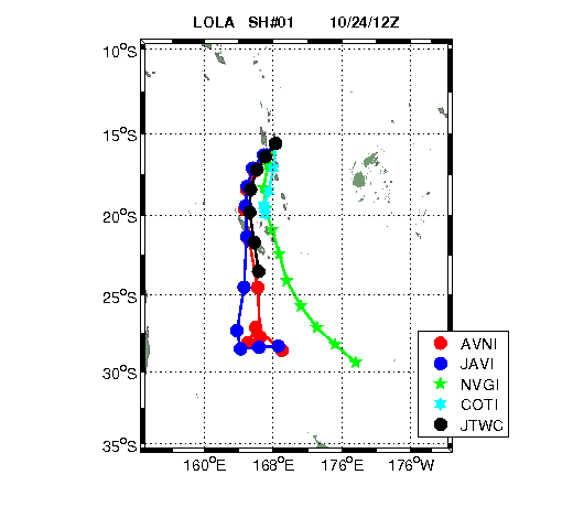
I'm actually blaming the "weird" steering pattern especially if the southward dip continues in the long period.
Image
0 likes   
Personal Forecast Disclaimer:
The posts in this forum are NOT official forecast and should not be used as such. They are just the opinion of the poster and may or may not be backed by sound meteorological data. They are NOT endorsed by any professional institution or storm2k.org. For official information, please refer to the NHC and NWS products.

dexterlabio
Category 5
Category 5
Posts: 3449
Joined: Sat Oct 24, 2009 11:50 pm

Re: WPAC: NALGAE - Severe Tropical Storm

#54 Postby dexterlabio » Thu Sep 29, 2011 6:06 am

What consensus? lol.
Image
0 likes   
Personal Forecast Disclaimer:
The posts in this forum are NOT official forecast and should not be used as such. They are just the opinion of the poster and may or may not be backed by sound meteorological data. They are NOT endorsed by any professional institution or storm2k.org. For official information, please refer to the NHC and NWS products.
RobWESTPACWX
WestPACMet
WestPACMet
Posts: 1616
Joined: Fri Sep 17, 2010 2:26 am
Location: Tokyo, Japan
Contact:

Re: WPAC: NALGAE - Severe Tropical Storm

#55 Postby RobWESTPACWX » Thu Sep 29, 2011 11:18 am

Ya Dexter, that model output updates every new run on the graphic, it defiantly is much different than what it was when I posted it. And is very much split at this time. Does look like most of the models do keep it on the due west course though.
0 likes   
Satellites, Charts and Forecasting tools for East Asia at WESTERNPACIFICWEATHER.COM

User avatar
cycloneye
Admin
Admin
Posts: 142552
Age: 68
Joined: Thu Oct 10, 2002 10:54 am
Location: San Juan, Puerto Rico

Re: WPAC: NALGAE - Typhoon

#56 Postby cycloneye » Thu Sep 29, 2011 3:22 pm

JMA upgrades to Typhoon.

TY 1119 (NALGAE)
Issued at 18:40 UTC, 29 September 2011
<Analyses at 29/18 UTC>
Scale -
Intensity Strong
Center position N17°55'(17.9°)
E130°25'(130.4°)
Direction and speed of movement W 30km/h(16kt)
Central pressure 955hPa
Maximum wind speed near the center 40m/s(80kt)
Maximum wind gust speed 60m/s(115kt)
Area of 50kt winds or more ALL130km(70NM)
Area of 30kt winds or more N280km(150NM)
S220km(120NM)
0 likes   
Visit the Caribbean-Central America Weather Thread where you can find at first post web cams,radars
and observations from Caribbean basin members Click Here

User avatar
Chacor
Category 5
Category 5
Posts: 10229
Joined: Mon Oct 02, 2006 10:43 pm
Location: Singapore

#57 Postby Chacor » Thu Sep 29, 2011 6:26 pm

WTPQ22 RJTD 292100
RSMC TROPICAL CYCLONE ADVISORY
NAME TY 1119 NALGAE (1119)
ANALYSIS
PSTN 292100UTC 17.8N 129.9E FAIR
MOVE W 13KT
PRES 955HPA
MXWD 080KT
GUST 115KT
50KT 70NM
30KT 150NM NORTH 120NM SOUTH
FORECAST
24HF 302100UTC 17.7N 124.0E 75NM 70%
MOVE W 14KT
PRES 945HPA
MXWD 090KT
GUST 130KT
45HF 011800UTC 18.0N 118.9E 140NM 70%
MOVE W 13KT
PRES 960HPA
MXWD 075KT
GUST 105KT
69HF 021800UTC 18.3N 114.7E 210NM 70%
MOVE W 10KT
PRES 960HPA
MXWD 075KT
GUST 105KT =
0 likes   

ricmood

#58 Postby ricmood » Thu Sep 29, 2011 6:36 pm

Anak ng pating!
After all the storms we've been through, Philippines just says "peh!" to this effing storm.
Just bring it!!!
0 likes   

Teddyfred
Tropical Low
Tropical Low
Posts: 12
Joined: Thu Sep 22, 2011 8:58 pm
Location: Atlanta, GA

Re: WPAC: NALGAE - Typhoon

#59 Postby Teddyfred » Fri Sep 30, 2011 2:23 am

Eye now visible:

Image

Image
0 likes   

User avatar
Chacor
Category 5
Category 5
Posts: 10229
Joined: Mon Oct 02, 2006 10:43 pm
Location: Singapore

#60 Postby Chacor » Fri Sep 30, 2011 3:44 am

WTPQ22 RJTD 300600
RSMC TROPICAL CYCLONE ADVISORY
NAME TY 1119 NALGAE (1119)
ANALYSIS
PSTN 300600UTC 17.9N 127.4E GOOD
MOVE W 13KT
PRES 955HPA
MXWD 080KT
GUST 115KT
50KT 70NM
30KT 180NM NORTH 150NM SOUTH
FORECAST
24HF 010600UTC 17.6N 121.5E 75NM 70%
MOVE W 14KT
PRES 950HPA
MXWD 080KT
GUST 115KT
48HF 020600UTC 17.6N 116.9E 140NM 70%
MOVE W 11KT
PRES 960HPA
MXWD 075KT
GUST 105KT
72HF 030600UTC 17.6N 112.5E 160NM 70%
MOVE W 10KT
PRES 960HPA
MXWD 075KT
GUST 105KT =
0 likes   


Return to “2011”

Who is online

Users browsing this forum: No registered users and 3 guests