EARTHQUAKE SWARM IN LA UNIONAnother earthquake swarm has developed in La Union near the Gulf of Fonseca, earlier this year was another one near the same location. 12 Earthquakes have been felt since the swarm began on November 20, additionally 2 more earthquakes have occurred in San Salvador and 2 more in the subduction zone offshore. It's important to mention that the quakes in La Union and San Salvador have been felt only in the closest areas to the epicenter, the subduction quakes have been felt in most of the country. A summary of the earthquakes:
Date: November 20 2011
Local Time: 23:18
Location: El Carmen, department of La Union.
Magnitude: 2.9
Date: November 22 2011
Local Time: 22:26
Location: Offshore 40 km south of San Diego.
Magnitude: 3.8
Date: November 23 2011
Local Time: 15:09
Location: 7 km northeast of La Union city.
Magnitude: 2.7
Date: November 23 2011
Local Time: 16:48
Location: Amapalita, department of La Union.
Magnitude: 2.6
Date: November 23 2011
Local Time: 17:23
Location: 5 km west of Conchagua, department of La Union.
Magnitude: 3.7
Date: November 23 2011
Local Time: 17:32
Location: 5 km west of Conchagua, department of La Union.
Magnitude: 2.7
Date: November 23 2011
Local Time: 20:31
Location: Offshore, 35 km south of Las Hojas beach.
Magnitude: 3.6
Date: November 24 2011
Local Time: 15:13
Location: 5 km southeast of El Carmen, department of La Union.
Magnitude: 4.6
Intensity: V in El Carmen.
Date: November 24 2011
Local Time: 15:59
Location: El Carmen, department of La Union.
Magnitude: 3.4
Intensity: III in El Carmen.
Date: November 24 2011
Local Time: 21:26
Location: 5 km east of El Carmen, department of La Union.
Depth: 1.1 km
Magnitude: 3.0
Intensity: II in El Carmen.
Date: November 24 2011
Local Time: 23:38
Location: 5 km east of El Carmen, department of La Union.
Depth: 1.2 km
Magnitude: 3.0
Intensity: II in El Carmen.
Date: November 25 2011
Local Time: 00:41
Location: 7 km southeast of El Carmen, department of La Union.
Depth: 1.9 km
Magnitude: 2.7
Intensity: II in El Carmen.
Date: November 25 2011
Local Time: 01:00
Location: 7 km southeast of El Carmen, department of La Union.
Depth: 5.9 km
Magnitude: 2.7
Intensity: II in El Carmen.
Date: November 25 2011
Local Time: 01:19
Location: 7 km west of Conchagua, department of La Union.
Depth: 4.2 km
Magnitude: 3.7
Intensity: IV in Conchagua.
Date: November 25 2011
Local Time: 02:02
Location: 5 km east of El Carmen, department of La Union.
Depth: 4.2 km
Magnitude: 3.2
Intensity: III in El Carmen.
Date: November 25 2011
Local Time: 03:28
Location: 5 km east of El Carmen, department of La Union.
Depth: 1.1 km
Magnitude: 2.7
Intensity: II in El Carmen.
Date: November 25 2011
Local Time: 03:49
Location: San Salvador.
Depth: 1.3 km
Magnitude: 1.7
Intensity: II in La Escalon neighborhood, San Salvador.
Date: November 25 2011
Local Time: 03:54
Location: San Salvador.
Depth: 1.3 km
Magnitude: 1.9
Intensity: II in La Escalon neighborhood, San Salvador.
Date: November 25 2011
Local Time: 05:32
Location: 5 km east of El Carmen, department of La Union.
Depth: 3.6 km
Magnitude: 2.8
Intensity: II in El Carmen.
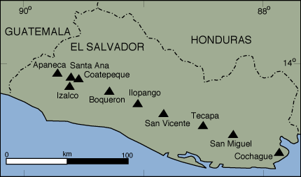
This map shows the location of the swarm in La Union: