
ATL: ERIKA - Remnants - Discussion
Moderator: S2k Moderators
Re: ATL: ERIKA Remnants - Discussion
I am in Largo today. It's been coming down heavy for almost an hour now.
0 likes

Re: ATL: ERIKA Remnants - Discussion
Getting a training situation of continuous cells on Radar along the Pinellas Coast now - could see some impressive rainfall totals. Largo's already near 2 inches based on radar estimated.
0 likes
It looks like the runs from a couple of days ago bringing the center of Erika's remnants up through the far eastern Gulf toward the FL Panhandle were on track.
0 likes
Personal Forecast Disclaimer:
The posts in this forum are NOT official forecasts and should not be used as such. They are just the opinion of the poster and may or may not be backed by sound meteorological data. They are NOT endorsed by any professional institution or storm2k.org. For official information, please refer to the NHC and NWS products.
The posts in this forum are NOT official forecasts and should not be used as such. They are just the opinion of the poster and may or may not be backed by sound meteorological data. They are NOT endorsed by any professional institution or storm2k.org. For official information, please refer to the NHC and NWS products.
Re: ATL: ERIKA Remnants - Discussion
that is where I live. We're getting hammered bad thunder and lightning tooronjon wrote:Pinellas Beaches getting hammered now.
0 likes
Re: ATL: ERIKA Remnants - Discussion
do you live here ndg? I'm right in this area as well.NDG wrote:I am in Largo today. It's been coming down heavy for almost an hour now.
0 likes
Re: ATL: ERIKA Remnants - Discussion
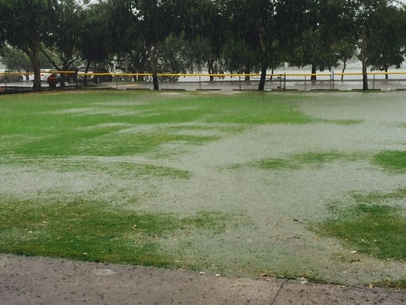
caneman wrote:do you live here ndg? I'm right in this area as well.NDG wrote:I am in Largo today. It's been coming down heavy for almost an hour now.
http://i20.photobucket.com/albums/b245/ ... pyavkl.jpg
I live in Orlando, here today visiting customers.
More rain:

0 likes

-
cycloneye

- Admin

- Posts: 139010
- Age: 67
- Joined: Thu Oct 10, 2002 10:54 am
- Location: San Juan, Puerto Rico
Re: ATL: ERIKA Remnants - Discussion
2 PM TWO:
A weak surface trough, the remnant of Erika, is producing
a large area of disorganized showers and thunderstorms over
the northeastern Gulf of Mexico. Surface pressures in the area
remain high and upper-level winds are not expected to be conducive
for redevelopment. This system could produce locally heavy
rainfall over portions of central and northern Florida during the
next day or so while it drifts northward.
* Formation chance through 48 hours...low...near 0 percent
* Formation chance through 5 days...low...near 0 percent
0 likes
Visit the Caribbean-Central America Weather Thread where you can find at first post web cams,radars
and observations from Caribbean basin members Click Here
and observations from Caribbean basin members Click Here
-
tolakram
- Admin
- Posts: 19165
- Age: 60
- Joined: Sun Aug 27, 2006 8:23 pm
- Location: Florence, KY (name is Mark)
Re: ATL: ERIKA Remnants - Discussion
0 likes
M a r k
- - - - -
Join us in chat: Storm2K Chatroom Invite. Android and IOS apps also available.
The posts in this forum are NOT official forecasts and should not be used as such. Posts are NOT endorsed by any professional institution or STORM2K.org. For official information and forecasts, please refer to NHC and NWS products.

Re: ATL: ERIKA Remnants - Discussion
Radar is looking better than ever. Not a peep from the NHC?
http://radar.weather.gov/ridge/radar.php?rid=TLH&product=N0R&overlay=11101111&loop=yes
http://radar.weather.gov/ridge/radar.php?rid=TLH&product=N0R&overlay=11101111&loop=yes
0 likes
The following post is NOT an official forecast and should not be used as such. It is just the opinion of the poster and may or may not be backed by sound meteorological data. It is NOT endorsed by any professional institution including storm2k.org For Official Information please refer to the NHC and NWS products.
-
tropicwatch

- Category 5

- Posts: 3205
- Age: 60
- Joined: Sat Jun 02, 2007 10:01 am
- Location: Panama City Florida
- Contact:
Sponger look up 
0 likes
Tropicwatch
Agnes 72', Eloise 75, Elena 85', Kate 85', Charley 86', Florence 88', Beryl 94', Dean 95', Erin 95', Opal 95', Earl 98', Georges 98', Ivan 2004', Arlene 2005', Dennis 2005', Ida 2009' Debby 2012' Irma 2017' Michael 2018'
Agnes 72', Eloise 75, Elena 85', Kate 85', Charley 86', Florence 88', Beryl 94', Dean 95', Erin 95', Opal 95', Earl 98', Georges 98', Ivan 2004', Arlene 2005', Dennis 2005', Ida 2009' Debby 2012' Irma 2017' Michael 2018'

Re: ATL: ERIKA Remnants - Discussion
I guess the attention would be a bit different if it was in the south part of the GOM slowly moving north, to little water left now.
0 likes
Personal Forecast Disclaimer:
The posts in this forum are NOT official forecast and should not be used as such. They are just the opinion of the poster and may or may not be backed by sound meteorological data. They are NOT endorsed by any professional institution or storm2k.org. For official information, please refer to the NHC and NWS products.
The posts in this forum are NOT official forecast and should not be used as such. They are just the opinion of the poster and may or may not be backed by sound meteorological data. They are NOT endorsed by any professional institution or storm2k.org. For official information, please refer to the NHC and NWS products.
-
Stormcenter
- S2K Supporter

- Posts: 6617
- Joined: Wed Sep 03, 2003 11:27 am
- Location: Houston, TX
Re: ATL: ERIKA Remnants - Discussion
Not moving much if any.
Airboy wrote:I guess the attention would be a bit different if it was in the south part of the GOM slowly moving north, to little water left now.
0 likes


Re:
drezee wrote:if pressures are not falling, then outflow boundaries should commence like last evening in...3...2...1
It's certainly trying to develop, and I think it has a (brief) chance of spinning up tomorrow if it can make it through the night and not move inland before that. It convection collapses then that's pretty much the end.
0 likes
The above post is not official and should not be used as such. It is the opinion of the poster and may or may not be backed by sound meteorological data. It is not endorsed by any professional institution or storm2k.org. For official information, please refer to the NHC and NWS products.
-
wxman57

- Moderator-Pro Met

- Posts: 22480
- Age: 66
- Joined: Sat Jun 21, 2003 8:06 pm
- Location: Houston, TX (southwest)
Re: ATL: ERIKA Remnants - Discussion
Looks more impressive than when it was a TS. However, pressures in the NE Gulf continue to rise, up to 1017-1018mb now. Winds across the NE Gulf are in the 5-10 kt range. It's a high-pressure TS. 
Here's a snapshot of my workstation. Any rotation may be in the mid levels.

Here's a snapshot of my workstation. Any rotation may be in the mid levels.
0 likes

-
cycloneye
- Admin
- Posts: 139010
- Age: 67
- Joined: Thu Oct 10, 2002 10:54 am
- Location: San Juan, Puerto Rico
Re: ATL: ERIKA Remnants - Discussion
A weak surface trough, the remnants of Erika, is producing an area
of disorganized showers and thunderstorms over the northeastern Gulf
of Mexico. Surface pressures in the area are high, and upper-level
winds are currently not conducive for redevelopment. This system
could produce locally heavy rainfall over portions of central and
northern Florida during the next day or so while it drifts
northward.
* Formation chance through 48 hours...low...near 0 percent
* Formation chance through 5 days...low...near 0 percent
0 likes
Visit the Caribbean-Central America Weather Thread where you can find at first post web cams,radars
and observations from Caribbean basin members Click Here
and observations from Caribbean basin members Click Here
Who is online
Users browsing this forum: No registered users and 20 guests