WPAC: MERANTI - Post-Tropical
Moderator: S2k Moderators
-
mrbagyo

- Category 5

- Posts: 3614
- Age: 31
- Joined: Thu Apr 12, 2012 9:18 am
- Location: 14.13N 120.98E
- Contact:
Re: WPAC: MERANTI - Typhoon
I think the 160 knots estimate is now justified... just now, given the current intensification trend.
0 likes
The posts in this forum are NOT official forecast and should not be used as such. They are just the opinion of the poster and may or may not be backed by sound meteorological data. They are NOT endorsed by any professional institution or storm2k.org. For official information, please refer to RSMC, NHC and NWS products.
-
NotoSans
- Category 5
- Posts: 1366
- Age: 24
- Joined: Sun Sep 27, 2015 1:15 am
- Location: Hong Kong
- Contact:
Re: WPAC: MERANTI - Typhoon
0 likes
Personal Forecast Disclaimer:
The posts in this forum are NOT official forecast and should not be used as such. They are just the opinion of the poster and may or may not be backed by sound meteorological data. They are NOT endorsed by any professional institution or storm2k.org. For official information, please refer to RSMC and NWS products.
The posts in this forum are NOT official forecast and should not be used as such. They are just the opinion of the poster and may or may not be backed by sound meteorological data. They are NOT endorsed by any professional institution or storm2k.org. For official information, please refer to RSMC and NWS products.
-
Yellow Evan

- Professional-Met

- Posts: 15951
- Age: 25
- Joined: Fri Jul 15, 2011 12:48 pm
- Location: Henderson, Nevada/Honolulu, HI
- Contact:
Re: WPAC: MERANTI - Typhoon
NotoSans wrote::uarrow: Agree. Meranti looks much more symmetrical now. Probably a high end T7.5. Needs a banding feature to obtain a 8.0 though.
SAB and JTWC have lately used a CDG ring with other systems, so in theory a WMG eye embedded in CDG would yield T7.0. And SAB had basically discouraged the use of BF's since 2007.
0 likes
-
SouthDadeFish

- Professional-Met
- Posts: 2835
- Joined: Thu Sep 23, 2010 2:54 pm
- Location: Miami, FL
- Contact:
Re: WPAC: MERANTI - Typhoon
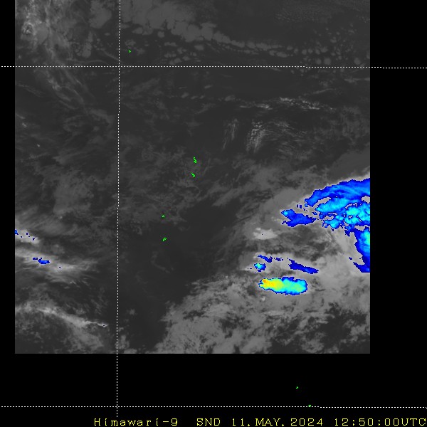
While still an amazingly powerful typhoon, there are signs that a secondary eyewall is forming:

This may cause a temporary weakening cycle to begin within the next 24-36 hours. I must note the timing of eyewall replacement cycles are not well forecast.
This may cause a temporary weakening cycle to begin within the next 24-36 hours. I must note the timing of eyewall replacement cycles are not well forecast.
0 likes
-
xtyphooncyclonex

- Category 5
- Posts: 3688
- Age: 22
- Joined: Sat Dec 08, 2012 9:07 am
- Location: Cebu City
- Contact:
Re: WPAC: MERANTI - Typhoon
Back after a loooooong break. 
This typhoon is eerily similar to Typhoon Viper in some Discovery Channel documentary I saw in YouTube Attains 160 kt strength and goes through the Bashi Channel. The documentary shows it maintain that strength hitting Hong Kong. I hope it won't follow what Viper did, even if it were fictional---it's freaking me out.
This typhoon is eerily similar to Typhoon Viper in some Discovery Channel documentary I saw in YouTube Attains 160 kt strength and goes through the Bashi Channel. The documentary shows it maintain that strength hitting Hong Kong.
0 likes
REMINDER: My opinions that I, or any other NON Pro-Met in this forum, are unofficial. Please do not take my opinions as an official forecast and warning. I am NOT a meteorologist. Following my forecasts blindly may lead to false alarm, danger and risk if official forecasts from agencies are ignored.

Re: WPAC: MERANTI - Typhoon
wxmann_91 wrote:^Not quite... Haiyan in 2013 had the dark gray completely encircling the eye (we only have the light gray here). Haiyan had estimates >T8.0 at times.
Really? how about Joaquin at Cat 4 peak?
Looks ain't everything.
0 likes
Remember, all of my post aren't official. For official warnings and discussions, Please refer to your local NWS products...
NWS for the Western Pacific
https://www.weather.gov/gum/
NWS for the Western Pacific
https://www.weather.gov/gum/
Re: WPAC: MERANTI - Typhoon
CURRENT ESTIMATE
Date (mmddhhmm): 09131019
SATCON: MSLP = 900 hPa MSW = 172 knots
SATCON Member Consensus: 162.0 knots
Pressure -> Wind Using SATCON MSLP: 160 knots
Distance to Outer Closed Isobar Used is 215 nm
Eye Size Correction Used is 2.6 knots Source: MW
Member Estimates
ADT: 916 hPa 143 knots Scene: CDO Date: SEP131030
CIMSS AMSU: 892 hPa 179 knots Bias Corr: 0 (MW) Date: 09130950
SSMIS: 901 hPa 158 knots Date: 09131019
CIRA AMSU: 1002 hPa 38 knots Date: 09110228
Wow continuing to increase...up to 180 knots!
0 likes
Remember, all of my post aren't official. For official warnings and discussions, Please refer to your local NWS products...
NWS for the Western Pacific
https://www.weather.gov/gum/
NWS for the Western Pacific
https://www.weather.gov/gum/
Re: WPAC: MERANTI - Typhoon
I wonder what the 12z BT will show. Last 2 warnings had it at 160 knots and since then it has continued to organize.
AMSU at 180 knots.
Patricia got lucky it had recon.
AMSU at 180 knots.
Patricia got lucky it had recon.
0 likes
Remember, all of my post aren't official. For official warnings and discussions, Please refer to your local NWS products...
NWS for the Western Pacific
https://www.weather.gov/gum/
NWS for the Western Pacific
https://www.weather.gov/gum/
-
1900hurricane

- Category 5
- Posts: 6044
- Age: 32
- Joined: Fri Feb 06, 2015 12:04 pm
- Location: Houston, TX
- Contact:
Re: WPAC: MERANTI - Typhoon
Well, at least AMSU/SATCON is consistent in really loving this thing. I'm actually getting Zeb '98 vibes with it at the moment.
0 likes
Contract Meteorologist. TAMU & MSST. Fiercely authentic, one of a kind. We are all given free will, so choose a life meant to be lived. We are the Masters of our own Stories.
Opinions expressed are mine alone.
Follow me on Twitter at @1900hurricane : Read blogs at https://1900hurricane.wordpress.com/
Opinions expressed are mine alone.
Follow me on Twitter at @1900hurricane : Read blogs at https://1900hurricane.wordpress.com/

Re: WPAC: MERANTI - Typhoon
0 likes
-
NotoSans
- Category 5
- Posts: 1366
- Age: 24
- Joined: Sun Sep 27, 2015 1:15 am
- Location: Hong Kong
- Contact:
Re: WPAC: MERANTI - Typhoon
JMA went with CI8.0 at 12Z. Expect them to go with lower than 900 hPa.
0 likes
Personal Forecast Disclaimer:
The posts in this forum are NOT official forecast and should not be used as such. They are just the opinion of the poster and may or may not be backed by sound meteorological data. They are NOT endorsed by any professional institution or storm2k.org. For official information, please refer to RSMC and NWS products.
The posts in this forum are NOT official forecast and should not be used as such. They are just the opinion of the poster and may or may not be backed by sound meteorological data. They are NOT endorsed by any professional institution or storm2k.org. For official information, please refer to RSMC and NWS products.
-
StormChaser75

- Tropical Depression

- Posts: 92
- Age: 22
- Joined: Sat Feb 06, 2016 4:23 pm
- Location: Corpus Christi TX
- Contact:


-
xtyphooncyclonex
- Category 5
- Posts: 3688
- Age: 22
- Joined: Sat Dec 08, 2012 9:07 am
- Location: Cebu City
- Contact:
Re: WPAC: MERANTI - Typhoon
Beat Haiyan's record in terms of pressure, and just 5 hPa (mbar) shy of Megi. Astonishing.
TY 1614 (Meranti)
Issued at 12:50 UTC, 13 September 2016
<Analysis at 12 UTC, 13 September>
Scale -
Intensity Violent
Center position N20°25' (20.4°)
E122°55' (122.9°)
Direction and speed of movement WNW 25 km/h (13 kt)
Central pressure 890 hPa
Maximum wind speed near center 60 m/s (120 kt)
Maximum wind gust speed 85 m/s (170 kt)
≥ 50 kt wind area ALL 130 km (70 NM)
≥ 30 kt wind area N 440 km (240 NM)
S 280 km (150 NM)
0 likes
REMINDER: My opinions that I, or any other NON Pro-Met in this forum, are unofficial. Please do not take my opinions as an official forecast and warning. I am NOT a meteorologist. Following my forecasts blindly may lead to false alarm, danger and risk if official forecasts from agencies are ignored.
-
cycloneye

- Admin

- Posts: 139065
- Age: 67
- Joined: Thu Oct 10, 2002 10:54 am
- Location: San Juan, Puerto Rico
Re: WPAC: MERANTI - Typhoon
0 likes
Visit the Caribbean-Central America Weather Thread where you can find at first post web cams,radars
and observations from Caribbean basin members Click Here
and observations from Caribbean basin members Click Here


-
galaxy401

- Category 5
- Posts: 2299
- Age: 28
- Joined: Sat Aug 25, 2012 9:04 pm
- Location: Casa Grande, Arizona
Re: WPAC: MERANTI - Typhoon
Macrocane wrote::eek: What a beautiful monster, yet Ian is still more discussed than Meranti
Where did you get that? Ian is barely discussed at all.
0 likes
Got my eyes on moving right into Hurricane Alley: Florida.
-
1900hurricane
- Category 5
- Posts: 6044
- Age: 32
- Joined: Fri Feb 06, 2015 12:04 pm
- Location: Houston, TX
- Contact:
Re: WPAC: MERANTI - Typhoon
galaxy401 wrote:Macrocane wrote::eek: What a beautiful monster, yet Ian is still more discussed than Meranti
Where did you get that? Ian is barely discussed at all.
Link: https://youtu.be/I38KW5mzRRU
0 likes
Contract Meteorologist. TAMU & MSST. Fiercely authentic, one of a kind. We are all given free will, so choose a life meant to be lived. We are the Masters of our own Stories.
Opinions expressed are mine alone.
Follow me on Twitter at @1900hurricane : Read blogs at https://1900hurricane.wordpress.com/
Opinions expressed are mine alone.
Follow me on Twitter at @1900hurricane : Read blogs at https://1900hurricane.wordpress.com/
-
1900hurricane
- Category 5
- Posts: 6044
- Age: 32
- Joined: Fri Feb 06, 2015 12:04 pm
- Location: Houston, TX
- Contact:
Re: WPAC: MERANTI - Typhoon
I know I've said this before, but we're probably just past peak intensity now. The cold medium greys on BD are eroding again, and microwave/radar is clear in showing an outer eyewall organizing for sure now.
0 likes
Contract Meteorologist. TAMU & MSST. Fiercely authentic, one of a kind. We are all given free will, so choose a life meant to be lived. We are the Masters of our own Stories.
Opinions expressed are mine alone.
Follow me on Twitter at @1900hurricane : Read blogs at https://1900hurricane.wordpress.com/
Opinions expressed are mine alone.
Follow me on Twitter at @1900hurricane : Read blogs at https://1900hurricane.wordpress.com/
-
galaxy401
- Category 5
- Posts: 2299
- Age: 28
- Joined: Sat Aug 25, 2012 9:04 pm
- Location: Casa Grande, Arizona
Re: WPAC: MERANTI - Typhoon
^ I didn't meant that though it definitely is cool to see recon there again. I was just wondering where Macrocane got the information of Ian being more discussed then this storm.
Meranti looks very beautiful but dangerous right now...
Meranti looks very beautiful but dangerous right now...
0 likes
Got my eyes on moving right into Hurricane Alley: Florida.
Re: WPAC: MERANTI - Typhoon
galaxy401 wrote:Macrocane wrote::eek: What a beautiful monster, yet Ian is still more discussed than Meranti
Where did you get that? Ian is barely discussed at all.
Indeed, I noticed that after my post
0 likes
Who is online
Users browsing this forum: No registered users and 118 guests