Texas Spring 2017
Moderator: S2k Moderators
Forum rules

The posts in this forum are NOT official forecast and should not be used as such. They are just the opinion of the poster and may or may not be backed by sound meteorological data. They are NOT endorsed by any professional institution or STORM2K.
-
wxman57

- Moderator-Pro Met

- Posts: 22480
- Age: 66
- Joined: Sat Jun 21, 2003 8:06 pm
- Location: Houston, TX (southwest)
Re: Texas Spring 2017
Finally, some cold and wet weather coming to Texas (and the Gulf Coast)! --- for spring break week... 
0 likes
-
TheProfessor

- Professional-Met

- Posts: 3505
- Age: 27
- Joined: Tue Dec 03, 2013 10:56 am
- Location: Wichita, Kansas
Re: Texas Spring 2017
There would be a big snowstorm(Eruo) In Ohio when I'm back in Texas. 
0 likes
An alumnus of The Ohio State University.
Your local National Weather Service office is your best source for weather information.
Your local National Weather Service office is your best source for weather information.
-
TheAustinMan

- Category 4

- Posts: 995
- Age: 24
- Joined: Mon Jul 08, 2013 4:26 pm
- Location: United States
- Contact:
Re: Texas Spring 2017
Large expanse of light to moderate rainfall covering much of South Texas this afternoon. Certainly a cool and wet start to March.


1 likes


- Treat my opinions with a grain of salt. For official information see your local weather service.
-
TeamPlayersBlue

- Category 5

- Posts: 3307
- Joined: Tue Feb 02, 2010 1:44 am
- Location: Denver/Applewood, CO
Re: Texas Spring 2017
17% cuts? Wow, that is ridiculous. Maybe it's congress trying to play hard ball since they are big on global warming. I'm not making a political statement or trying to incite anything either. The amateur in me was thinking March would be cooler than normal. Not surprised by some of the forecasts.
0 likes
Personal Forecast Disclaimer:
The posts in this forum are NOT official forecast and should not be used as such. They are just the opinion of the poster and may or may not be backed by sound meteorological data. They are NOT endorsed by any professional institution or storm2k.org. For official information, please refer to the NHC and NWS products.
The posts in this forum are NOT official forecast and should not be used as such. They are just the opinion of the poster and may or may not be backed by sound meteorological data. They are NOT endorsed by any professional institution or storm2k.org. For official information, please refer to the NHC and NWS products.
-
South Texas Storms

- Professional-Met
- Posts: 4003
- Joined: Thu Jun 24, 2010 12:28 am
- Location: Houston, TX
Re: Texas Spring 2017
TheAustinMan wrote:Large expanse of light to moderate rainfall covering much of South Texas this afternoon. Certainly a cool and wet start to March.
It's the perfect start to March! I love it
1 likes

Re: Texas Spring 2017
TeamPlayersBlue wrote:17% cuts? Wow, that is ridiculous. Maybe it's congress trying to play hard ball since they are big on global warming. I'm not making a political statement or trying to incite anything either. The amateur in me was thinking March would be cooler than normal. Not surprised by some of the forecasts.
I am all for cuts and saving where there is excess. Equipment and research such as satellites and NWP is not areas that should be considered as such which the proposal seems to hit hardest. The proposal hasn't gone to congress, so far ideas from the administration. I certainly hope it does not come to fruition as it stands.
Meanwhile GFS has some snow in Oklahoma and parts of the Red River areas 200 hours out
1 likes
The above post and any post by Ntxw is NOT an official forecast and should not be used as such. It is just the opinion of the poster and may or may not be backed by sound meteorological data. It is NOT endorsed by any professional institution including Storm2k. For official information, please refer to NWS products.
Help support Storm2K!

Re: Texas Spring 2017
I agree Ntxw, it's important that we have the best tools avaliable to us when it comes to forecasting.
What a lovely afternoon. Perfect for a picnic in the park or a stroll by the river.
What a lovely afternoon. Perfect for a picnic in the park or a stroll by the river.
1 likes
Resident Rain Miser
I am a weather hobbyist living 3.5 miles south of Downtown Austin and in no way or fashion should anything I say concerning forecasts be taken seriously. Please check your local NWS for accurate weather forecasting and conditions.
I am a weather hobbyist living 3.5 miles south of Downtown Austin and in no way or fashion should anything I say concerning forecasts be taken seriously. Please check your local NWS for accurate weather forecasting and conditions.
-
Brent
- S2K Supporter

- Posts: 37087
- Age: 35
- Joined: Sun May 16, 2004 10:30 pm
- Location: Tulsa Oklahoma
- Contact:
Re: Texas Spring 2017
It feels more like winter today than most of the winter did... 
4 likes
#neversummer
-
Tireman4

- S2K Supporter
- Posts: 5674
- Age: 58
- Joined: Fri Jun 30, 2006 1:08 pm
- Location: Humble, Texas
- Contact:
Re: Texas Spring 2017
Brent wrote:It feels more like winter today than most of the winter did...
Agreed. I love it.
0 likes
-
Brent
- S2K Supporter
- Posts: 37087
- Age: 35
- Joined: Sun May 16, 2004 10:30 pm
- Location: Tulsa Oklahoma
- Contact:
Re: Texas Spring 2017
GFS still says more to come. Mid 30s at DFW this frame.

But the Euro has temps near 90 at almost the same time. No real front indicated.
But the Euro has temps near 90 at almost the same time.
0 likes
#neversummer
-
TeamPlayersBlue
- Category 5
- Posts: 3307
- Joined: Tue Feb 02, 2010 1:44 am
- Location: Denver/Applewood, CO
Re: Texas Spring 2017
The GFS needs so much more help, research and money into the program. Cant believe we are ok at being second best in the model game.
0 likes
Personal Forecast Disclaimer:
The posts in this forum are NOT official forecast and should not be used as such. They are just the opinion of the poster and may or may not be backed by sound meteorological data. They are NOT endorsed by any professional institution or storm2k.org. For official information, please refer to the NHC and NWS products.
The posts in this forum are NOT official forecast and should not be used as such. They are just the opinion of the poster and may or may not be backed by sound meteorological data. They are NOT endorsed by any professional institution or storm2k.org. For official information, please refer to the NHC and NWS products.
-
bubba hotep

- S2K Supporter
- Posts: 5454
- Joined: Wed Dec 28, 2016 1:00 am
- Location: Collin County Texas
Re: Texas Spring 2017
TeamPlayersBlue wrote:The GFS needs so much more help, research and money into the program. Cant believe we are ok at being second best in the model game.
The GFS isn't nearly as bad as people make it out to be and there is a perception issue, since it runs out to 384 hrs. No deterministic model is going to perform well at those ranges. Obviously, the Euro is a better model but the GFS isn't worthless. In fact, I would argue that since the latest upgrade, the Euro has issues with precipitation placement and amounts. The Euro has been flopping around like crazy as well in the medium range lately. Another wild swing with the 12z run today:

All the models are struggling right now, probably in part due to the MJO deamplifying and the background state starting to transition from nina to nino. Also, right now the Pacific jet isn't raging across the Pacific generating a nice stable wave guide. Instead, there is wave breaking all over the place.
0 likes
Winter time post are almost exclusively focused on the DFW area.
-
1900hurricane

- Category 5
- Posts: 6044
- Age: 32
- Joined: Fri Feb 06, 2015 12:04 pm
- Location: Houston, TX
- Contact:
Re: Texas Spring 2017
There have been a few tornado warned storms today near the SETX coast.
1 likes
Contract Meteorologist. TAMU & MSST. Fiercely authentic, one of a kind. We are all given free will, so choose a life meant to be lived. We are the Masters of our own Stories.
Opinions expressed are mine alone.
Follow me on Twitter at @1900hurricane : Read blogs at https://1900hurricane.wordpress.com/
Opinions expressed are mine alone.
Follow me on Twitter at @1900hurricane : Read blogs at https://1900hurricane.wordpress.com/
Re: Texas Spring 2017
bubba hotep wrote:TeamPlayersBlue wrote:The GFS needs so much more help, research and money into the program. Cant believe we are ok at being second best in the model game.
The GFS isn't nearly as bad as people make it out to be and there is a perception issue, since it runs out to 384 hrs. No deterministic model is going to perform well at those ranges. Obviously, the Euro is a better model but the GFS isn't worthless. In fact, I would argue that since the latest upgrade, the Euro has issues with precipitation placement and amounts. The Euro has been flopping around like crazy as well in the medium range lately. Another wild swing with the 12z run today:
http://www.tropicaltidbits.com/analysis ... mer_11.png
All the models are struggling right now, probably in part due to the MJO deamplifying and the background state starting to transition from nina to nino. Also, right now the Pacific jet isn't raging across the Pacific generating a nice stable wave guide. Instead, there is wave breaking all over the place.
Perhaps short and some cases medium term Gfs is decent. But the whole body of work the Euro is a superior model and as a whole consistently scores higher than the GFS medium and sometimes short ranges. The data put out by the Euro is far much more vast than the GFS (many terabytes) of data, caveat is accessing it can be expensive. Seasonally however bad it is, euro suites is also better relative to the time scales. Initialization of the Euro is also much greater in scope with obs and system of input data. NCEP ran the GFS with Euro parameters/data a few years ago and got good results. GFS advances often is something the euro got/figured a decade ago.
0 likes
The above post and any post by Ntxw is NOT an official forecast and should not be used as such. It is just the opinion of the poster and may or may not be backed by sound meteorological data. It is NOT endorsed by any professional institution including Storm2k. For official information, please refer to NWS products.
Help support Storm2K!
Help support Storm2K!
-
bubba hotep
- S2K Supporter
- Posts: 5454
- Joined: Wed Dec 28, 2016 1:00 am
- Location: Collin County Texas
Re: Texas Spring 2017
Ntxw wrote:bubba hotep wrote:TeamPlayersBlue wrote:The GFS needs so much more help, research and money into the program. Cant believe we are ok at being second best in the model game.
The GFS isn't nearly as bad as people make it out to be and there is a perception issue, since it runs out to 384 hrs. No deterministic model is going to perform well at those ranges. Obviously, the Euro is a better model but the GFS isn't worthless. In fact, I would argue that since the latest upgrade, the Euro has issues with precipitation placement and amounts. The Euro has been flopping around like crazy as well in the medium range lately. Another wild swing with the 12z run today:
http://www.tropicaltidbits.com/analysis ... mer_11.png
All the models are struggling right now, probably in part due to the MJO deamplifying and the background state starting to transition from nina to nino. Also, right now the Pacific jet isn't raging across the Pacific generating a nice stable wave guide. Instead, there is wave breaking all over the place.
Perhaps short and some cases medium term Gfs is decent. But the whole body of work the Euro is a superior model and as a whole consistently scores higher than the GFS medium and sometimes short ranges. The data put out by the Euro is far much more vast than the GFS (many terabytes) of data, caveat is accessing it can be expensive. Seasonally however bad it is, euro suites is also better relative to the time scales. Initialization of the Euro is also much greater in scope with obs and system of input data. NCEP ran the GFS with Euro parameters/data a few years ago and got good results. GFS advances often is something the euro got/figured a decade ago.
I covered that with the, "Obviously, the Euro is the better model" and there is no argument there. For the most part, we know what the Euro does and how it does it. The problem is that the resources haven't been dedicated to making the GFS a superior model. It is just comical to see tweets highlighting GFS bust when the Euro bust just as spectacular. The last 3 Euro runs have had snowstorms up and down the EC. All 3 in different places. The point is, the Euro isn't perfect and the GFS isn't totally useless.
0 likes
Winter time post are almost exclusively focused on the DFW area.
-
bubba hotep
- S2K Supporter
- Posts: 5454
- Joined: Wed Dec 28, 2016 1:00 am
- Location: Collin County Texas
Re: Texas Spring 2017
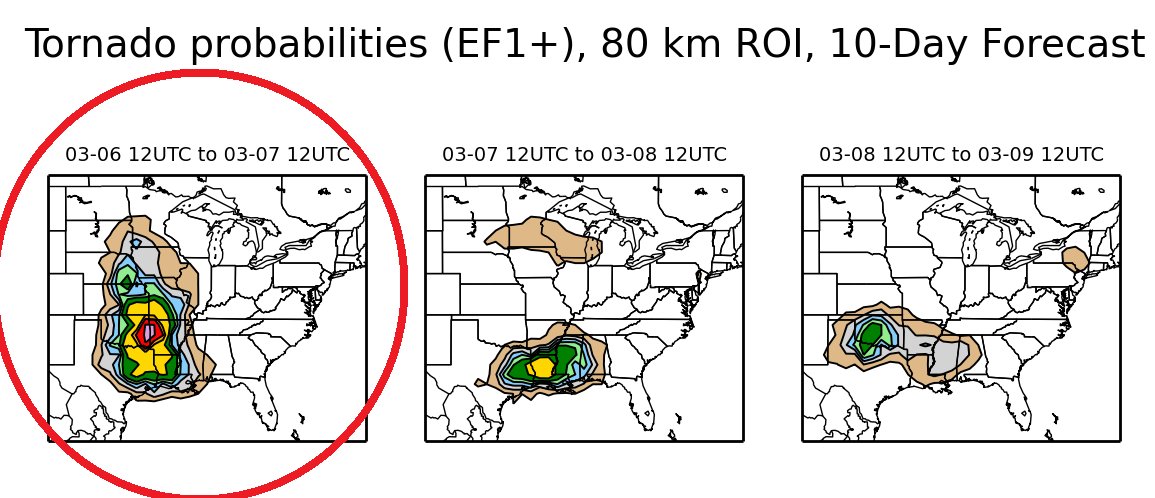
NE Texas and E. Oklahoma could be under the gun tomorrow. We have a cabin in the bulls eye, I'll send pics of any tornadoes that we see
1 likes
Winter time post are almost exclusively focused on the DFW area.
Re: Texas Spring 2017
1.60" fell in at my place which actually surprised me because I didn't think it was going to be that much. I have 2 gauges in different areas of the yard simply for my verification. Quite pleased....
2 likes
Resident Rain Miser
I am a weather hobbyist living 3.5 miles south of Downtown Austin and in no way or fashion should anything I say concerning forecasts be taken seriously. Please check your local NWS for accurate weather forecasting and conditions.
I am a weather hobbyist living 3.5 miles south of Downtown Austin and in no way or fashion should anything I say concerning forecasts be taken seriously. Please check your local NWS for accurate weather forecasting and conditions.
-
Brent
- S2K Supporter
- Posts: 37087
- Age: 35
- Joined: Sun May 16, 2004 10:30 pm
- Location: Tulsa Oklahoma
- Contact:
Re: Texas Spring 2017
bubba hotep wrote:Ntxw wrote:bubba hotep wrote:
The GFS isn't nearly as bad as people make it out to be and there is a perception issue, since it runs out to 384 hrs. No deterministic model is going to perform well at those ranges. Obviously, the Euro is a better model but the GFS isn't worthless. In fact, I would argue that since the latest upgrade, the Euro has issues with precipitation placement and amounts. The Euro has been flopping around like crazy as well in the medium range lately. Another wild swing with the 12z run today:
http://www.tropicaltidbits.com/analysis ... mer_11.png
All the models are struggling right now, probably in part due to the MJO deamplifying and the background state starting to transition from nina to nino. Also, right now the Pacific jet isn't raging across the Pacific generating a nice stable wave guide. Instead, there is wave breaking all over the place.
Perhaps short and some cases medium term Gfs is decent. But the whole body of work the Euro is a superior model and as a whole consistently scores higher than the GFS medium and sometimes short ranges. The data put out by the Euro is far much more vast than the GFS (many terabytes) of data, caveat is accessing it can be expensive. Seasonally however bad it is, euro suites is also better relative to the time scales. Initialization of the Euro is also much greater in scope with obs and system of input data. NCEP ran the GFS with Euro parameters/data a few years ago and got good results. GFS advances often is something the euro got/figured a decade ago.
I covered that with the, "Obviously, the Euro is the better model" and there is no argument there. For the most part, we know what the Euro does and how it does it. The problem is that the resources haven't been dedicated to making the GFS a superior model. It is just comical to see tweets highlighting GFS bust when the Euro bust just as spectacular. The last 3 Euro runs have had snowstorms up and down the EC. All 3 in different places. The point is, the Euro isn't perfect and the GFS isn't totally useless.
I have to agree here... I can't remember how many times this winter I've seen the Euro's fantasy snowstorms believed more because "oh it's the Euro" and then it's been totally different the next run...
They each have their flaws. I honestly believe the Euro was better a couple years ago than it is now. It seems when it got upgraded it got worse in some respects
and yes, the GFS could use some work too. It has its own epic fails. No model is going to be right all the time. Even the well-regarded hi-res short term models can be dead wrong.
What I look for more in models anyway is consistency... whether it comes from the Euro or GFS doesn't really matter...
0 likes
#neversummer
Re: Texas Spring 2017
Yes, but the discussion from TPB was not that the recent forecast of the Euro and/or GFS is good or bad. It was the fact we need more funding into the GFS model to match that of the Euro overall at the least so we're getting a little off base on that with the quality of this winter's forecast.
Back on topic pretty good shots of cold...towards the northeastern US, maybe even some snowstorms. Looks like glancing blow to Texas, as of the models right now. Nothing really noteworthy, not frigid but not terribly hot either.
As of the first 5 days of March DFW is 3F above normal, already starting relatively warm.
0 likes
The above post and any post by Ntxw is NOT an official forecast and should not be used as such. It is just the opinion of the poster and may or may not be backed by sound meteorological data. It is NOT endorsed by any professional institution including Storm2k. For official information, please refer to NWS products.
Help support Storm2K!
Help support Storm2K!
-
weatherdude1108
- Category 5
- Posts: 4172
- Joined: Tue Dec 13, 2011 1:04 pm
- Location: Northwest Austin/Cedar Park, TX
Re: Texas Spring 2017
JDawg512 wrote:1.60" fell in at my place which actually surprised me because I didn't think it was going to be that much. I have 2 gauges in different areas of the yard simply for my verification. Quite pleased....
I got just about exactly 1.00" over 24 hours or so. Nice soaking rain. It still managed to puddle in a couple spots out in the usual low areas of backyard for some reason, despite the dry spells we have had. Must still be pretty wet underneath the soil surface in my area. Fell at a perfect rate to infiltrate.
2 likes
The preceding post is NOT an official forecast, and should not be used as such. It is only the opinion of the poster and may or may not be backed by sound meteorological data. It is NOT endorsed by any professional institution including storm2k.org. For Official Information please refer to the NHC and NWS products.
Return to “USA & Caribbean Weather”
Who is online
Users browsing this forum: No registered users and 62 guests