
Tropical Wave in Eastern Caribbean
Moderator: S2k Moderators
Forum rules

The posts in this forum are NOT official forecasts and should not be used as such. They are just the opinion of the poster and may or may not be backed by sound meteorological data. They are NOT endorsed by any professional institution or STORM2K. For official information, please refer to products from the National Hurricane Center and National Weather Service.
-
Sciencerocks
- Category 5

- Posts: 7287
- Age: 38
- Joined: Thu Jul 06, 2017 1:51 am

Re: Tropical Wave WSW of Cabo Verde Islands
Sciencerocks wrote:Bones has declared it DEAD!
Or, its just playing possum.......
2 likes
Personal Forecast Disclaimer:
The posts in this forum are NOT official forecast and should not be used as such. They are just the opinion of the poster and may or may not be backed by sound meteorological data. They are NOT endorsed by any professional institution or storm2k.org. For official information, please refer to the NHC and NWS products.
The posts in this forum are NOT official forecast and should not be used as such. They are just the opinion of the poster and may or may not be backed by sound meteorological data. They are NOT endorsed by any professional institution or storm2k.org. For official information, please refer to the NHC and NWS products.
-
TheStormExpert

- Category 5
- Posts: 8487
- Age: 30
- Joined: Wed Feb 16, 2011 5:38 pm
- Location: Palm Beach Gardens, FL
Re: Tropical Wave WSW of Cabo Verde Islands
Sciencerocks wrote:Bones has declared it DEAD!
It was never alive to began with, only in the GFS's imagination!
1 likes
The following post is NOT an official forecast and should not be used as such. It is just the opinion of the poster and may or may not be backed by sound meteorological data. It is NOT endorsed by storm2k.org.
-
gatorcane

- S2K Supporter

- Posts: 23499
- Age: 46
- Joined: Sun Mar 13, 2005 3:54 pm
- Location: Boca Raton, FL
Re: Tropical Wave WSW of Cabo Verde Islands
While the GFS-op clearly busted, it could be preview of something more realistic that could happen once the SAL starts to let up (usually by mid-August). Wind shear looks very low across the tropical MDR between Lesser Antilles and Africa. Had it not been for that SAL and dry air, the GFS could have been correct. I anticipate some long nights ahead come Aug-October.
4 likes
-
Aric Dunn
- Category 5
- Posts: 21228
- Age: 41
- Joined: Sun Sep 19, 2004 9:58 pm
- Location: Ready for the Chase.
- Contact:
Re: Tropical Wave east of Windward Islands
Looks like... the "dead" wave wants to try and make a last ditched effort before the graveyard in the carribean.
convection is limited and popcorn but its has been increasing and the broad turning along the wave axis has increased quite a bit since yesterday.
something more to watch since there used to be model support.... chances are low but the environment is pretty good as the dry air has moistened quite a bit. it of course would have to do something in the next 24 to 36 hours before the eastern carrib.
0 likes
Note: If I make a post that is brief. Please refer back to previous posts for the analysis or reasoning. I do not re-write/qoute what my initial post said each time.
If there is nothing before... then just ask
Space & Atmospheric Physicist, Embry-Riddle Aeronautical University,
I believe the sky is falling...
If there is nothing before... then just ask
Space & Atmospheric Physicist, Embry-Riddle Aeronautical University,
I believe the sky is falling...
-
cycloneye

- Admin

- Posts: 139137
- Age: 67
- Joined: Thu Oct 10, 2002 10:54 am
- Location: San Juan, Puerto Rico
Re: Tropical Wave east of Windward Islands
Unlocked the thread to get any further comments about this wave although I dont see anything forming from it but can deliver some scattered weak squalls to the islands.Wave axis is around 55W as of this post.
1 likes
Visit the Caribbean-Central America Weather Thread where you can find at first post web cams,radars
and observations from Caribbean basin members Click Here
and observations from Caribbean basin members Click Here
-
Aric Dunn
- Category 5
- Posts: 21228
- Age: 41
- Joined: Sun Sep 19, 2004 9:58 pm
- Location: Ready for the Chase.
- Contact:
Re: Tropical Wave east of Windward Islands
vorticity from 12 hours ago...
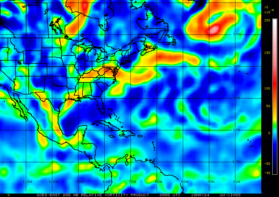
current vorticity..

current vorticity..
0 likes
Note: If I make a post that is brief. Please refer back to previous posts for the analysis or reasoning. I do not re-write/qoute what my initial post said each time.
If there is nothing before... then just ask
Space & Atmospheric Physicist, Embry-Riddle Aeronautical University,
I believe the sky is falling...
If there is nothing before... then just ask
Space & Atmospheric Physicist, Embry-Riddle Aeronautical University,
I believe the sky is falling...

Re: Tropical Wave just east of Windward Islands
Nice vorticity with it today but as soon as it enters the Caribbean the hauling low level jet will dissipate the vorticity. I'll say this TW will be a good candidate for the EPAC basin. 
1 likes
-
Aric Dunn
- Category 5
- Posts: 21228
- Age: 41
- Joined: Sun Sep 19, 2004 9:58 pm
- Location: Ready for the Chase.
- Contact:
Re: Tropical Wave just east of Windward Islands
NDG wrote:Nice vorticity with it today but as soon as it enters the Caribbean the hauling low level jet will dissipate the vorticity. I'll say this TW will be a good candidate for the EPAC basin.
yeah chances are quite low only has a short amount of time to establish some sort of a surface reflection before carrib to survive... but it is the tropics and you just never know..
honestly I impressed it even came back this much.. it was covered in the SAL and stretched out so much ..
0 likes
Note: If I make a post that is brief. Please refer back to previous posts for the analysis or reasoning. I do not re-write/qoute what my initial post said each time.
If there is nothing before... then just ask
Space & Atmospheric Physicist, Embry-Riddle Aeronautical University,
I believe the sky is falling...
If there is nothing before... then just ask
Space & Atmospheric Physicist, Embry-Riddle Aeronautical University,
I believe the sky is falling...
-
AtlanticWind

- S2K Supporter
- Posts: 1805
- Age: 65
- Joined: Sun Aug 08, 2004 9:57 pm
- Location: Plantation,Fla
Re: Tropical Wave in Eastern Caribbean
A tropical wave is just E of the Lesser Antilles with axis
extending from 18N59W to 06N59W, moving W at 20-25 kt within the
last 24 hours. The wave is in a region of neutral to favorable
wind shear S of 16N that along with moderate moist, and upper
level divergence support scattered showers and tstms from 11N to
16N between 56W and 65W.
From NHC discussion
extending from 18N59W to 06N59W, moving W at 20-25 kt within the
last 24 hours. The wave is in a region of neutral to favorable
wind shear S of 16N that along with moderate moist, and upper
level divergence support scattered showers and tstms from 11N to
16N between 56W and 65W.
From NHC discussion
0 likes
-
AtlanticWind
- S2K Supporter
- Posts: 1805
- Age: 65
- Joined: Sun Aug 08, 2004 9:57 pm
- Location: Plantation,Fla
Re: Tropical Wave in Eastern Caribbean
Caribbean Sea tropical wave has its axis along 63W/64W south of
18N. This wave is moving westward at an estimated speed of 19 kt
over the past 24 hours. The wave exhibited a well pronounced
northeast to southeast wind shift in the upper air sounding from
Trinidad this morning at 12Z. Last visible satellite imagery
continued to show a pretty well-defined cloud structure to the
wave, with what appears to be a low-level vorticity maximum on the
southern portion of the wave axis at 12.5N64W. Scattered moderate
convection is within 30 nm of 14N64W. Scattered showers and
isolated thunderstorms are elsewhere east of the wave axis. This
wave is forecast to move across the rest of the eastern Caribbean
through Saturday and reach the central Caribbean by Saturday
evening. Increasing moisture along scattered showers and isolated
thunderstorms will follow the wave. Some of the shower and
thunderstorm activity may contain gusty winds.
From NHC discussion.
0 likes
Who is online
Users browsing this forum: No registered users and 192 guests