ATL: INVEST 95L - Discussion

Moderator: S2k Moderators

Message
Author
Stormcenter
S2K Supporter
S2K Supporter
Posts: 6617
Joined: Wed Sep 03, 2003 11:27 am
Location: Houston, TX

Re: ATL: INVEST 95L - Discussion

#121 Postby Stormcenter » Tue Sep 11, 2018 3:58 pm

What makes NAM’s run so significant? Don’t think it did well with even Gordon.


quote="Steve"]
jaguars_22 wrote:How fast is this supposed to move?? 0-10? 10-15


Whatever the distance from where it is now til about 10:00am Friday when NAM has "it" reaching shore. Think this will be Joyce by then, but we'll see.[/quote]
0 likes   

User avatar
SoupBone
Category 5
Category 5
Posts: 3073
Joined: Tue Sep 20, 2005 5:24 pm

Re: ATL: INVEST 95L - Discussion

#122 Postby SoupBone » Tue Sep 11, 2018 3:58 pm

Steve wrote:
jaguars_22 wrote:How fast is this supposed to move?? 0-10? 10-15


Whatever the distance from where it is now til about 10:00am Friday when NAM has "it" reaching shore. Think this will be Joyce by then, but we'll see.
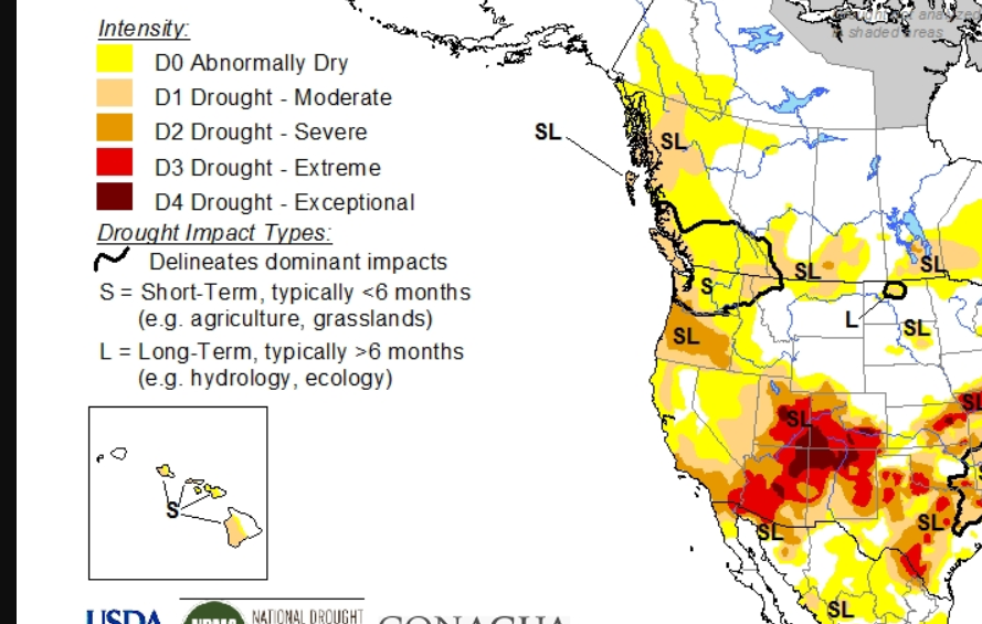

Joyce needs to go find herself a home in Northern mexico. They absolutely need the rain there.

Image
1 likes   
Personal Forecast Disclaimer:
The posts in this forum are NOT official forecast and should not be used as such. They are just the opinion of the poster and may or may not be backed by sound meteorological data. They are NOT endorsed by any professional institution or storm2k.org. For official information, please refer to the NHC and NWS products.

User avatar
wxGuy
Tropical Storm
Tropical Storm
Posts: 104
Joined: Thu Jun 14, 2018 1:50 pm

Re: ATL: INVEST 95L - Discussion

#123 Postby wxGuy » Tue Sep 11, 2018 4:01 pm

ICON showing a more north jog then west at the end of this run
Last edited by wxGuy on Tue Sep 11, 2018 4:02 pm, edited 1 time in total.
0 likes   

User avatar
MississippiWx
S2K Supporter
S2K Supporter
Posts: 1535
Joined: Sat Aug 14, 2010 1:44 pm
Location: Hattiesburg, Mississippi

Re: ATL: INVEST 95L - Discussion

#124 Postby MississippiWx » Tue Sep 11, 2018 4:01 pm

Certainly has the shape of a developing system that moves out of the NW Caribbean. As usual with these systems, it takes a little while to get the low levels right. As of now, still not much but maybe a hint of a broad low. Probably needs at least another 24-36 hours.
3 likes   
This post is not an official forecast and should not be used as such. It is just the opinion of MississippiWx and may or may not be backed by sound meteorological data. It is not endorsed by any professional institution including storm2k.org. For Official Information please refer to the NHC and NWS products.

User avatar
NDG
S2K Supporter
S2K Supporter
Posts: 14933
Joined: Sun Jul 09, 2006 10:14 pm
Location: Orlando, FL

Re: ATL: INVEST 95L - Discussion

#125 Postby NDG » Tue Sep 11, 2018 4:02 pm

As if the ULL is trying to work itself down to the surface.

Image
2 likes   

User avatar
Steve
S2K Supporter
S2K Supporter
Posts: 8605
Joined: Sat Apr 05, 2003 11:41 pm
Location: Not a state-caster

Re: ATL: INVEST 95L - Discussion

#126 Postby Steve » Tue Sep 11, 2018 4:34 pm

Stormcenter wrote:What makes NAM’s run so significant? Don’t think it did well with even Gordon.


quote="Steve"]
jaguars_22 wrote:How fast is this supposed to move?? 0-10? 10-15


Whatever the distance from where it is now til about 10:00am Friday when NAM has "it" reaching shore. Think this will be Joyce by then, but we'll see.
[/quote]

It didn’t. But it shows a closed isobar (I believe underdone) system moving into the same general area that other models have shown. I think the the RGEM, if it’s right and if it went out further, would show about the same thing. The EC, which also shows it, only runs in 24 hour increments on TT though I guess I could get 6 hour progs at weather.us. Also it was the only 18z model out when I typed that. RGEM is out to 33H but is weaker than 12z and 06z and a little faster. Either way, landfall looks good in the 65-68 hour window.
0 likes   

User avatar
MississippiWx
S2K Supporter
S2K Supporter
Posts: 1535
Joined: Sat Aug 14, 2010 1:44 pm
Location: Hattiesburg, Mississippi

Re: ATL: INVEST 95L - Discussion

#127 Postby MississippiWx » Tue Sep 11, 2018 4:37 pm

NDG wrote:As if the ULL is trying to work itself down to the surface.

https://i.imgur.com/Zuew65I.gif


The latent heat produced by all of 95L's convection and the convection near Texas has all but killed the upper level low.
3 likes   
This post is not an official forecast and should not be used as such. It is just the opinion of MississippiWx and may or may not be backed by sound meteorological data. It is not endorsed by any professional institution including storm2k.org. For Official Information please refer to the NHC and NWS products.

User avatar
cycloneye
Admin
Admin
Posts: 139009
Age: 67
Joined: Thu Oct 10, 2002 10:54 am
Location: San Juan, Puerto Rico

Re: ATL: INVEST 95L - Discussion

#128 Postby cycloneye » Tue Sep 11, 2018 6:20 pm

8 PM TWO:

1. An area of disturbed weather located over the extreme northwestern
Caribbean Sea and the southeastern Gulf of Mexico continues to show
some signs of organization. Upper-levels winds are forecast to
become more conducive for development, and a tropical depression is
likely to form by Thursday night while the disturbance moves across
the western Gulf of Mexico. If necessary, an Air Force
reconnaissance plane will investigate the system tomorrow.
Interests across northeastern Mexico and the coasts of Texas and
Louisiana should monitor the progress of this system. Regardless of
development, heavy rainfall and gusty winds are expected to continue
over western Cuba and portions of the northeastern Yucatan Peninsula
through tonight.
* Formation chance through 48 hours...medium...50 percent.
* Formation chance through 5 days...high...70 percent.

.
0 likes   
Visit the Caribbean-Central America Weather Thread where you can find at first post web cams,radars
and observations from Caribbean basin members Click Here

User avatar
Clearcloudz
Category 2
Category 2
Posts: 523
Joined: Sun Jun 10, 2018 1:46 pm
Location: Rosenberg TX

Re: ATL: INVEST 95L - Discussion

#129 Postby Clearcloudz » Tue Sep 11, 2018 6:23 pm

Pressures are falling in the vicinity of the Yucatan peninsula, signaling the development of a broad surface trough of low pressure. With the shear forecast to greatly lessen over this system tomorrow in the south-central GOM, it’s code red for TC genesis in the short term #al95

 https://twitter.com/ToddKimberlain/status/1039564341706678274


1 likes   

User avatar
Clearcloudz
Category 2
Category 2
Posts: 523
Joined: Sun Jun 10, 2018 1:46 pm
Location: Rosenberg TX

Re: ATL: INVEST 95L - Discussion

#130 Postby Clearcloudz » Tue Sep 11, 2018 7:07 pm

Shear is continuing to decrease ahead of 95L. Something is throwing the models off???

Image
0 likes   

EasyTiger
Tropical Depression
Tropical Depression
Posts: 54
Joined: Wed Jul 27, 2011 8:42 am
Location: Houston, TX

Re: ATL: INVEST 95L - Discussion

#131 Postby EasyTiger » Tue Sep 11, 2018 7:23 pm

Shear is continuing to decrease ahead of 95L. Something is throwing the models off???


Haven't looked at the shear map recently. What's interesting is the amount of shear ahead of Florence. Much greater than that ahead of 95L.
0 likes   

User avatar
Extratropical94
Professional-Met
Professional-Met
Posts: 3535
Age: 29
Joined: Wed Oct 20, 2010 6:36 am
Location: Hamburg, Germany
Contact:

Re: ATL: INVEST 95L - Discussion

#132 Postby Extratropical94 » Tue Sep 11, 2018 7:26 pm

EasyTiger wrote:
Shear is continuing to decrease ahead of 95L. Something is throwing the models off???


Haven't looked at the shear map recently. What's interesting is the amount of shear ahead of Florence. Much greater than that ahead of 95L.


Most of the shear ahead of Florence is caused by the storm itself, especially by the upper level outflow, and will not impact Florence.
3 likes   
54° 11' 59'' N, 9° 9' 20'' E
Boomer Sooner!
Go Broncos! Go Cards! Go Niners!
- Daniel

User avatar
abajan
S2K Supporter
S2K Supporter
Posts: 4175
Joined: Sun Sep 07, 2003 5:10 am
Location: Barbados

Re: ATL: INVEST 95L - Discussion

#133 Postby abajan » Tue Sep 11, 2018 8:12 pm

I imagine Cuba is gettin' a ton of rain, if the satellite pix are anything to go by. :eek:
1 likes   

User avatar
Rgv20
S2K Supporter
S2K Supporter
Posts: 2456
Age: 37
Joined: Wed Jan 05, 2011 5:42 pm
Location: Edinburg/McAllen Tx

Re: ATL: INVEST 95L - Discussion

#134 Postby Rgv20 » Tue Sep 11, 2018 8:21 pm

Afternoon Discussion out of the NWS Brownsville

First...and for what it`s worth...global deterministic models
(GFS,ECWMF, UKMET, Canadian GEM) all carry a circulation, with
relatively modest pressure falls, to the coast somewhere along the
Coastal Bend. The elongated look of the disturbance as well as a
jump to the north-northwest to just north of the Yucatan peninsula
rather than along the Peninsula may have helped to guidance to
"lean" toward the mid Texas coast vs. the Lower Texas coast.
Second, there remains notable wind shear in the western Gulf,
courtesy of the overnight convection and an eastward nudge of the
`atmospheric river` that brought the flooding rains to parts of
the region and the end of the drought/dryness to others. That wind
shear, should it be present even if weakened, would argue for the
model consensus slow development of the system. A quick look at
intensity forecasts suggest the potential for a depression or
tropical storm at this point.

That said, if the shear does relax over the next 36 to 48 hours,
the system has a better shot to intensify, with plenty of deep
layer moisture in the envelope as well as peak warm temperatures
in the 29-30C range (September in the Gulf). If that were to
happen, the ability of the cyclone to track a bit farther south
might improve as the 500 mb ridge between Florence and the
southern Plains could become just dominant enough to bring more of
a westward, than northwestward, movement.


Because of the uncertainty, it`s just a bit too soon to bite off
on any one solution, and better just to lean in a little bit
toward the pragmatic answer which does favor a more northwest
movement and slower intensification at this point.


With this in mind, have followed the WPC/NHC idea for moderate
rain chances and more modest QPF for the region, with slightly
higher amounts on a southeast to northwest line along the coast
(South Padre to Falfurrias) and lesser values in the populated mid
Valley, which could use a break after the big rains since last
Saturday night.
1 likes   
The following post is NOT an official forecast and should not be used as such. It is just the opinion of the poster and may or may not be backed by sound meteorological data. It is NOT endorsed by any professional institution including storm2k.org For Official Information please refer to the NHC and NWS products.

User avatar
wxGuy
Tropical Storm
Tropical Storm
Posts: 104
Joined: Thu Jun 14, 2018 1:50 pm

Re: ATL: INVEST 95L - Discussion

#135 Postby wxGuy » Tue Sep 11, 2018 8:23 pm

Image
0 likes   

User avatar
Portastorm
Storm2k Moderator
Storm2k Moderator
Posts: 9787
Age: 61
Joined: Fri Jul 11, 2003 9:16 am
Location: South Austin, TX
Contact:

Re: ATL: INVEST 95L - Discussion

#136 Postby Portastorm » Tue Sep 11, 2018 9:58 pm

System looks like garbage tonight. Who knows ... maybe the GFS was right.
1 likes   
Any forecasts under my name are to be taken with a grain of salt. Get your best forecasts from the National Weather Service and National Hurricane Center.

I'm a certified Advanced SKYWARN-trained spotter and am active on Twitter at @TravisCOSW, a social media partner of the NWS Austin-San Antonio office.

User avatar
SoupBone
Category 5
Category 5
Posts: 3073
Joined: Tue Sep 20, 2005 5:24 pm

Re: ATL: INVEST 95L - Discussion

#137 Postby SoupBone » Tue Sep 11, 2018 10:52 pm

Portastorm wrote:System looks like garbage tonight. Who knows ... maybe the GFS was right.


Blind squirrel, nut? :lol:
1 likes   
Personal Forecast Disclaimer:
The posts in this forum are NOT official forecast and should not be used as such. They are just the opinion of the poster and may or may not be backed by sound meteorological data. They are NOT endorsed by any professional institution or storm2k.org. For official information, please refer to the NHC and NWS products.

User avatar
wkwally
Category 1
Category 1
Posts: 279
Joined: Sun Jun 27, 2010 9:18 pm
Location: Humble, Texas

Re: ATL: INVEST 95L - Discussion

#138 Postby wkwally » Tue Sep 11, 2018 10:54 pm

Will there be any second any time soon for 95L?
0 likes   

User avatar
chaser1
S2K Supporter
S2K Supporter
Posts: 4679
Age: 63
Joined: Sat Oct 15, 2005 5:59 pm
Location: Longwood, Fl

Re: ATL: INVEST 95L - Discussion

#139 Postby chaser1 » Wed Sep 12, 2018 1:49 am

I've seen road-kill that looked more impressive then this invest :lol:
2 likes   
Personal Forecast Disclaimer:
The posts in this forum are NOT official forecast and should not be used as such. They are just the opinion of the poster and may or may not be backed by sound meteorological data. They are NOT endorsed by any professional institution or storm2k.org. For official information, please refer to the NHC and NWS products.


stormlover2013
Category 5
Category 5
Posts: 2312
Joined: Thu Aug 22, 2013 12:06 pm
Location: Lumberton, Texas

Re: ATL: INVEST 95L - Discussion

#140 Postby stormlover2013 » Wed Sep 12, 2018 6:38 am

Boy boy this looks horrendous
0 likes   


Return to “2018”

Who is online

Users browsing this forum: No registered users and 12 guests