
3/4 days ago GFS had DFW today hitting 80s (today). Cold front/warm front North of the Red River. Cold front is clearing straight into the Gulf off the Texas coast.
31F currently and mist/fog.
Texas Winter 2018-2019
Moderator: S2k Moderators
Forum rules
 The posts in this forum are NOT official forecast and should not be used as such. They are just the opinion of the poster and may or may not be backed by sound meteorological data. They are NOT endorsed by any professional institution or STORM2K.

The posts in this forum are NOT official forecast and should not be used as such. They are just the opinion of the poster and may or may not be backed by sound meteorological data. They are NOT endorsed by any professional institution or STORM2K.
Re: Texas Winter 2018-2019
2 likes
The above post and any post by Ntxw is NOT an official forecast and should not be used as such. It is just the opinion of the poster and may or may not be backed by sound meteorological data. It is NOT endorsed by any professional institution including Storm2k. For official information, please refer to NWS products.
Help support Storm2K!
-
orangeblood
- S2K Supporter

- Posts: 3334
- Joined: Tue Dec 15, 2009 6:14 pm
- Location: Fort Worth, TX
Re: Texas Winter 2018-2019
Ntxw wrote:3/4 days ago GFS had DFW today hitting 80s (today). Cold front/warm front North of the Red River. Cold front is clearing straight into the Gulf off the Texas coast.
31F currently and mist/fog.
The flaws with these models under this type situation is truly astounding...its a very serious issue considering the road treatment resources weren't put in place when they obviously should have (wasted tax dollars). I counted two dozen wrecks this morning just on my route to work, some serious, due to untreated bridges. More accountability needs to fall at the foot of the NWS office and modeling community because I'm not sure improvement is being made, it happens every single year like clockwork.
3 likes
-
Tireman4

- S2K Supporter
- Posts: 5674
- Age: 58
- Joined: Fri Jun 30, 2006 1:08 pm
- Location: Humble, Texas
- Contact:
Re: Texas Winter 2018-2019
Portastorm wrote:cctxhurricanewatcher wrote:Looks like the DFW area is the new Freezing Drizzle Capital of Texas. Who will be next? San Antonio needs to step up.
Dammit DFW!
You have stolen our (Austin) weather.
That is it. In the name of Porta, I am calling a flag on the play. This is against the rules of the Snow League. I am filing a formal protest with the league
2 likes
-
TheProfessor

- Professional-Met

- Posts: 3505
- Age: 27
- Joined: Tue Dec 03, 2013 10:56 am
- Location: Wichita, Kansas
Re: Texas Winter 2018-2019
orangeblood wrote:Ntxw wrote:3/4 days ago GFS had DFW today hitting 80s (today). Cold front/warm front North of the Red River. Cold front is clearing straight into the Gulf off the Texas coast.
31F currently and mist/fog.
The flaws with these models under this type situation is truly astounding...its a very serious issue considering the road treatment resources weren't put in place when they obviously should have (wasted tax dollars). I counted two dozen wrecks this morning just on my route to work, some serious, due to untreated bridges. More accountability needs to fall at the foot of the NWS office and modeling community because I'm not sure improvement is being made, it happens every single year like clockwork.
The NWS offices can't do much other than using their skills they've learned(these shallow cold air masses are always difficult for forecasters and models a like.) I know the men and women at FWD and they're all very bright especially their SOO. The office has been understaffed for a while now(I hope I don't get in trouble for mentioning that lol) but they do their best with what they have. To fix the problem you need to go above the office and into the politics who slow down progress(I've seen what some of the forecasters can do to make their jobs more efficient.) and disallow innovation. There's also the matter of funding. I've always been of the opinion that NOAA should be under the D.O.D and get that type of funding.
Anyways I'm glad you north Texas folks are getting some wintry weather, although I could personally do without freezing drizzle, I have had to skate to school enough times this year lol.
5 likes
An alumnus of The Ohio State University.
Your local National Weather Service office is your best source for weather information.
Your local National Weather Service office is your best source for weather information.
-
CaptinCrunch

- S2K Supporter
- Posts: 8564
- Age: 56
- Joined: Mon Nov 03, 2003 4:33 pm
- Location: Lake Worth, TX (Tarrant Co.)
Re: Texas Winter 2018-2019
NWS FTW MANED up to the current situation..
Area Forecast Discussion...UPDATED
National Weather Service Fort Worth TX
545 AM CST Thu Feb 28 2019
.UPDATE...
We issued a small Winter Weather Advisory a little while ago for
the Metroplex where persistent freezing drizzle has started to
glaze over elevated road surfaces. We`ve seen the reports of
accidents ticking up over the last hour or so. The primary
surface arteries are just damp, but bridges and overpasses have
had sufficient time to cool to allow ice accretion to commence. In
fact, several ASOS sites are now reporting measurable ice amounts
(1-2 hundredths of an inch). The combination of wetbulb
temperatures in the ideal 27-29 degree range and light rates
tends to maximize ice-to-liquid ratios. Conditions should improve
after 10 AM or so (when the current advisory is set to expire) as
temperatures warm above freezing and somewhat drier air moves in
from the northwest.
Carlaw
Friday morning will start out quite a bit warmer than this morning
with temperatures generally in the 30s and lower 40s although
there will continue to be extensive cloud cover across the region.
Patchy drizzle may also continue across our west and southwest
counties where a band of moderate 925-850 mb warm advection will
be ongoing. The temperature forecast for Friday afternoon is
proving to be quite challenging as several components will come
into play through the afternoon and the ultimate result could be
forecast temperature errors as highs as 15 to 20 degrees. We`ll
start the day off cool, but not terribly cold, as the remnants of
our post frontal airmass linger across the region. The
aforementioned band of warm advection above our shallow colder air
will spread northeast through the day, likely keeping fairly
extensive cloud cover in place, especially across the eastern half
of the region. Meanwhile, to the west, increasing southwesterly
flow aloft will mean an erosion of the cloud cover into the early
afternoon hours across our western counties where a weak dryline
may push as far east as Eastland county. Strong warming is
expected near and behind this feature. And finally, a more defined
area of surface troughing will set up by late afternoon somewhere
between I-20 and the Red River in response to falling pressures
across West Texas and ahead of the next cold front in the Plains.
This troughing will help establish a more northeasterly wind across
a good portion of North Texas by afternoon, reinforcing the cooler
air already in place. All that being said, we`ll have a sharp
temperature gradient forecast for North Texas on Friday with highs
in upper 40s to mid 50s for much of the region, warming into the
70s to near 80 across our far western counties. These colder
temperatures are more in line with the latest high-res guidance
which tends to do better with the shallow colder air. If the warm
advection is stronger and results in much better mixing than
currently forecast, then these forecast temps will be too cold.
On Saturday, we`ll see the leading edge of shallow colder air
start to spill back into North Texas. Strong low level warm
advection should lead to some scattered showers, especially across
the northern half of the region Saturday afternoon and evening. By
Saturday night, a strong shortwave and 120 kt upper jet will
spread into the Southern Plains resulting in increasing forcing
for ascent. Lapse rates will steepen sufficiently for some
elevated instability to be present across North Texas and with an
increasing coverage of showers, we may also see a few embedded
thunderstorms. All of this occurs ahead of a strong arctic front
that will blast through the region early Sunday morning. Strong
north winds and falling temperatures can be expected through the
day Sunday, although it does appear that moisture will scour out
rather quickly and precipitation should come to and end during the
mid morning hours before temperatures fall below freezing. At this
time, it appears that the threat for any wintry precipitation will
remain to our north, but we will continue to monitor the
situation, especially across our northern counties.
Temperatures on Sunday night will be quite cold, with many areas
north and west of the Metroplex dropping into the mid and upper
teens with the rest of the region in the low to mid 20s. The cold
air will be slow to modify through the early part of next week,
but with the upper pattern becoming more amplified, and ridging
spreading into the Plains by mid week, we should finally start to
warm up with perhaps some increasing rain chances toward the end
of the week.
Dunn
1 likes
-
Ralph's Weather
- S2K Supporter
- Posts: 2968
- Age: 36
- Joined: Fri Dec 13, 2013 11:55 am
- Location: Lindale, TX
Re: Texas Winter 2018-2019
Models are 5-10 degrees warm this morning. Heck the GFS shows DFW in the low 40s by noon haha. These trends match trends to our NW yesterday. As recently as Monday the GFS showed the Hill Country in the 80s right now and N TX i the 70s, only a 50 degree bust 3 days out 
1 likes
Follow on Facebook at Ralph's Weather.
-
Ralph's Weather
- S2K Supporter
- Posts: 2968
- Age: 36
- Joined: Fri Dec 13, 2013 11:55 am
- Location: Lindale, TX
Re: Texas Winter 2018-2019
We are about to start getting int NAm range for early next week so let's see what it shows today and esp tomorrow before throwing in the towel completely. If it is dry we will sure see some cold mornings though. Records lows next week are 18-20 for Tyler Mon-Wed which are very achievable. Record low highs are possible here Mon/Tues with current records of 35/40 respectively. I'd trade the record lows for an inch of snow happily though so I am hoping for a stronger shortwave late Monday.
Last edited by Ralph's Weather on Thu Feb 28, 2019 12:29 pm, edited 1 time in total.
1 likes
Follow on Facebook at Ralph's Weather.
-
wxman57

- Moderator-Pro Met

- Posts: 22480
- Age: 66
- Joined: Sat Jun 21, 2003 8:06 pm
- Location: Houston, TX (southwest)
Re: Texas Winter 2018-2019
You guys want to see what winter looked like in December of 1989? A friend of mine just passed along the link below to NWS surface maps (every 3 hrs) since 1985. The map below is just before Christmas of 1989. 0F at DFW, 7F in Houston. If you want to see more pleasant temps, check out August 31, 2000 around 21z.
https://www.wpc.ncep.noaa.gov/html/sfc-zoom.php

https://www.wpc.ncep.noaa.gov/html/sfc-zoom.php
8 likes
-
weatherdude1108
- Category 5

- Posts: 4172
- Joined: Tue Dec 13, 2011 1:04 pm
- Location: Northwest Austin/Cedar Park, TX
Re: Texas Winter 2018-2019
This is awesome! Cool to look back to see what the weather maps showed on a given day, back to 1985. Thanks!
3 likes
The preceding post is NOT an official forecast, and should not be used as such. It is only the opinion of the poster and may or may not be backed by sound meteorological data. It is NOT endorsed by any professional institution including storm2k.org. For Official Information please refer to the NHC and NWS products.
-
Haris

- Category 5
- Posts: 1808
- Joined: Mon Nov 27, 2017 8:19 pm
- Location: ( Bee Cave) West Austin, Texas
Re: Texas Winter 2018-2019
Very nice steady rain ! Oh, missed it soo much!
1/4” today so far
Temp stuck at 36 ALL day so far
1/4” today so far
Temp stuck at 36 ALL day so far
3 likes
Weather geek and a storm spotter in West Austin. Not a degreed meteorologist. Big snow fan. Love rain and cold! Despise heat!
-
Lagreeneyes03
- Category 1

- Posts: 476
- Joined: Mon Dec 09, 2013 10:53 am
- Location: Luxurious Lake Grapevine
Re: Texas Winter 2018-2019
wxman57 wrote:You guys want to see what winter looked like in December of 1989? A friend of mine just passed along the link below to NWS surface maps (every 3 hrs) since 1985. The map below is just before Christmas of 1989. 0F at DFW, 7F in Houston. If you want to see more pleasant temps, check out August 31, 2000 around 21z.
https://www.wpc.ncep.noaa.gov/html/sfc-zoom.php
http://wxman57.com/images/winter.JPG
August 3, 2011 was pretty good, too. A little toasty but fun.
0 likes
I'm a Princess, not a forecaster.
Re: Texas Winter 2018-2019
Just had 5” here two days ago and it’s raining pretty good here once again. Could easily see another inch of rain today.
2 likes
-
South Texas Storms

- Professional-Met
- Posts: 4002
- Joined: Thu Jun 24, 2010 12:28 am
- Location: Houston, TX
Re: Texas Winter 2018-2019
Since today is the last day of Meteorological Winter, thought I would comment a bit on what happened vs. what was expected.
This being my first winter working on the Long-Range team with Arctic Thunder, I've obviously learned a lot. The thing that strikes me the most was that the flow pattern never slowed down. This prevented any big SW cut-off lows and Nor'easters from developing. Our forecast along with NOAA's weren't very good, and we're still in the process of finding out what happened and how we can improve in the future.
All of the long-range signals and analogs pointed to an exciting winter across Texas, but unfortunately that didn't turn out to be the case. Oh well...there's always next year!
Hoping for a cool and wet spring
7 likes
-
Brent
- S2K Supporter
- Posts: 37086
- Age: 35
- Joined: Sun May 16, 2004 10:30 pm
- Location: Tulsa Oklahoma
- Contact:
Re: Texas Winter 2018-2019
orangeblood wrote:Ntxw wrote:3/4 days ago GFS had DFW today hitting 80s (today). Cold front/warm front North of the Red River. Cold front is clearing straight into the Gulf off the Texas coast.
31F currently and mist/fog.
The flaws with these models under this type situation is truly astounding...its a very serious issue considering the road treatment resources weren't put in place when they obviously should have (wasted tax dollars). I counted two dozen wrecks this morning just on my route to work, some serious, due to untreated bridges. More accountability needs to fall at the foot of the NWS office and modeling community because I'm not sure improvement is being made, it happens every single year like clockwork.
I can't really fault the NWS here though, I mean its a no win situation around here. Look at the WWA's they issued before and nothing happened
Look at all the times TXDOT treated the roads around here for 34 and rain...
none of the TV mets forecast it either because honestly every single model(not just the GFS) was way too warm this morning. Who could have seen this coming honestly? It could have just as easily been they issued another WWA in advance and it turned out to be nothing like many other setups we've had
I won't deny though that the models need seriously upgraded though... I mean how in 2019 can they be so wrong??
3 likes
#neversummer
-
South Texas Storms
- Professional-Met
- Posts: 4002
- Joined: Thu Jun 24, 2010 12:28 am
- Location: Houston, TX
Re: Texas Winter 2018-2019
One other thing to note...I hope yall decide to hang around with us in the Spring, Summer, and Fall threads. I know our Winter thread is most active, but it's nice discussing the weather year-round! If not, we'll see yall next Winter! 
6 likes
-
Ralph's Weather
- S2K Supporter
- Posts: 2968
- Age: 36
- Joined: Fri Dec 13, 2013 11:55 am
- Location: Lindale, TX
Re: Texas Winter 2018-2019
Brent wrote:orangeblood wrote:Ntxw wrote:3/4 days ago GFS had DFW today hitting 80s (today). Cold front/warm front North of the Red River. Cold front is clearing straight into the Gulf off the Texas coast.
31F currently and mist/fog.
The flaws with these models under this type situation is truly astounding...its a very serious issue considering the road treatment resources weren't put in place when they obviously should have (wasted tax dollars). I counted two dozen wrecks this morning just on my route to work, some serious, due to untreated bridges. More accountability needs to fall at the foot of the NWS office and modeling community because I'm not sure improvement is being made, it happens every single year like clockwork.
I can't really fault the NWS here though, I mean its a no win situation around here. Look at the WWA's they issued before and nothing happened
none of the TV mets forecast it either because honestly every single model(not just the GFS) was way too warm this morning. Who could have seen this coming honestly? It could have just as easily been they issued another WWA in advance and it turned out to be nothing like many other setups we've had
The NAM highlighted it a since it came within range on Monday and typically you can take off an additional 5-10 degrees from the NAM and here we are. See my post back on Tuesday.
Ralph's Weather wrote:Watch for a massive temp bust on Thu across N and NE TX. Forecast is for mid 50s but may only see mid 30s with a rain sleet mix.
3 likes
Follow on Facebook at Ralph's Weather.
-
CaptinCrunch
- S2K Supporter
- Posts: 8564
- Age: 56
- Joined: Mon Nov 03, 2003 4:33 pm
- Location: Lake Worth, TX (Tarrant Co.)
Re: Texas Winter 2018-2019
Brent wrote:orangeblood wrote:Ntxw wrote:3/4 days ago GFS had DFW today hitting 80s (today). Cold front/warm front North of the Red River. Cold front is clearing straight into the Gulf off the Texas coast.
31F currently and mist/fog.
The flaws with these models under this type situation is truly astounding...its a very serious issue considering the road treatment resources weren't put in place when they obviously should have (wasted tax dollars). I counted two dozen wrecks this morning just on my route to work, some serious, due to untreated bridges. More accountability needs to fall at the foot of the NWS office and modeling community because I'm not sure improvement is being made, it happens every single year like clockwork.
I can't really fault the NWS here though, I mean its a no win situation around here. Look at the WWA's they issued before and nothing happened
Look at all the times TXDOT treated the roads around here for 34 and rain...
none of the TV mets forecast it either because honestly every single model(not just the GFS) was way too warm this morning. Who could have seen this coming honestly? It could have just as easily been they issued another WWA in advance and it turned out to be nothing like many other setups we've had
I won't deny though that the models need seriously upgraded though... I mean how in 2019 can they be so wrong??
Actually this is were past experience should have been applied by the NWS. These setups always lean towards the models busting on temps.
0 likes
-
Ralph's Weather
- S2K Supporter
- Posts: 2968
- Age: 36
- Joined: Fri Dec 13, 2013 11:55 am
- Location: Lindale, TX
Re: Texas Winter 2018-2019
The upper flow is zonal but there was plenty of cold air to our N and it flows south out of the northern Plains with the slightest push until it moderates. The upper level zonal flow carries enough moisture for cloud cover and precip thus cutting way back on moderating temps. Global models struggle mightily with purely surface based events like this. -EPO/PNA is a cold pattern, but with the very fast flow no big troughs can carve out so global models see warmth. It is warm at 850mb, but the surface cold has bled underneath the warmth.
0 likes
Follow on Facebook at Ralph's Weather.
Re: Texas Winter 2018-2019
CaptinCrunch wrote:Brent wrote:orangeblood wrote:
The flaws with these models under this type situation is truly astounding...its a very serious issue considering the road treatment resources weren't put in place when they obviously should have (wasted tax dollars). I counted two dozen wrecks this morning just on my route to work, some serious, due to untreated bridges. More accountability needs to fall at the foot of the NWS office and modeling community because I'm not sure improvement is being made, it happens every single year like clockwork.
I can't really fault the NWS here though, I mean its a no win situation around here. Look at the WWA's they issued before and nothing happened
Look at all the times TXDOT treated the roads around here for 34 and rain...
none of the TV mets forecast it either because honestly every single model(not just the GFS) was way too warm this morning. Who could have seen this coming honestly? It could have just as easily been they issued another WWA in advance and it turned out to be nothing like many other setups we've had
I won't deny though that the models need seriously upgraded though... I mean how in 2019 can they be so wrong??
Actually this is were past experience should have been applied by the NWS. These setups always lean towards the models busting on temps.
DFW daytime maxed out today about 37. Not the 50s or 60s. Definitely not 80s. The bust gap the past day or so has been numerically bad. 5-10F is usually enough to be criticized but 20-30F should just not happen within a 48HR forecast. One of the biggest departures I have seen missed since following fronts.
2 likes
The above post and any post by Ntxw is NOT an official forecast and should not be used as such. It is just the opinion of the poster and may or may not be backed by sound meteorological data. It is NOT endorsed by any professional institution including Storm2k. For official information, please refer to NWS products.
Help support Storm2K!
Help support Storm2K!
-
Texas Snow

- S2K Supporter
- Posts: 730
- Joined: Mon Oct 19, 2015 12:06 pm
- Location: N. Dallas & Cedar Creek Lake
Re: Texas Winter 2018-2019
Today we had a touch of freezing drizzle. Sigh.
This photo is 4 years ago today in what was surely the last real snow in DFW. The mother of all snowball fights after sledding. Oh how I miss the olden days.
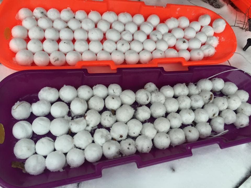
This photo is 4 years ago today in what was surely the last real snow in DFW. The mother of all snowball fights after sledding. Oh how I miss the olden days.

6 likes
"Don't let wishcastin get in the way of your forecastin"

Who is online
Users browsing this forum: No registered users and 33 guests