EPAC: HENRIETTE - Remnants

Moderator: S2k Moderators

Message
Author
User avatar
Yellow Evan
Professional-Met
Professional-Met
Posts: 15951
Age: 25
Joined: Fri Jul 15, 2011 12:48 pm
Location: Henderson, Nevada/Honolulu, HI
Contact:

Re: EPAC: NINE-E - Tropical Depression

#21 Postby Yellow Evan » Sun Aug 11, 2019 10:56 pm

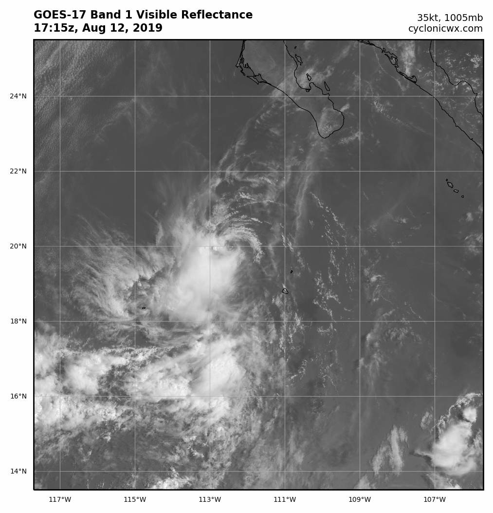
Chris90 wrote:Hey, it's got 36 hours, EPac cyclones have pulled some impressive tricks with that amount of time. I'll go ahead and throw it the possibility for 55kts.


Considering its small size and low shear environment, this is a valid point. Given the lack of model support, I'm not bullish but I also likely would have shown a 40 knot peak in the opening advisory if I was doing it.
3 likes   

floridasun78
Category 5
Category 5
Posts: 3755
Joined: Sun May 17, 2009 10:16 pm
Location: miami fl

Re: EPAC: NINE-E - Tropical Depression

#22 Postby floridasun78 » Sun Aug 11, 2019 11:47 pm

so that little islands don't get warring? td passing over it now so no one live on that islands?
0 likes   

Chris90
Category 2
Category 2
Posts: 637
Age: 34
Joined: Thu Jun 01, 2017 9:36 pm

Re: EPAC: NINE-E - Tropical Depression

#23 Postby Chris90 » Mon Aug 12, 2019 12:08 am

floridasun78 wrote:so that little islands don't get warring? td passing over it now so no one live on that islands?


I believe that small island is San Benedicto, and it is uninhabited. The larger island to the south of that is Socorro, and it does have a small population in association with what I believe is a naval base. No warnings or watches will be necessary for them though.
0 likes   
Solar Aquarian
Lunar Cancerian
:uarrow: Sagittarian

User avatar
Nancy Smar
Category 5
Category 5
Posts: 1081
Age: 23
Joined: Wed Aug 16, 2017 10:03 pm

Re: EPAC: NINE-E - Tropical Depression

#24 Postby Nancy Smar » Mon Aug 12, 2019 2:26 am

HENRIETTE, EP, E, , , , , 09, 2019, TS, S, 2019080418, 9999999999, , 019, , , 1, WARNING, 4, EP092019
0 likes   

Astromanía
Category 2
Category 2
Posts: 737
Age: 25
Joined: Sat Aug 25, 2018 10:34 pm
Location: Monterrey, N.L, México

Re: EPAC: HENRIETTE - Tropical Storm

#25 Postby Astromanía » Mon Aug 12, 2019 3:30 am

Those are the Revillagigedo islands, its a protect natural area, so no people live there, only in the biggest island (Socorro) there is a small population, I wouldn't worried about them now but in some days with the possible formation of a strong hurricane that is forecast to pass over the islands at peak intensity, almost a cat 4 according to GFS.
0 likes   

Astromanía
Category 2
Category 2
Posts: 737
Age: 25
Joined: Sat Aug 25, 2018 10:34 pm
Location: Monterrey, N.L, México

Re: EPAC: HENRIETTE - Tropical Storm

#26 Postby Astromanía » Mon Aug 12, 2019 3:32 am

Hi Henriette!. :roll:
3 likes   

User avatar
cycloneye
Admin
Admin
Posts: 139056
Age: 67
Joined: Thu Oct 10, 2002 10:54 am
Location: San Juan, Puerto Rico

Re: EPAC: HENRIETTE - Tropical Storm

#27 Postby cycloneye » Mon Aug 12, 2019 4:51 am

Tropical Storm Henriette Discussion Number 2
NWS National Hurricane Center Miami FL EP092019
300 AM MDT Mon Aug 12 2019

Deep convection has continued to burst over the western portion of
the cyclone overnight. Although the system is sheared with the
center located near the northeastern edge of the convective mass, a
couple of ASCAT passes have shown a very small area of 30-35 kt
winds over the northwestern portion of the circulation. These
winds extend no more than about 15-20 n mi from the center, but
based on these data the initial wind speed has been increased to
35 kt. Henriette becomes the eighth named storm in the eastern
Pacific basin this season.

The ASCAT data also assisted in locating the center this morning,
and recent fixes show that Henriette continues to move west-
northwestward or 295/12 kt. The tropical storm should move
west-northwestward around the southwestern portion of a deep-layer
ridge that extends westward from northern Mexico. As Henriette
weakens, it is likely to turn westward within the low-level flow.
The updated NHC track forecast is similar to the previous advisory
through 36 hours, but has been adjusted southward at 48 hours to be
closer to the various consensus aids.

Henriette is not anticipated to strengthen much more. Although the
system is predicted to remain over warm waters and within an area of
light to moderate northeasterly shear today, nearby dry mid-level
air is likely to prevent significant strengthening. By Tuesday
morning, Henriette will be moving over cooler waters and into a
more stable airmass. This should lead to weakening, and the
cyclone is predicted to degenerate into a remnant low within
48 hours, with dissipation occurring shortly thereafter.


FORECAST POSITIONS AND MAX WINDS

INIT 12/0900Z 19.5N 110.9W 35 KT 40 MPH
12H 12/1800Z 20.2N 112.4W 35 KT 40 MPH
24H 13/0600Z 21.0N 114.4W 35 KT 40 MPH
36H 13/1800Z 21.7N 116.8W 30 KT 35 MPH
48H 14/0600Z 22.0N 120.0W 25 KT 30 MPH...POST-TROP/REMNT LOW
72H 15/0600Z...DISSIPATED

$$
Forecaster Brown
1 likes   
Visit the Caribbean-Central America Weather Thread where you can find at first post web cams,radars
and observations from Caribbean basin members Click Here

User avatar
NDG
S2K Supporter
S2K Supporter
Posts: 14933
Joined: Sun Jul 09, 2006 10:14 pm
Location: Orlando, FL

Re: EPAC: HENRIETTE - Tropical Storm

#28 Postby NDG » Mon Aug 12, 2019 5:37 am

Barely a weak TS. Yet another struggling EPAC system.

Image
0 likes   

User avatar
NotSparta
Professional-Met
Professional-Met
Posts: 1647
Age: 22
Joined: Fri Aug 18, 2017 8:24 am
Location: Naples, FL
Contact:

Re: EPAC: HENRIETTE - Tropical Storm

#29 Postby NotSparta » Mon Aug 12, 2019 5:59 am

This season reminds me of 2012 in the Atlantic. Went thru a bunch of names, but the storms were weak for the most part
0 likes   
This post was probably an opinion of mine, and in no way is official. Please refer to http://www.hurricanes.gov for official tropical analysis and advisories.

My website, with lots of tropical wx graphics, including satellite and recon: http://cyclonicwx.com

User avatar
Hurricane Jed
Category 2
Category 2
Posts: 542
Age: 36
Joined: Mon Jan 24, 2011 3:36 pm
Location: Cen Tex

Re: EPAC: HENRIETTE - Tropical Storm

#30 Postby Hurricane Jed » Mon Aug 12, 2019 7:38 am

NotSparta wrote:This season reminds me of 2012 in the Atlantic. Went thru a bunch of names, but the storms were weak for the most part


2012 had 10 hurricanes and a few moderate to strong tropical storms. I’d figure 2013 would remind one more of this season. And at least the EPAC is getting storms.
1 likes   

User avatar
NotSparta
Professional-Met
Professional-Met
Posts: 1647
Age: 22
Joined: Fri Aug 18, 2017 8:24 am
Location: Naples, FL
Contact:

Re: EPAC: HENRIETTE - Tropical Storm

#31 Postby NotSparta » Mon Aug 12, 2019 7:44 am

Hurricane Jed wrote:
NotSparta wrote:This season reminds me of 2012 in the Atlantic. Went thru a bunch of names, but the storms were weak for the most part


2012 had 10 hurricanes and a few moderate to strong tropical storms. I’d figure 2013 would remind one more of this season. And at least the EPAC is getting storms.


True, maybe a cross between 2012 and 2013-like activity (compared to the ATL avg) since the storms aren't that weak (2 majors, ACE not significantly below normal). But still, a lot of weak systems
0 likes   
This post was probably an opinion of mine, and in no way is official. Please refer to http://www.hurricanes.gov for official tropical analysis and advisories.

My website, with lots of tropical wx graphics, including satellite and recon: http://cyclonicwx.com

Dave C
S2K Supporter
S2K Supporter
Posts: 868
Joined: Thu Sep 04, 2003 4:36 pm
Location: Middleboro, Mass.(midway between Cape Cod and Boston)

Re: EPAC: HENRIETTE - Tropical Storm

#32 Postby Dave C » Mon Aug 12, 2019 9:04 am

Astromanía wrote:Those are the Revillagigedo islands, its a protect natural area, so no people live there, only in the biggest island (Socorro) there is a small population, I wouldn't worried about them now but in some days with the possible formation of a strong hurricane that is forecast to pass over the islands at peak intensity, almost a cat 4 according to GFS.

I remember hurricane Linda passed over them with cat 5 winds.
0 likes   

User avatar
cycloneye
Admin
Admin
Posts: 139056
Age: 67
Joined: Thu Oct 10, 2002 10:54 am
Location: San Juan, Puerto Rico

Re: EPAC: HENRIETTE - Tropical Storm

#33 Postby cycloneye » Mon Aug 12, 2019 9:34 am

Tropical Storm Henriette Discussion Number 3
NWS National Hurricane Center Miami FL EP092019
900 AM MDT Mon Aug 12 2019

Henriette is a sheared tropical cyclone, with microwave and
first-light visible satellite imagery revealing a low level center
that is near the northeastern edge of the deep convection. The
overall presentation of the cyclone has changed little over the past
several hours, and therefore the initial intensity is being held at
35 kt. This is in agreement with an earlier ASCAT pass showing a
very small area of 30-35 kt winds over the northwestern portion of
the circulation.

The initial motion is 295/10 kt. Henriette is expected to continue
this general motion for the next 24 hours as it is steered by a
mid-level ridge that extends from northern Mexico to the north of
the cyclone. A turn to the west is expected on Tuesday as the
system weakens and becomes steered by the low-level flow. The
official forecast is slightly south of the previous one through 24
hours, due to a more southward initial position. Beyond 24 hours,
the official forecast is very near the previous one, and near the
middle of the consensus aids.

Northeasterly shear and dry air over the northern portion of the
cyclone should continue to keep the low level center near the edge
of the deep convection into tonight, preventing any further
strengthening. By 24 hours, the cyclone is forecast to cross the 26
C SST isotherm and move into a more stable airmass. This should
cause the cyclone to lose its convection and weaken on Tuesday, with
the system likely becoming a remnant low by Tuesday night. The
official intensity forecast is close to the previous one, and is in
agreement with the various dynamical and consensus aids.

FORECAST POSITIONS AND MAX WINDS

INIT 12/1500Z 19.7N 112.2W 35 KT 40 MPH
12H 13/0000Z 20.2N 113.9W 35 KT 40 MPH
24H 13/1200Z 20.9N 116.1W 30 KT 35 MPH
36H 14/0000Z 21.4N 118.8W 25 KT 30 MPH...POST-TROP/REMNT LOW
48H 14/1200Z...DISSIPATED

$$
Forecaster Latto/Pasch
1 likes   
Visit the Caribbean-Central America Weather Thread where you can find at first post web cams,radars
and observations from Caribbean basin members Click Here

User avatar
DioBrando
Category 4
Category 4
Posts: 917
Age: 27
Joined: Sun Aug 12, 2018 12:45 pm

Re: EPAC: HENRIETTE - Tropical Storm

#34 Postby DioBrando » Mon Aug 12, 2019 9:51 am

-facepalm-

quantity over quality. here we go again. shows how hostile the environment really is in the epac.
0 likes   
blonde stacey (xe/xem/xir)

User avatar
cycloneye
Admin
Admin
Posts: 139056
Age: 67
Joined: Thu Oct 10, 2002 10:54 am
Location: San Juan, Puerto Rico

Re: EPAC: HENRIETTE - Tropical Storm

#35 Postby cycloneye » Mon Aug 12, 2019 9:52 am

2 likes   
Visit the Caribbean-Central America Weather Thread where you can find at first post web cams,radars
and observations from Caribbean basin members Click Here

User avatar
NotSparta
Professional-Met
Professional-Met
Posts: 1647
Age: 22
Joined: Fri Aug 18, 2017 8:24 am
Location: Naples, FL
Contact:

Re: EPAC: HENRIETTE - Tropical Storm

#36 Postby NotSparta » Mon Aug 12, 2019 1:34 pm

Center exposed:

Image
1 likes   
This post was probably an opinion of mine, and in no way is official. Please refer to http://www.hurricanes.gov for official tropical analysis and advisories.

My website, with lots of tropical wx graphics, including satellite and recon: http://cyclonicwx.com

User avatar
Hurricane Jed
Category 2
Category 2
Posts: 542
Age: 36
Joined: Mon Jan 24, 2011 3:36 pm
Location: Cen Tex

Re: EPAC: HENRIETTE - Tropical Storm

#37 Postby Hurricane Jed » Mon Aug 12, 2019 9:10 pm

Bad as it looks, I feel like Gil was worse. That’s not saying much though.
5 likes   

User avatar
cycloneye
Admin
Admin
Posts: 139056
Age: 67
Joined: Thu Oct 10, 2002 10:54 am
Location: San Juan, Puerto Rico

Re: EPAC: HENRIETTE - Tropical Storm

#38 Postby cycloneye » Mon Aug 12, 2019 9:53 pm

Tropical Storm Henriette Discussion Number 5
NWS National Hurricane Center Miami FL EP092019
900 PM MDT Mon Aug 12 2019

Scatterometer data and visible satellite imagery indicate that
Henriette has maintained a robust, compact low-level circulation
despite the pulsing convection. In fact, three earlier ASCAT passes
between 1613Z and 1728Z indicated reliable wind speeds of 37-38 kt,
suggesting that Henriette could have been near 40 kt prior to those
times. However, since 1800Z, northeasterly vertical wind shear
and dry air intrusions have reduced and confined the overall
convective pattern to just intermittent bursts in the southwestern
quadrant. The initial intensity is being maintained at 35 kt based
on the shear pattern, a UW-CIMSS ADT intensity estimate of T2.4/34
kt, and allowing for some slight spin down of the low-level vortex.

The initial motion remains 290/11 kt. A west-northwestward motion
is forecast to continue for the next 24 hours so, followed by a
turn toward the west by early Wednesday as the weakening cyclone
becomes vertically shallow and gets steered by the low-level
easterly tradewind flow. The new NHC forecast track remains
essentially unchanged and is just an extension of the previous
advisory, and lies about midway between the consensus models HCCA
and TVCE.

Although the official intensity forecast calls for steady weakening,
it is possible that Henriette could remain a tropical storm in 12 h
due to the cyclone coming out of the convective maximum period and
still located over SSTs between 26C and 26.5 deg C. However, by 18 h
and beyond, the cyclone will be moving over sub-26C SSTs and into a
drier environment, which is expected to result in significant
weakening, with Henriette degenerating into a remnant low by late
Tuesday and dissipating by late Wednesday. The official intensity
forecast is identical to previous advisory and closely follows the
IVCN and HCCA consensus intensity forecast models.

FORECAST POSITIONS AND MAX WINDS

INIT 13/0300Z 20.7N 114.3W 35 KT 40 MPH
12H 13/1200Z 21.2N 116.0W 30 KT 35 MPH
24H 14/0000Z 21.8N 118.4W 25 KT 30 MPH...POST-TROP/REMNT LOW
36H 14/1200Z 22.3N 121.0W 20 KT 25 MPH...POST-TROP/REMNT LOW
48H 15/0000Z...DISSIPATED

$$
Forecaster Stewart
1 likes   
Visit the Caribbean-Central America Weather Thread where you can find at first post web cams,radars
and observations from Caribbean basin members Click Here

User avatar
Yellow Evan
Professional-Met
Professional-Met
Posts: 15951
Age: 25
Joined: Fri Jul 15, 2011 12:48 pm
Location: Henderson, Nevada/Honolulu, HI
Contact:

Re: EPAC: HENRIETTE - Tropical Storm

#39 Postby Yellow Evan » Mon Aug 12, 2019 11:48 pm

Hurricane Jed wrote:Bad as it looks, I feel like Gil was worse. That’s not saying much though.


Yea it's structure isn't that bad even if the low level center has been partially exposed the entire time.
0 likes   

User avatar
cycloneye
Admin
Admin
Posts: 139056
Age: 67
Joined: Thu Oct 10, 2002 10:54 am
Location: San Juan, Puerto Rico

Re: EPAC: HENRIETTE - Tropical Depression

#40 Postby cycloneye » Tue Aug 13, 2019 5:02 am

CDEP4

Tropical Depression Henriette Discussion Number 6
NWS National Hurricane Center Miami FL EP092019
200 AM PDT Tue Aug 13 2019

Deep convection associated with Henriette dissipated shortly after
the release of the previous advisory, with the cyclone becoming a
swirl of low- to mid-level clouds. Recent scatterometer data
indicate that the winds associated with the cyclone have weakened
quickly and these data support an initial intensity of 25 kt.
Henriette is heading toward cooler waters and a more stable
environment and it is unlikely that organized deep convection will
return. As a result, the system will continue to quickly weaken and
it is expected to degenerate into a remnant low later today.

The depression is being steered west-northwestward at about 11 kt
to the south of a low- to mid-level ridge. The low-level ridge is
forecast to remain intact during the next day or so and Henriette
or its remnants should continue on a west-northwestward heading
until dissipation occurs on Wednesday. The new NHC track forecast
is near the middle of the guidance envelope and is essentially an
update of the previous advisory.


FORECAST POSITIONS AND MAX WINDS

INIT 13/0900Z 21.1N 115.2W 25 KT 30 MPH
12H 13/1800Z 21.5N 116.9W 20 KT 25 MPH...POST-TROP/REMNT LOW
24H 14/0600Z 22.0N 119.1W 15 KT 15 MPH...POST-TROP/REMNT LOW
36H 14/1800Z...DISSIPATED

$$
Forecaster Brown
0 likes   
Visit the Caribbean-Central America Weather Thread where you can find at first post web cams,radars
and observations from Caribbean basin members Click Here


Return to “2019”

Who is online

Users browsing this forum: No registered users and 28 guests