AL, 92, 2020090418, , BEST, 0, 152N, 252W, 25, 1009, DB, 34, NEQ, 0, 0, 0, 0, 1011, 180, 50, 0, 0, L, 0, , 0, 0, INVEST, S, 0, , 0, 0, 0, 0, genesis-num, 035,
ATL: PAULETTE - Remnants - Discussion
Moderator: S2k Moderators
-
cycloneye

- Admin

- Posts: 139025
- Age: 67
- Joined: Thu Oct 10, 2002 10:54 am
- Location: San Juan, Puerto Rico
ATL: PAULETTE - Remnants - Discussion
0 likes
Visit the Caribbean-Central America Weather Thread where you can find at first post web cams,radars
and observations from Caribbean basin members Click Here
and observations from Caribbean basin members Click Here

Re: ATL: INVEST 92L - Discussion
Up to 40/80 in the latest TWO.
0 likes
Irene '11 Sandy '12 Hermine '16 5/15/2018 Derecho Fay '20 Isaias '20 Elsa '21 Henri '21 Ida '21
I am only a meteorology enthusiast who knows a decent amount about tropical cyclones. Look to the professional mets, the NHC, or your local weather office for the best information.
I am only a meteorology enthusiast who knows a decent amount about tropical cyclones. Look to the professional mets, the NHC, or your local weather office for the best information.
-
ElectricStorm

- Category 5

- Posts: 4523
- Age: 23
- Joined: Tue Aug 13, 2019 11:23 pm
- Location: Skiatook, OK / Norman, OK
Re: ATL: INVEST 92L - Discussion
Well hopefully this one won't be as much of a pain in the butt to track like the previous 92L...
2 likes
I am in no way a professional. Take what I say with a grain of salt as I could be totally wrong. Please refer to the NHC, NWS, or SPC for official information.
Boomer Sooner!
Boomer Sooner!
-
ouragans

- Category 1

- Posts: 465
- Age: 52
- Joined: Sun Jun 12, 2011 12:09 pm
- Location: Abymes, Guadeloupe F.W.I
- Contact:
Re: ATL: INVEST 92L - Discussion
Finally!
Code: Select all
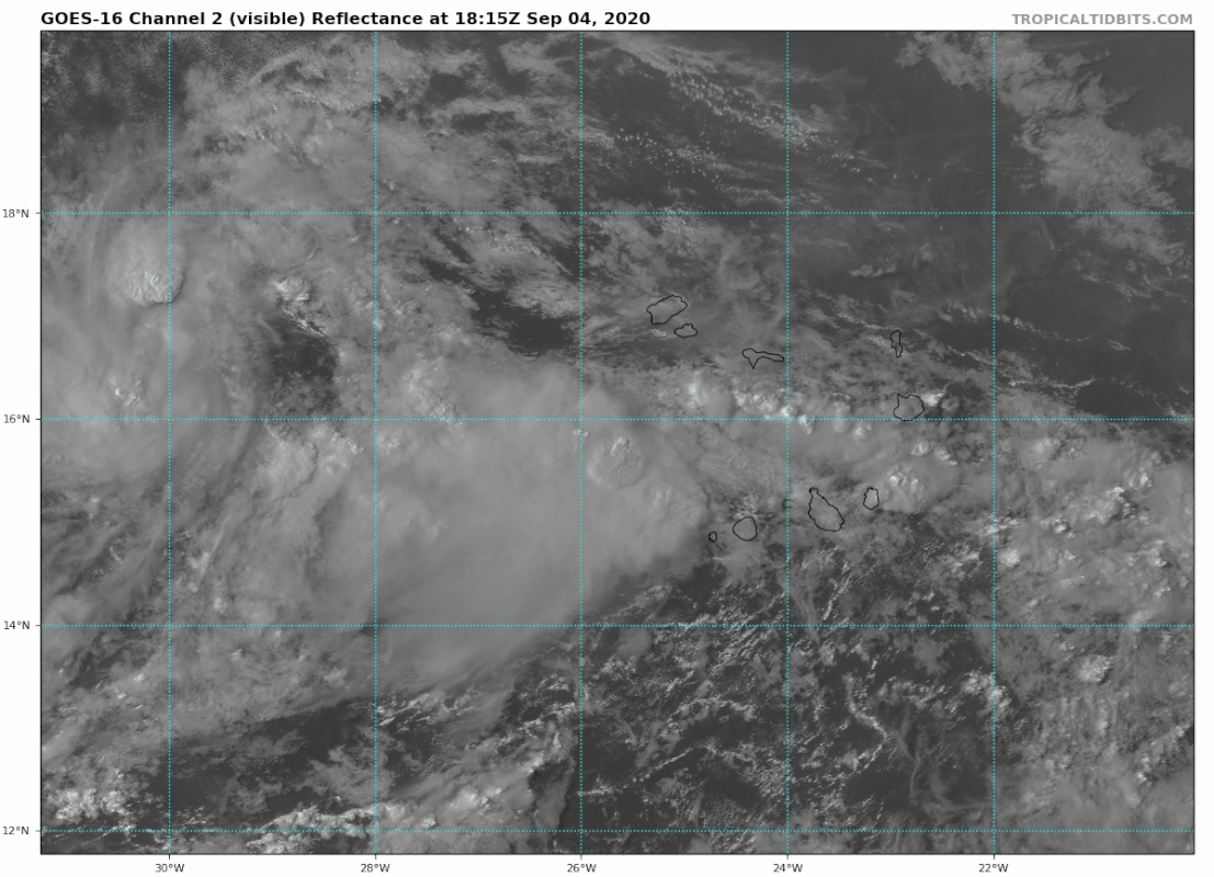
3. A tropical wave and area of low pressure located just west of the Cabo Verde Islands is producing a large area of disorganized showers and thunderstorms.  Gradual development of this system is expected as it moves westward to west-northwestward, and a tropical depression is likely to form late this weekend or early next week when the system reaches the central tropical Atlantic.
* Formation chance through 48 hours...medium...40 percent.
* Formation chance through 5 days...high...80 percent.
Last edited by ouragans on Fri Sep 04, 2020 1:11 pm, edited 1 time in total.
0 likes
Personal forecast disclaimer
This post is a personal point of view, not an information. Please refer to official statements for life-threatening decisions.
David '79, Frederic '79, Hugo '89, Iris, Luis & Marilyn '95, Georges '98, Lenny '99, Dean '07, Irma '17, Maria '17, Fiona '22, Philippe '23, Tammy '23
16°13'33.3,"6N -61°36'39.5"W
-
wxman57

- Moderator-Pro Met

- Posts: 22480
- Age: 66
- Joined: Sat Jun 21, 2003 8:06 pm
- Location: Houston, TX (southwest)
Re: ATL: INVEST 92L - Discussion
Appears to be a good chance that this one will be playing around in the open Atlantic north of the Caribbean over the coming week. Good! I still have 6 more comp days to take...
4 likes

Re: ATL: INVEST 92L - Discussion
wxman57 wrote:Appears to be a good chance that this one will be playing around in the open Atlantic north of the Caribbean over the coming week. Good! I still have 6 more comp days to take...
Signals look like 9/15 to 10/15 will be a sprint. Rest up
0 likes
-
Aric Dunn
- Category 5
- Posts: 21228
- Age: 41
- Joined: Sun Sep 19, 2004 9:58 pm
- Location: Ready for the Chase.
- Contact:
Re: ATL: INVEST 92L - Discussion
About time..
Open atlantic all depends on the interaction. and since 91L is dying quickly there should less of an interaction and out too sea is less likely.
Open atlantic all depends on the interaction. and since 91L is dying quickly there should less of an interaction and out too sea is less likely.
0 likes
Note: If I make a post that is brief. Please refer back to previous posts for the analysis or reasoning. I do not re-write/qoute what my initial post said each time.
If there is nothing before... then just ask
Space & Atmospheric Physicist, Embry-Riddle Aeronautical University,
I believe the sky is falling...
If there is nothing before... then just ask
Space & Atmospheric Physicist, Embry-Riddle Aeronautical University,
I believe the sky is falling...
-
SFLcane

- S2K Supporter

- Posts: 9606
- Age: 46
- Joined: Sat Jun 05, 2010 1:44 pm
- Location: Lake Worth Florida
Re: ATL: INVEST 92L - Discussion
Aric Dunn wrote:About time..
Open atlantic all depends on the interaction. and since 91L is dying quickly there should less of an interaction and out too sea is less likely.
Hi Aric,
There is very strong ensemble agreement for just that. That's not why 92L is going OTS is due to the weakness in the ridge.
2 likes
-
ElectricStorm
- Category 5
- Posts: 4523
- Age: 23
- Joined: Tue Aug 13, 2019 11:23 pm
- Location: Skiatook, OK / Norman, OK
Re: ATL: INVEST 92L - Discussion
If this goes OTS harmlessly then I'm rooting for it to become a major
1 likes
I am in no way a professional. Take what I say with a grain of salt as I could be totally wrong. Please refer to the NHC, NWS, or SPC for official information.
Boomer Sooner!
Boomer Sooner!
-
gatorcane

- S2K Supporter
- Posts: 23499
- Age: 46
- Joined: Sun Mar 13, 2005 3:54 pm
- Location: Boca Raton, FL
Re: ATL: INVEST 92L - Discussion
Looks like it could rack up some ACE while staying out to sea. A good one to track and root for it to become a major knowing it may not impact anybody.
1 likes
-
Hypercane_Kyle

- Category 5
- Posts: 2899
- Joined: Sat Mar 07, 2015 7:58 pm
- Location: Cape Canaveral, FL
Re: ATL: INVEST 92L - Discussion
Really hoping for a nice, harmless, major hurricane fish storm out of this. We've had enough destruction this season.
4 likes
My posts are my own personal opinion, defer to the National Hurricane Center (NHC) and other NOAA products for decision making during hurricane season.
-
DestinHurricane

- Category 4

- Posts: 930
- Joined: Tue May 01, 2018 8:05 am
- Location: Columbus, OH... need to get back in the action
Re: ATL: INVEST 92L - Discussion
SFLcane wrote:Aric Dunn wrote:About time..
Open atlantic all depends on the interaction. and since 91L is dying quickly there should less of an interaction and out too sea is less likely.
Hi Aric,
There is very strong ensemble agreement for just that. That's not why 92L is going OTS is due to the weakness in the ridge.
No I think what he means is that the ensembles are making 92L interact with 91L and because of that they are OTS. If they didn't interact they might not be OTS.
Its too early to declare this OTS.
3 likes
Destin/Santa Rosa Beach, Florida: Ivan 2004, Dennis 2005, Michael 2018, Sally 2020
Fort Lauderdale, Florida Eta 2020, Many future storms!
THE Ohio State University:
Fort Lauderdale, Florida Eta 2020, Many future storms!
THE Ohio State University:
Re: ATL: INVEST 92L - Discussion
DestinHurricane wrote:SFLcane wrote:Aric Dunn wrote:About time..
Open atlantic all depends on the interaction. and since 91L is dying quickly there should less of an interaction and out too sea is less likely.
Hi Aric,
There is very strong ensemble agreement for just that. That's not why 92L is going OTS is due to the weakness in the ridge.
No I think what he means is that the ensembles are making 92L interact with 91L and because of that they are OTS. If they didn't interact they might not be OTS.
Its too early to declare this OTS.
Yes, nobody can say it is a 100% certainty, but it isn't too early to lay odds on OTS at something like 98% based on overwhelming model support for that and overall climo, which favors OTS for most in the E Atl even in a La Nina. Fortunately, there isn't enough westward momentum in the MDR for this to get far west. If someone asked me to lay $1,000 to win $100 on a bet that it would be OTS, I'd take that bet. Bermuda, however, it at much higher risk than the US and Bahamas.
2 likes
Personal Forecast Disclaimer:
The posts in this forum are NOT official forecasts and should not be used as such. They are just the opinion of the poster and may or may not be backed by sound meteorological data. They are NOT endorsed by any professional institution or storm2k.org. For official information, please refer to the NHC and NWS products.
The posts in this forum are NOT official forecasts and should not be used as such. They are just the opinion of the poster and may or may not be backed by sound meteorological data. They are NOT endorsed by any professional institution or storm2k.org. For official information, please refer to the NHC and NWS products.

Re: ATL: INVEST 92L - Discussion
LarryWx wrote:DestinHurricane wrote:SFLcane wrote:
Hi Aric,
There is very strong ensemble agreement for just that. That's not why 92L is going OTS is due to the weakness in the ridge.
No I think what he means is that the ensembles are making 92L interact with 91L and because of that they are OTS. If they didn't interact they might not be OTS.
Its too early to declare this OTS.
Yes, nobody can say it is a 100% certainty, but it isn't too early to lay odds on OTS at something like 98% based on overwhelming model support for that and overall climo, which favors OTS for most in the E Atl even in a La Nina. Fortunately, there isn't enough westward momentum in the MDR for this to get far west. If someone asked me to lay $1,000 to win $100 on a bet that it would be OTS, I'd take that bet. Bermuda, however, it at much higher risk than the US and Bahamas.
Out to sea, I don't see any scenarios that will allow this one to go west...the next wave might be a different story.
Too bad there is not a site for making weather bets. A skilled forecaster could do quite well. Many people would take that bet the other way, $100 to win $1000 if it does not go out to sea.
1 likes

Re: ATL: INVEST 92L - Discussion
Jr0d wrote:LarryWx wrote:DestinHurricane wrote:
No I think what he means is that the ensembles are making 92L interact with 91L and because of that they are OTS. If they didn't interact they might not be OTS.
Its too early to declare this OTS.
Yes, nobody can say it is a 100% certainty, but it isn't too early to lay odds on OTS at something like 98% based on overwhelming model support for that and overall climo, which favors OTS for most in the E Atl even in a La Nina. Fortunately, there isn't enough westward momentum in the MDR for this to get far west. If someone asked me to lay $1,000 to win $100 on a bet that it would be OTS, I'd take that bet. Bermuda, however, it at much higher risk than the US and Bahamas.
Out to sea, I don't see any scenarios that will allow this one to go west...the next wave might be a different story.
Too bad there is not a site for making weather bets. A skilled forecaster could do quite well. Many people would take that bet the other way, $100 to win $1000 if it does not go out to sea.
https://betonweather.io/ Don't waste all your allowance on it
1 likes
Andrew '92 Opal '95 Blizzard '96 Izzy '03 Irene '11 Sandy '12
The following post is NOT an official forecast and should not be used as such. It is just the opinion is not be backed by sound meteorological data. It is NOT endorsed by any professional institution including storm2k.org For Official Information please refer to the NHC and NWS products.
The following post is NOT an official forecast and should not be used as such. It is just the opinion is not be backed by sound meteorological data. It is NOT endorsed by any professional institution including storm2k.org For Official Information please refer to the NHC and NWS products.
-
AnnularCane

- S2K Supporter
- Posts: 2634
- Joined: Thu Jun 08, 2006 9:18 am
- Location: Wytheville, VA
Re: ATL: INVEST 92L - Discussion
DestinHurricane wrote:No I think what he means is that the ensembles are making 92L interact with 91L and because of that they are OTS. If they didn't interact they might not be OTS.
Its too early to declare this OTS.
Why are they more likely to go out to sea if they interact?
0 likes
Re: ATL: INVEST 92L - Discussion
LarryWx wrote:DestinHurricane wrote:SFLcane wrote:
Hi Aric,
There is very strong ensemble agreement for just that. That's not why 92L is going OTS is due to the weakness in the ridge.
No I think what he means is that the ensembles are making 92L interact with 91L and because of that they are OTS. If they didn't interact they might not be OTS.
Its too early to declare this OTS.
Yes, nobody can say it is a 100% certainty, but it isn't too early to lay odds on OTS at something like 98% based on overwhelming model support for that and overall climo, which favors OTS for most in the E Atl even in a La Nina. Fortunately, there isn't enough westward momentum in the MDR for this to get far west. If someone asked me to lay $1,000 to win $100 on a bet that it would be OTS, I'd take that bet. Bermuda, however, it at much higher risk than the US and Bahamas.
I mean sure ... all else equal, if you told me a developing wave at 15n, 25w is likely to go OTS, that's easy to agree with simply using climatology as a rationale.
OTOH, if the rationale is that it will go OTS based on the model solutions of the behavior (6-8 days from now) of a rogue ULL spinning in the Central Atlantic .... then, sure I'd definitely lay some dough on the underdog, especially if you're giving me 50-1 odds (~2%)
1 likes

Re: ATL: INVEST 92L - Discussion
Almost 16N and the circulation of 91L will keep this headed towards the mid Atlantic.
Might even drag down a trough and pull them both OTS.
Might even drag down a trough and pull them both OTS.
0 likes
-
Deshaunrob17
- Tropical Storm

- Posts: 180
- Joined: Tue Aug 18, 2020 7:49 am
Re: ATL: INVEST 92L - Discussion
gatorcane wrote:Looks like it could rack up some ACE while staying out to sea. A good one to track and root for it to become a major knowing it may not impact anybody.
Also it's nice to see a out to sea major... Too many majors inpacted land since 2015. Every year since 2015 had at least 1 landfalling major
2 likes
Who is online
Users browsing this forum: No registered users and 26 guests