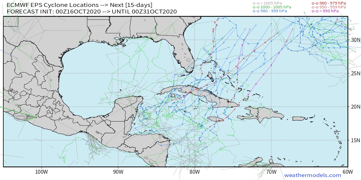
TheStormExpert wrote:All the 12z EPS eject this NE over Cuba and The Bahamas then OTS, with no threat to Florida.
https://twitter.com/hurricanemanwx/status/1321223005155020806
Yep, it’s gone heading out to sea.
I have an image for you from Zeta.
Moderator: S2k Moderators


TheStormExpert wrote:All the 12z EPS eject this NE over Cuba and The Bahamas then OTS, with no threat to Florida.
https://twitter.com/hurricanemanwx/status/1321223005155020806


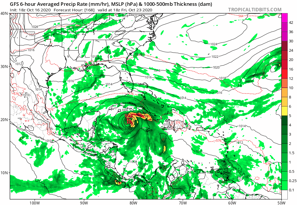

Spacecoast wrote:I also have an (gfs-Para) image for you from Zeta....
https://i.postimg.cc/TwGpycFt/gfs-mslp-pcpn-watl-fh168-384.gif
Spacecoast wrote:I also have an (gfs-Para) image for you from Zeta....
https://i.postimg.cc/TwGpycFt/gfs-mslp-pcpn-watl-fh168-384.gif


SFLcane wrote:Not saying para will verify but what’s so unrealistic to have a hurricane moving ne into the Bahamas in November then get trapped by a ridge? Especially in 2020 given the stubborn ridging already in place


gatorcane wrote:Quiet thread this morning and I can see why looking at the models which unanimously bring this into Central America or show weak development.
gatorcane wrote:Quiet thread this morning and I can see why looking at the models which unanimously bring this into Central America or show weak development.
aspen wrote:gatorcane wrote:Quiet thread this morning and I can see why looking at the models which unanimously bring this into Central America or show weak development.
We’re in that same stage that we were with pre-Zeta: after many aggressive model runs, nearly all of the globals drop this, leaving it up to the ensembles, and people start doubting this’ll ever form.

Jr0d wrote:
It had a run like this pre-Zeta also.
Until a low actually forms, the models are more or less for entertainment value.
It definitely seems like its going to be something of a close call. If it moves into CA, it presumably dies out, whereas, it might not get quite that far west, then it should move out over Cuba. After that, its likely to go out to sea (or at least not threaten FL - mabye NE/Atlantic Canada.)SouthFLTropics wrote:FWIW... yesterday's 18z Para buries it into Central America but it appears that by hour 384 the remnants end up in the Bahamas. Nothing crazy like yesterday's 12z run of the Para. Today's 00z run of the Para is up to hour 150 right now with missing frames but it does show development to the east of Central America once again. We'll have to wait for the rest of the run to see where it goes from there.
SouthFLTropics wrote:FWIW... yesterday's 18z Para buries it into Central America but it appears that by hour 384 the remnants end up in the Bahamas. Nothing crazy like yesterday's 12z run of the Para. Today's 00z run of the Para is up to hour 150 right now with missing frames but it does show development to the east of Central America once again. We'll have to wait for the rest of the run to see where it goes from there.
cp79 wrote:SouthFLTropics wrote:FWIW... yesterday's 18z Para buries it into Central America but it appears that by hour 384 the remnants end up in the Bahamas. Nothing crazy like yesterday's 12z run of the Para. Today's 00z run of the Para is up to hour 150 right now with missing frames but it does show development to the east of Central America once again. We'll have to wait for the rest of the run to see where it goes from there.
Makes more sense. Yesterday’s run was a joke and completely unrealistic, especially with a pretty strong front expected to move through Florida Monday. They’re call for highs in the upper 60s to low 70s here in Tampa. That should either sweep out to sea or block any storm from hitting Fla. The CA solution makes sense, too. But I think the season-ending front that comes next week should keep the US safe.

Users browsing this forum: Hurricane2022, IcyTundra, Sciencerocks, TheAustinMan and 63 guests


