GOM/Caribbean/Atlantic Ocean SST'S and Anomalies
Moderator: S2k Moderators
Forum rules
The posts in this forum are NOT official forecasts and should not be used as such. They are just the opinion of the poster and may or may not be backed by sound meteorological data. They are NOT endorsed by any professional institution or STORM2K. For official information, please refer to products from the National Hurricane Center and National Weather Service.
-
JonathanBelles
- Professional-Met

- Posts: 11430
- Age: 35
- Joined: Sat Dec 24, 2005 9:00 pm
- Location: School: Florida State University (Tallahassee, FL) Home: St. Petersburg, Florida
- Contact:
-
Scorpion
-
JonathanBelles
- Professional-Met

- Posts: 11430
- Age: 35
- Joined: Sat Dec 24, 2005 9:00 pm
- Location: School: Florida State University (Tallahassee, FL) Home: St. Petersburg, Florida
- Contact:
-
JonathanBelles
- Professional-Met

- Posts: 11430
- Age: 35
- Joined: Sat Dec 24, 2005 9:00 pm
- Location: School: Florida State University (Tallahassee, FL) Home: St. Petersburg, Florida
- Contact:
Coredesat wrote:The shear anomalies may be low, but the shear is still there. They don't really say anything about what shear will be like during the actual season (which is a month away). In fact, the GFS forecast shows an increase in shear throughout most of the basin and a return to a zonal flow pattern for at least the next 168 hours, which should put a nail in the coffin of preseason activity in April and early May.
How accurate are these GFS forecasts? I haven't heard much on them probably because they aren't the most accurate.
Last year was like watching paint dry. It would be nice to see at least some action this year, but there's going to be complaining soon, so we really have to get back on topic.
Don't remind me
0 likes
-
Coredesat
- Tampa Bay Hurricane
- Category 5

- Posts: 5598
- Age: 38
- Joined: Fri Jul 22, 2005 7:54 pm
- Location: St. Petersburg, FL
cycloneye wrote:
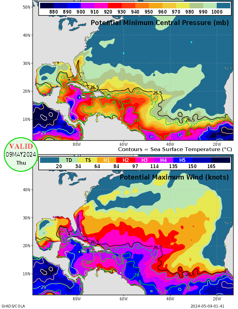
According to the latest data of potential maximun winds and potential minimun pressure,many parts of the Atlantic basin can support major hurricane winds,and the pressures are relativly low especially in the Caribbean Sea and in the MDR area.
If those SSTS, Heat Content, and Lower Pressures continue the Central Atlantic and
Caribbean could see a very severe hurricane season.
0 likes
- flightwxman
- Tropical Depression

- Posts: 65
- Joined: Wed Apr 18, 2007 6:45 pm
- Location: Disney's Backyard, FL
- Contact:
Is it just me, or is that convective area moving off the african coast headed straight for that area?
Last edited by flightwxman on Wed May 02, 2007 11:20 pm, edited 1 time in total.
0 likes
- MississippiHurricane
- ChatStaff

- Posts: 648
- Age: 41
- Joined: Sat Jul 16, 2005 12:20 am
- Location: Hanover, Maryland
- Contact:
Since were on the topic of water temps, here is a buoy data link for water temps:
http://ndbc.noaa.gov/
http://ndbc.noaa.gov/
0 likes
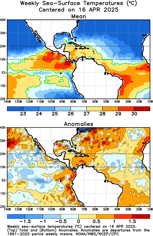
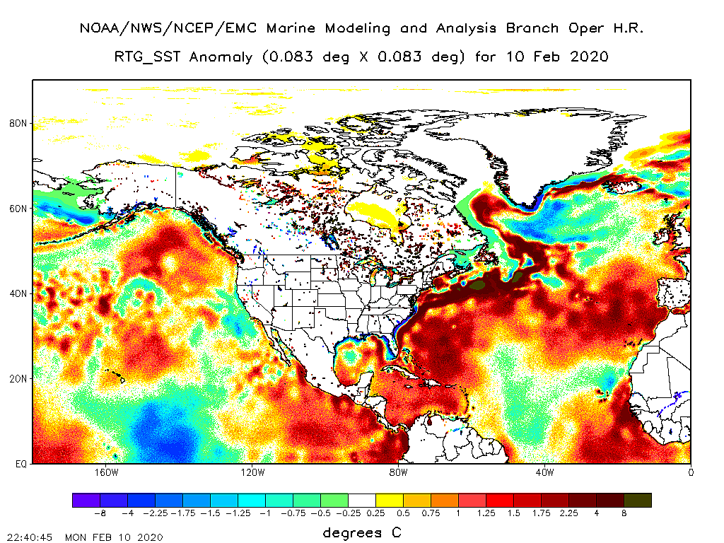
The caribbean is about a degree warmer than usual for this time of year. What does that equate to in time period, are we about a week ahead of schedule in terms of SST?
There is over 40 knots of shear over most of the area which is probably typical for this time of year. Nobody is expecting amother 2005 are they?
There is over 40 knots of shear over most of the area which is probably typical for this time of year. Nobody is expecting amother 2005 are they?
0 likes
- Tampa Bay Hurricane
- Category 5

- Posts: 5598
- Age: 38
- Joined: Fri Jul 22, 2005 7:54 pm
- Location: St. Petersburg, FL
The following post is NOT an official forecast and should not be used as such.
It is just the opinion of the poster and may or may not be backed by sound
meteorological data. It is NOT endorsed by any professional institution including
storm2k.org For Official Information please refer to the NHC and NWS products.
2007 could be AS BAD AS 2005 in terms of storm severity.
I am going to go out on a limb- looking at those ssts, if shear
decreases, and moist pattern over Africa continues- Another 2005
in terms of storm severities- Not Damage- Is Possible...I think we
could see another 2005- IN TERMS OF INTENSITY BUT HOPEFULLY
NOT DEVASTATION.
I feel VERY STRONGLY this way...VERY STRONGLY. I mean look at those ssts,
and the moist pattern...I expect a VERY SEVERE HURRICANE SEASON FOR THE CENTRAL
AND WESTERN ATLANTIC INCLUDING THE LESSER ANTILLES AND CARRIBEAN
ISLANDS TO THE CARIBBEAN.
0 likes
SST in the florida keys hitting 30C over past 3 days...
http://www.ndbc.noaa.gov/station_page.php?station=SMKF1
http://www.ndbc.noaa.gov/station_page.php?station=SMKF1
0 likes
- Tampa Bay Hurricane
- Category 5

- Posts: 5598
- Age: 38
- Joined: Fri Jul 22, 2005 7:54 pm
- Location: St. Petersburg, FL
drezee wrote:SST in the florida keys hitting 30C over past 3 days...
http://www.ndbc.noaa.gov/station_page.php?station=SMKF1
Sea Surface Temperatures have already briefly climbed above 86 degrees.
This strengthens my meteorological expectations for a very severe
hurricane season, as elaborated upon in my prediction a couple
posts earlier in this thread. I can't stress this enough: Everyone needs to
be ready.
0 likes
-
JonathanBelles
- Professional-Met

- Posts: 11430
- Age: 35
- Joined: Sat Dec 24, 2005 9:00 pm
- Location: School: Florida State University (Tallahassee, FL) Home: St. Petersburg, Florida
- Contact:
-
HurricaneHunter914
- Category 5

- Posts: 4439
- Age: 32
- Joined: Fri Mar 10, 2006 7:36 pm
- Location: College Station, TX
http://www.ssd.noaa.gov/PS/TROP/DATA/RT/SST/ATL/20.jpg
It's really heating up out there. Almost half of the GOM is covered in high 70s.
It's really heating up out there. Almost half of the GOM is covered in high 70s.
0 likes
- Tampa Bay Hurricane
- Category 5

- Posts: 5598
- Age: 38
- Joined: Fri Jul 22, 2005 7:54 pm
- Location: St. Petersburg, FL
Anyone notice the very large area of convection over the
central Atlantic and Central Caribbean?
Probably a trough
http://cimss.ssec.wisc.edu/tropic/real- ... xirg8n.GIF
central Atlantic and Central Caribbean?
Probably a trough
http://cimss.ssec.wisc.edu/tropic/real- ... xirg8n.GIF
0 likes


