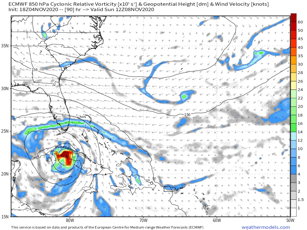
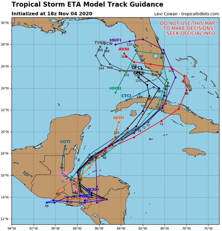
Cat5James wrote:SFLcane wrote:Gfs and the 18z euro still develop this and take it towards Florida. Not sure what took place on the 00z guidance
HMON as well... only model I saw drop it was the HWRF... what are we missing?
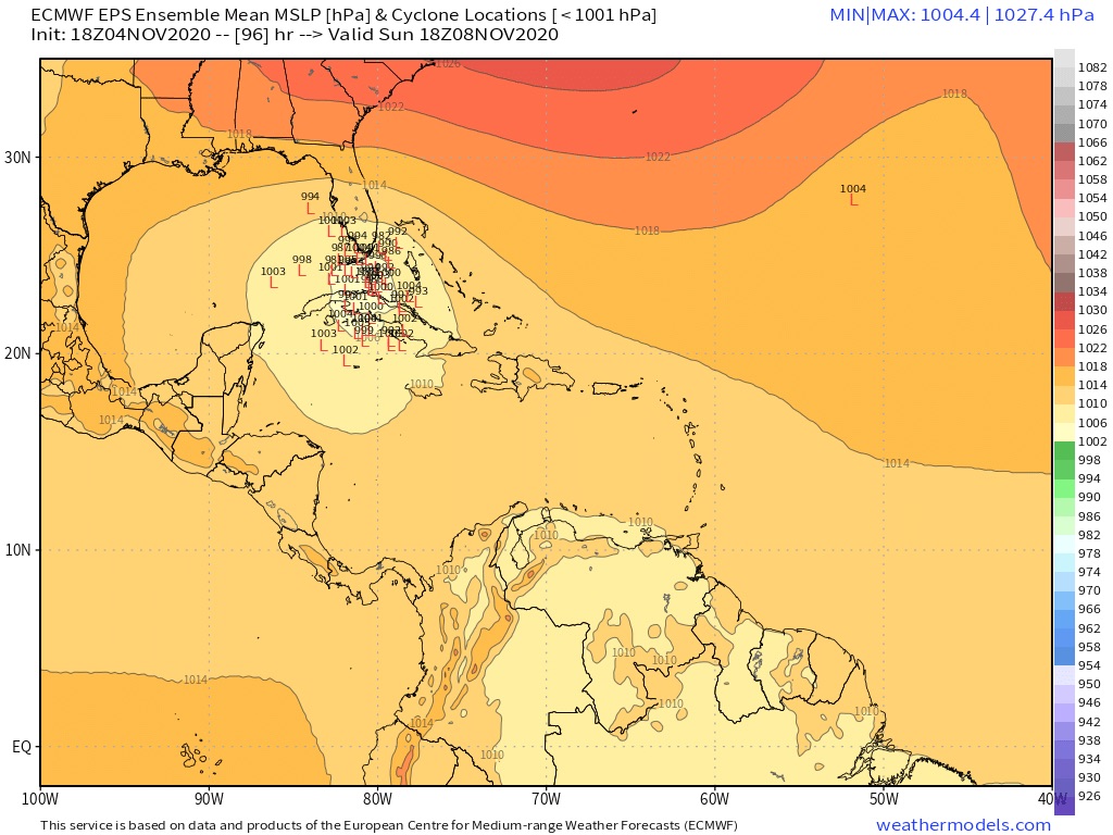
Compare 0z AVNI track to previous 18z AVNI track, which did not go into EPAC. HWFI also is less bullish on re-emerging.
Since TVCN is Consensus of AVNI / HWFI /CTCI / EMXI, this drastic change in AVNI caused a substanstial change to TVCN, which in turn MAY cause a change in OFCL, depending on whether NHC believes this change in AVNI (previous cycle GFS).
They probably will not change anything based on one run.
Some of these models are treating whatever emerges N of Honduras as a separate, (non-Eta) system, and continue to call whatever goes into EPAC... Eta.


