Florida Weather

U.S. & Caribbean Weather Discussions and Severe Weather Events

Moderator: S2k Moderators

Forum rules

The posts in this forum are NOT official forecast and should not be used as such. They are just the opinion of the poster and may or may not be backed by sound meteorological data. They are NOT endorsed by any professional institution or STORM2K.

Help Support Storm2K
Message
Author
User avatar
NDG
S2K Supporter
S2K Supporter
Posts: 15446
Joined: Sun Jul 09, 2006 10:14 pm
Location: Orlando, FL

Re: Florida Weather

#11301 Postby NDG » Mon Jan 30, 2017 3:56 pm

AxaltaRacing24 wrote:
gatorcane wrote:Even at 24 hours, the CMC still thinks 30sF will be widespread across the peninsula:

https://s23.postimg.org/4s5uxkluj/gem_T2m_seus_5.png

lol. Unless the sky is clear as can be, it won't be that dramatic IMO


It is still being a little too cold bias by a few degrees IMO. If anything it has been trending warmer on each run for tomorrow morning during the past few days when just 3 days ago it was showing widespread 20s for the FL Peninsula, lol.
GFS MOS guidance looks good to me, which shows a lot of rural across interior central and even northern S FL getting into the upper 30s with widespread frost.

Image
0 likes   

psyclone
S2K Supporter
S2K Supporter
Posts: 4768
Joined: Wed Aug 24, 2005 9:04 pm
Location: palm harbor fl

Re: Florida Weather

#11302 Postby psyclone » Mon Jan 30, 2017 5:54 pm

Frost advisories are out for much of central florida (all of the Melbourne CWA except Martin county) and a big chunk of the Tampa bay CWA away from the coast as a crisp, beautiful day makes way for a clear, cold night. a warming trend (a slow one) commences with sunrise tomorrow. Longer term, the early part of February is looking good for freeze avoidance for the peninsula, after which the magic of climo really starts working in our favor WRT freezes.
0 likes   

User avatar
gatorcane
S2K Supporter
S2K Supporter
Posts: 23691
Age: 47
Joined: Sun Mar 13, 2005 3:54 pm
Location: Boca Raton, FL

Re: Florida Weather

#11303 Postby gatorcane » Mon Jan 30, 2017 8:30 pm

49F at PIE (St Pete-Clearwater airport) already with a low of 49F forecasted, NWS should lower the forecast temps.

Curiously, TPA (Tampa International airport) is 6 degrees warmer at 55F.
0 likes   

psyclone
S2K Supporter
S2K Supporter
Posts: 4768
Joined: Wed Aug 24, 2005 9:04 pm
Location: palm harbor fl

Re: Florida Weather

#11304 Postby psyclone » Mon Jan 30, 2017 8:49 pm

That Tamp ob does seem warm. it actually matches the ob @ Whitted. it sure feels cold. Nevertheless, the frost will be confined to the way outlying areas. Brooksville is down to 43 with a dewpoint of 34 so some frost up that way is a good bet.
0 likes   

User avatar
AdamFirst
S2K Supporter
S2K Supporter
Posts: 2491
Age: 36
Joined: Thu Aug 14, 2008 10:54 am
Location: Port Saint Lucie, FL

Re: Florida Weather

#11305 Postby AdamFirst » Mon Jan 30, 2017 9:35 pm

Fort Pierce Airport is already down to 42 degrees just after 9 PM. My outdoor thermometer is reading 50 degrees and falling quickly.
0 likes   
Dolphins Marlins Canes Golden Panthers HEAT
Andrew 1992 - Irene 1999 - Frances 2004 - Jeanne 2004 - Wilma 2005 - Fay 2008 - Isaac 2012 - Matthew 2016 - Irma 2017 - Dorian 2019 - Ian 2022 - Nicole 2022 - Milton 2024

TheStormExpert

Re: Florida Weather

#11306 Postby TheStormExpert » Mon Jan 30, 2017 11:14 pm

I believe both the GFS and Euro have been warm biased this winter with each cold front. IMO the GFS though has been especially warm biased with temperatures with every significant cold we've had this season when in reality it ends up being 4-8 degrees colder in my locale.
0 likes   

psyclone
S2K Supporter
S2K Supporter
Posts: 4768
Joined: Wed Aug 24, 2005 9:04 pm
Location: palm harbor fl

Re: Florida Weather

#11307 Postby psyclone » Mon Jan 30, 2017 11:33 pm

that's interesting and a contrast from prior years when the cold was routinely over estimated. good thing we're not dealing with legit cold.
0 likes   

TheStormExpert

Re: Florida Weather

#11308 Postby TheStormExpert » Tue Jan 31, 2017 12:18 am

psyclone wrote:that's interesting and a contrast from prior years when the cold was routinely over estimated. good thing we're not dealing with legit cold.

So true! I enjoy the cool/cold weather especially since it's hot and humid the majority of the year. But I would never want to see a repeat of the winter months of 2010.
0 likes   

User avatar
NDG
S2K Supporter
S2K Supporter
Posts: 15446
Joined: Sun Jul 09, 2006 10:14 pm
Location: Orlando, FL

Re: Florida Weather

#11309 Postby NDG » Tue Jan 31, 2017 6:34 am

TheStormExpert wrote:I believe both the GFS and Euro have been warm biased this winter with each cold front. IMO the GFS though has been especially warm biased with temperatures with every significant cold we've had this season when in reality it ends up being 4-8 degrees colder in my locale.


True but only in the short term of its raw output. The GFS has been cold bias in its medium to long range forecast with forecasting numerous freezing temps for central FL that never materialized.
In the short term like for this morning is always good to go with the GFS MOS guidance which did an ok job for this morning, though areas away from body of water where the winds totally collapsed the temps dropped lower than what MOS guidance forecasted like for example at the Orlando Int'l airport where it is currently 38 degrees & calm winds, with my locale sitting at 41 degrees which was forecasted to be colder than the airport.
0 likes   

User avatar
NDG
S2K Supporter
S2K Supporter
Posts: 15446
Joined: Sun Jul 09, 2006 10:14 pm
Location: Orlando, FL

Re: Florida Weather

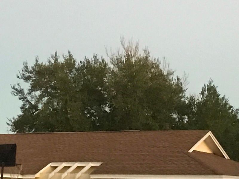
#11310 Postby NDG » Tue Jan 31, 2017 7:01 am

I woke up to no frost at all in my neighborhood, I was expecting light frost at least on the rooftops.

Image
0 likes   

User avatar
northjaxpro
S2K Supporter
S2K Supporter
Posts: 8900
Joined: Mon Sep 27, 2010 11:21 am
Location: Jacksonville, FL

Re: Florida Weather

#11311 Postby northjaxpro » Tue Jan 31, 2017 7:16 am

It got down to 36 degrees here this morning. We escaped the freeze mark here at my house. There was very light frost, mostly on the top of my rooftop of the house and of my car.. Cecil Commerce , the cold drainage spot here in Duval County on Jacksonville's westside, got down to 32 degrees, which appears to be the only spot where it got to the freeze mark this morning.

EDIT: Palatka reported 32 degrees this morning as well. I do not see any other reporting stations across Northeast Florida that reached the freeze mark.
0 likes   
NEVER, EVER SAY NEVER in the tropics and weather in general, and most importantly, with life itself!!

________________________________________________________________________________________

Fay 2008 Beryl 2012 Debby 2012 Colin 2016 Hermine 2016 Julia 2016 Matthew 2016 Irma 2017 Dorian 2019

Patrick99
Category 5
Category 5
Posts: 1770
Joined: Mon May 24, 2004 3:43 pm
Location: SW Broward, FL

Re: Florida Weather

#11312 Postby Patrick99 » Tue Jan 31, 2017 8:17 am

It's been pretty much as expected in Miami. Mid-upper 50s eastern parts of the metro, low 50s west. I'll go ahead and wager that this will essentially be it for us in terms of "significant" cool weather. Looks like a frontal passage around 2/9-2/11, but nothing noteworthy.
0 likes   

User avatar
gatorcane
S2K Supporter
S2K Supporter
Posts: 23691
Age: 47
Joined: Sun Mar 13, 2005 3:54 pm
Location: Boca Raton, FL

Re: Florida Weather

#11313 Postby gatorcane » Tue Jan 31, 2017 12:33 pm

Patrick99 wrote:It's been pretty much as expected in Miami. Mid-upper 50s eastern parts of the metro, low 50s west. I'll go ahead and wager that this will essentially be it for us in terms of "significant" cool weather. Looks like a frontal passage around 2/9-2/11, but nothing noteworthy.


Last couple of runs of the GFS have trended much colder. Latest 12Z run shows two nights of mid 30s down into Central Florida, but as we know, GFS could be overdoing things.

Image
0 likes   

User avatar
gatorcane
S2K Supporter
S2K Supporter
Posts: 23691
Age: 47
Joined: Sun Mar 13, 2005 3:54 pm
Location: Boca Raton, FL

Re: Florida Weather

#11314 Postby gatorcane » Tue Jan 31, 2017 9:19 pm

Well here we go again. You would think I would learn my lesson by now! :double: :cold: :eek:

Image
0 likes   

User avatar
northjaxpro
S2K Supporter
S2K Supporter
Posts: 8900
Joined: Mon Sep 27, 2010 11:21 am
Location: Jacksonville, FL

Re: Florida Weather

#11315 Postby northjaxpro » Tue Jan 31, 2017 10:56 pm

The GFS runs indeed have trended colder since yesterday. This is still 10 days out and a decent chance that this may change a couple of more times. But, it does at least look like we will have at least one more pretty decent shot of cool air in our region by end of next week (2/9 - 2/11-17). We still have +PNA for now, although long range indications are pointing toward West Coast ridging starting to collapse by the middle of February.

500mb heights are quite low on the latest runs out 300 hours as the upper level trough sharpens pretty good across the Eastern CONUS. We should have a better idea just how cold the second weekend of February may get in this area in the next 3-4 days of model runs.
0 likes   
NEVER, EVER SAY NEVER in the tropics and weather in general, and most importantly, with life itself!!

________________________________________________________________________________________

Fay 2008 Beryl 2012 Debby 2012 Colin 2016 Hermine 2016 Julia 2016 Matthew 2016 Irma 2017 Dorian 2019

psyclone
S2K Supporter
S2K Supporter
Posts: 4768
Joined: Wed Aug 24, 2005 9:04 pm
Location: palm harbor fl

Re: Florida Weather

#11316 Postby psyclone » Tue Jan 31, 2017 11:32 pm

we're in a for a week of simply superb weather. Enjoy
0 likes   

User avatar
chaser1
S2K Supporter
S2K Supporter
Posts: 5476
Age: 64
Joined: Sat Oct 15, 2005 5:59 pm
Location: Longwood, Fl

Re: Florida Weather

#11317 Postby chaser1 » Wed Feb 01, 2017 2:53 am

Looks to me that the later we go out in time, the more and more pronounced the 500mb ridge out West becomes. GFS has been pretty locked in on maintaining an overall longwave trough over the E. Conus while really piling up that cold air between Hudson Bay and areas North of Nova Scotia. Naturally here in Florida, it gets harder and harder to experience damaging frost and freeze events as the days become slowly longer and snowpack over the Eastern and Central US recede. That said, id venture to guess that if the mid to long range GFS were to verify that a greater and more prolonged threat of frost damage will exist for much of Florida and possibly into colder locations of S. Florida near and south of Lake 'O. Appears to me that it is quite possible that freezing temps will likely be far more widespread throughout N. Florida and inland areas west and north of the I-4 corridor, than this past air mass brought with it. Potential event timing still looking like around Feb. 9-12 with yet another re-amplification of the 500mb pattern bringing more cold temps to Florida around the 15th. The upper air support along with what appears to be an even further northerly tap of cold air advection around Feb. 10-12 might just chase a lot of Florida snow-birds to the W. U.S. LOL. I think this will largely be the established overall pattern over the CONUS through much of Feb. and into early to middle March.

FWIW, the most recent Arctic Oscillation & Polar Vortex forecast update seem to bear out such a cold scenario for the Eastern U.S. and Florida likely included (link below)

https://www.aer.com/science-research/cl ... scillation
0 likes   
Andy D

(For official information, please refer to the NHC and NWS products.)

User avatar
northjaxpro
S2K Supporter
S2K Supporter
Posts: 8900
Joined: Mon Sep 27, 2010 11:21 am
Location: Jacksonville, FL

Re: Florida Weather

#11318 Postby northjaxpro » Wed Feb 01, 2017 5:02 am

:uarrow: Well, if the PNA can stay positive for a little while longer, then yes I can see a pattern that potentially could lock in for much colder temperatures for much of the Eastern CONUS for February. The problem is we haven't had any sustained possible PNA pattern all winter. PNA has been negative mostly this winter, which has given the West, especially the Pacific NW, among one of the coldest and snowey winters in recent memory.. So, it will be interesting to see if the tleconnections can hold favorable for colder weather to impact the Deep South and give us some semblence of winter weather for February.

But, yes most definitely we will get it appears a decent dump of polar air to drop south next weekend February 9-11.

So, a warm up next week of temps possibly reaching the low 80s here in Jax by middle of next week, before the next cold air snap . The PNA should stay positive at least up to about mid- February. This should allow at least one more potentially decent cold shot to come toward Florida the next 10 days.
0 likes   
NEVER, EVER SAY NEVER in the tropics and weather in general, and most importantly, with life itself!!

________________________________________________________________________________________

Fay 2008 Beryl 2012 Debby 2012 Colin 2016 Hermine 2016 Julia 2016 Matthew 2016 Irma 2017 Dorian 2019

HURRICANELONNY
Category 5
Category 5
Posts: 1383
Joined: Wed May 07, 2003 6:48 am
Location: HOLLYWOOD.FL

Re: Florida Weather

#11319 Postby HURRICANELONNY » Wed Feb 01, 2017 7:50 am

The AO is progged to go negative around then but I've seen that before. If it happens and maybe the NAO goes a little bit negative. Then I'd say a cool shot for down here and cold for north fl.
http://www.cpc.ncep.noaa.gov/products/p ... x/ao.shtml

:roll:
0 likes   
hurricanelonny

psyclone
S2K Supporter
S2K Supporter
Posts: 4768
Joined: Wed Aug 24, 2005 9:04 pm
Location: palm harbor fl

Re: Florida Weather

#11320 Postby psyclone » Wed Feb 01, 2017 9:21 am

I'd bet on a transient shot of cool at best... and the CPC outlooks which average out warm for the timeframe in question would seem to bear that out. While it's too soon to declare victory, Winter and it's associated freeze season are getting wobbly.
0 likes   


Return to “USA & Caribbean Weather”

Who is online

Users browsing this forum: No registered users and 9 guests