Multi-day outbreak of May 25-31
Moderator: S2k Moderators
Forum rules

The posts in this forum are NOT official forecast and should not be used as such. They are just the opinion of the poster and may or may not be backed by sound meteorological data. They are NOT endorsed by any professional institution or STORM2K.
-
WeatherGuesser
- Category 5

- Posts: 2672
- Joined: Tue Jun 29, 2010 6:46 am
-
TwisterFanatic

- Category 5
- Posts: 1041
- Joined: Mon Jun 28, 2010 12:43 pm
- Location: Sallisaw, Oklahoma
Need to watch that cell that is coming into the Anadarko area, it's coming into a very favorable environment for supercells/tornadoes.
0 likes
Personal Forecast Disclaimer:
The posts in this forum are NOT official forecast and should not be used as such. They are just the opinion of the poster and may or may not be backed by sound meteorological data. They are NOT endorsed by any professional institution or storm2k.org. For official information, please refer to the NHC and NWS products.
The posts in this forum are NOT official forecast and should not be used as such. They are just the opinion of the poster and may or may not be backed by sound meteorological data. They are NOT endorsed by any professional institution or storm2k.org. For official information, please refer to the NHC and NWS products.

-
TwisterFanatic
- Category 5
- Posts: 1041
- Joined: Mon Jun 28, 2010 12:43 pm
- Location: Sallisaw, Oklahoma
Storm WSW of Guthrie is beginning to develop a hook echo.
0 likes
Personal Forecast Disclaimer:
The posts in this forum are NOT official forecast and should not be used as such. They are just the opinion of the poster and may or may not be backed by sound meteorological data. They are NOT endorsed by any professional institution or storm2k.org. For official information, please refer to the NHC and NWS products.
The posts in this forum are NOT official forecast and should not be used as such. They are just the opinion of the poster and may or may not be backed by sound meteorological data. They are NOT endorsed by any professional institution or storm2k.org. For official information, please refer to the NHC and NWS products.
-
TwisterFanatic
- Category 5
- Posts: 1041
- Joined: Mon Jun 28, 2010 12:43 pm
- Location: Sallisaw, Oklahoma
And as soon as I post that, a Tornado Warning is issued.
0 likes
Personal Forecast Disclaimer:
The posts in this forum are NOT official forecast and should not be used as such. They are just the opinion of the poster and may or may not be backed by sound meteorological data. They are NOT endorsed by any professional institution or storm2k.org. For official information, please refer to the NHC and NWS products.
The posts in this forum are NOT official forecast and should not be used as such. They are just the opinion of the poster and may or may not be backed by sound meteorological data. They are NOT endorsed by any professional institution or storm2k.org. For official information, please refer to the NHC and NWS products.
-
TwisterFanatic
- Category 5
- Posts: 1041
- Joined: Mon Jun 28, 2010 12:43 pm
- Location: Sallisaw, Oklahoma
860
WFUS54 KOUN 301835
TOROUN
OKC073-083-301915-
/O.NEW.KOUN.TO.W.0047.130530T1835Z-130530T1915Z/
BULLETIN - EAS ACTIVATION REQUESTED
TORNADO WARNING
NATIONAL WEATHER SERVICE NORMAN OK
135 PM CDT THU MAY 30 2013
THE NATIONAL WEATHER SERVICE IN NORMAN HAS ISSUED A
* TORNADO WARNING FOR...
SOUTHEASTERN KINGFISHER COUNTY IN CENTRAL OKLAHOMA...
CENTRAL LOGAN COUNTY IN CENTRAL OKLAHOMA...
* UNTIL 215 PM CDT
* AT 132 PM CDT...NATIONAL WEATHER SERVICE METEOROLOGISTS DETECTED A
SEVERE THUNDERSTORM CAPABLE OF PRODUCING A TORNADO. THIS DANGEROUS
STORM WAS LOCATED 5 MILES WEST OF CASHION...AND MOVING NORTHEAST AT
30 MPH.
IN ADDITION TO A TORNADO...LARGE DAMAGING HAIL UP TO GOLF BALL SIZE
IS EXPECTED WITH THIS STORM.
* LOCATIONS IMPACTED INCLUDE...
GUTHRIE...CRESCENT...CASHION...CIMARRON CITY...CEDAR VALLEY...
NAVINA AND SEWARD.
0 likes
Personal Forecast Disclaimer:
The posts in this forum are NOT official forecast and should not be used as such. They are just the opinion of the poster and may or may not be backed by sound meteorological data. They are NOT endorsed by any professional institution or storm2k.org. For official information, please refer to the NHC and NWS products.
The posts in this forum are NOT official forecast and should not be used as such. They are just the opinion of the poster and may or may not be backed by sound meteorological data. They are NOT endorsed by any professional institution or storm2k.org. For official information, please refer to the NHC and NWS products.
-
TwisterFanatic
- Category 5
- Posts: 1041
- Joined: Mon Jun 28, 2010 12:43 pm
- Location: Sallisaw, Oklahoma
Thinking tornado warning for Anadarko storm soon.
0 likes
Personal Forecast Disclaimer:
The posts in this forum are NOT official forecast and should not be used as such. They are just the opinion of the poster and may or may not be backed by sound meteorological data. They are NOT endorsed by any professional institution or storm2k.org. For official information, please refer to the NHC and NWS products.
The posts in this forum are NOT official forecast and should not be used as such. They are just the opinion of the poster and may or may not be backed by sound meteorological data. They are NOT endorsed by any professional institution or storm2k.org. For official information, please refer to the NHC and NWS products.
-
TwisterFanatic
- Category 5
- Posts: 1041
- Joined: Mon Jun 28, 2010 12:43 pm
- Location: Sallisaw, Oklahoma
KFOR chopper is showing a well defined lowering just SE of Cashion.
0 likes
Personal Forecast Disclaimer:
The posts in this forum are NOT official forecast and should not be used as such. They are just the opinion of the poster and may or may not be backed by sound meteorological data. They are NOT endorsed by any professional institution or storm2k.org. For official information, please refer to the NHC and NWS products.
The posts in this forum are NOT official forecast and should not be used as such. They are just the opinion of the poster and may or may not be backed by sound meteorological data. They are NOT endorsed by any professional institution or storm2k.org. For official information, please refer to the NHC and NWS products.
-
TwisterFanatic
- Category 5
- Posts: 1041
- Joined: Mon Jun 28, 2010 12:43 pm
- Location: Sallisaw, Oklahoma
Rotating wall cloud near Anadarko.
0 likes
Personal Forecast Disclaimer:
The posts in this forum are NOT official forecast and should not be used as such. They are just the opinion of the poster and may or may not be backed by sound meteorological data. They are NOT endorsed by any professional institution or storm2k.org. For official information, please refer to the NHC and NWS products.
The posts in this forum are NOT official forecast and should not be used as such. They are just the opinion of the poster and may or may not be backed by sound meteorological data. They are NOT endorsed by any professional institution or storm2k.org. For official information, please refer to the NHC and NWS products.
-
TwisterFanatic
- Category 5
- Posts: 1041
- Joined: Mon Jun 28, 2010 12:43 pm
- Location: Sallisaw, Oklahoma
New Warning north of Guthrie storm.
109
WFUS54 KTSA 301851
TORTSA
OKC113-117-301930-
/O.NEW.KTSA.TO.W.0031.130530T1851Z-130530T1930Z/
BULLETIN - EAS ACTIVATION REQUESTED
TORNADO WARNING
NATIONAL WEATHER SERVICE TULSA OK
151 PM CDT THU MAY 30 2013
THE NATIONAL WEATHER SERVICE IN TULSA HAS ISSUED A
* TORNADO WARNING FOR...
CENTRAL OSAGE COUNTY IN NORTHEAST OKLAHOMA...
PAWNEE COUNTY IN NORTHEAST OKLAHOMA...
* UNTIL 230 PM CDT
* AT 149 PM CDT...A SEVERE THUNDERSTORM CAPABLE OF PRODUCING A
TORNADO WAS LOCATED 9 MILES WEST OF PAWNEE...MOVING EAST AT 25 MPH.
* SOME LOCATIONS IN OR NEAR THE PATH OF THIS STORM INCLUDE...
PAWNEE...SKEDEE AND BLACKBURN.
PRECAUTIONARY/PREPAREDNESS ACTIONS...
0 likes
Personal Forecast Disclaimer:
The posts in this forum are NOT official forecast and should not be used as such. They are just the opinion of the poster and may or may not be backed by sound meteorological data. They are NOT endorsed by any professional institution or storm2k.org. For official information, please refer to the NHC and NWS products.
The posts in this forum are NOT official forecast and should not be used as such. They are just the opinion of the poster and may or may not be backed by sound meteorological data. They are NOT endorsed by any professional institution or storm2k.org. For official information, please refer to the NHC and NWS products.

20z update
SPC AC 301949
DAY 1 CONVECTIVE OUTLOOK
NWS STORM PREDICTION CENTER NORMAN OK
0249 PM CDT THU MAY 30 2013
VALID 302000Z - 311200Z
...THERE IS A MDT RISK OF SVR TSTMS OVER PORTIONS OF CNTRL AND ERN
OK...
...THERE IS A SLGT RISK OF SVR TSTMS FROM NRN TX NEWD INTO WI...
...NWRN TX...
EXPANDED SLIGHT RISK SWWD ALONG THE FRONT INTO NWRN TX WHERE A CU
FIELD CONTINUES TO INCREASE. SUBSTANTIAL INSTABILITY AND LONG
HODOGRAPHS WILL FAVOR SUPERCELLS CAPABLE OF LARGE HAIL. AN
INCREASING LOW LEVEL JET LATER IN THE EVENING COULD RESULT IN A
TORNADO THREAT AS WELL IF SUPERCELLS REMAIN.
...MUCH OF KS INTO ERN NEB...
REMOVED MUCH OF THE AREA FROM SLIGHT RISK AS THE EARLIER MCS HAS
RESULTED IN COOLER/MORE STABLE CONDITIONS. ACTIVITY TO THE W
ASSOCIATED WITH THE UPPER VORTICITY CENTER AND THERMAL TROUGH WILL
ALLOW FOR A FEW MARGINALLY SEVERE HAIL CORES WITH 5 PERCENT COVERAGE
EXPECTED.
...WRN AR...
EXPANDED HIGHER TORNADO PROBABILITIES INTO THE AREA AS CLUSTERS OF
CELLS CONTINUE TO SHOW SIGNS OF ROTATION. THE MOIST AND UNSTABLE AIR
MASS...AS WELL AS MODERATE SRH WILL CONTINUE TO FAVOR SUPERCELLS
CAPABLE OF HAIL AND A FEW TORNADOES.
..JEWELL.. 05/30/2013
.PREV DISCUSSION... /ISSUED 1126 AM CDT THU MAY 30 2013/
...SYNOPSIS...
A NEGATIVELY TILTED MIDLEVEL TROUGH EXTENDING FROM AN UPPER LOW OVER
THE NRN HIGH PLAINS INTO SRN PLAINS WILL PIVOT NEWD THROUGH THE
MID/UPPER-MS VALLEY IN RESPONSE TO THE PROGRESSION OF
MID/UPPER-LEVEL JET STREAKS THROUGH AND DOWNSTREAM OF THE TROUGH
BASE. THIS LARGE-SCALE PATTERN EVOLUTION WILL CONTRIBUTE TO A
CORRIDOR OF HEIGHT FALLS FROM THE MID-MS/LOWER-MO VALLEYS NEWD INTO
THE UPPER GREAT LAKES WITH HEIGHT RISES ACROSS THE CNTRL/SRN HIGH
PLAINS.
IN THE LOW LEVELS...A SURFACE FRONT EXTENDING FROM AN OCCLUDED LOW
PRESSURE OVER N-CNTRL SD THROUGH CNTRL PARTS OF NEB/KS TO A
SECONDARY LOW OVER N-CNTRL OK WILL SLOWLY ADVANCE EWD. THE SWRN
EXTENSION OF THIS FRONT FROM THE N-CNTRL OK LOW INTO WRN TX WILL
TRANSITION TO A DRYLINE WHICH WILL MIX EWD THROUGH WRN OK AND
W-CNTRL TX TODAY. THE SYNOPTIC COLD FRONT AND DRYLINE ALONG WITH AN
OUTFLOW BOUNDARY SETTLING SWD THROUGH NRN OK WILL LIKELY SERVE AS
THE FOCAL POINTS FOR SEVERE TSTM DEVELOPMENT LATER TODAY.
...SRN PLAINS INTO OZARK PLATEAU THIS AFTERNOON INTO TONIGHT...
THE 12Z OUN SOUNDING SAMPLED A VOLATILE THERMODYNAMIC ENVIRONMENT
FEATURING A 700-500-MB LAPSE RATE IN EXCESS OF 9 C/KM ATOP A
DEEP...MOIST BOUNDARY LAYER WITH A LOWEST-100-MB MEAN MIXING RATIO
OF AROUND 15 G/KG. MIDLEVEL HEIGHT RISES/WARMING WITH THE PASSAGE
OF THE MIDLEVEL TROUGH WILL LESSEN LAPSE RATES IN THE MIDLEVELS
GENERALLY S OF 1-40...THOUGH DAYTIME HEATING SHOULD COMPENSATE WITH
MLCAPE APPROACHING 2500-3000 J/KG BY AFTERNOON S OF OUTFLOW BOUNDARY
AND E OF DRYLINE.
THE TRAILING EXTENSION OF HEIGHT FALLS ATTENDANT TO MIDLEVEL TROUGH
PROGRESSING INTO THE MID-MS VALLEY COUPLED WITH A RELATIVELY WEAK
CAP OBSERVED ON THE 12Z OUN/LZK SOUNDINGS MAY PERMIT ONGOING TSTMS
ACROSS ERN OK TO PERSIST EWD INTO AR...WITH THE NRN EXTENSION OF
THIS REGIME POTENTIALLY MERGING WITH ONGOING MCS OVER CNTRL/ERN KS
INTO WRN MO. THE RISK FOR HAIL AND DAMAGING WINDS WILL EXIST WITH
THE MORE OUTFLOW DOMINANT CONVECTION ASSOCIATED WITH THE MCS...WHILE
ALL FACETS OF SEVERE WEATHER WILL BE POSSIBLE WITH THE STORMS MOVING
INTO AR.
IN THE WAKE OF THIS ACTIVITY...CONDITIONAL UNCERTAINTY EXISTS WITH
REGARD TO STORM DEVELOPMENT ALONG THE DRYLINE OWING TO RISING
MIDLEVEL HEIGHTS THROUGH THE PEAK OF THE DIURNAL HEATING CYCLE. AS
SUCH...STRONG HEATING W OF THE DRYLINE WILL BE THE PRIMARY MECHANISM
FOSTERING ANY STORM DEVELOPMENT. SHOULD ISOLATED STORMS DEVELOP AND
BECOME SUSTAINED...THE COMBINATION OF STRONG AMOUNTS OF INSTABILITY
AND VERTICAL SHEAR WILL SUPPORT INTENSE SUPERCELLS CAPABLE OF VERY
LARGE HAIL AND TORNADOES /POSSIBLY SIGNIFICANT/ ACROSS THE MODERATE
RISK AREA.
...MID-MS VALLEY INTO UPPER MIDWEST THIS AFTERNOON INTO TONIGHT...
ONE OR MULTIPLE BANDS OF TSTMS ARE EXPECTED TO EVOLVE TODAY
DOWNSTREAM FROM KS/WRN MO MCS AS HEIGHT FALLS ACT ON A MOIST AND
MODERATELY UNSTABLE /I.E. MLCAPE VALUES OF 1000-1500 J PER KG/ AIR
MASS. OBSERVED AND FORECAST WIND PROFILES EXHIBIT A VEER-BACK
SIGNATURE WHICH WILL PROMOTE MIXED STORM MODES WITH THE PRIMARY
HAZARD BEING DAMAGING WINDS. HOWEVER...GIVEN THE MOIST...LOW LCL
BOUNDARY LAYER AND MODERATELY STRONG LOW-LEVEL SHEAR...A FEW
TORNADOES WILL BE POSSIBLE WITH EMBEDDED SUPERCELLS AND/OR
LINE-RELATED MESO-VORTICES.
...MID-MO VALLEY THIS AFTERNOON AND EVENING...
RELATIVELY COLD MIDLEVEL TEMPERATURES WILL ALIGN WITH FILTERED
SUNSHINE AND BOUNDARY LAYER DEWPOINTS IN THE 50S TO YIELD POCKETS OF
MODEST DESTABILIZATION THIS AFTERNOON. LOW-LEVEL UPLIFT ALONG THE
COLD FRONT SHOULD BE SUFFICIENT TO INITIATE SCATTERED TSTMS SOME OF
WHICH WILL BE CAPABLE OF SEVERE HAIL.
CLICK TO GET WUUS01 PTSDY1 PRODUCT
NOTE: THE NEXT DAY 1 OUTLOOK IS SCHEDULED BY 0100Z
CURRENT UTC TIME: 1959Z (9:59PM), RELOAD THIS PAGE TO UPDATE THE TIME
0 likes
-
wx247

- S2K Supporter

- Posts: 14279
- Age: 42
- Joined: Wed Feb 05, 2003 10:35 pm
- Location: Monett, Missouri
- Contact:
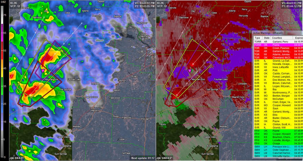
Storms in Arkansas look very good on radar. Impressive rotation on the tornado warned cells, too. Not an area where you can see a tornado until it is too late.
0 likes
Personal Forecast Disclaimer:
The posts in this forum are NOT official forecast and should not be used as such. They are just the opinion of the poster and may or may not be backed by sound meteorological data. They are NOT endorsed by any professional institution or storm2k.org. For official information, please refer to the NHC and NWS products.
The posts in this forum are NOT official forecast and should not be used as such. They are just the opinion of the poster and may or may not be backed by sound meteorological data. They are NOT endorsed by any professional institution or storm2k.org. For official information, please refer to the NHC and NWS products.

Re: Multi-day outbreak for most of this week
It seems like no one is mentioning how widespread this is so far, very different from yesterday for sure. Looking at the national map, huge amounts of discrete activity all over the country and pop corn convection everywhere...the most this year. There are like TOR warnings in 6 different states. 8 TOR warnings now, the outbreak is ramping up.

0 likes

Re: Multi-day outbreak for most of this week
Cyclenall wrote:It seems like no one is mentioning how widespread this is so far, very different from yesterday for sure. Looking at the national map, huge amounts of discrete activity all over the country and pop corn convection everywhere...the most this year. There are like TOR warnings in 6 different states. 8 TOR warnings now, the outbreak is ramping up.
Hm, yeah, i agree on you that storms will intensify, not least the time given, but yesterday i count 12 - 13 counties with warnings at several times.
0 likes
Return to “USA & Caribbean Weather”
Who is online
Users browsing this forum: HurricaneBelle and 69 guests