The kicker is I am going to New Orleans leaving tomorrow morning for the weekend. I am not very concerned, because the storm is hugging land and shouldn't strengthen very much. However things do change and I will keep a close eye on the weather. Of course this is after I win a whole lot of money at Harrah's
ATL: Tropical Depression Fay
Moderator: S2k Moderators
-
crazycajuncane

- S2K Supporter

- Posts: 1097
- Joined: Sun Aug 15, 2004 2:51 pm
- Location: Lafayette, Louisiana
- Contact:
Re: ATL: Tropical Storm Fay in NE GOM
Good ole Rob Perillo local met just seem surprised about the change in the forecast track. Now a night or two ago him and Nelson Robinson seemed to get tired of the storm. They barely mentioned it. Now I just saw that they'll possibly have Tropical Storm force winds in New Orleans. Interesting how the shift in track can change things. Just two nights ago they said we'd get a nice northerly breeze from the storm and now tropical rainbands.
The kicker is I am going to New Orleans leaving tomorrow morning for the weekend. I am not very concerned, because the storm is hugging land and shouldn't strengthen very much. However things do change and I will keep a close eye on the weather. Of course this is after I win a whole lot of money at Harrah's
The kicker is I am going to New Orleans leaving tomorrow morning for the weekend. I am not very concerned, because the storm is hugging land and shouldn't strengthen very much. However things do change and I will keep a close eye on the weather. Of course this is after I win a whole lot of money at Harrah's
0 likes
-
Sean in New Orleans

- Category 5

- Posts: 1794
- Joined: Thu Aug 28, 2003 7:26 pm
- Location: New Orleans, LA 30.0N 90.0W
- Contact:
-
Sabanic

- Category 2

- Posts: 683
- Age: 66
- Joined: Wed Aug 01, 2007 7:01 am
- Location: Mobile, AL
- Contact:
Re: ATL: Tropical Storm Fay in NE GOM
cpdaman wrote:lets see steve lyons and derek ortt say increasing shear for fay (sw shear that is)
you can see her encroaching on some shear as the west edge "flattens out"
now i don't know wether that feature weakens or not but as long as it makes some progress east, the shear will be there
it's like some people can't imagine the storm weakening as it heads near them
as always lets watch what happens
It surely can happen, but it ain't happening right now is it Bro? Just going by what is presently happening. I don't think anyone really wants to put up with much, but she was supposed to be weakening already and it isn't happening.
0 likes
-
MGC

- S2K Supporter
- Posts: 5940
- Joined: Sun Mar 23, 2003 9:05 pm
- Location: Pass Christian MS, or what is left.
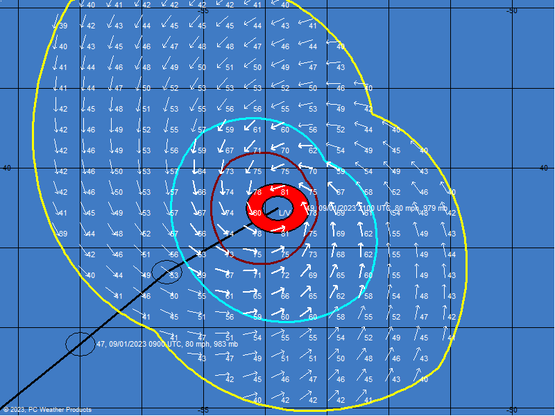
If Fay can continue the westward track and emerge back out over the GOM tomorrow, I think there is a good chance that Fay should remain a TS until landfall along the central GOM coast. This evening, a burst of convection near the circulation center is evident on IR satellite. I would not be surprised if the TS watch is extended westward also. I guess tomorrow we will secure the yard for anything that might blow away.......MGC
Of course the above is MGC's opinion and not an official forecast.
Of course the above is MGC's opinion and not an official forecast.
0 likes
-
Sabanic
- Category 2
- Posts: 683
- Age: 66
- Joined: Wed Aug 01, 2007 7:01 am
- Location: Mobile, AL
- Contact:
Re:
MGC wrote:If Fay can continue the westward track and emerge back out over the GOM tomorrow, I think there is a good chance that Fay should remain a TS until landfall along the central GOM coast. This evening, a burst of convection near the circulation center is evident on IR satellite. I would not be surprised if the TS watch is extended westward also. I guess tomorrow we will secure the yard for anything that might blow away.......MGC
Of course the above is MGC's opinion and not an official forecast.
I agree with you MGC
0 likes
-
crazycajuncane
- S2K Supporter
- Posts: 1097
- Joined: Sun Aug 15, 2004 2:51 pm
- Location: Lafayette, Louisiana
- Contact:
Re:
Sean in New Orleans wrote:Interesting...with the projected path, I could possibly see myself being off of work on Monday. We'll see. Very interesting.
Wow you must have a great job. I know they do things different in New Orleans, but I think tropical storm rain bands wouldn't shut down work in Lafayette. I am planning on leaving New Orleans Monday morning so I hope the weather isn't nasty out there for the drive back.
0 likes
-
Dean4Storms
- S2K Supporter
- Posts: 6358
- Age: 63
- Joined: Sun Aug 31, 2003 1:01 pm
- Location: Miramar Bch. FL
-
Ed Mahmoud
Re: ATL: Tropical Storm Fay in NE GOM
Not an expert on radar, but it looks like the center is on the Northwestern edge of the clear area some think is an eye, and is very close to being on the coast a smidge West of due South of TLH

0 likes
-
CYCLONE MIKE
- Category 5
- Posts: 2183
- Joined: Tue Aug 31, 2004 6:04 pm
- Location: Gonzales, LA
Re: ATL: Tropical Storm Fay in NE GOM
Quick question. Looking at latest sat. loops see some kind of spinning around 30.6n 83.6 w or there abouts. Can anybody tell me what this is? Certainly not any kind of reformation?
0 likes
-
Sean in New Orleans
- Category 5
- Posts: 1794
- Joined: Thu Aug 28, 2003 7:26 pm
- Location: New Orleans, LA 30.0N 90.0W
- Contact:
Re: Re:
crazycajuncane wrote:Sean in New Orleans wrote:Interesting...with the projected path, I could possibly see myself being off of work on Monday. We'll see. Very interesting.
Wow you must have a great job. I know they do things different in New Orleans, but I think tropical storm rain bands wouldn't shut down work in Lafayette. I am planning on leaving New Orleans Monday morning so I hope the weather isn't nasty out there for the drive back.
They have a conference call tomorrow and one on Sunday, so we'll see. But, if we have winds gusting to over 60 mph with heavy squalls, the banks will close. The City of New Orleans will request that people stay off of the streets.
0 likes
-
stormy1970al

- Tropical Storm

- Posts: 158
- Age: 56
- Joined: Sat May 31, 2008 12:54 pm
- Location: Fairhope AL


Re: ATL: Tropical Storm Fay in NE GOM
[quote="wthrman13Well, your comment is kind of rude actually. Do you seriously think I wouldn't be looking at radar? I see the feature people are talking about, I just don't think it is an eye. It's circumstantial structure in the showers. Can you not see that the radar echoes in that feature are rotating considerably slower than the outer rainband? If an eye were to form now, it would form from the contraction of that outer rainband, not inside of it.[/quote]
wxsouth said, "To back up wthrman13...there is no eye! The center of circulation is not even associated with that "eye" you claim is moving onshore in Wakulla County. The center is in the rain free area to the east of Dog/St. George Island...as can be confirmed by doppler velocity data and recon data. This storm has no eye and it doesn't have an inner core...it's not going to intensify significantly."[/quote]
Then, if I understood the Weather Channel correctly, I guess that makes them wrong?
About an hour or so ago, I could have sworn I heard them say the eye was over water and he even pointed to exactly where in the gulf?
Not saying you are incorrect, but you are not in aggreance with TWC, FWIW.
Last edited by bayoubebe on Fri Aug 22, 2008 10:37 pm, edited 2 times in total.
0 likes
-
HurricaneHunter914
- Category 5
- Posts: 4439
- Age: 32
- Joined: Fri Mar 10, 2006 7:36 pm
- Location: College Station, TX

Re: ATL: Tropical Storm Fay in NE GOM
bayoubebe wrote:[quote="wxsouthWell, your comment is kind of rude actually. Do you seriously think I wouldn't be looking at radar? I see the feature people are talking about, I just don't think it is an eye. It's circumstantial structure in the showers. Can you not see that the radar echoes in that feature are rotating considerably slower than the outer rainband? If an eye were to form now, it would form from the contraction of that outer rainband, not inside of it.
wxsouth said, "To back up wthrman13...there is no eye! The center of circulation is not even associated with that "eye" you claim is moving onshore in Wakulla County. The center is in the rain free area to the east of Dog/St. George Island...as can be confirmed by doppler velocity data and recon data. This storm has no eye and it doesn't have an inner core...it's not going to intensify significantly."[/quote]
Then, if I understood the Weather Channel correctly, I guess that makes them wrong?
About an hour or so ago, I could have sworn I heard them say the eye was over water and he even pointed to exactly where in the gulf?
Not saying you are incorrect, but you are not in aggreance with TWC, FWIW.[/quote]
If they are calling it an eye...then I strongly disagree. The center of circulation is over the gulf...and dry air rotating in on the eastern side of the circulation gives the radar appearance of an "eye". Maybe its easier for viewers to understand if they call it an eye. It doesn't really matter in the overall scheme of things.
0 likes
-
Ed Mahmoud
Re: ATL: Tropical Storm Fay in NE GOM
If we're too obnoxious to our pro-mets, and they stop posting, then this is just the Wunderground w/o Dr. Master's putting out the latest update each day...
0 likes
-
Ed Mahmoud
Re: ATL: Tropical Storm Fay in NE GOM
BTW, if I am correct, and the center is on the Northwest corner of the clear area, then it is getting a nice band of convection on its Northern edge.
0 likes
-
srainhoutx

- S2K Supporter
- Posts: 6919
- Age: 68
- Joined: Sun Jan 14, 2007 11:34 am
- Location: Haywood County, NC
- Contact:
Re: ATL: Tropical Storm Fay in NE GOM
Ed Mahmoud wrote:If we're too obnoxious to our pro-mets, and they stop posting, then this is just the Wunderground w/o Dr. Master's putting out the latest update each day...
Well spoken Ed
0 likes
Re: ATL: Tropical Storm Fay in NE GOM
wxsouth wrote:bayoubebe wrote:[quote="wxsouthWell, your comment is kind of rude actually. Do you seriously think I wouldn't be looking at radar? I see the feature people are talking about, I just don't think it is an eye. It's circumstantial structure in the showers. Can you not see that the radar echoes in that feature are rotating considerably slower than the outer rainband? If an eye were to form now, it would form from the contraction of that outer rainband, not inside of it.
wxsouth said, "To back up wthrman13...there is no eye! The center of circulation is not even associated with that "eye" you claim is moving onshore in Wakulla County. The center is in the rain free area to the east of Dog/St. George Island...as can be confirmed by doppler velocity data and recon data. This storm has no eye and it doesn't have an inner core...it's not going to intensify significantly."
Then, if I understood the Weather Channel correctly, I guess that makes them wrong?
About an hour or so ago, I could have sworn I heard them say the eye was over water and he even pointed to exactly where in the gulf?
Not saying you are incorrect, but you are not in aggreance with TWC, FWIW.[/quote]
If they are calling it an eye...then I strongly disagree. The center of circulation is over the gulf...and dry air rotating in on the eastern side of the circulation gives the radar appearance of an "eye". Maybe its easier for viewers to understand if they call it an eye. It doesn't really matter in the overall scheme of things.[/quote]
I thought they said eye, but on second thought, maybe they did say center of circulation.
0 likes

Who is online
Users browsing this forum: No registered users and 58 guests