#143 Postby northjaxpro » Sun Jul 17, 2011 9:41 am
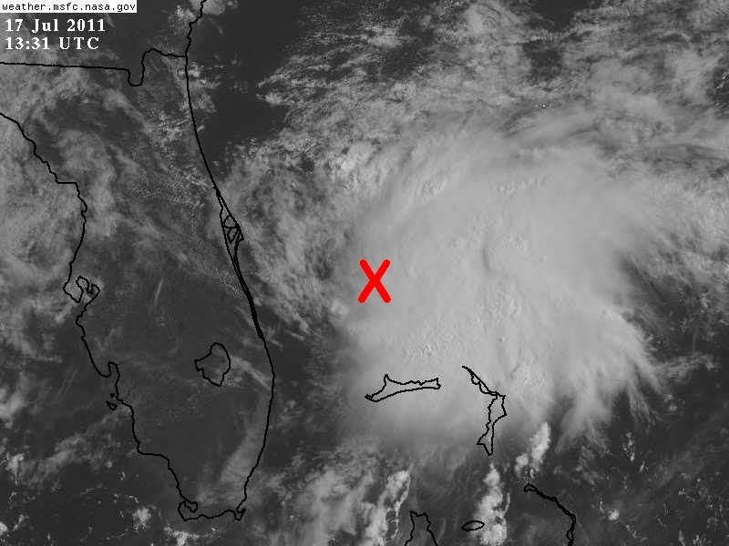
Aric Dunn wrote:NDG wrote:I would put a better getting organized low pressure center at or just below the 28th latitude, conservatively, if not a bit closer to the deep convection.
I am basing this per the latest sat loop and radar loop, but strong vorticity may still be strongest above the surface as we are still not seeing any really surface pressure drops in the area.
http://i20.photobucket.com/albums/b245/ ... o2j3Zb.jpg
Actually I was just about to post something similar. I have it approximately at 27.9 77.8
Aric, observing radar and satellite imagery, those coordinates for a rough center estimate is about right.
I went out for a couple of hours this morning for a jog, came back and see 98L is continuing to look better in its satellite imagery. Really looking forward to the Air Force Recon aircraft flying in to investigate 98L this afternoon. Steering currents are rather weak for the next 48 hours or so and 98L is going to meander around during this time. I think it will definitely have sufficient enough time over water in the short term to develop into a TD or possibly a minimal TS within the next 24 hours or so.
Last edited by
northjaxpro on Sun Jul 17, 2011 9:45 am, edited 1 time in total.
0 likes
NEVER, EVER SAY NEVER in the tropics and weather in general, and most importantly, with life itself!!
________________________________________________________________________________________
Fay 2008 Beryl 2012 Debby 2012 Colin 2016 Hermine 2016 Julia 2016 Matthew 2016 Irma 2017 Dorian 2019


