
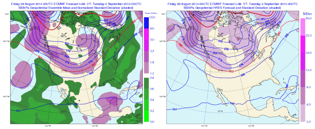
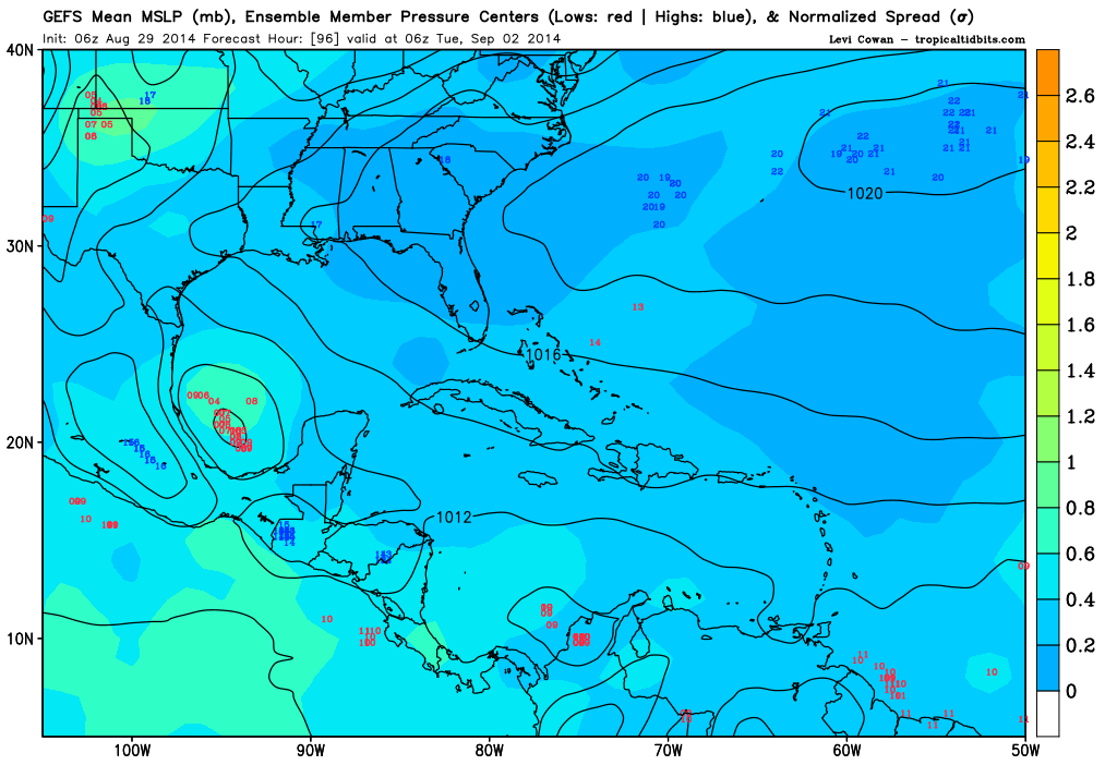
NDG wrote:With King Euro backing away with development of this TW is the reason why the NHC is keeping it with such a low chance.
using the EC for genesis is as dumb as using the CMC. One is on one extreme while the other is on the other
Moderator: S2k Moderators
NDG wrote:With King Euro backing away with development of this TW is the reason why the NHC is keeping it with such a low chance.


NDG wrote:With King Euro backing away with development of this TW is the reason why the NHC is keeping it with such a low chance.


Alyono wrote:NDG wrote:With King Euro backing away with development of this TW is the reason why the NHC is keeping it with such a low chance.
using the EC for genesis is as dumb as using the CMC. One is on one extreme while the other is on the other


Alyono wrote:NDG wrote:With King Euro backing away with development of this TW is the reason why the NHC is keeping it with such a low chance.
using the EC for genesis is as dumb as using the CMC. One is on one extreme while the other is on the other
NDG wrote:Alyono wrote:NDG wrote:With King Euro backing away with development of this TW is the reason why the NHC is keeping it with such a low chance.
using the EC for genesis is as dumb as using the CMC. One is on one extreme while the other is on the other
All I know is that the Euro has performed very well with genesis in the Atlantic this season so far while the GFS has continued to forecast ghost storms one after another one, I guess we can call the Euro lucky in the Atlantic Basin? But I doubt it.
Alyono wrote:NDG wrote:Alyono wrote:
using the EC for genesis is as dumb as using the CMC. One is on one extreme while the other is on the other
All I know is that the Euro has performed very well with genesis in the Atlantic this season so far while the GFS has continued to forecast ghost storms one after another one, I guess we can call the Euro lucky in the Atlantic Basin? But I doubt it.
If you would follow the EC GLOBALLY as I do, you would know that it has developed like 1 out of every 10 TCs. It is the opposite extreme as the CMC

Alyono wrote:If you would follow the EC GLOBALLY as I do, you would know that it has developed like 1 out of every 10 TCs. It is the opposite extreme as the CMC
Users browsing this forum: No registered users and 31 guests

