ATL: CINDY - Post-Tropical - Discussion
Moderator: S2k Moderators
-
Tireman4

- S2K Supporter

- Posts: 5903
- Age: 60
- Joined: Fri Jun 30, 2006 1:08 pm
- Location: Humble, Texas
- Contact:
Re: ATL: CINDY - Recon
Ahh ok. Srain mentioned it. He is tracking on the end for KHOU Weatherboard and for his forecast later this morning.
0 likes
-
fwbbreeze

- S2K Supporter
- Posts: 898
- Joined: Sun Mar 21, 2004 10:09 pm
- Location: Fort Walton Beach, FL
Re: ATL: CINDY - Tropical Storm - Discussion
It was a busy early morning in the Florida Panhandle. These images are from around Fort Walton Beach


Last edited by fwbbreeze on Wed Jun 21, 2017 10:18 am, edited 2 times in total.
3 likes
-
tropicwatch

- Category 5

- Posts: 3426
- Age: 62
- Joined: Sat Jun 02, 2007 10:01 am
- Location: The Villages, Florida
- Contact:
Re: ATL: CINDY - Recon
Actually it is still ongoing.
0 likes
Tropicwatch
Agnes 72', Eloise 75, Elena 85', Kate 85', Charley 86', Florence 88', Beryl 94', Dean 95', Erin 95', Opal 95', Earl 98', Georges 98', Ivan 2004', Arlene 2005', Dennis 2005', Ida 2009' Debby 2012' Irma 2017' Michael 2018'
Agnes 72', Eloise 75, Elena 85', Kate 85', Charley 86', Florence 88', Beryl 94', Dean 95', Erin 95', Opal 95', Earl 98', Georges 98', Ivan 2004', Arlene 2005', Dennis 2005', Ida 2009' Debby 2012' Irma 2017' Michael 2018'

Re: ATL: CINDY - Tropical Storm - Discussion
wxman57 wrote:Just a reminder to keep the discussions civil today. Don't attack anyone for being "wrong" or whatever. If I see any of that I'll force you to endure a REALLY warm winter next December-February. For now, I'll keep my promise of a cold, icy winter for the Deep South.
I called you out a few days ago in this thread for ruining my winter. Don't you dare threaten that again this year!
0 likes
Personal Forecast Disclaimer:
The posts in this forum are NOT official forecast and should not be used as such. They are just the opinion of the poster and may or may not be backed by sound meteorological data. They are NOT endorsed by any professional institution or storm2k.org. For official information, please refer to the NHC and NWS products.
The posts in this forum are NOT official forecast and should not be used as such. They are just the opinion of the poster and may or may not be backed by sound meteorological data. They are NOT endorsed by any professional institution or storm2k.org. For official information, please refer to the NHC and NWS products.
-
Tireman4
- S2K Supporter
- Posts: 5903
- Age: 60
- Joined: Fri Jun 30, 2006 1:08 pm
- Location: Humble, Texas
- Contact:
Re: ATL: CINDY - Tropical Storm - Discussion
wxman57 wrote:Just a reminder to keep the discussions civil today. Don't attack anyone for being "wrong" or whatever. If I see any of that I'll force you to endure a REALLY warm winter next December-February. For now, I'll keep my promise of a cold, icy winter for the Deep South.
Oh man no. Here we go again. Sheesh. The man gets the almost summer of his dreams (Summer 2011..nearly driving Porta insane), no Winters to speak of at all in Houston the past umpteen years and now..more threats. What did ever do to you? LOL....sheesh.....back on topic...umm Wxman 57..did you see the latest recon on winds south of Galveston?
1 likes
-
Nederlander
- S2K Supporter
- Posts: 1259
- Joined: Sat Jul 19, 2008 4:28 pm
- Location: Conroe, TX
Re: ATL: CINDY - Tropical Storm - Discussion
As for the shear relaxing: it could be slightly, but just looking at visible you can see the new convection on the NW side being sheared.
0 likes
-
weatherguy425
- Tropical Storm

- Posts: 180
- Joined: Sun Aug 16, 2009 1:06 pm
- Location: Houston, TX > Lubbock, TX > Savannah, GA
- Contact:
Re: ATL: CINDY - Tropical Storm - Discussion
For what it is worth, shear has definitely relaxed...
http://tropic.ssec.wisc.edu/real-time/w ... d=shr&zoom
http://tropic.ssec.wisc.edu/real-time/w ... d=shr&zoom
0 likes
-
Aric Dunn
- Category 5
- Posts: 21238
- Age: 43
- Joined: Sun Sep 19, 2004 9:58 pm
- Location: Ready for the Chase.
- Contact:
Re: ATL: CINDY - Tropical Storm - Discussion
the gulf is of course not all that deep and upwhelling will become an issue pretty quick. At least in terms of any better organization due to the lower shear ..
0 likes
Note: If I make a post that is brief. Please refer back to previous posts for the analysis or reasoning. I do not re-write/qoute what my initial post said each time.
If there is nothing before... then just ask
Space & Atmospheric Physicist, Embry-Riddle Aeronautical University,
I believe the sky is falling...
If there is nothing before... then just ask
Space & Atmospheric Physicist, Embry-Riddle Aeronautical University,
I believe the sky is falling...
-
weatherguy425
- Tropical Storm
- Posts: 180
- Joined: Sun Aug 16, 2009 1:06 pm
- Location: Houston, TX > Lubbock, TX > Savannah, GA
- Contact:
Re: ATL: CINDY - Tropical Storm - Discussion
Aric Dunn wrote:the gulf is of course not all that deep and upwhelling will become an issue pretty quick. At least in terms of any better organization due to the lower shear ..
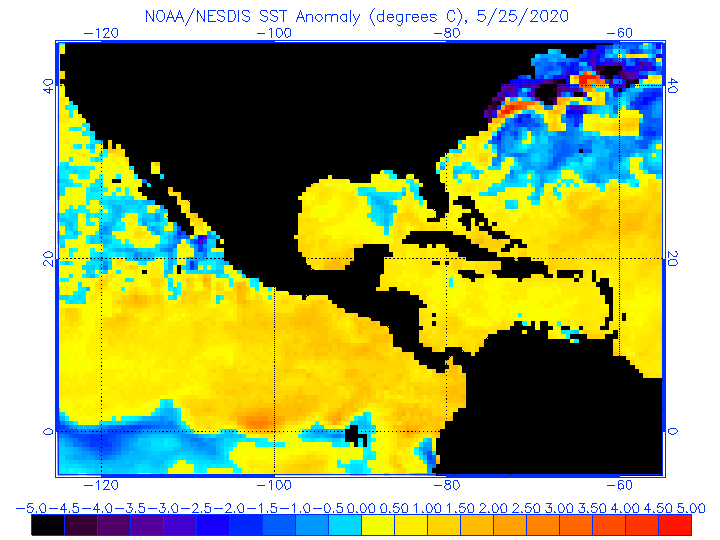
Is the water warm enough to really make a difference? Probably not, but, certainly warmer across the western third or so of the GOM.
0 likes
-
TheStormExpert
Re: ATL: CINDY - Tropical Storm - Discussion
Shear might have relaxed but dry air remains a HUGE issue. This explains why Cindy has taken on a Subtropical look.
1 likes
-
OntarioEggplant
- Category 1

- Posts: 312
- Joined: Sun Aug 07, 2016 11:16 am
Re: ATL: CINDY - Tropical Storm - Discussion
The model inconsistency on Texas impacts is frustrating my forecasting that I have to do for the state. The GFS backed way off of rain totals, but the Euro keeps hanging on to heavier totals as it shows Cindy getting better organized before landfall. I'm leaning towards the Euro with the blowup of storms on the NW side... Could see isolated amounts up to 7 inches for parts of Houston if the Euro ends up being correct. Thinking though maybe 2-5 in general for Houston and slightly less for Beaumont/PA
0 likes
Re: ATL: CINDY - Tropical Storm - Discussion
Disorganized TS here with appears to be multiple vortices swirling around. Never the less, a classic June system impacting the North Gulf Coast and especially the coast of Louisiana.
1 likes
-
sphelps8681
- Category 2

- Posts: 785
- Joined: Thu Aug 16, 2007 5:37 pm
- Location: Somewhere over the rainbow
Re: ATL: CINDY - Tropical Storm - Discussion
Latest from NHC
Tropical Storm Cindy Discussion Number 8
NWS National Hurricane Center Miami FL AL032017
1000 AM CDT Wed Jun 21 2017
Cindy has the overall appearance of a subtropical cyclone this
morning with a convective cluster just northwest of the center and
additional convection in a ragged band well removed from the center
in the eastern semicircle. However, there is more convection near
the center than earlier, so the system remains a tropical cyclone on
this advisory. Regular water vapor imagery and experimental
low-level water vapor imagery from GOES-16 show that a significant
amount of dry air is present just east of the center, and this is
likely disrupting the convective organization. Surface observations
and reports from an Air Force Reserve Hurricane Hunter aircraft show
that the maximum winds have decreased a little and are now near 45
kt. The data also show that the 34-kt wind radii have decreased
over the northeastern quadrant.
The initial motion is now 310/9. There is little change in either
the track forecast philosophy or the track forecast from the
previous advisory. Cindy is expected to turn northward and move
through a break in the mid-level subtropical ridge along the
northwest Gulf of Mexico coast. Later in the forecast period Cindy,
or its remnants, should accelerate northeastward in the westerlies
over the eastern United States.
Given the presence of the dry air near the center and its affects
on the convection, little change in strength is expected before
landfall. Cindy should weaken after landfall and eventually become
absorbed in a frontal system over the eastern United States just
after 72 h.
While the aforementioned dry air is sufficient to keep Cindy from
intensifying, it will do little to reduce the overall rainfall
threat. Heavy rainfall is expected to continue over portions of the
central and eastern Gulf Coast, which could cause life-threatening
flash flooding in some locations. For more information on the
flooding hazard, see products from your local National Weather
Service office and the Weather Prediction Center.
0 likes
-
PTrackerLA

- Category 5
- Posts: 5281
- Age: 42
- Joined: Thu Oct 10, 2002 8:40 pm
- Location: Lafayette, LA
Re: ATL: CINDY - Tropical Storm - Discussion
We're in a major dry slot here in Lafayette and I see no signs of that changing for several hours. The sun keeps breaking out with breezy conditions. Looks like the heaviest rains could fall from Beaumont - Lake Charles with the heavy feeder bands east of New Orleans. We might end up getting very little.
0 likes
-
tropicwatch
- Category 5
- Posts: 3426
- Age: 62
- Joined: Sat Jun 02, 2007 10:01 am
- Location: The Villages, Florida
- Contact:
Re: ATL: CINDY - Tropical Storm - Discussion
I am kind of confused on why they are calling it 310 at 9
Last three vortex messages:
A. Time of Center Fix: 21st day of the month at 11:09:10Z
B. Center Fix Coordinates: 27°22'N 92°13'W (27.3667N 92.2167W)
A. Time of Center Fix: 21st day of the month at 12:01:30Z
B. Center Fix Coordinates: 27°17'N 92°24'W (27.2833N 92.4W)
A. Time of Center Fix: 21st day of the month at 13:51:40Z
B. Center Fix Coordinates: 27°14'N 92°26'W (27.2333N 92.4333W)
0 likes
Tropicwatch
Agnes 72', Eloise 75, Elena 85', Kate 85', Charley 86', Florence 88', Beryl 94', Dean 95', Erin 95', Opal 95', Earl 98', Georges 98', Ivan 2004', Arlene 2005', Dennis 2005', Ida 2009' Debby 2012' Irma 2017' Michael 2018'
Agnes 72', Eloise 75, Elena 85', Kate 85', Charley 86', Florence 88', Beryl 94', Dean 95', Erin 95', Opal 95', Earl 98', Georges 98', Ivan 2004', Arlene 2005', Dennis 2005', Ida 2009' Debby 2012' Irma 2017' Michael 2018'
-
cajungal

- Category 5
- Posts: 2354
- Age: 49
- Joined: Sun Mar 14, 2004 9:34 pm
- Location: Schriever, Louisiana (60 miles southwest of New Orleans)
Re: ATL: CINDY - Tropical Storm - Discussion
PTrackerLA wrote:We're in a major dry slot here in Lafayette and I see no signs of that changing for several hours. The sun keeps breaking out with breezy conditions. Looks like the heaviest rains could fall from Beaumont - Lake Charles with the heavy feeder bands east of New Orleans. We might end up getting very little.
Same here in Thibodaux. We basically have had nothing since about midnight. Sun is peeking through and dead calm here. Wonder if we are going to get anything else
0 likes
Re: ATL: CINDY - Tropical Storm - Discussion
1 likes
-
Hurricane_Apu
- Tropical Storm
- Posts: 124
- Joined: Tue Aug 31, 2004 5:47 pm
Re: ATL: CINDY - Tropical Storm - Discussion
PTrackerLA wrote:We're in a major dry slot here in Lafayette and I see no signs of that changing for several hours. The sun keeps breaking out with breezy conditions. Looks like the heaviest rains could fall from Beaumont - Lake Charles with the heavy feeder bands east of New Orleans. We might end up getting very little.
The center would have to make it all the way to San Antonio to bring the real precip here. It looks like our show is over...
0 likes
-
Stormcenter
- S2K Supporter
- Posts: 6689
- Joined: Wed Sep 03, 2003 11:27 am
- Location: Houston, TX
Re: ATL: CINDY - Tropical Storm - Discussion
Looks like moisture increasing again somewhat on the eastern side of Cindy
http://weather.cod.edu/satrad/exper/?parms=gulf-02-24-1
http://weather.cod.edu/satrad/exper/?parms=gulf-02-24-1
0 likes
-
AJC3

- Admin

- Posts: 4155
- Age: 62
- Joined: Tue Aug 31, 2004 7:04 pm
- Location: Ballston Spa, New York
- Contact:
Re: ATL: CINDY - Tropical Storm - Discussion
panamatropicwatch wrote:I am kind of confused on why they are calling it 310 at 9
Last three vortex messages:
A. Time of Center Fix: 21st day of the month at 11:09:10Z
B. Center Fix Coordinates: 27°22'N 92°13'W (27.3667N 92.2167W)
A. Time of Center Fix: 21st day of the month at 12:01:30Z
B. Center Fix Coordinates: 27°17'N 92°24'W (27.2833N 92.4W)
A. Time of Center Fix: 21st day of the month at 13:51:40Z
B. Center Fix Coordinates: 27°14'N 92°26'W (27.2333N 92.4333W)
They're using a longer term motion for the larger center of the gyre. The shorter term recon fixes, especially with all those multiple low level swirls, can get pretty "jumpy" for lack of a better word.
Edit: I just ball parked a 12 hour motion based on my own analysis, fixing positions at 0315 and 1515 UTC. I came up with 300/7 (27.1N 91.5W T0 27.6N 92.5W). So I would have indicated a more WNW motion since late last night, since 300 is closer to true WNW (292.5) than to true NW (315).
1 likes
Who is online
Users browsing this forum: No registered users and 17 guests