#1586 Postby eastcoastFL » Fri Sep 23, 2022 9:35 pm
caneman wrote:SapphireSea wrote:Bocadude85 wrote:
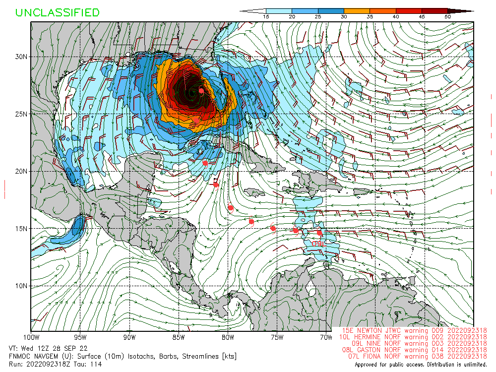
My money is on the further south solutions, how often have we seen systems that are moving NE hook even more to the right then forecast? The westerlies that are forecast across the northern gulf are going to push this to the right. I’m going to say landfall between Everglades City and Ft. Myers as a mid range Cat 3, of course this is just my amateur opinion.
Would probably agree. Seems like there is less differences between GFS and EC that is let on. Big difference from what I can glean is that GFS is weighing heavier on upper layers for steering like a much stronger storm (700-250mb) and it predicts an upper high closer to Florida. The EC is weighing the bit weaker (850mb-500mb) more and has upper ridge a bit further away from Florida.
I think W57 and anyone else that GFS is too left is probably right too. Can see low-level vorticity showing where the trof influence / front is going to be present, and the GFS unrealistically goes through it with minimal shear and no adjustment to the right as would be expected; And doesn't weaken Ian until Big Bend. EC is handling this better and you can see the influence of this zone behave more realistically.
I highly doubt Euro is handling anything better. Its also showing a weaker system. That won't be determined until post cyclone. If anything, NHC has been shifting more to the western solution and I think we'll get another west shift at 11
I don’t know, the GFS has been all over the map so it’s kind of hard to lend too much credence towards it. The NHC seems to be leaning more towards the euro solution for a reason since they began advisories. The trough is obviously going to be a player in the track and the euro depicts it much stronger and keeps it around longer than the GFS does. GFS shows it getting kicked out to sea fairly quickly and then the ridge over Texas starts influencing the system as well making it sorts drift more north for a short period. So it’s anyones guess for now.
I imagine timing will be key for those set ups as well so we have to wait and see how fast it moves across the Caribbean. Then land interaction with Cuba could through a wrench into the final track and timing as well.
4 likes
Personal Forecast Disclaimer:
The posts in this forum are NOT official forecast and should not be used as such. They are just the opinion of the poster and may or may not be backed by sound meteorological data. They are NOT endorsed by any professional institution or storm2k.org. For official information, please refer to the NHC and NWS products.


