
Awesome shot T-man. That's pretty much the way things looked all around Lafourche and St. Charles this morning too.
Steve
Gulf of Mexico (Is Invest 91L)
Moderator: S2k Moderators
Forum rules

The posts in this forum are NOT official forecasts and should not be used as such. They are just the opinion of the poster and may or may not be backed by sound meteorological data. They are NOT endorsed by any professional institution or STORM2K. For official information, please refer to products from the National Hurricane Center and National Weather Service.
-
Stormcenter
- S2K Supporter

- Posts: 6689
- Joined: Wed Sep 03, 2003 11:27 am
- Location: Houston, TX
Re: Gulf of Mexico area
There seems to be a spin basically paralleling the LA. coastline toward the west from what I can see. It will probably be inland before it has a chance to become anything.
http://www.ssd.noaa.gov/goes/east/gmex/loop-vis.html
http://www.ssd.noaa.gov/goes/east/gmex/loop-vis.html
0 likes
-
Category 5

- Category 5

- Posts: 10074
- Age: 36
- Joined: Sun Feb 11, 2007 10:00 pm
- Location: New Brunswick, NJ
- Contact:
Re: Gulf of Mexico area
If they dropped it from the TWO then that means that any chance for development from this has passed. Time to put this one to bed.
Last edited by Category 5 on Tue Jul 29, 2008 2:22 pm, edited 1 time in total.
0 likes
-
Ed Mahmoud
Re: Gulf of Mexico area
Stormcenter wrote:There seems to be a spin basically paralleling the LA. coastline toward the west from what I can see. It will probably be inland before it has a chance to become anything.
http://www.ssd.noaa.gov/goes/east/gmex/loop-vis.html
I doubt it will, but I hope it makes it far enough West to rain on my yard.
0 likes
-
wxman57

- Moderator-Pro Met

- Posts: 23175
- Age: 68
- Joined: Sat Jun 21, 2003 8:06 pm
- Location: Houston, TX (southwest)
Re: Gulf of Mexico area
Pressures have been rising off the LA coast today as the very weak surface trof moved inland. I can see a weak mid-level spin offshore, but convection is quite weak and scattered. Development chances are slim.
0 likes
-
Ed Mahmoud
Re: Gulf of Mexico area
Finally have a few reports of winds with an Easterly component in South Louisiana. (See below- not all the stations that should have an East-ish wind do) If this had happened yesterday, maybe South Louisiana might have gotten a TD or TS out of this.
Might be just a hint of a spin on radar and satellite just offshore of Cocodrie (where I had to change a flat tire while being attacked by horseflies), or a touch West of due South of Port Fourchon.
Probably a case of a little too little, a little too late.
Marsh Island still has a West wind, just offshore, so those East winds North of the apparent center are not unanimous. ie, there probably isn't a surface circulation, and I was fooled by Patterson and LFT, which may be experiencing t-storm outflows.
0 likes
-
Stormcenter
- S2K Supporter
- Posts: 6689
- Joined: Wed Sep 03, 2003 11:27 am
- Location: Houston, TX
Re: Gulf of Mexico area
wxman57 wrote:Pressures have been rising off the LA coast today as the very weak surface trof moved inland. I can see a weak mid-level spin offshore, but convection is quite weak and scattered. Development chances are slim.
Well at least someone else confirms the spin. It's pretty obvious in the lastest vis. loop. I agree the likelihood for development is slim. Thanks for the analysis.
0 likes

Re: Gulf of Mexico area
T-man wrote:Thought you guys might enjoy what the squall looked like as it approached the crescent city this morning. I work nights, and I too watched the light show on the GOM early this morning. A heavy downpour ensued shortly after I took the picture.
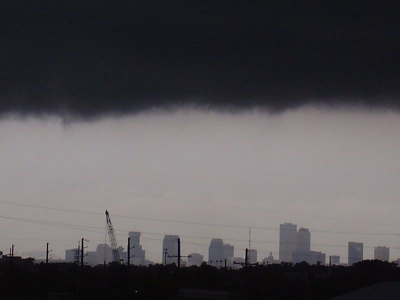
Enjoying the cooling effects of this feature, but it looks to me now to be moving inland. Nice outflow trying to form on the last visible loop image.... post-K I watch everything until the fat lady sings!
Great shot T-Man; glad to see the "cranes in the sky" have finally arrived here in New Orleans.
0 likes
-
wxman57
- Moderator-Pro Met
- Posts: 23175
- Age: 68
- Joined: Sat Jun 21, 2003 8:06 pm
- Location: Houston, TX (southwest)
Re: Gulf of Mexico area
Stormcenter wrote:wxman57 wrote:Pressures have been rising off the LA coast today as the very weak surface trof moved inland. I can see a weak mid-level spin offshore, but convection is quite weak and scattered. Development chances are slim.
Well at least someone else confirms the spin. It's pretty obvious in the lastest vis. loop. I agree the likelihood for development is slim. Thanks for the analysis.
It's always easier to see a mid-level rotation when the convection is dying.
0 likes

T-Man... do you work at the port? It looks like that photo was taken up Tchoupitoulas, correct?
Spent last night at my camp in Buras, La. Lots of rain and thunder last night and early this morning, but not much happening today. Almost no wind, but the break from the heat is certainly welcome.
Spent last night at my camp in Buras, La. Lots of rain and thunder last night and early this morning, but not much happening today. Almost no wind, but the break from the heat is certainly welcome.
0 likes
-
Ed Mahmoud
Re: Gulf of Mexico area
Joe Bastardi has not posted on this blob, and mentioned it all of about 5 seconds in yesterday's video.
A lot of the developments he predicts don't develop, but it is awfully rare for something to develop he didn't predict first.
He didn't predict this, the Canadian didn't predict this, well, odds are very, very remote.
A lot of the developments he predicts don't develop, but it is awfully rare for something to develop he didn't predict first.
He didn't predict this, the Canadian didn't predict this, well, odds are very, very remote.
0 likes
-
tolakram
- Admin

- Posts: 20186
- Age: 62
- Joined: Sun Aug 27, 2006 8:23 pm
- Location: Florence, KY (name is Mark)
Re: Gulf of Mexico area
It's on odd one.
http://rammb.cira.colostate.edu/ramsdis ... is_floater
Really looks like there is something there and moving W, SW, but the floater is moving that direction too so it may be an illusion.
http://rammb.cira.colostate.edu/ramsdis ... is_floater
Really looks like there is something there and moving W, SW, but the floater is moving that direction too so it may be an illusion.
0 likes

Re: Gulf of Mexico area
[quote="Ed Mahmoud"]Joe Bastardi has not posted on this blob, and mentioned it all of about 5 seconds in yesterday's video.
A lot of the developments he predicts don't develop, but it is awfully rare for something to develop he didn't predict first.
He didn't predict this, the Canadian didn't predict this, well, odds are very, very remote.[/quote]
I agree Ed...I think this particular "blob" has missed it's window of opportunity...maybe when the next front comes along Thursday or Friday and digs into the GOM it may have a chance to do something but I agree with you that this particular area of disturbed weather will likely be nothing more than a nice a heat breaker for those folks in Louisiana who have been suffocating the last few days.
0 likes
-
Stormcenter
- S2K Supporter
- Posts: 6689
- Joined: Wed Sep 03, 2003 11:27 am
- Location: Houston, TX
Re: Gulf of Mexico area
tolakram wrote:It's on odd one.
http://rammb.cira.colostate.edu/ramsdis ... is_floater
Really looks like there is something there and moving W, SW, but the floater is moving that direction too so it may be an illusion.
It is a pretty large system and hard to just ignore no matter what it is or is not.
By the way while is still over water anything is possible so don't write is off just yet even
though the possibility is remote.
http://rammb.cira.colostate.edu/ramsdis ... is_floater
0 likes

Re: Gulf of Mexico area
tolakram wrote:It's on odd one.
http://rammb.cira.colostate.edu/ramsdis ... is_floater
Really looks like there is something there and moving W, SW, but the floater is moving that direction too so it may be an illusion.
I don't think its an illusion. I see the MLC moving SW comparing it to the longitude line.
0 likes
-
Ed Mahmoud
Re: Gulf of Mexico area
Double Post alert:
Saw 2 different NWS WSO mention this isn their AFDs, although both thought GFS was too aggressive.
Current Northern GOMEX blob didn't quite make it, maybe the next one can...
12Z GFS predicts sub-tropical cyclone for New Orleans on Monday
Original to this topic: I am away from the PC/S2K and Houston business hours tomorrow, due business trip to Austin. But my lawn needs the rain. Wi$hcasting in full mode for a day like SE Louisiana's in SE Texas tomorrow.
0 likes
-
vbhoutex

- Storm2k Executive
- Posts: 29149
- Age: 74
- Joined: Wed Oct 09, 2002 11:31 pm
- Location: Cypress, TX
- Contact:
Re: Gulf of Mexico area
Definitely not an illusion on the W or WSW movement. The mlc has been moving w-wsw for a couple of days now. Oppurtunity for further development approximately 20% imo. Things just aren't quite right for it, but I never say never. I will say that when Alicia formed, my dad and I had noticed it on the satellites in its' early stages(fam was visiting p's in FL)and my last statement to him as we left to head back to Houston was "watch us have to deal with this a couple of days after we get home" and the rest is history, so I never write these off till they disapate.
0 likes

Re: Gulf of Mexico area
Any chance we'll get some rain in Houston out of this? Certainly looks like it's headed west...
0 likes
Re: Gulf of Mexico area
The only semblance of a surface spiral that I can see is over by Pensacola. And that isn't too hot either.
0 likes
Who is online
Users browsing this forum: pepecool20 and 81 guests