
Here are some USGS water gauge sites for the west Houston area. Yanks - take a look at the one for Langham Creek near W. Little York. It's the gauge right on Hwy 6 near my place. Yikes!
http://waterdata.usgs.gov/usa/nwis/uv?site_no=08072760
http://waterdata.usgs.gov/usa/nwis/uv?site_no=08072700
SE Texas weather thread #2 - Flood watch issued!
Moderator: S2k Moderators
Forum rules

The posts in this forum are NOT official forecast and should not be used as such. They are just the opinion of the poster and may or may not be backed by sound meteorological data. They are NOT endorsed by any professional institution or STORM2K.
-
TexasStooge

- Category 5

- Posts: 38127
- Joined: Tue Mar 25, 2003 1:22 pm
- Location: Irving (Dallas County), TX
- Contact:
Due to flooding and the severe weather Monday, several schools are closed Monday:
- Galveston ISD
- The University of Houston-Downtown
- The University of Houston Main Campus until noon
- Anahuac ISD
- Benji's Charter School
Due to street flooding, Houston ISD spokesman Terry Abbott said some buses are having a hard time getting out this morning, and there are some delays.
SOURCE: KHOU CBS 11
For more updates, go to KHOU.com
0 likes

-
PTrackerLA

- Category 5
- Posts: 5281
- Age: 42
- Joined: Thu Oct 10, 2002 8:40 pm
- Location: Lafayette, LA
-
Yankeegirl

- Category 5
- Posts: 3417
- Age: 50
- Joined: Sun May 23, 2004 11:59 pm
- Location: Cy-Fair, Northwest Houston
- Contact:
-
TexasStooge
- Category 5
- Posts: 38127
- Joined: Tue Mar 25, 2003 1:22 pm
- Location: Irving (Dallas County), TX
- Contact:
I still don't see any live streaming coverage from TV stations, only the NewsRadio stations seem to do all the talking:
KPRC-AM - http://950kprc.com
KTRH-AM - http://ktrh.com/
KNTH-AM - http://1070knth.com/
Yeah, I know, "Like that helps."
KPRC-AM - http://950kprc.com
KTRH-AM - http://ktrh.com/
KNTH-AM - http://1070knth.com/
Yeah, I know, "Like that helps."
Last edited by TexasStooge on Mon Oct 16, 2006 10:48 am, edited 1 time in total.
0 likes
-
Extremeweatherguy

- Category 5
- Posts: 11095
- Joined: Mon Oct 10, 2005 8:13 pm
- Location: Florida
-
Extremeweatherguy
- Category 5
- Posts: 11095
- Joined: Mon Oct 10, 2005 8:13 pm
- Location: Florida
SPC now has our area under a hatched 10% tornado risk area for the rest of the day. The hatching means that strong tornadoes are possible!

what would REALLY be bad is if we got a break and some sun and then had that next system move in from central TX. If that happened, then some big time tornado action would likely be possible this afternoon.
...SERN TX INTO THE LOWER MS RIVER VALLEY...
SUPERCELLS HAVE REMAINED INTENSE WITH PERSISTENT LOW LEVEL ROTATION
FROM THE UPPER TX COAST INTO SRN LA/FAR SRN MS EARLY THIS MORNING...
ESPECIALLY NEAR THE MARINE FRONT. AREA VWP/S SUPPORT MODEL GUIDANCE
IN SUSTAINING VERY STRONG LLJ ACROSS THIS REGION FOR MUCH OF THE
DAY...WITH 11Z WNF PROFILER REVEALING 70 KT WINDS AT 1KM. THIS
LEAVES EXTREME LOW LEVEL SHEAR / EVIDENT THIS MORNING WITH OBSERVED
0-1 KM SRH IN EXCESS OF 400 M2/S2 AT KHGX AND KLCH / OVERSPREADING A
RICH TROPICAL BOUNDARY LAYER CHARACTERIZED BY SURFACE DEW POINTS IN
THE MID/UPPER 70S. WITH DIURNAL HEATING INCREASING POTENTIAL FOR
ROTATING STORMS TO ROOT INTO THIS RICH BOUNDARY LAYER...TORNADO
THREAT WILL REMAIN ENHANCED OVER THE REGION AND ISOLATED SIGNIFICANT
TORNADOES MAY OCCUR. THE LLJ WILL GRADUALLY VEER AND 50-70 KT
MAXIMUM IS FORECAST TO LIFT NNEWD INTO THE TN VALLEY LATER THIS
EVENING. HOWEVER...CONTINUED FEED OF TROPICAL AIR OFF THE GULF
COULD SUSTAIN A TORNADO THREAT ALONG THE GULF COAST FOR MUCH OF THE
PERIOD AS FORECAST SOUNDINGS MAINTAIN SFC-1 KM SRH IN EXCESS OF 150
M2/S2 UNDER 40+ KT SSWLY H85 FLOW THROUGH AT LEAST 06Z TONIGHT.
what would REALLY be bad is if we got a break and some sun and then had that next system move in from central TX. If that happened, then some big time tornado action would likely be possible this afternoon.
0 likes

Yes it does feel tropical with the high moisture content, strong gusty winds, fast moving low clouds. I decided to work at our Clear Lake office rather than go downtown.
0 likes
The following post is NOT an official forecast and should not be used as such. It is just the opinion of the poster and may or may not be backed by sound meteorological data. It is NOT endorsed by any professional institution including storm2k.org For Official Information please refer to the NHC and NWS products.
-
PTrackerLA
- Category 5
- Posts: 5281
- Age: 42
- Joined: Thu Oct 10, 2002 8:40 pm
- Location: Lafayette, LA
Looks like the worst might be over for the Houston metro as the heavy band of storms has shifted north of the city. It will be interesting to see what occurs through the course of the morning around my area as some of the cells are beginning to become tornadic as they move just west of my area. The axis of heavy rain seems to be shifting north from the coastal areas so I'm afraid we might not get enough of the much needed rain out of this. So far we've only had a little over 1/2 inch.
0 likes
-
southerngale

- Retired Staff

- Posts: 27418
- Joined: Thu Oct 10, 2002 1:27 am
- Location: Southeast Texas (Beaumont area)
10% for tornado...dang. I don't recall if/when I've even seen it that high. And here I was analyzing the radar, thinking OK....I see an end in sight. It's gotta get better. I was thinking/hoping they'd drop the severe threat for the rest of the day. I guess I need to read...I still don't know exactly what's supposed to cause the severe threat today. Everything overnight has been from the GOM mess coming ashore.
Edit: PT..I've had about 600 inches as the heavy rains just parked over me all night..I'd be more than happy to share! I can't believe y'all haven't gotten more out of all this. geesh
I literally have a lake in my yard.
Edit: PT..I've had about 600 inches as the heavy rains just parked over me all night..I'd be more than happy to share! I can't believe y'all haven't gotten more out of all this. geesh
I literally have a lake in my yard.
Last edited by southerngale on Mon Oct 16, 2006 8:08 am, edited 1 time in total.
0 likes
-
Extremeweatherguy
- Category 5
- Posts: 11095
- Joined: Mon Oct 10, 2005 8:13 pm
- Location: Florida
2 "official" tornado reports so far. I am sure we will see more added to this list through the day though:
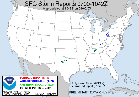
1100 CHINA JEFFERSON TX 3005 9434 TORNADO DESTROYED MOBILE HOMES. TIME APPROXIMATE. REPORTED BY JEFFERSON COUNTY SHERIFF OFFICE. (LCH)
1200 LUMBERTON HARDIN TX 3026 9420 POSSIBLE TORNADO. DEBRIS REPORTED IN THE AIR WITH NUMEROUS TREES DOWN AND OTHER DAMAGE. TIME APPROXIMATE. REPORTED BY KBTV CHANNEL 4 IN BEAUMONT. (LCH)
0 likes
-
jasons2k

- Storm2k Executive

- Posts: 8290
- Age: 52
- Joined: Wed Jul 06, 2005 12:32 pm
- Location: The Woodlands, TX
Whew - what a morning!
Just before I left the house the tronado warning went up just to my SW. I have relatives in town and told them to watch the radar scope.
I was prepared for a parking-lot commute on the Hardy but surprisingly the traffic was very light. I heard on the radio about the next tornado warning - they listed The Woodlands, Oak Ridge, Conroe - etc., so I promptly called home.
I checked GR3 when I got into the office and it looks like the circulation just clipped to the south of the neighborhood. Images coming soon.
Also - Buffalo Bayou at I-45 is very close to coming out of its banks. It's the highest I've seen it since moving back to Houston a year ago...
0 likes
These storms are training right over my area here west of Conroe. I don't know how much rain we have gotten but it's a big time turd floater.
Ok, it just let up but this last cell had some serious wind in it and blinding rain. It looks like alot more moving in from the southwest. I've got 4 inches in rain gauge since yesterday evening.
Ok, it just let up but this last cell had some serious wind in it and blinding rain. It looks like alot more moving in from the southwest. I've got 4 inches in rain gauge since yesterday evening.
0 likes