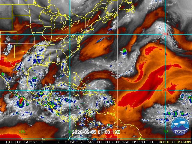
Potentially rainy Labor Day weekend ahead for South Florida particularly Sunday through next week
By Sunday night/Monday morning, the TUTT low becomes reoriented as
it progresses just west of Cuba. A 250 hPa jet streak on the
eastern periphery of this upper low becomes oriented such that a
broad area of upper diffluence (inferred upper divergence) is
draped over a greater portion of South Florida. Furthermore,
several vorticity maxima spawn on the eastern portion of this
upper low and progress northerly towards South Florida. A low-
level response in the wind field manifests, as plentiful moisture
advects over the region in association with a moist tropical
airmass. This could be a concerning synoptic setup for South
Florida, as widespread bouts of showers and storms may develop as
a result of this pattern. Efficient rain processes associated with
a high theta-e tropospheric column may lead to impressive
tropical rain rates. The period of concern may start as early as
Tuesday and extend through the week. Given that this potential
event is still further out in the forecast period, be sure to
monitor and pursue the latest forecast information, as the timing
and impacts of this event are likely to change with an evolving
pattern.
https://forecast.weather.gov/product.ph ... glossary=0