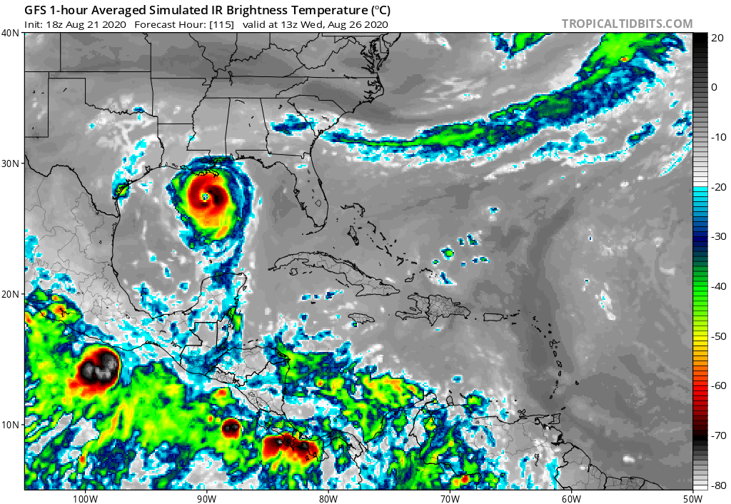
ATL: LAURA - Models

Moderator: S2k Moderators

Message
Author
User avatar
Kazmit
Category 5
Category 5
Posts: 2124
Age: 22
Joined: Mon Jul 25, 2016 8:49 am
Location: Williamsburg, VA / Bermuda

Re: ATL: LAURA - Models

#1681 Postby Kazmit » Fri Aug 21, 2020 5:24 pm

Kingarabian wrote:
shiny-pebble wrote:GFS went from barely a TS to a low end CAT 3/high end CAT 2. There is something seriously wrong with the models if this verifies. We're not even too far out at this point and its flip flopping like crazy.

Sent from my SM-G970U using Tapatalk

This is simply the correction run by the GFS. Unfortunately future runs could end up even stronger.

What is a correction run?
0 likes   
Igor 2010, Sandy 2012, Fay 2014, Gonzalo 2014, Joaquin 2015, Nicole 2016, Humberto 2019

I am only a tropical weather enthusiast. My predictions are not official and may or may not be backed by sound meteorological data. For official information, please refer to the NHC and NWS products.

SunnyThoughts
Category 5
Category 5
Posts: 2263
Joined: Wed Jul 09, 2003 12:42 pm
Location: Pensacola, Florida

Re: ATL: LAURA - Models

#1682 Postby SunnyThoughts » Fri Aug 21, 2020 5:25 pm

BigB0882 wrote:I can’t believe the difference in track from these last runs from what I looked at just this morning. I thought Louisiana was definitely safe from Laura and maybe needed to watch 14. Now it seems the other way around and it’s even possible according to the Euro ensembles this ends up even further west than Louisiana. But scariest of all is that this is looking more and more like it has the chance to absolutely bomb out. Will take everything to come together but the chance is there.


I know what you mean. I woke up this morning thinking we may have to deal with a formidable hurricane ( Laura) here in NW Fla...now it looks as though it may go far west of us here. This is such a unique setup with both systems in the gulf at the same time, Im not sure what to think anymore. The fact neither has really gotten their act together structurally (yet) makes it tougher on the models to predict what will happen in the future imo. I wish everyone good luck..and prepare, because who knows where or how strong for either of these systems.
0 likes   

User avatar
SouthernBreeze
Category 1
Category 1
Posts: 284
Age: 68
Joined: Tue Aug 31, 2004 4:54 pm
Location: SC/NC line- on the SC Coast

Re: ATL: LAURA - Models

#1683 Postby SouthernBreeze » Fri Aug 21, 2020 5:25 pm

No wonder NOAA is giving "best guesse"s too.

Quote from NOAA 5 PM Discussion:
The center is not very easy to see, even on visible or radar
images, but the best guess at an initial motion is 275/15 kt
2 likes   
My posts are NOT official forecast and should not be used as such. It's just my opinion and not backed by sound meteorological data, and NOT endorsed by any professional institution or storm2k.org. For official information, please refer to the NHC and NWS products.

grazed by many - most wind damage: Hugo (pre-cellphone days!) & most water: Floyd

User avatar
toad strangler
S2K Supporter
S2K Supporter
Posts: 4543
Joined: Sun Jul 28, 2013 3:09 pm
Location: Earth
Contact:

Re: ATL: LAURA - Models

#1684 Postby toad strangler » Fri Aug 21, 2020 5:27 pm

Anybody doubting this season should clock out and come back next June. Laura is set up to be a monster and the general track and calendar say Look Out. :eek:
6 likes   

User avatar
Kingarabian
S2K Supporter
S2K Supporter
Posts: 15989
Joined: Sat Aug 08, 2009 3:06 am
Location: Honolulu, Hawaii

Re: ATL: LAURA - Models

#1685 Postby Kingarabian » Fri Aug 21, 2020 5:29 pm

Kazmit wrote:
Kingarabian wrote:
shiny-pebble wrote:GFS went from barely a TS to a low end CAT 3/high end CAT 2. There is something seriously wrong with the models if this verifies. We're not even too far out at this point and its flip flopping like crazy.

Sent from my SM-G970U using Tapatalk

This is simply the correction run by the GFS. Unfortunately future runs could end up even stronger.

What is a correction run?


When a model is wrong for a while then finally gets different information and starts correcting towards other likelier solutions.
3 likes   
RIP Kobe Bryant

User avatar
Hammy
Category 5
Category 5
Posts: 5849
Age: 42
Joined: Fri May 25, 2012 5:25 pm
Contact:

Re: ATL: LAURA - Models

#1686 Postby Hammy » Fri Aug 21, 2020 5:33 pm

DestinHurricane wrote:
cp79 wrote:
DestinHurricane wrote:Euro now on board with development. I'll guess that Euro will keep trending stronger in the next few runs.


Surprised since it has it going through the roughest mountains. Not sure it can survive that. The good news is the trend has been south today, even some flirting with takikg this into Mexico now, so hopefully that trend continues.


As has been stated a thousand times already, land interaction isn't necessarily bad for a weak depression or open wave. It helped Isaias consolidate. Fay 2008 has been referenced several times now.

It shreds already strong storms, not weak waves or depressions.


Depends on the angle of approach and what part of Hispaniola it goes over--for a lot of weaker sheared systems that have come in from the southeast it's been the final nail, systems that go southwest to northeast or skirt the top have been aided in instances where it didn't lead to restricted inflow, particularly faster moving systems.

Depending on what part of Hispaniola it traverses (the southern portion is far more mountainous) will make the difference. The bigger question is if it can stay off of Cuba.

Kingarabian wrote:
shiny-pebble wrote:GFS went from barely a TS to a low end CAT 3/high end CAT 2. There is something seriously wrong with the models if this verifies. We're not even too far out at this point and its flip flopping like crazy.

Sent from my SM-G970U using Tapatalk

This is simply the correction run by the GFS. Unfortunately future runs could end up even stronger.


Are you thinking similarly with the Euro, which also now shows redevelopment in the Gulf?
3 likes   
The above post is not official and should not be used as such. It is the opinion of the poster and may or may not be backed by sound meteorological data. It is not endorsed by any professional institution or storm2k.org. For official information, please refer to the NHC and NWS products.

bella_may
Category 4
Category 4
Posts: 908
Joined: Wed Dec 22, 2010 2:13 pm
Location: SE Mississippi coast

Re: ATL: LAURA - Models

#1687 Postby bella_may » Fri Aug 21, 2020 5:38 pm

Gonna be some long nights of model watching in the next few days
1 likes   

User avatar
Kingarabian
S2K Supporter
S2K Supporter
Posts: 15989
Joined: Sat Aug 08, 2009 3:06 am
Location: Honolulu, Hawaii

Re: ATL: LAURA - Models

#1688 Postby Kingarabian » Fri Aug 21, 2020 5:39 pm

Hammy wrote:Are you thinking similarly with the Euro, which also now shows redevelopment in the Gulf?

Yes. It has started to with its recent 12z run.
1 likes   
RIP Kobe Bryant

AxaltaRacing24
Category 5
Category 5
Posts: 1753
Age: 25
Joined: Wed Jul 27, 2016 11:14 am
Location: Jupiter, FL

Re: ATL: LAURA - Models

#1689 Postby AxaltaRacing24 » Fri Aug 21, 2020 5:41 pm

Kazmit wrote:
Kingarabian wrote:
shiny-pebble wrote:GFS went from barely a TS to a low end CAT 3/high end CAT 2. There is something seriously wrong with the models if this verifies. We're not even too far out at this point and its flip flopping like crazy.

Sent from my SM-G970U using Tapatalk

This is simply the correction run by the GFS. Unfortunately future runs could end up even stronger.

What is a correction run?

what he is trying to say is that the model is finally caving towards the others that showed the stronger solutions. which, means that it was likely incorrect the entire time.
1 likes   

User avatar
gatorcane
S2K Supporter
S2K Supporter
Posts: 23691
Age: 47
Joined: Sun Mar 13, 2005 3:54 pm
Location: Boca Raton, FL

Re: ATL: LAURA - Models

#1690 Postby gatorcane » Fri Aug 21, 2020 5:45 pm

It is one run of the GFS. Remember it showed a CAT 2 into extreme southern Florida a few days back in one of the runs and dropped it. If the LLC can survive land interaction, there is a good chance we can see some intensification in the Gulf. Lots of questions still.
4 likes   

User avatar
Kingarabian
S2K Supporter
S2K Supporter
Posts: 15989
Joined: Sat Aug 08, 2009 3:06 am
Location: Honolulu, Hawaii

Re: ATL: LAURA - Models

#1691 Postby Kingarabian » Fri Aug 21, 2020 5:47 pm

gatorcane wrote:It is one run of the GFS. Remember it showed a CAT 2 into extreme southern Florida a few days back in one of the runs and dropped it. If the LLC can survive land interaction, there is a good chance we can see some intensification in the Gulf. Lots of questions still.

I think the important thing from the 18z run is that the initial GFS fix was close to the NHC's center.

18z Euro runs in about hour. I'm expecting a stronger system as well in its 90 hour forecast period.
1 likes   
RIP Kobe Bryant

3090
Category 2
Category 2
Posts: 549
Age: 65
Joined: Fri Aug 19, 2011 4:01 pm

Re: ATL: LAURA - Models

#1692 Postby 3090 » Fri Aug 21, 2020 5:50 pm

Weaker tropical systems are not affected by the mountainous terrains of land masses. However, stronger more intense hurricanes are affected. In some cases, weaker systems are enhanced by the mountainous terrain, due to frictional forces, to help spin up their organization. It sounds weird, but I heard a few pro mets talking about this today. I am not 100% certain I have provided the most accurate depiction of what their explanation was, but the main point is, lesser systems are not as affected by rougher terrain.
3 likes   

User avatar
gatorcane
S2K Supporter
S2K Supporter
Posts: 23691
Age: 47
Joined: Sun Mar 13, 2005 3:54 pm
Location: Boca Raton, FL

Re: ATL: LAURA - Models

#1693 Postby gatorcane » Fri Aug 21, 2020 5:52 pm

18Z GFS simulated IR. Let us hope it was a one run anomaly:

Image
6 likes   

TheStormExpert

Re: ATL: LAURA - Models

#1694 Postby TheStormExpert » Fri Aug 21, 2020 5:58 pm

The model runs and intensity literally are starting to remind me of Rita in 2005. Assuming the 18z run wasn’t a fluke!
Last edited by TheStormExpert on Fri Aug 21, 2020 5:59 pm, edited 1 time in total.
3 likes   

Fancy1001
Category 1
Category 1
Posts: 452
Joined: Thu Jul 16, 2020 10:16 pm

Re: ATL: LAURA - Models

#1695 Postby Fancy1001 » Fri Aug 21, 2020 5:58 pm

Both Hmon and Hwfr are coming in stronger.
0 likes   

User avatar
HouTXmetro
Category 5
Category 5
Posts: 3949
Joined: Sun Jun 13, 2004 6:00 pm
Location: District of Columbia, USA

Re: ATL: LAURA - Models

#1696 Postby HouTXmetro » Fri Aug 21, 2020 5:59 pm

I am shocked with this latest GFS run, shocked! Is this an outlier or could this actually make it that far west. Is it out of the realm of possibility it trends even further west?
0 likes   
[Disclaimer: My Amateur Opinion, please defer to your local authorities or the NHC for Guidance.]

sphelps8681
Category 2
Category 2
Posts: 785
Joined: Thu Aug 16, 2007 5:37 pm
Location: Somewhere over the rainbow

Re: ATL: LAURA - Models

#1697 Postby sphelps8681 » Fri Aug 21, 2020 6:01 pm

TheStormExpert wrote:The model runs and intensity literally are starting to remind me of Rita in 2005. Assuming the 18z run wasn’t a fluke!


Yes I agree. Just looked back at Rita track and it is quite similar.
0 likes   

User avatar
Audrey2Katrina
Category 5
Category 5
Posts: 4252
Age: 75
Joined: Fri Dec 23, 2005 10:39 pm
Location: Metaire, La.

Re: ATL: LAURA - Models

#1698 Postby Audrey2Katrina » Fri Aug 21, 2020 6:02 pm

gatorcane wrote:18Z GFS simulated IR. Let us hope it was a one run anomaly:

https://i.postimg.cc/JhXNBWhy/gfs-ir-watl-20.png


Good Gravy! Where do they have that heading at that time? Is that Laura?
0 likes   
Flossy 56 Audrey 57 Hilda 64* Betsy 65* Camille 69* Edith 71 Carmen 74 Bob 79 Danny 85 Elena 85 Juan 85 Florence 88 Andrew 92*, Opal 95, Danny 97, Georges 98*, Isidore 02, Lili 02, Ivan 04, Cindy 05*, Dennis 05, Katrina 05*, Gustav 08*, Isaac 12*, Nate 17, Barry 19, Cristobal 20, Marco, 20, Sally, 20, Zeta 20*, Claudette 21 IDA* 21 Francine *24

sphelps8681
Category 2
Category 2
Posts: 785
Joined: Thu Aug 16, 2007 5:37 pm
Location: Somewhere over the rainbow

Re: ATL: LAURA - Models

#1699 Postby sphelps8681 » Fri Aug 21, 2020 6:05 pm

Audrey2Katrina wrote:
gatorcane wrote:18Z GFS simulated IR. Let us hope it was a one run anomaly:

https://i.postimg.cc/JhXNBWhy/gfs-ir-watl-20.png


Good Gravy! Where do they have that heading at that time? Is that Laura?


Yep.
0 likes   

supercane4867
Category 5
Category 5
Posts: 4966
Joined: Wed Nov 14, 2012 10:43 am

Re: ATL: LAURA - Models

#1700 Postby supercane4867 » Fri Aug 21, 2020 6:13 pm

18z HWRF running. I’d be surprised if it doesn’t end up with a CAT5 in the Gulf.
3 likes   


Return to “2020”

Who is online

Users browsing this forum: No registered users and 1 guest