Well Defined Wave off African Coast
Moderator: S2k Moderators
Forum rules

The posts in this forum are NOT official forecasts and should not be used as such. They are just the opinion of the poster and may or may not be backed by sound meteorological data. They are NOT endorsed by any professional institution or STORM2K. For official information, please refer to products from the National Hurricane Center and National Weather Service.


-
HURAKAN

- Professional-Met

- Posts: 46084
- Age: 39
- Joined: Thu May 20, 2004 4:34 pm
- Location: Key West, FL
- Contact:
Re: Organized Wave=8 PM TWO=Development after low emerges
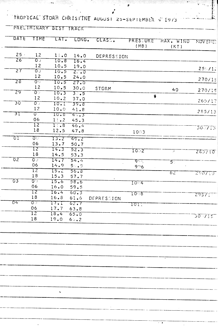
Honeyko wrote:blp wrote:Wow! TS Christine formed as a Depression at 14W over land.
I'm sure that's just a data/typing screw-up...there's no way the NHC would have any way of measuring the profile of a blob over central Niger, and certainly not in 1973.
0 likes


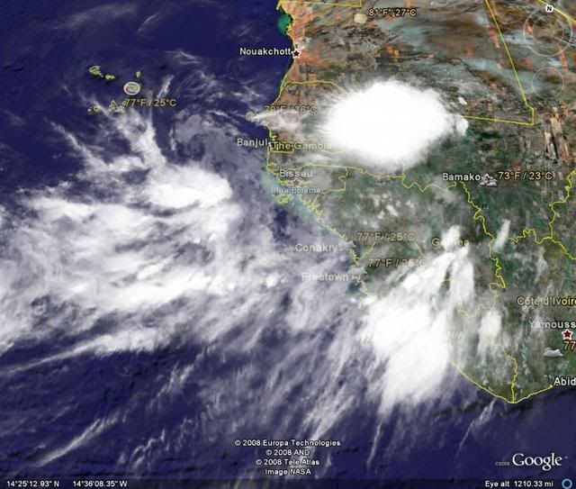
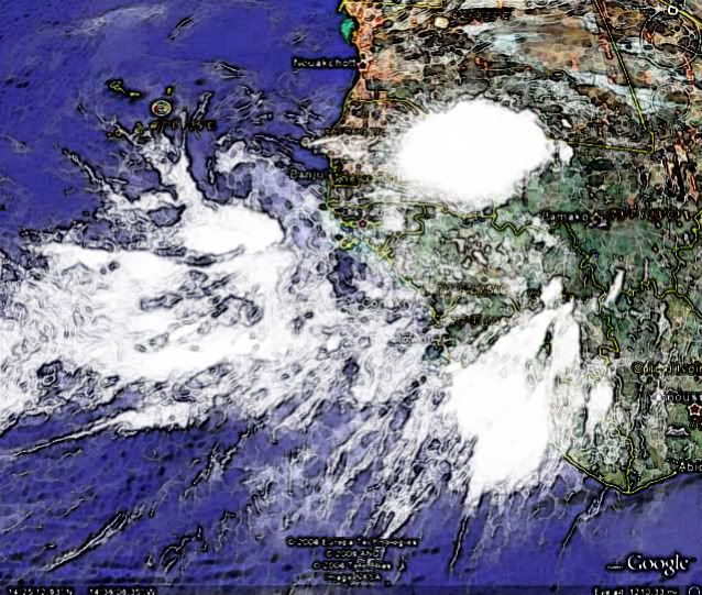

Re: Well Defined Wave about to emerge Africa
Looks like the low might be close to this location. Look at the wind shift below.
Local Observations
http://www.wunderground.com/history/air ... atename=NA
Tambacounda, Senegal
Time (GMT): Sea Level Pressure: Wind Dir: Wind Speed: Gust Speed: Precip: Events: Conditions:
12:00 AM 1013 hPa ENE 18.4 mph / 29.6 km/h / - -
3:00 AM 1010 hPa WSW 6.9 mph / 11.1 km/h / 3.1 m/s - N/A Rain , Thunderstorm Thunderstorms and Rain
0 likes
TROPICAL WEATHER OUTLOOK
NWS TPC/NATIONAL HURRICANE CENTER MIAMI FL
200 AM EDT MON JUL 21 2008
A VIGOROUS AND WELL-DEFINED TROPICAL WAVE IS LOCATED OVER WESTERN
AFRICA A COUPLE HUNDRED MILES EAST OF DAKAR SENEGAL. THIS SYSTEM
HAS THE POTENTIAL TO BECOME A TROPICAL CYCLONE VERY QUICKLY AFTER
IT EMERGES INTO THE EASTERN ATLANTIC WITHIN THE NEXT DAY OR TWO.
$$
FORECASTER PASCH
0 likes
-
americanrebel
Re: Well Defined Wave about to emerge Africa
So is it possible my prediction of 11 am (central time) will be spot on when this will be named Eduardo?
0 likes
-
Mecklenburg
-
Matt-hurricanewatcher
Re: Well Defined Wave about to emerge Africa
I'm really starting to doubt development of this low because of how far north it is coming off. 15 north is to far north period.
I also highly doubt that the nhc will upgrade this as it is coming off.
I also highly doubt that the nhc will upgrade this as it is coming off.
0 likes
-
Mecklenburg
Re: Well Defined Wave about to emerge Africa
Matt-hurricanewatcher wrote:I'm really starting to doubt development of this low because of how far north it is coming off. 15 north is to far north period.
I also highly doubt that the nhc will upgrade this as it is coming off.
it could probably descend to a lower latitude just like Ivan
0 likes

To be honest, I can't see this coming off very far north. It's going to dip to the south-west a bit like the models have been showing.
First % chance that this African Wave will become a:
Tropical Depression: 85%
Tropical Storm: 80%
Hurricane: Unknown %
Category 2, 3, 4, and 5 Hurricane: Unknown %
This is not from any program or scientific formula, this is just my thoughts alone on the %'s.
The following post is NOT an official forecast or product and should not be used as such. It is just the opinion of the poster and may or may not be backed by sound meteorological data. It is NOT endorsed by any professional institution including storm2k.org For Official Information please refer to the NHC and NWS products.
First % chance that this African Wave will become a:
Tropical Depression: 85%
Tropical Storm: 80%
Hurricane: Unknown %
Category 2, 3, 4, and 5 Hurricane: Unknown %
This is not from any program or scientific formula, this is just my thoughts alone on the %'s.
Last edited by Cyclenall on Mon Jul 21, 2008 2:11 am, edited 1 time in total.
0 likes


-
Mecklenburg
Re: Well Defined Wave about to emerge Africa
within how many more hours will this blob emerge into the ocean?
0 likes

-
Mecklenburg
Re: Well Defined Wave about to emerge Africa
hello, can somebody give me a link to the GFDL model website? thnx...
0 likes
Who is online
Users browsing this forum: pepecool20 and 199 guests