ATL: EARL - Post-Tropical - Discussion
Moderator: S2k Moderators
-
Category5Kaiju

- Category 5

- Posts: 4338
- Joined: Thu Dec 24, 2020 12:45 pm
- Location: Seattle during the summer, Phoenix during the winter
Re: ATL: INVEST 91L - Discussion
So how exactly would the story change if the southern lobe becomes more dominant?
0 likes
Unless explicitly stated, all information in my posts is based on my own opinions and observations. Tropical storms and hurricanes can be extremely dangerous. Refer to an accredited weather research agency or meteorologist if you need to make serious decisions regarding an approaching storm.
-
ScottNAtlanta

- Category 5
- Posts: 2535
- Joined: Sat May 25, 2013 3:11 pm
- Location: Atlanta, GA
Re: ATL: INVEST 91L - Discussion
Ok, here is a question/comment. Currently the broad circulation is positively tilted. That would make it more difficult to consolidate vorticity on the north side, correct? You would want it more negatively tilted since the steering flow is westerly.
0 likes
The posts in this forum are NOT official forecast and should not be used as such. They are just the opinion of the poster and may or may not be backed by sound meteorological data. They are NOT endorsed by any professional institution or storm2k.org. For official information, please refer to the NHC and NWS products.
-
skyline385

- Category 5
- Posts: 2728
- Age: 35
- Joined: Wed Aug 26, 2020 11:15 pm
- Location: Houston TX
Re: ATL: INVEST 91L - Discussion
ScottNAtlanta wrote:Ok, here is a question/comment. Currently the broad circulation is positively tilted. That would make it more difficult to consolidate vorticity on the north side, correct? You would want it more negatively tilted since the steering flow is westerly.
Most models seem to think the north lobe will become the center so I am guessing the physics favor it under the current conditions?
Sent from my iPhone using Tapatalk
0 likes
-
Kingarabian

- S2K Supporter

- Posts: 16373
- Joined: Sat Aug 08, 2009 3:06 am
- Location: Honolulu, Hawaii
Re: ATL: INVEST 91L - Discussion
Category5Kaiju wrote:So how exactly would the story change if the southern lobe becomes more dominant?
It's not certain because the steering remains very complex.
Some ensembles in their recent runs show more potential for SECONUS threat if the southern lobe takes over. In fact, model runs that showed 91L getting really close to Florida or stalling over the Bahamas showed the southern lobe being the more dominant one. They've recently switched over to the northern lobe and now most of the models take this OTS. Because the environment remains quite hostile things are far from certain. I think towards the end of this week we'll have a much better idea. OTS is probably favored here per climo, but in La Nina seasons those odds are less.
2 likes
RIP Kobe Bryant
-
ScottNAtlanta
- Category 5
- Posts: 2535
- Joined: Sat May 25, 2013 3:11 pm
- Location: Atlanta, GA
Re: ATL: INVEST 91L - Discussion
skyline385 wrote:ScottNAtlanta wrote:Ok, here is a question/comment. Currently the broad circulation is positively tilted. That would make it more difficult to consolidate vorticity on the north side, correct? You would want it more negatively tilted since the steering flow is westerly.
Most models seem to think the north lobe will become the center so I am guessing the physics favor it under the current conditions?
Sent from my iPhone using Tapatalk
I ask, because generally for an open wave it would not. You would want the northern end in front because it makes cyclonic rotation easier using less energy. That's why the wave the GFS wanted to blow up in the Caribbean didn't develop while it was positively tilted. It is hard to wrap around the energy if the bottom end is out front. It causes it to become more elongated I believe.
0 likes
The posts in this forum are NOT official forecast and should not be used as such. They are just the opinion of the poster and may or may not be backed by sound meteorological data. They are NOT endorsed by any professional institution or storm2k.org. For official information, please refer to the NHC and NWS products.
-
Sciencerocks
- Category 5
- Posts: 10186
- Age: 40
- Joined: Thu Jul 06, 2017 1:51 am

-
AutoPenalti
- Category 5
- Posts: 4091
- Age: 29
- Joined: Mon Aug 17, 2015 4:16 pm
- Location: Ft. Lauderdale, Florida
Re: ATL: INVEST 91L - Discussion
Sciencerocks wrote:Now this is hideous!!! Elongated mess!
https://imagizer.imageshack.com/img923/1676/DXI0QE.gif
Looks to be trying to slingshot to the NE lobe.
0 likes
The posts in this forum are NOT official forecasts and should not be used as such. They are just the opinion of the poster and may or may not be backed by sound meteorological data. They are NOT endorsed by any professional institution or STORM2K. For official information, please refer to products from the NHC and NWS.
Model Runs Cheat Sheet:
GFS (5:30 AM/PM, 11:30 AM/PM)
HWRF, GFDL, UKMET, NAVGEM (6:30-8:00 AM/PM, 12:30-2:00 AM/PM)
ECMWF (1:45 AM/PM)
TCVN is a weighted averaged
-
cycloneye

- Admin

- Posts: 149550
- Age: 69
- Joined: Thu Oct 10, 2002 10:54 am
- Location: San Juan, Puerto Rico
Re: ATL: INVEST 91L - Discussion
AL, 91, 2022082918, , BEST, 0, 147N, 475W, 30, 1008, DB
0 likes
Visit the Caribbean-Central America Weather Thread where you can find at first post web cams,radars
and observations from Caribbean basin members Click Here
and observations from Caribbean basin members Click Here

ATL: INVEST 91L - Models
Just recently, SE Fl was directly in the crosshairs. If I had a nickel for every time they were shown as the focal point of a hurricane landfall and then a recurve happened, I would be rich. Same again today. Here comes the recurve, seemingly, unless things change. My friends down there don’t pay much attention to the crosshairs any more. Not a good idea, though.
1 likes
-
AutoPenalti
- Category 5
- Posts: 4091
- Age: 29
- Joined: Mon Aug 17, 2015 4:16 pm
- Location: Ft. Lauderdale, Florida
ATL: INVEST 91L - Models
sunnyday wrote:Just recently, SE Fl was directly in the crosshairs. If I had a nickel for every time they were shown as the focal point of a hurricane landfall and then a recurve happened, I would be rich. Same again today. Here comes the recurve, seemingly, unless things change. My friends down there don’t pay much attention to the crosshairs any more. Not a good idea, though.
Better to be prepared to be honest.
0 likes
The posts in this forum are NOT official forecasts and should not be used as such. They are just the opinion of the poster and may or may not be backed by sound meteorological data. They are NOT endorsed by any professional institution or STORM2K. For official information, please refer to products from the NHC and NWS.
Model Runs Cheat Sheet:
GFS (5:30 AM/PM, 11:30 AM/PM)
HWRF, GFDL, UKMET, NAVGEM (6:30-8:00 AM/PM, 12:30-2:00 AM/PM)
ECMWF (1:45 AM/PM)
TCVN is a weighted averaged
-
toad strangler

- S2K Supporter
- Posts: 4546
- Joined: Sun Jul 28, 2013 3:09 pm
- Location: Earth
- Contact:
Re: ATL: INVEST 91L - Discussion
Sciencerocks wrote:Now this is hideous!!! Elongated mess!
https://imagizer.imageshack.com/img923/1676/DXI0QE.gif
If near naked swirls are your thing than ya, this looks worse than 92L
0 likes
My Weather Station
https://www.wunderground.com/dashboard/pws/KFLPORTS603
https://www.wunderground.com/dashboard/pws/KFLPORTS603
-
cycloneye
- Admin
- Posts: 149550
- Age: 69
- Joined: Thu Oct 10, 2002 10:54 am
- Location: San Juan, Puerto Rico
Re: ATL: INVEST 91L - Discussion
0 likes
Visit the Caribbean-Central America Weather Thread where you can find at first post web cams,radars
and observations from Caribbean basin members Click Here
and observations from Caribbean basin members Click Here

Re: ATL: INVEST 91L - Discussion
While it is encouraging to see the models have shifted towards turning north before the CONUS, i am hesitant to write this one off just yet.
If this forms further south than expected(very possible), stays weak until near the Bahamas (also possible), and moves a little slower, then it could miss the shortwave trough that is supposed to pull it north...high pressure is likely going to fill in after that short wave system...
Hopefully todays models have a better grip of the big picture and tomorrow and later this week we wont have the windshield wiper effect with possible paths.
4 likes
-
DestinHurricane

- Category 4

- Posts: 935
- Joined: Tue May 01, 2018 8:05 am
- Location: New York, NY
Re: ATL: INVEST 91L - Models
sunnyday wrote:Just recently, SE Fl was directly in the crosshairs. If I had a nickel for every time they were shown as the focal point of a hurricane landfall and then a recurve happened, I would be rich. Same again today. Here comes the recurve, seemingly, unless things change. My friends down there don’t pay much attention to the crosshairs any more. Not a good idea, though.
When one does finally hit as a major, (and it will in our lifetime, trust me) people will be shocked and unprepared.
4 likes
Michael 2018
-
wxman57

- Moderator-Pro Met

- Posts: 23175
- Age: 68
- Joined: Sat Jun 21, 2003 8:06 pm
- Location: Houston, TX (southwest)
Re: ATL: INVEST 91L - Discussion
Excellent agreement between GFS & EC as far as track through day 6. However, GFS is 40mb lower than EC for central pressure. GFS just can't help itself.
3 likes
-
Blown Away

- S2K Supporter
- Posts: 10253
- Joined: Wed May 26, 2004 6:17 am
Re: ATL: INVEST 91L - Discussion
Latest. Appears stationary.
Last edited by Blown Away on Mon Aug 29, 2022 3:01 pm, edited 1 time in total.
0 likes
Hurricane Eye Experience: David 79, Irene 99, Frances 04, Jeanne 04, Wilma 05… Hurricane Brush Experience: Andrew 92, Erin 95, Floyd 99, Matthew 16, Irma 17, Ian 22, Nicole 22…
-
ElectricStorm

- Category 5
- Posts: 5148
- Age: 25
- Joined: Tue Aug 13, 2019 11:23 pm
- Location: Norman, OK
Re: ATL: INVEST 91L - Discussion
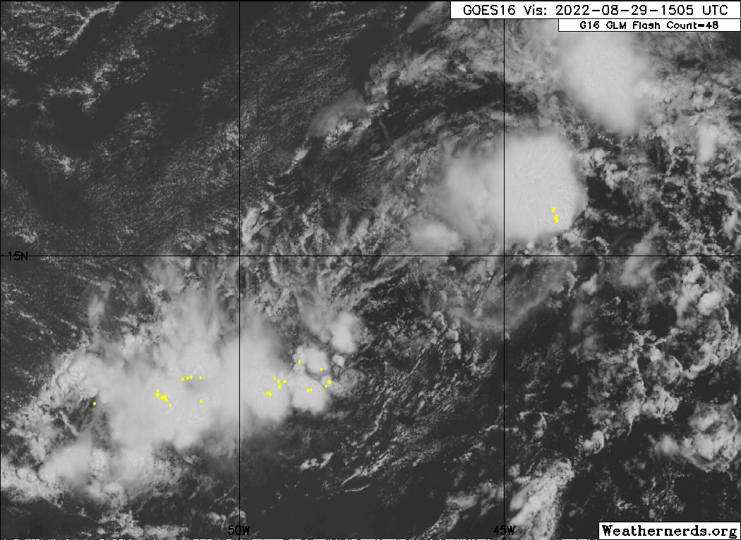
Convection starting to fire closer to the center now. Should still take a few more days to consolidate, then it should get going once it's north of the islands. Pretty much behaving as expected so far.
4 likes
B.S Meteorology, University of Oklahoma '25
Please refer to the NHC, NWS, or SPC for official information.
Please refer to the NHC, NWS, or SPC for official information.
-
Kingarabian
- S2K Supporter
- Posts: 16373
- Joined: Sat Aug 08, 2009 3:06 am
- Location: Honolulu, Hawaii
Re: ATL: INVEST 91L - Discussion
wxman57 wrote:Excellent agreement between GFS & EC as far as track through day 6. However, GFS is 40mb lower than EC for central pressure. GFS just can't help itself.
The Euro has been much more bullish on this than the GFS.
4 likes
RIP Kobe Bryant

Re: ATL: INVEST 91L - Discussion
Kingarabian wrote:Category5Kaiju wrote:So how exactly would the story change if the southern lobe becomes more dominant?
It's not certain because the steering remains very complex.
Some ensembles in their recent runs show more potential for SECONUS threat if the southern lobe takes over. In fact, model runs that showed 91L getting really close to Florida or stalling over the Bahamas showed the southern lobe being the more dominant one. They've recently switched over to the northern lobe and now most of the models take this OTS. Because the environment remains quite hostile things are far from certain. I think towards the end of this week we'll have a much better idea. OTS is probably favored here per climo, but in La Nina seasons those odds are less.
The ULL to the north of the elongated surface circulation should lose its influence fairly soon.
Northern "lobe" has been moving back SW and is now again below 15N where this is likely to consolidate.
The circulation is becoming more symmetrical and if the models were expecting the current ULL to pull the low level center out and north early, this run could be a miss for them.
All the 12Z runs were quite comforting except as you explained the ensemble members that better modeled a TUTT miss.
2 likes
-
Sciencerocks
- Category 5
- Posts: 10186
- Age: 40
- Joined: Thu Jul 06, 2017 1:51 am
Re: ATL: INVEST 91L - Discussion
I am thinking looking at the models that stronger means west and weaker means recurve. Conditions look far more favorable under a stronger ridge that would produce a more westerly track. Irma, Isabel, Andrew, Ike and Dorian are classic examples of this.
If this recurves earlier it may well never become more then a mid end tropical storm. At least until it is moving northeastward out too sea above 30 and then we'll have to see.
If this recurves earlier it may well never become more then a mid end tropical storm. At least until it is moving northeastward out too sea above 30 and then we'll have to see.
0 likes
Who is online
Users browsing this forum: No registered users and 11 guests