SFLcane wrote:chaser1 wrote:
Could be Helene. Lets see if the GFS joins along?
Srongest run yet by the cmc..
https://i.postimg.cc/pXBmp3DN/gggg.gif
The timeline seems to be moving up on the GFS too. Interesting times potentially ahead
Moderator: S2k Moderators


SFLcane wrote:chaser1 wrote:
Could be Helene. Lets see if the GFS joins along?
Srongest run yet by the cmc..
https://i.postimg.cc/pXBmp3DN/gggg.gif


chaser1 wrote:Also, as SFLcane pointed out the 0600Z AIFS run earlier this morning, I had not realized (or probably paid that much attention until now) that this was the 3rd model run in a row where AIFS was depicting this Caribbean feature. Let's see if ICON or GFS jumps aboard. If strong long-range model consistency were to occur, continue AND verify then this late month disturbance may have implications beyond this one potential storm. That level of long range (or frankly "any") model recognition might suggest that Western basin conditions might be becoming increasingly favorable to the extent that models are simply better able to reflect that as we move into October. The other possibilities of course include this modeled disturbance to simply never verify or just be another "one off" within a head scratcher of a season.


zal0phus wrote:Possible Helene concerns me, we all know how warm the WCAR is right now. Do we have any idea about the shear situation down there?
Category5Kaiju wrote:zal0phus wrote:Possible Helene concerns me, we all know how warm the WCAR is right now. Do we have any idea about the shear situation down there?
Except what if the Southeastern US coast system steals that name? And then we get no other storms until this forecast one?
You know where I’m going with this, right?


gatorcane wrote:18Z GFS has it in the long-range.
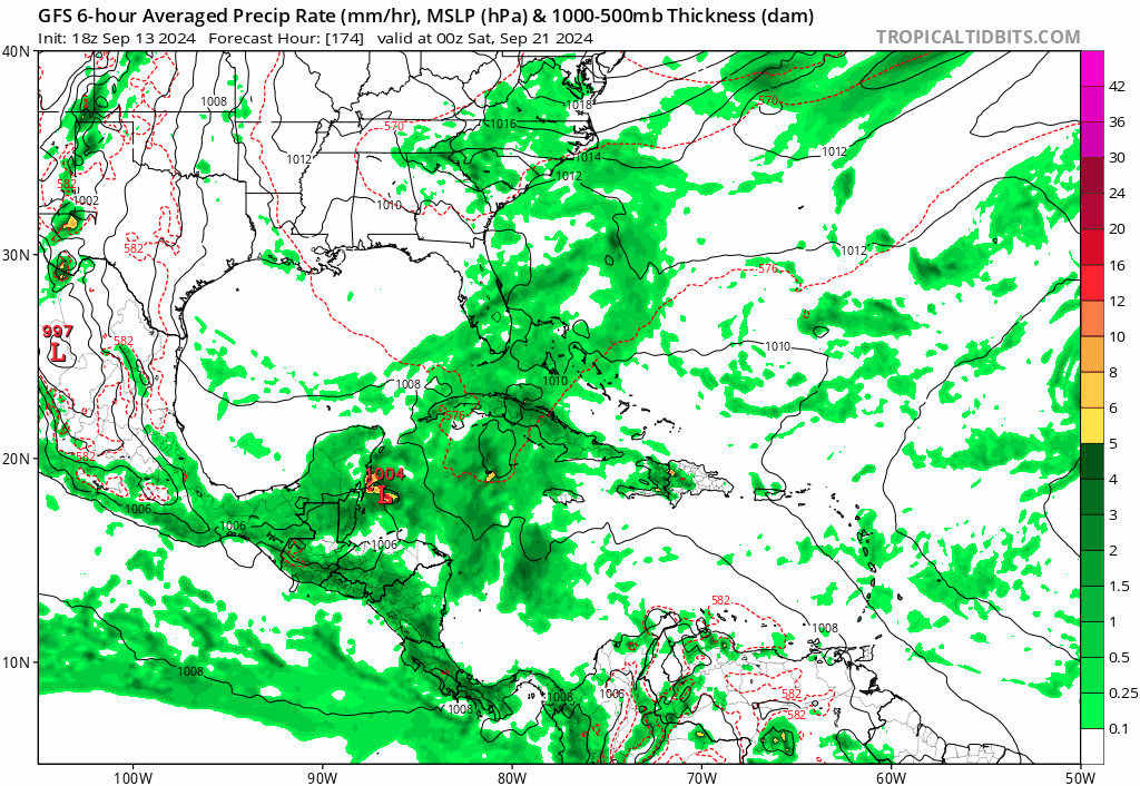
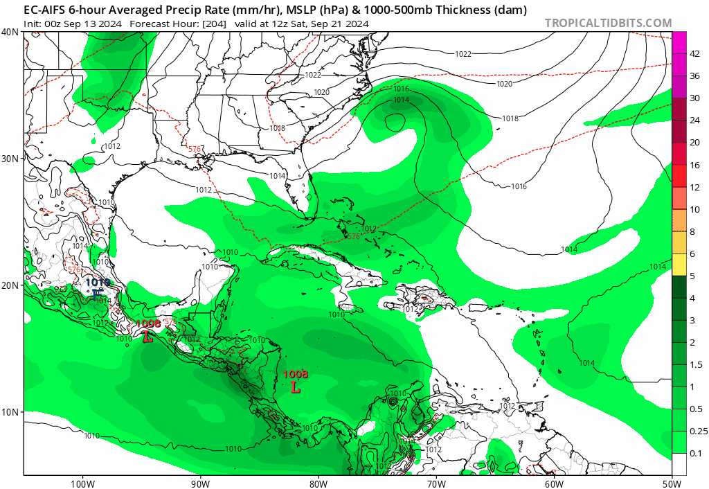
Both the ECMWF and GFS show a substantial weakness over the SE US and Florida in the medium to long-range so anything in the Western Caribbean could get pulled north as the EC-AIFS and GFS are showing:
https://i.postimg.cc/htjvp0K0/gfs-mslp-pcpn-watl-fh174-252.gif
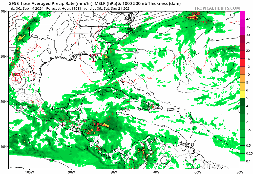
gatorcane wrote:Both the 00Z GFS and 06Z GFS continue to show development in the Western Caribbean with the system getting pulled north, 06Z run below:
https://i.postimg.cc/c46j3hvN/gfs-mslp-pcpn-watl-fh168-246.gif
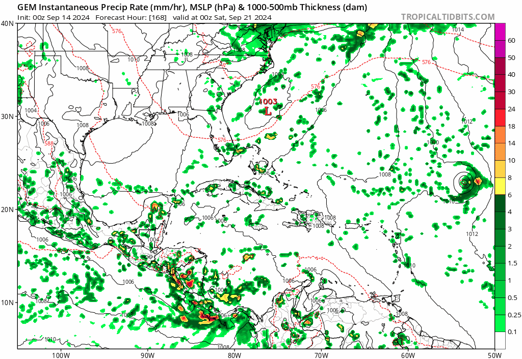
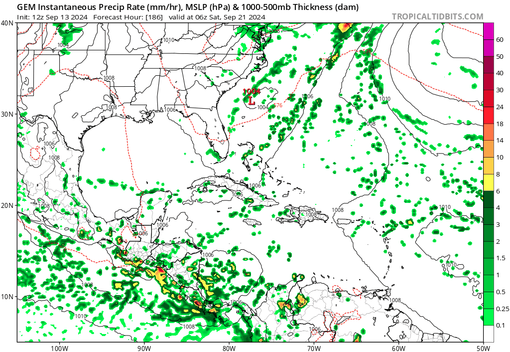
00Z Canadian:
https://i.postimg.cc/4N7rHP0h/gem-mslp-pcpn-watl-fh168-240.gif
jlauderdal wrote:gatorcane wrote:Both the 00Z GFS and 06Z GFS continue to show development in the Western Caribbean with the system getting pulled north, 06Z run below:
https://i.postimg.cc/c46j3hvN/gfs-mslp-pcpn-watl-fh168-246.gif
00Z Canadian:
https://i.postimg.cc/4N7rHP0h/gem-mslp-pcpn-watl-fh168-240.gif
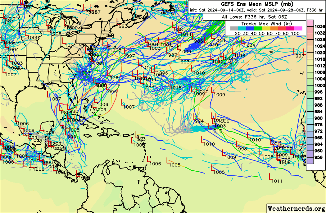
Looks like a textbook late season florida hurricane pattern.
AutoPenalti wrote:Models are sniffing something out down there for sure but I doubt it will be organized.
Users browsing this forum: No registered users and 185 guests


