FLpanhandle91 wrote:That recon about to take off is NOAA'S G-IV upper-level bird (Gonzo). NOAA 42 (Kermit) doesn't take off until 1500CDT.
So that’s roughly 4pm EST, and then it probably won’t get to the eye for another 2 hours. That’s a long wait for a system like this…fingers crossed it catches Milton’s peak.
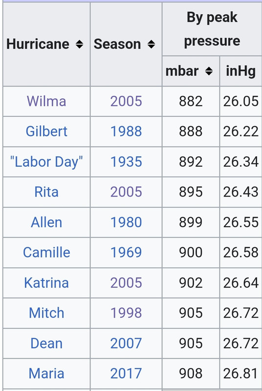
If Milton hasn’t started its modeled EWRC/eyewall meld by then, I think the odds of Kermit finding a sub-900 system are very high. Maybe even sub-890.