TROPICAL WEATHER OUTLOOK
NWS TPC/NATIONAL HURRICANE CENTER MIAMI FL
800 AM EDT WED JUL 22 2009
FOR THE NORTH ATLANTIC...CARIBBEAN SEA AND THE GULF OF MEXICO...
DISORGANIZED SHOWERS AND THUNDERSTORMS SPREADING OVER THE
SOUTHEASTERN BAHAMAS AND HISPANIOLA ADJACENT WATERS ARE ASSOCIATED
WITH A TROPICAL WAVE MOVING TOWARD THE NORTHWEST AT 20 TO 25 MPH.
UPPER-LEVEL WINDS REMAIN UNFAVORABLE FOR DEVELOPMENT DURING THE
NEXT DAY OR SO. THERE IS A LOW CHANCE...LESS THAN 30 PERCENT...OF
THIS SYSTEM BECOMING A TROPICAL CYCLONE DURING THE NEXT 48 HOURS.
DISORGANIZED CLOUDINESS AND THUNDERSTORMS EXTENDING FROM THE
NORTHERN BAHAMAS NORTHWARD INTO THE ATLANTIC FOR SEVERAL HUNDRED
MILES ARE ASSOCIATED WITH A WEAK SURFACE TROUGH. SURFACE PRESSURES
ARE HIGH IN THIS AREA AND THERE ARE NO SIGNS OF ORGANIZATION AT
THIS TIME. THERE IS A LOW CHANCE...LESS THAN 30 PERCENT...OF THIS
SYSTEM BECOMING A TROPICAL CYCLONE DURING THE NEXT 48 HOURS.
ELSEWHERE...TROPICAL CYCLONE FORMATION IS NOT EXPECTED DURING THE
NEXT 48 HOURS.
$$
FORECASTER BEVEN/ROBERTS
somethin around bahamas (just east) RECON SCHED
Moderator: S2k Moderators
Forum rules

The posts in this forum are NOT official forecasts and should not be used as such. They are just the opinion of the poster and may or may not be backed by sound meteorological data. They are NOT endorsed by any professional institution or STORM2K. For official information, please refer to products from the National Hurricane Center and National Weather Service.
-
dolebot_Broward_NW
- Category 2

- Posts: 529
- Joined: Fri Sep 10, 2004 6:38 am
Just saw it on the weather channel on my way out to work, had to stop by the site and see it. No invest yet, but it sure looks impressive to the eye.
Been tracking this wave since it left africa. Seems to be combining with the cold front.
Good thing that blob isnt 50-150 miles west of where it is....otherwise FL wx would be a lot different!
Yesterdays NWS Miami discussion had the wave over us today, despite model guidance and other indicators that it would recurve and sort of get sucked up into the trough.
Last edited by dolebot_Broward_NW on Wed Jul 22, 2009 7:28 am, edited 1 time in total.
0 likes
-
HURAKAN

- Professional-Met

- Posts: 46084
- Age: 39
- Joined: Thu May 20, 2004 4:34 pm
- Location: Key West, FL
- Contact:
Re:
Cyclone1 wrote:Just saw it on the weather channel on my way out to work, had to stop by the site and see it. No invest yet, but it sure looks impressive to the eye.
I agree. Nothing at the surface yet but we need to keep an eye on it.

Latest
0 likes
-
wxman57

- Moderator-Pro Met

- Posts: 23175
- Age: 68
- Joined: Sat Jun 21, 2003 8:06 pm
- Location: Houston, TX (southwest)
Re:
Cyclone1 wrote:Just saw it on the weather channel on my way out to work, had to stop by the site and see it. No invest yet, but it sure looks impressive to the eye.
You're eye is seeing the rotation of an upper-level low near the trailing end of the cold front just north of the Bahamas. At the surface, pressure is relatively high - 1016 to 1018mb. Cannot see any surface rotation on obs.
Such systems can develop into tropical cyclones in a lower shear environment. This one will remain in high shear, though. Will probably become a big frontal low south of Newfoundland and Greenland in a few days as the models are forecasting.
0 likes
-
srainhoutx

- S2K Supporter

- Posts: 6919
- Age: 68
- Joined: Sun Jan 14, 2007 11:34 am
- Location: Haywood County, NC
- Contact:
Re: Re:
wxman57 wrote:Cyclone1 wrote:Just saw it on the weather channel on my way out to work, had to stop by the site and see it. No invest yet, but it sure looks impressive to the eye.
You're eye is seeing the rotation of an upper-level low near the trailing end of the cold front just north of the Bahamas. At the surface, pressure is relatively high - 1016 to 1018mb. Cannot see any surface rotation on obs, and can't even see any surface trof. It's not a surface feature.
Such systems can develop into tropical cyclones in a lower shear environment. This one will remain in high shear, though. Will probably become a big frontal low south of Newfoundland and Greenland in a few days as the models are forecasting.
And the NHC 'may' just classify it just to mess up your office pool as a STS or ETS.
0 likes
-
wxman57
- Moderator-Pro Met
- Posts: 23175
- Age: 68
- Joined: Sat Jun 21, 2003 8:06 pm
- Location: Houston, TX (southwest)
Re: Re:
srainhoutx wrote:
And the NHC 'may' just classify it just to mess up your office pool as a STS or ETS.I do agree though, nothing warm core about this one.
We're ready to go. I think the team are getting bored with the lack of action. Here's a surface plot of the region. Sort of hand-analyzed using PaintShop Pro. If anything should be an invest in the Atlantic, this should be. Nothing left of 97L today. If it was to get going before it passes east of Hatteras, then the NHC may name the low.
Currently, lowest pressure is near Miami, not near the storms.

0 likes
-
srainhoutx
- S2K Supporter
- Posts: 6919
- Age: 68
- Joined: Sun Jan 14, 2007 11:34 am
- Location: Haywood County, NC
- Contact:
Re: somethin around bahamas (just east)
Actually, I was a bit surprised it was not declared an invest yesterday. Certaily looked better than 97L did. Today is another day. Keep the "team" calm. The "season" is just getting started. 
0 likes
Re: somethin around bahamas (just east)
Outflow is good to the NW-E - seems to be something to keep an eye on for those who live in NC:
http://www.goes.noaa.gov/HURRLOOPS/huirloop.html
http://www.goes.noaa.gov/HURRLOOPS/huirloop.html
0 likes
-
WeatherLovingDoc

- S2K Supporter
- Posts: 453
- Joined: Fri Sep 05, 2008 10:08 pm
- Location: Washington D.C.
Re: somethin around bahamas (just east)
Little choice where to go:
http://www.atmos.washington.edu/images/fronts-ire/2009072212.gif
Not a prediction or forecast, amateur weather observer here!
http://www.atmos.washington.edu/images/fronts-ire/2009072212.gif
Not a prediction or forecast, amateur weather observer here!
0 likes
-
TropicalWXMA

- Tropical Storm

- Posts: 114
- Joined: Wed May 18, 2005 9:22 pm
- Location: Boston, MA
- Contact:
Re: somethin around bahamas (just east)
It definitely looks like it's trying to do something down there...
http://www.ssec.wisc.edu/data/east/anim ... astwv.html
http://www.ssec.wisc.edu/data/east/anim ... astwv.html
0 likes
-
senorpepr

- Military Met/Moderator

- Posts: 12542
- Age: 43
- Joined: Fri Aug 22, 2003 9:22 pm
- Location: Mackenbach, Germany
- Contact:
NOUS42 KNHC 221445
WEATHER RECONNAISSANCE FLIGHTS
CARCAH, NATIONAL HURRICANE CENTER, MIAMI, FL.
1045 AM EDT WED 22 JULY 2009
SUBJECT: TROPICAL CYCLONE PLAN OF THE DAY (TCPOD)
VALID 23/1100Z TO 24/1100Z JULY 2009
TCPOD NUMBER.....09-055
I. ATLANTIC REQUIREMENTS
1. SUSPECT AREA (OFF CAROLINA COAST)
FLIGHT ONE - TEAL 70
A. 23/1800Z
B. AFXXX 01AAA INVEST
C. 23/1530Z
D. 34.0N 75.0W
E. 23/1745Z TO 22/2200Z
F. SFC TO 10,000 FT
FLIGHT TWO - TEAL 71
A. 24/1200Z, 1800Z
B. AFXXX 0202A CYCLONE
C. 24/0830Z
D. 40.0N 71.0W
E. 24/1130Z TO 24/1730Z
F. SFC TO 10,000 FT
2. OUTLOOK FOR SUCCEEDING DAY.....NEGATIVE.
3. REMARKS: NOAA AOC MAY BEGIN A SERIES OF RESEARCH
MISSIONS JUST EAST OF GRAND BAHAMA ISLAND AT 23/2000Z.
BOTH A P-3 (NOAA 43) AND THE G-IV (NOAA 49) WOULD
PARTICIPATE WITH A TAKEOFF PLANNED FOR EVERY 12 HOURS.
OPERATING ALTITUDES: G-IV 41,000 TO 45,000 FT.
P-3 8,000 TO 10,000 FT.
II. PACIFIC REQUIREMENTS
1. NEGATIVE RECONNAISSANCE REQUIREMENTS.
2. SUCCEEDING DAY OUTLOOK.....NEGATIVE.
JWP
0 likes
-
Dean4Storms
- S2K Supporter
- Posts: 6358
- Age: 63
- Joined: Sun Aug 31, 2003 1:01 pm
- Location: Miramar Bch. FL
-
wxman57
- Moderator-Pro Met
- Posts: 23175
- Age: 68
- Joined: Sat Jun 21, 2003 8:06 pm
- Location: Houston, TX (southwest)
Re: somethin around bahamas (just east) RECON SCHED
Here's a recent analysis. Pressures in the thunderstorm area in the 1017-1020mb range. Lowest pressure is south of Florida (1014-1015mb). Just a tropical wave interacting with an upper low and the trailing end of a front in a high shear environment for now. Will very likely form a surface low center over the next 24-48 hours as it tracks off the east U.S. coast along the front. More of a frontal low than a TC, but the NHC could decide it warrants a name before it heads off to Newfoundland/Greenland in 3-4 days.
Interesting that NHC talks about possible recon for a system that isn't even an invest:

Interesting that NHC talks about possible recon for a system that isn't even an invest:
0 likes


Re: somethin around bahamas (just east) RECON SCHED
Looks like a little naked twist off the coast of Miami near where 57 said the lowest pressures were, that would put it in a pocket air and heading inland from the looks of Vis. loop.
http://weather.msfc.nasa.gov/GOES/goeseastconus.html
dry air
http://www.ssd.noaa.gov/goes/east/gmex/wv-l.jpg
Other than that little swirl I don't see any vorticity except with the Mid and Upper level low just off the coast of FLA.
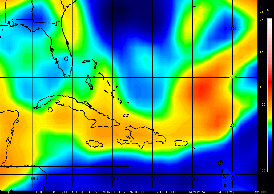
http://cimss.ssec.wisc.edu/tropic2/real ... 8vor1Z.GIF
http://weather.msfc.nasa.gov/GOES/goeseastconus.html
dry air
http://www.ssd.noaa.gov/goes/east/gmex/wv-l.jpg
Other than that little swirl I don't see any vorticity except with the Mid and Upper level low just off the coast of FLA.
http://cimss.ssec.wisc.edu/tropic2/real ... 8vor1Z.GIF
0 likes
-
wxman57
- Moderator-Pro Met
- Posts: 23175
- Age: 68
- Joined: Sat Jun 21, 2003 8:06 pm
- Location: Houston, TX (southwest)
Re: somethin around bahamas (just east) RECON SCHED
tailgater wrote:Looks like a little naked twist off the coast of Miami near where 57 said the lowest pressures were, that would put it in a pocket air and heading inland from the looks of Vis. loop.
http://weather.msfc.nasa.gov/GOES/goeseastconus.html
dry air
http://www.ssd.noaa.gov/goes/east/gmex/wv-l.jpg
Other than that little swirl I don't see any vorticity except with the Mid and Upper level low just off the coast of FLA.
http://cimss.ssec.wisc.edu/tropic2/real ... 8vor1Z.GIF
That's nothing of concern by Miami, just some very small cumulus clouds in stable air. Any surface low would form east of the upper low near the convection. No signs of that yet.
0 likes
-
Ed Mahmoud
Re: somethin around bahamas (just east) RECON SCHED
With a little help from NASA satellite page baking powder...
Home made visible floater loop of Bahamas (sub)tropical disturbance.
Home made visible floater loop of Bahamas (sub)tropical disturbance.
0 likes
-
floridasun78
- Category 5

- Posts: 3755
- Joined: Sun May 17, 2009 10:16 pm
- Location: miami fl
-
wxman57
- Moderator-Pro Met
- Posts: 23175
- Age: 68
- Joined: Sat Jun 21, 2003 8:06 pm
- Location: Houston, TX (southwest)
Re: somethin around bahamas (just east) RECON SCHED
I made a color loop of the region. No organization. Pressures appear to be rising, actually:
http://myweb.cableone.net/nolasue/FloaterLoop.gif
http://myweb.cableone.net/nolasue/FloaterLoop.gif
0 likes