Drought-how will it affect the upcoming hurricane season?
Moderator: S2k Moderators
Forum rules

The posts in this forum are NOT official forecasts and should not be used as such. They are just the opinion of the poster and may or may not be backed by sound meteorological data. They are NOT endorsed by any professional institution or STORM2K. For official information, please refer to products from the National Hurricane Center and National Weather Service.

-
Stephanie

- S2K Supporter

- Posts: 23843
- Age: 63
- Joined: Thu Feb 06, 2003 9:53 am
- Location: Glassboro, NJ
I've been thinking about the relationship between droughts and hurricane seasons lately as well. All of PA is under a drought watch. It looked like today we would get some decent rain here in South Jersey, but I don't know what the heck happened. Things were just DAMP when I got home and I didn't see any puddles to speak of. We are about 5 inches below normal in precipitation for this year.
Anyway, whenever we've been in a drought situation we've generally been saved by it by a tropical system of sorts. I'm wondering if the relationship is really due to the La Nina weather pattern and not a coincidence.
The Mid Atlantic IS DUE for a hurricane. The last one we did have come close to us was Isabel, which fortunately was a shell of her original formidable strength.
Noone should let their guard down during any hurricane season. I just hope though that the Gulf Coast is spared this year.
0 likes
-
Jim Cantore
-
CHRISTY
well form what i know during LA NINA years the JET STREAM rides up north preventing any weather system to get to the south east.what i mean is the southeast is under a huge dome of high pressure.i really think u can't relate drought conditions with what might be setting up this year.Stephanie wrote:I've been thinking about the relationship between droughts and hurricane seasons lately as well. All of PA is under a drought watch. It looked like today we would get some decent rain here in South Jersey, but I don't know what the heck happened. Things were just DAMP when I got home and I didn't see any puddles to speak of. We are about 5 inches below normal in precipitation for this year.
Anyway, whenever we've been in a drought situation we've generally been saved by it by a tropical system of sorts. I'm wondering if the relationship is really due to the La Nina weather pattern and not a coincidence.
The Mid Atlantic IS DUE for a hurricane. The last one we did have come close to us was Isabel, which fortunately was a shell of her original formidable strength.
Noone should let their guard down during any hurricane season. I just hope though that the Gulf Coast is spared this year.
0 likes
-
terstorm1012

- S2K Supporter
- Posts: 1314
- Age: 44
- Joined: Fri Sep 10, 2004 5:36 pm
- Location: Millersburg, PA
Hurricane Floyd wrote:AussieMark wrote:Extremeweatherguy wrote:The bad thing is that hurricanes sometimes seem to target the drought-stricken areas, and sadly those areas look to be along the Gulf coast this year...especially in Texas. Because of this, I am worried that we will see another record breaking Gulf coast season.
I think in 1999 a lot of Midatlantic was in drought during the spring and summer then came Dennis and Floyd
and we know what happened after that
yes we were in a drought, Floyd ended it pretty much everywhere.
Floyd AND Dennis
Isabel and Bertha/Fran came in wet years so the correlation may be coincidental about drought and mid-Atlantic hurricane hits, but 1954's Carol, Hazel and Edna came during a dry year.
0 likes
-
terstorm1012
- S2K Supporter
- Posts: 1314
- Age: 44
- Joined: Fri Sep 10, 2004 5:36 pm
- Location: Millersburg, PA
Stephanie wrote:I've been thinking about the relationship between droughts and hurricane seasons lately as well. All of PA is under a drought watch. It looked like today we would get some decent rain here in South Jersey, but I don't know what the heck happened. Things were just DAMP when I got home and I didn't see any puddles to speak of. We are about 5 inches below normal in precipitation for this year.
Anyway, whenever we've been in a drought situation we've generally been saved by it by a tropical system of sorts. I'm wondering if the relationship is really due to the La Nina weather pattern and not a coincidence.
The Mid Atlantic IS DUE for a hurricane. The last one we did have come close to us was Isabel, which fortunately was a shell of her original formidable strength.
Noone should let their guard down during any hurricane season. I just hope though that the Gulf Coast is spared this year.
It is interesting that you guys down that way are dryer than we are given the coastal areas got way more snow then we did in the mid-state. The blizzard in February barely touched us.
0 likes
-
terstorm1012
- S2K Supporter
- Posts: 1314
- Age: 44
- Joined: Fri Sep 10, 2004 5:36 pm
- Location: Millersburg, PA
Stephanie wrote:We just didn't anymore significant snow/precipitation between the December storm and February.
Ahh that makes sense. Same here more or less. We only received about 18" of snow this year at Harrisburg Int'l Airport. York received a foot and a half more or more because of the February storm, and it's just 30 miles away from here, but they're in the same drought situation.
0 likes


This is just food for thought...
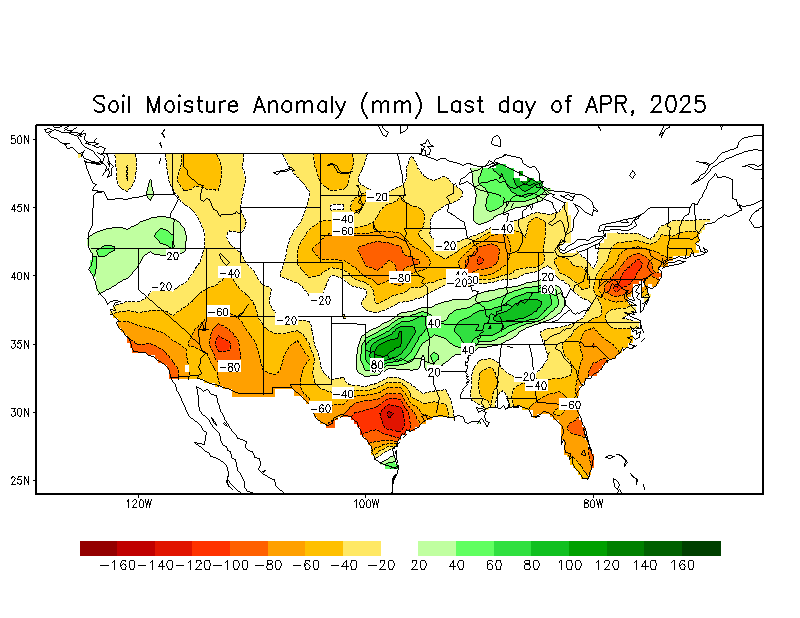
A lot of research has shown that springtime U.S. soil moisture anomalies can lead large upper ridges later in the season. Now the most recent 30 days show:
http://www.cpc.ncep.noaa.gov/soilmst/im ... 0.anom.gif
Basically the entire southeast portion of the nation is facing some sort of short-term drought. What is thought to happen is that the drought conditions can feed on itself to some extent... ie less moisture to evaporate from the surface, temperatures are warmer, the entire area begins to warm and an in-situ high pressure system forms due to the warm/dry air. Theoretically it could lead to a 1980-like situation with strong high pressure over the U.S. and direct tracks more toward S TX or Mexico. However there is still time for any of this to change and it is just one factor in the rather complicated earth/atmosphere system...
0 likes
-
Audrey2Katrina

- Category 5

- Posts: 4252
- Age: 76
- Joined: Fri Dec 23, 2005 10:39 pm
- Location: Metaire, La.
CHRISTY wrote:that is not a good statement to be saying because u dont want to give floridians a false sence of security.u have to prepare no matter what...thats why there only predictions nobody knows what truely is going to happen in 2006.but i guess everybody has there own opinion on what might happen in 2006 thats why i love STORM2K.Hurricane Hunter 914 wrote:I have to agree with CVW, 2004 also had a drought like condition and then came Charley, Frances, Ivan, and Jeanne. I think Florida will be seeing dejavue.
Christy, I don't believe he was giving any Floridians a false sense of security at all. Quite the contrary. Deja-vu is the sense that you've "seen this before," and he goes on to cite that after the drought conditions of 2004, Florida got slammed by Charley, Frances, Ivan, and Jeanne... hardly something to feel secure about...
Personally I wish anyone near one of these things only the best of luck; but pray God none come near the CGOM at least for the next two years. We really need a break! I've all along held that 2006 would be more of a East-coast, to track across to Tex/Mex season; but with these unpredictable things, anything and everything is possible. Even here in the Katrina Krater, we just can't afford to get anything remotely resembling a false sense of security...more of a 6 month state of anxiety is more like it.
A2K
0 likes
-
spinfan4eva
- Category 1

- Posts: 295
- Joined: Tue Aug 23, 2005 1:27 am
- Location: Jacksonville, Florida
- Contact:
Remembering in 1998, Florida had the worst flooding ever from el-nino and by spring, we had the worst Wildfires where Northeast florida was blanketed in smoke causing reduced visibillities and respiratory problems for many then in the summer, we had 3 close calls... Dennis, Floyd, Irene
The tallahassee NWS are giving hints that their area may get some action this season.
The tallahassee NWS are giving hints that their area may get some action this season.
HYDROLOGIC OUTLOOK...CORRECTED
NATIONAL WEATHER SERVICE TALLAHASSEE FL
613 PM EDT FRI APR 14 2006
CORRECTED TO ADD NEXT ISSUANCE DATE.
...DROUGHT POTENTIAL OUTLOOK FOR SOUTHEAST ALABAMA...SOUTHWEST AND
SOUTH CENTRAL GEORGIA...AND THE FLORIDA BIG BEND AND PANHANDLE...
...MODERATE DROUGHT CONDITIONS NOW EXIST IN THE PANHANDLE...
...DROUGHT DEVELOPMENT LIKELY ELSEWHERE ACROSS THE AREA...
SYNOPSIS...
APRIL IS ON AVERAGE THE SECOND DRIEST MONTH OF THE YEAR WITH AMOUNTS
GENERALLY IN THE 3 TO 4 INCH RANGE. UNFORTUNATELY THIS IS COMING ON
THE HEELS OF A VERY DRY MARCH.
THE FOLLOWING TABLE SHOWS THE OBSERVED RAINFALL AMOUNTS...30-YEAR
NORMALS...DEPARTURE FROM NORMAL AND PERCENTAGE OF NORMAL FROM
JANUARY 1 THROUGH APRIL 14 FOR SELECTED SITES ACROSS THE LOCAL
TRI-STATE AREA. SIMILAR STATISTICS ARE PROVIDED FOR THE PERIOD
MARCH 1 THROUGH APRIL 14.
STATION OBSERVED 30-YEAR DEPARTURE PERCENT
RAINFALL NORMAL FROM NORMAL OF NORMAL
TALLAHASSEE FL
SINCE JANUARY 1 10.02 18.33 - 8.31 55
SINCE MARCH 1 0.31 8.23 - 7.92 04
APALACHICOLA FL
SINCE JANUARY 1 7.01 15.21 - 8.20 46
SINCE MARCH 1 0.28 6.48 - 6.20 04
PANAMA CITY FL
SINCE JANUARY 1 8.23 18.66 -10.43 44
SINCE MARCH 1 0.23 8.09 - 7.86 03
GENEVA AL
SINCE JANUARY 1 11.72 20.42 - 8.70 57
SINCE MARCH 1 1.64 8.54 - 6.90 19
ALBANY GA
SINCE JANUARY 1 10.98 18.43 - 7.45 60
SINCE MARCH 1 0.89 7.42 - 6.53 12
ASHBURN GA
SINCE JANUARY 1 11.66 16.66 - 5.00 70
SINCE MARCH 1 1.87 6.77 - 4.90 28
AS YOU CAN SEE...THE GREATEST YEAR-TO-DATE RAINFALL DEFICITS EXTEND
FROM THE WESTERN FLORIDA BIG BEND THROUGH THE FLORIDA PANHANDLE AND
ACROSS EXTREME SOUTHEAST ALABAMA. TALLAHASSEE...APALACHICOLA AND
PANAMA CITY HAVE HAD LESS THAN 5 PERCENT OF NORMAL RAINFALL SO FAR
THIS SPRING.
HYDROLOGIC IMPACTS...
STREAMFLOW ARE GENERALLY RUNNING 10 PERCENT OR LESS OF NORMAL ON THE
PEA...CHOCTAWHATCHEE...APALACHICOLA...OCHLOCKONEE AND FLINT RIVERS.
FLOWS ARE SLIGHTLY ABOVE NORMAL IN THE ST. MARKS AND AUCILLA RIVER
BASINS IN THE FLORIDA BIG BEND. FLOWS IN THE STEINHATCHEE...
FENHOLLOWAY...AND ECONFINA BASINS IN THE SAN PEDRO BAY AREA ARE
RUNNING 20 PERCENT OF NORMAL IN THE FLORIDA BIG BEND.
GROUND WATER LEVELS IN SOUTHWEST GEORGIA ARE NEAR OR SLIGHTLY BETTER
THAN THEY WERE THIS TIME LAST YEAR. FLORIDA PANHANDLE GROUND WATER
LEVELS ARE SIGNIFICANTLY HIGHER THAN COMPARED TO THE 1998-2000
DROUGHT. THIS SHOULD HELP SUSTAIN BASEFLOW LEVELS ON MOST CREEKS AND
STEAMS IN THE FLORIDA PANHANDLE.
FIRE DANGER IMPACTS...
SURFACE CONDITIONS ARE VERY DRY IN THE FLORIDA PANHANDLE WITH KBDI
INDICES OF 400 TO IN EXCESS OF 500 BEING OBSERVED FROM THE
APALACHICOLA RIVER AND WEST. WITH TINDER DRY DEBRIS FROM LAST YEARS
HURRICANES...FIRE WEATHER CONDITIONS WILL CONTINUE TO BE A CONCERN
OVER THE FLORIDA PANHANDLE THIS SPRING.
AGRICULTURAL IMPACTS...
THOUGH WARM DRY WEATHER HELPS SPRING PLANTING...SURFACE SOILS ARE
ABNORMALLY DRY IN THE TRI-STATE AREA ENCOMPASSING SOUTHEAST
ALABAMA...SOUTHWEST GEORGIA AND THE FLORIDA PANHANDLE. DEVELOPING
SUMMER CROPS WILL NEED RAIN IN MUCH OF THE GULF COAST AREA.
UNFORTUNATELY RAINFALL CHANCES ARE NOT VERY GOOD FOR THIS SPRING.
FORTUNATELY GROUND WATER SUPPLIES ARE IN BETTER SHAPE THAN THE
1998-2000 DROUGHT YEARS.
OUTLOOK...
LA NINA CONDITIONS PERSIST IN THE EQUATORIAL PACIFIC WHICH IS
GENERALLY ASSOCIATED WITH BELOW NORMAL RAINFALL ACROSS THE
SOUTHEASTERN U.S. DURING SPRING. HOWEVER...SEA SURFACE TEMPERATURES
ARE GRADUALLY BEGINNING TO RISE...POSSIBLY SIGNALING A RETURN TO
NEUTRAL CONDITIONS. HOW QUICKLY THIS TRANSITION OCCURS WILL HAVE AN
IMPACT ON THE UPCOMING ATLANTIC HURRICANE SEASON. ACTIVITY IN THE
TROPICAL ATLANTIC IS GENERALLY ENHANCED WHEN LA NINA CONDITIONS ARE
PRESENT IN THE PACIFIC.
LITTLE IF ANY RAINFALL IS EXPECTED ACROSS THE REGION INTO EARLY NEXT
WEEK. THE 6-10 DAY PRECIPITATION OUTLOOK ISSUED TODAY BY THE CLIMATE
PREDICTION CENTER CALLS FOR AN ENHANCED CHANCE FOR ABOVE NORMAL
RAINFALL FOR THE PERIOD FROM APRIL 20-24. THE 8-14 DAY OUTLOOK CALLS
FOR EQUAL CHANCES FOR ABOVE OR BELOW NORMAL PRECIPITATION. THE
SEASONAL OUTLOOK FOR THE PERIOD APRIL THROUGH JUNE FAVORS DRIER THAN
NORMAL CONDITIONS LOCALLY.
CREDITS...
INFORMATION FOR THIS REPORT WAS PROVIDED COURTESY OF THE WEEKLY
DROUGHT MONITOR REPORT...UNITED STATES DEPARTMENT OF AGRICULTURE...
WEEKLY CROP MONITOR...UNITED STATES FOREST SERVICE...THE NATIONAL
DROUGHT MONITOR CENTER...NORTHWEST FLORIDA WATER MANAGEMENT DISTRICT
AND THE UNITED STATES GEOLOGIC SURVEY.
THIS OUTLOOK WILL BE UPDATED APPROXIMATELY ONCE EVERY TWO WEEKS.
0 likes
Who is online
Users browsing this forum: No registered users and 52 guests