DorkyMcDorkface wrote:This is a bit of a ways out but I am honestly more interested in this MDR signal the GEFS is latching on to; it's been there the past few runs. A tropical wave is obviously a much more realistic pathway to cyclogenesis than the spurious Venezuelan vorticity the GFS is always obsessed with this time of year. For that reason, I feel more confidence in other models possibly sniffing
this out in the near future. With the current SSTs I'd say an early season MDR TD/TS is within the realm of possibility. We'll see.
https://i.ibb.co/SK0q8Yc/90668154-2.gif
The GFS actually isn't developing this from a spurious vorticity associated with the CAG, it's origins are related to a TW that is expected to depart the coast of Africa here shortly. You can follow this in the 700mb vort signature from the latest GFS run below (roughly highlighted the wave axis in pink in the animation below):

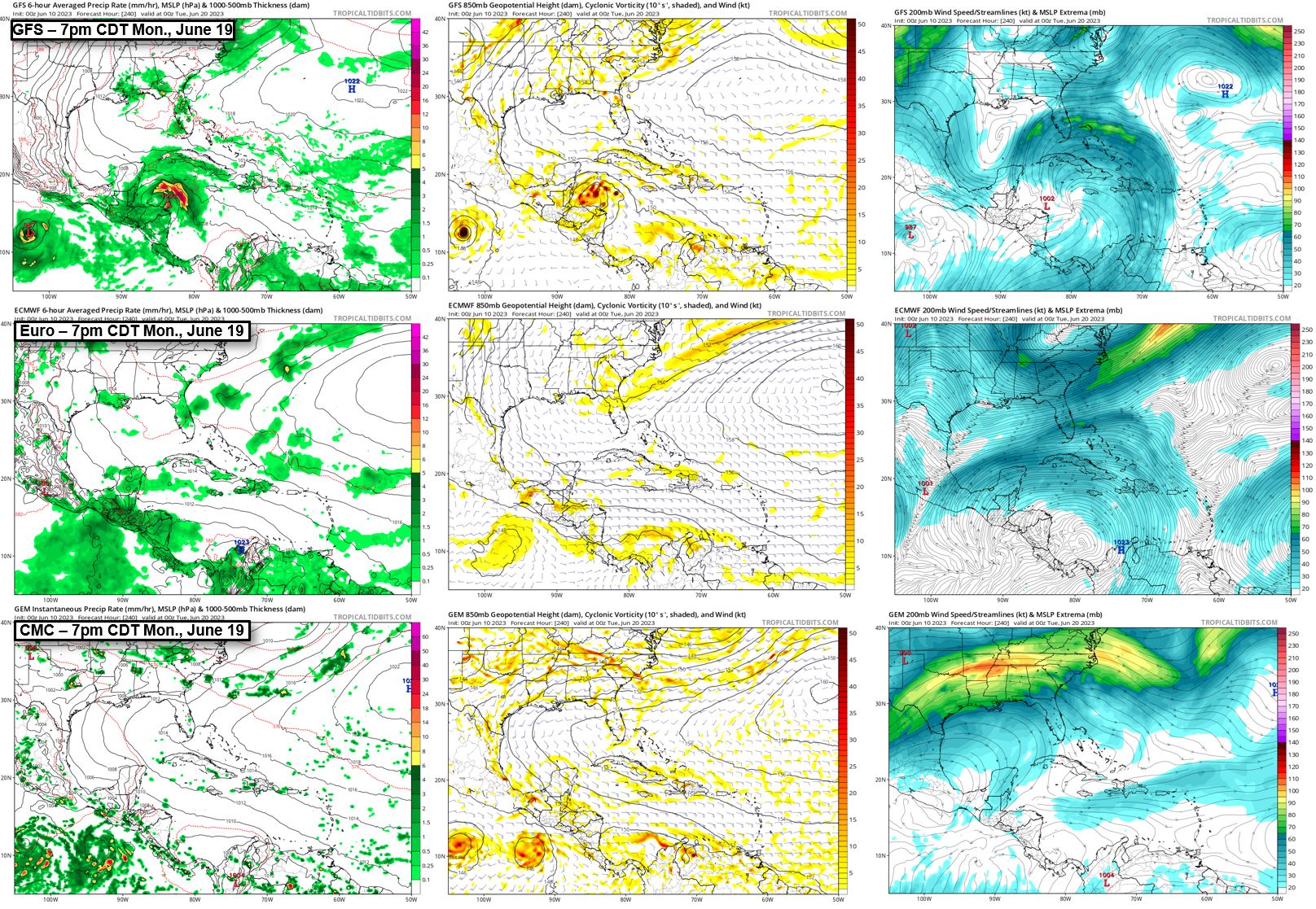
The difference in the models is the upper-level features and steering pattern. The GFS has a sharp trough that extends all the way down towards the Yucatan peninsula (highlighted in pink below). This has multiple impacts: (1) displaces the subtropical high towards the northeast (highlighted in orange), (2) erodes the western periphery of the high pressure area, (3) reduces zonal flow in the Caribbean, and (4) provides the necessary "lift" for this tropical wave to exit the Caribbean towards the GOM.

Compare this to last night's 00z ECMWF run at the same time frame, and you can see the high pressure is oriented more E to W and extends further west, there is only a weak signature of a trough over CONUS that doesnt extend nearly as far south, and the zonal flow in the Caribbean carries the wave vort signature through Central America and into the EPAC.


