#2013 Postby Category5Kaiju » Mon Oct 27, 2025 10:28 pm
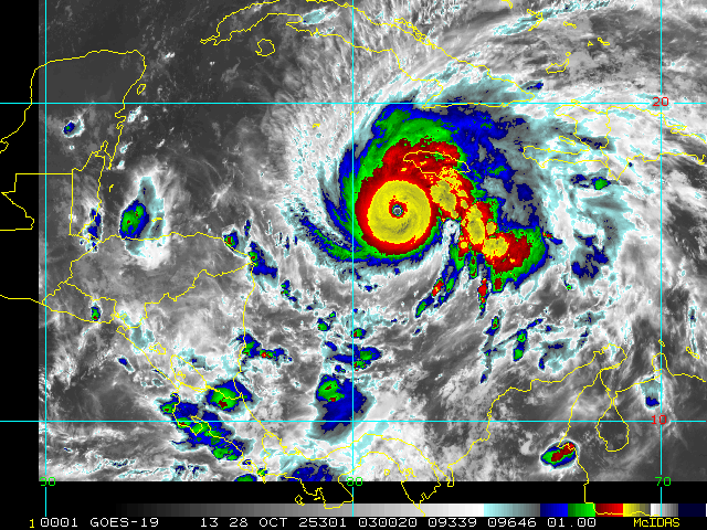
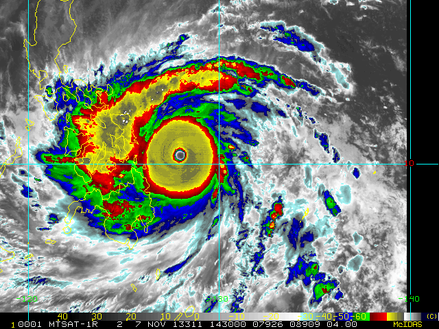
It's honestly crazy to think that Josh Morgerman, let alone quite a few other newer and younger storm chasers, are basically about to experience a top-tier hurricane with not only high-end Category 5 winds but also an extremely low pressure, likely in the 900s or even possibly sub-900 (well, I'm aware that Josh has been through Haiyan, so perhaps this is something more related towards the newer chasers in the field). This isn't an experience that many around the world can say that they've had, so to say that I'm starting to feel a bit nervous on behalf of some of the people who decided to chase this storm, let alone the residents of Jamaica who are in the path, is a bit of an understatement. Hope they're ready for what's to come.
9 likes
Unless explicitly stated, all information in my posts is based on my own opinions and observations. Tropical storms and hurricanes can be extremely dangerous. Refer to an accredited weather research agency or meteorologist if you need to make serious decisions regarding an approaching storm.


 \
\


