

ATL: IAN - Models
Moderator: S2k Moderators


-
Blown Away

- S2K Supporter

- Posts: 10253
- Joined: Wed May 26, 2004 6:17 am
Re: ATL: IAN - Models
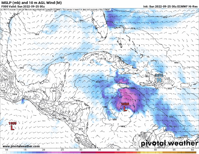
00z ECMWF
1 likes
Hurricane Eye Experience: David 79, Irene 99, Frances 04, Jeanne 04, Wilma 05… Hurricane Brush Experience: Andrew 92, Erin 95, Floyd 99, Matthew 16, Irma 17, Ian 22, Nicole 22…
-
AtlanticWind

- S2K Supporter
- Posts: 1898
- Age: 67
- Joined: Sun Aug 08, 2004 9:57 pm
- Location: Plantation,Fla
Re: ATL: IAN - Models
Every model is a little (HWRF, HMON, CANADIAN) to a lot (EURO, UKMET, ICON) east of GFS
Somethings gotta give.
Somethings gotta give.
2 likes
-
Jelmergraaff
- Tropical Storm

- Posts: 138
- Age: 23
- Joined: Fri Aug 27, 2021 1:00 pm
- Location: The Netherlands
Re: ATL: IAN - Models
HMON now showing a category 5 hurricane at +84h with a minimum pressure of 919 mb and sustained winds of 146kt/168mph. 

4 likes
21-year old meteorologist and student MSc Climate Studies from The Netherlands. Interested in all fields of meteorology and climatology, including tropical systems like hurricanes.
-
Bocadude85

- Category 5

- Posts: 2991
- Age: 39
- Joined: Mon Apr 18, 2005 2:20 pm
- Location: Honolulu,Hi
Re: ATL: IAN - Models
Will be interesting to see the Euro ensembles, it’s the EURO/UKMET/ICON and to a lesser extent the CMC against the GFS and HWRF..something has got to give.. if the GFS ends up being correct then I will certainly have new found respect for it.
1 likes
Re: ATL: IAN - Models
Jelmergraaff wrote:HMON now showing a category 5 hurricane at +84h with a minimum pressure of 919 mb and sustained winds of 146kt/168mph.
https://www.tropicaltidbits.com/analysis/models/hmon/2022092500/hmon_mslp_wind_09L_29.png
Wow, the HMON is quite far to the west! Where was the prior run?
1 likes
Personal Forecast Disclaimer:
The posts in this forum are NOT official forecasts and should not be used as such. They are just the opinion of the poster and may or may not be backed by sound meteorological data. They are NOT endorsed by any professional institution or storm2k.org. For official information, please refer to the NHC and NWS products.
The posts in this forum are NOT official forecasts and should not be used as such. They are just the opinion of the poster and may or may not be backed by sound meteorological data. They are NOT endorsed by any professional institution or storm2k.org. For official information, please refer to the NHC and NWS products.

-
Bocadude85
- Category 5
- Posts: 2991
- Age: 39
- Joined: Mon Apr 18, 2005 2:20 pm
- Location: Honolulu,Hi
Re: ATL: IAN - Models
6z Early track guidance has shifted east, NHC is now west of the TVCN, I’m honestly surprised the TVCN didn’t shift further south..maybe the Big Bend will be the landfall location.
1 likes
Re: ATL: IAN - Models
0Z EPS spread looks tighter than the 12Z EPS with perhaps a further east mean. Any other takes on this?
1 likes
Personal Forecast Disclaimer:
The posts in this forum are NOT official forecasts and should not be used as such. They are just the opinion of the poster and may or may not be backed by sound meteorological data. They are NOT endorsed by any professional institution or storm2k.org. For official information, please refer to the NHC and NWS products.
The posts in this forum are NOT official forecasts and should not be used as such. They are just the opinion of the poster and may or may not be backed by sound meteorological data. They are NOT endorsed by any professional institution or storm2k.org. For official information, please refer to the NHC and NWS products.
-
Bocadude85
- Category 5
- Posts: 2991
- Age: 39
- Joined: Mon Apr 18, 2005 2:20 pm
- Location: Honolulu,Hi
Re: ATL: IAN - Models
LarryWx wrote:0Z EPS spread looks tighter than the 12Z EPS with perhaps a further east mean. Any other takes on this?
1 likes
-
Bocadude85
- Category 5
- Posts: 2991
- Age: 39
- Joined: Mon Apr 18, 2005 2:20 pm
- Location: Honolulu,Hi
Re: ATL: IAN - Models
LarryWx wrote:0Z EPS spread looks tighter than the 12Z EPS with perhaps a further east mean. Any other takes on this?
Definitely looks like the 0Z EPS is a touch further southeast, more concentrated in the Punta Gorda/Sarasota area.
1 likes
-
Chris_in_Tampa
- Category 5
- Posts: 5101
- Age: 42
- Joined: Thu Jun 21, 2007 11:06 pm
- Location: Tampa, Florida, USA
- Contact:


-
Chris_in_Tampa
- Category 5
- Posts: 5101
- Age: 42
- Joined: Thu Jun 21, 2007 11:06 pm
- Location: Tampa, Florida, USA
- Contact:
Re: ATL: IAN - Models
Sunday
6Z Early Cycle models & 0Z Late Cycle models
Through 5 days:

Complete (as available from NHC ATCF system / ECMWF for Euro and Ensemble):

Many names off the map.
6Z Early Cycle models & 0Z Late Cycle models
Through 5 days:
Complete (as available from NHC ATCF system / ECMWF for Euro and Ensemble):
Many names off the map.
9 likes
-
AxaltaRacing24
- Category 5
- Posts: 1774
- Age: 25
- Joined: Wed Jul 27, 2016 11:14 am
- Location: Jupiter, FL
-
Chris_in_Tampa
- Category 5
- Posts: 5101
- Age: 42
- Joined: Thu Jun 21, 2007 11:06 pm
- Location: Tampa, Florida, USA
- Contact:

-
Stormgodess

- Category 1

- Posts: 316
- Joined: Mon Sep 14, 2020 1:31 am


Re: ATL: IAN - Models
The 00Z model spread didn't narrow any so I'd expect the NHC track to stay rather than shift east over Ocean Pond.
Overnight it looks to me like like the forward speed diminished but we can check the recon points to confirm.
Forward speed is important as the ridge rolling east would decimate the eastern models if slower track evolution is confirmed.
Overnight it looks to me like like the forward speed diminished but we can check the recon points to confirm.
Forward speed is important as the ridge rolling east would decimate the eastern models if slower track evolution is confirmed.
1 likes
Who is online
Users browsing this forum: No registered users and 44 guests