Invest 98L,Central Atlantic
Moderator: S2k Moderators

Re: Invest 98L,Central Atlantic-Discussions-Analysis & Imagery
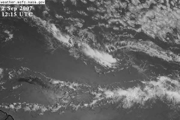
Convection, is firing again this morning over the LLC located at about 40W
0 likes
-
cycloneye

- Admin

- Posts: 149276
- Age: 69
- Joined: Thu Oct 10, 2002 10:54 am
- Location: San Juan, Puerto Rico
Re: Invest 98L,Central Atlantic-Discussions-Analysis & Imagery
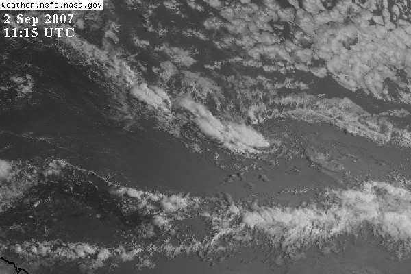
NRL Visible Image at 10:45 UTC

Still the low center is detached from convection.However,it is a well defined low and once it gets more favorable conditions,it will develop.Is moving much slower than the other ones (Dean and Disturbance that is now Felix in that longitud) and that has to be watched as ridges and troughs in the Atlantic will play a key roll in terms of where this will go.
Fellow Caribbean members,lets keep watching as we have plenty of time to prepare for what this may bring to the area,unless something happens that it goes NE of the islands.
0 likes


-
cycloneye
- Admin
- Posts: 149276
- Age: 69
- Joined: Thu Oct 10, 2002 10:54 am
- Location: San Juan, Puerto Rico
Re: Invest 98L,Central Atlantic-Discussions-Analysis & Imagery
02/1145 UTC 11.8N 38.6W TOO WEAK 98L -- Atlantic Ocean
http://www.ssd.noaa.gov/PS/TROP/positions.html
http://www.ssd.noaa.gov/PS/TROP/positions.html
0 likes
-
HURAKAN

- Professional-Met

- Posts: 46084
- Age: 39
- Joined: Thu May 20, 2004 4:34 pm
- Location: Key West, FL
- Contact:
TWD 805 AM:
...SPECIAL FEATURES...
AN AREA OF LOW PRESSURE IS ASSOCIATED WITH A TROPICAL WAVE ALONG
38W...OR ABOUT MIDWAY BETWEEN AFRICA AND THE LESSER ANTILLES.
THE LOW HAS BEEN MOVING SLOWLY SOUTHWESTWARD OVERNIGHT BUT IS
FORECAST TO BEGIN MOVING WESTWARD LATER TODAY. ASSOCIATED
SHOWER ACTIVITY IS LIMITED AND ENVIRONMENTAL CONDITIONS ARE ONLY
MARGINALLY FAVORABLE FOR DEVELOPMENT. HOWEVER...THE CIRCULATION
IS WELL-DEFINED AND THERE IS STILL SOME POTENTIAL FOR THIS
SYSTEM TO BECOME A TROPICAL DEPRESSION DURING THE NEXT COUPLE OF
DAYS. SCATTERED MODERATE CONVECTION IS FROM 11N-14N BETWEEN
38W-43W...DISPLACED TO THE W OF THE EXPOSED CENTER DUE TO ABOUT
20 KT OF ELY SHEAR.
0 likes
-
Weatherboy1

- Category 5

- Posts: 1190
- Age: 50
- Joined: Mon Jul 05, 2004 1:50 pm
- Location: Jupiter/Sarasota, FL
-
Derek Ortt
-
HurricaneMaster_PR

- Category 2

- Posts: 795
- Joined: Tue Jul 22, 2003 6:23 pm
- Location: San Juan, Puerto Rico
Re: Invest 98L,Central Atlantic-Discussions-Analysis & Imagery
TAFB continues to foresee a tropical cyclone within the next 24 hours

0 likes
-
windstorm99

- S2K Supporter

- Posts: 1578
- Age: 48
- Joined: Sat May 26, 2007 8:10 am
- Location: Miami, Florida
- Contact:

-
windstorm99
- S2K Supporter
- Posts: 1578
- Age: 48
- Joined: Sat May 26, 2007 8:10 am
- Location: Miami, Florida
- Contact:
Re: Invest 98L,Central Atlantic-Discussions-Analysis & Imagery
Thoughts on the lasest models for 98L...
0 likes
-
stormchazer

- Category 5
- Posts: 2462
- Joined: Fri Aug 29, 2003 12:00 pm
- Location: Lakeland, Florida
- Contact:
-
wxwonder12
- Tropical Storm

- Posts: 199
- Joined: Thu May 12, 2005 11:29 am
Re: Invest 98L,Central Atlantic-Discussions-Analysis & Imagery
Dosen't seem like it will go due West for right now anyway.
0 likes
-
Tampa Bay Hurricane

- Category 5
- Posts: 5597
- Age: 38
- Joined: Fri Jul 22, 2005 7:54 pm
- Location: St. Petersburg, FL
Re: Invest 98L,Central Atlantic-Discussions-Analysis & Imagery
Models trending north, looks to move just north of the islands
and into the bahamas possibly later in the week, then go West
as the ridge builds back in.
and into the bahamas possibly later in the week, then go West
as the ridge builds back in.
0 likes
-
HURAKAN
- Professional-Met
- Posts: 46084
- Age: 39
- Joined: Thu May 20, 2004 4:34 pm
- Location: Key West, FL
- Contact:
Re: Invest 98L,Central Atlantic-Discussions-Analysis & Imagery
Tampa Bay Hurricane wrote:Models trending north, looks to move just north of the islands
and into the bahamas possibly later in the week, then go West
as the ridge builds back in.
I don't like your analysis!!!! But it sounds right.
0 likes
-
Blown Away

- S2K Supporter
- Posts: 10253
- Joined: Wed May 26, 2004 6:17 am
Re: Invest 98L,Central Atlantic-Discussions-Analysis & Imagery
windstorm99 wrote:
Now that's the kind of model confusion we like to see and debate about. Yep we are in September and the troughs are coming into play.
0 likes
Who is online
Users browsing this forum: No registered users and 74 guests